Thomas Jefferson’s Monticello home has maps and mementos from Lewis & Clark’s expedition all over his front hall, showing how interested he was in the Native Americans, geography, flora & fauna, and other discoveries. He also had strategic interests in mapping both the huge Louisiana territory he purchased from France and the further lands to the Pacific. Having read Captain Cook’s voyages, he was interested in discovering any practical, cross-country trading routes.
And there was plenty of competition. De Anza had explored up the coast to San Francisco in 1776, and the Spanish were busy establishing missions in California. The Russians staked their claim in Alaska before 1800 and were beginning to explore down the coast. The Scottish explorer Mackenzie had already followed Native American travel routes to the Arctic along the river later named for him and crossed the continent in 1793, arriving within months of the naval expedition of Vancouver. The British made no secret of their intention to expand their fur trading to the Columbia River.
So Jefferson scraped together $2,324 from an uncooperative Congress and gave the money to Captain Meriwether Lewis and William Clark, younger brother of the famous war hero. Jefferson personally tutored Lewis in geography, hiring experts to assist in medicine, navigation, botany and taxidermy, giving Lewis full access to his legendary library, likely the largest private one in the US. Jefferson was fascinated by the reports of the expedition, following it closely, but he spoke little about the full plan publicly—except to justify the expense to Congress—to keep the reports from foreign rivals.
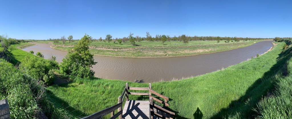
The first boat was completed in Pittsburgh, and Lewis launched into the Ohio River there at the end of August, 1803, with some crew, arms from Harpers Ferry, 200 lbs of dried soup, tobacco, wine, trade goods, med kit, and his Newfoundland dog, Seaman. He met up with Clark’s team in Louisville, KY, including Clark’s slave York, who became the first African American explorer known to cross overland to the Pacific. They traveled down the Ohio to the Mississippi and then up the Missouri, past Ste. Geneviève and St Louis, where they spent the winter. Then they paddled up river past the confluence of the Niobrara to Knife River (see photo), ND, where young Sacagawea joined the expedition with her French husband and their baby, after the expedition wintered nearby.
In the spring, they continued up river past what would become the Fort Union Trading Post, past the Milk River confluence, and each time they came to a fork, they would need to decide which was the Missouri River, often exploring both forks. Eventually, they reached the headwaters and traveled overland past what would later be the Big Hole Battlefield, before finding their way down the Clearwater, Snake and Columbia Rivers, with help from the Nez Perce. Mapping that Native American trade route over the Rockies was one of the expedition’s key accomplishments. Finally, they reached the Pacific and wintered at Fort Clatsop, beating a Russian explorer who arrived that spring.
On their way back, Lewis took a more northerly route, close to Glacier, and Clark southerly, along the Yellowstone River, before meeting again on the Missouri. The Spanish sent troops to arrest them, but couldn’t catch up, as traveling downriver back the way they came was much quicker. Jefferson was very pleased with the expedition’s success, grew corn samples at Monticello and reported Lewis & Clark’s scientific discoveries to Congress.
Jefferson appointed Lewis Governor of Louisiana Territory, but many hated Lewis for protecting Native American rights and spread conspiracies against him. Lewis’ territorial secretary and rival smeared him in letters to Washington, causing the government to refuse to reimburse Lewis for expedition expenses, which bankrupted Lewis, only two years after the expedition returned. On a trip to Washington to clear his name and his debts, he was likely murdered on the Natchez Trace, suspiciously described as a ‘suicide’ despite multiple injuries. Seaman survived the expedition, but the faithful dog refused food and died immediately after Lewis’ mysterious death.
Sacagawea, their teen interpreter and diplomat, died at 24, but Clark helped support her children. Clark was less generous with York, who had expected to gain his freedom but was refused. Clark lived longer than Lewis and was Governor of Missouri territory from 1813 to 1820. A credible report later placed York in Wyoming, living among natives as a Chief.
WOW.
Betsy Lawrence Luxury Property Agent Landvest, Inc 280 Elm Street, Suite 4 So. Dartmouth, MA 02748 508.317.8669 https://www.landvest.com/real-estate-agent/125/betsy-lawrence
Pingback: Continental Divide National Scenic Trail | Zero Carbon Travel
Pingback: Pacific Crest National Scenic Trail | Zero Carbon Travel
Pingback: South Dakota in Photos | Zero Carbon Travel
Pingback: Freedom’s Frontier National Heritage Area | Zero Carbon Travel