Chilkoot Trail

21 year old Jack London arrived in 1897, along with many other stampeders in the Klondike Gold Rush. There were two ways to get from Seattle to the Klondike, the easy way by water, or the hard way overland. The folks who could afford it, sailed 2500 miles to the mouth of the Yukon at St Michael on the Bering Strait, and then they transferred to steam stern paddle wheelers to travel 1500 miles up the Yukon River. Most people, especially after the 1893 Depression, traveled 900 miles by packed steamship to Skagway, then walked up the trail above into the snow capped mountains. Once in Canada, they were still some 500 winding miles from where gold was discovered.

Since the coastal Tlingit (klinkit) tribe had kicked out the Hudson Bay company, they had a trading route over the mountains, trading oily fish for fur with their inland relatives and the Tagish tribe near Carcross. In 1890 Jack Dalton explored, mapped and publicized the trail over the pass. Then a Tagish guide and his American prospector brother in law struck gold near a Yukon tributary in Canada on 16 August 1896. Together the Tlingit and Tagish people guided the stampede over the Chilkoot pass on their route and helped carry gear.

At first, the trail is quite easy, following the shallow, flat valley along the Taiya river above from the long wharf at Dyea (die-ee) where Jack landed on 7 August 1897. But approaching the border with British Columbia at mile 33, the trail rises sharply to 3,750 feet at latitude 60º. The combination of high altitude and high northern latitude meant snow and ice almost year round.

And the trail up the pass is more of a wall, climbing at a ~40º angle for the last 1000 feet, with 1500 steps carved in ice. And to prevent unprepared people from starving, the Mounties required a year’s supply of food and gear to continue into Canada. So, Jack climbed the golden steps dozens of times hauling his gear to the top. Since the trail was crowded, this meant slowly climbing in a long line on the stairs, at the speed of the slowest climber, with a 60 pound pack on your back each time.

On Palm Sunday 1898, at a time the native guides warned folks not to go, there were a series of avalanches that killed up to 100 stampeders climbing the Chilkoot pass. Many were buried at the Slide Cemetery in Dyea, now a ghost town.

The Canadian side was not easier, depending on the weather. If your timing was fortuitous the rivers were flowing, and you hiked slowly down over some very rough terrain. Then you simply built a boat big enough to carry you and your gear down the long lakes and down the river and sturdy enough to get through the rapids and narrow canyons. If your timing was not so lucky, then everything at the top was frozen and you had to make camp at altitude—no ultralight down sleeping bags back then—for months waiting for the thaw near the beginning of summer. Jack was lucky enough to make it almost all the way before wintering about 80 miles from the gold fields. He would later write a short story called “To Build a Fire” about a man trying to survive in the cold.

For Jack and the hardy ones who made it all the way to the Klondike, they discovered that local prospectors had already staked claims on the gold fields, that Dawson City had been built and that the prices were astronomical. Jack London spun his experiences into gold eventually, writing Daughter of the Snows, Call of the Wild and White Fang among many adventure books and short stories.

Today, the Chilkoot National Historic Trail is part of the Klondike National Historical Park in Seattle & Skagway, and together with the Chilkoot Trail National Historic Site in British Columbia, it is recognized as the Klondike Gold Rush International Historical Park. Unfortunately, the trail is closed at the border for unfathomable reasons.

Klondike Gold Rush National Historical Park Alaska

Alaska! With a bit less excitement than the stampede of the late 1890s, I made it to Skagway Alaska, a dream come true for me, my 50th state and my 49th in my electric car. Just a couple more posts will cover my trip to Alaska this May. First, Klondike Gold Rush NHP is the main part of the park with a million annual visitors, most arriving by cruise ship. The section in Seattle is smaller but still a great place to learn about the gold rush.

Historically, the whole thing was a big misunderstanding. A native named Keish was on a fishing tip with his brother-in-law, his sister and his nephew. His brother-in-law was a prospector who got a tip from another prospector and convinced the others to look for gold on a tributary of the Yukon River. Luckily they found some gold mid August 1896, and the news spread like wildfire. Gold mining claims were filed by mostly Canadian prospectors almost immediately, and by January, Dawson City was set along the Yukon River as a base for fortune seekers.

To be clear, the gold was found over four hundred miles north of Skagway. Think Nashville to Chicago, but with bears, glaciers, mountains and no roads. And within a short time, no more mining claims were available. But the US had just suffered the Panic of 1893, the worst economic depression in history (until the Great Depression) with unemployment reaching 25% and massive continuing poverty. So, a legendary myth was born out of thin air by self-enriching writers who never left their cities, and tens of thousands of people traveled from around the world for the next two years with Gold Fever.

Outfitters, especially in Seattle, sold specialized gear, including dried food, sleeping bags and tinned meat. Steamships took thousands up the coast to the deep harbor at Skagway and a few around to the Bering Sea and the mouth of the Yukon River. The idea was to sail up a long bay, walk up the Taiya River valley, climb the incredibly steep ‘golden stairs’ carved in ice, follow an arctic watershed slowly descending on the other side, build a boat and take it down the Yukon River past the Whitehorse Rapids to Dawson. By the time the Americans got there, the gold fields were taken, they were without prospects and most were broke. Many turned around, and many died on the journey. On Palm Sunday 1898, avalanches killed about 100 on the trail, and prompted folks to switch to the White Pass route, which I drove alongside on a stunning clear day.

The historic site is filled with memorabilia, many fascinating buildings and stunning stories of conmen, gunfights, prostitution, riches and saloon society. While not part of the park service, the Red Onion has an enlightening tour about the ladies who serviced men for 15 minutes at a time in small rooms upstairs. The best known story in town is about Soapie Smith a colorful conman involved in a gunfight. A Scottish clerk named Robert Service arrived years after the rush ended, but absorbed the stories and converted them into poetry, writing “The Cremation of Sam McGee” among others that I first heard in grade school. Warren Harding was inducted into the Arctic Brotherhood when he visited Skagway briefly as President, and I believe they named a glacier in his honor.

If the cruise ship companies spent years designing the perfect port of call, they still couldn’t have imagined one like this. Surrounded by beautiful snow capped mountains with wildlife, four giant ships at a time, thousands of tourists, plus a tourist train to & from Whitehorse Canada, plus the occasional crazy drivers like me, all waltz into town at once, packing the streets, renting bikes, shopping, eating, hiking (more about that on Wednesday) and visiting historic sites, including bars & brothels. Skagway means windy in the native tongue, so when the wind whips down the long main street, step into one of the fascinating alleys or shops. Great fun!

Glacier Bay National Park

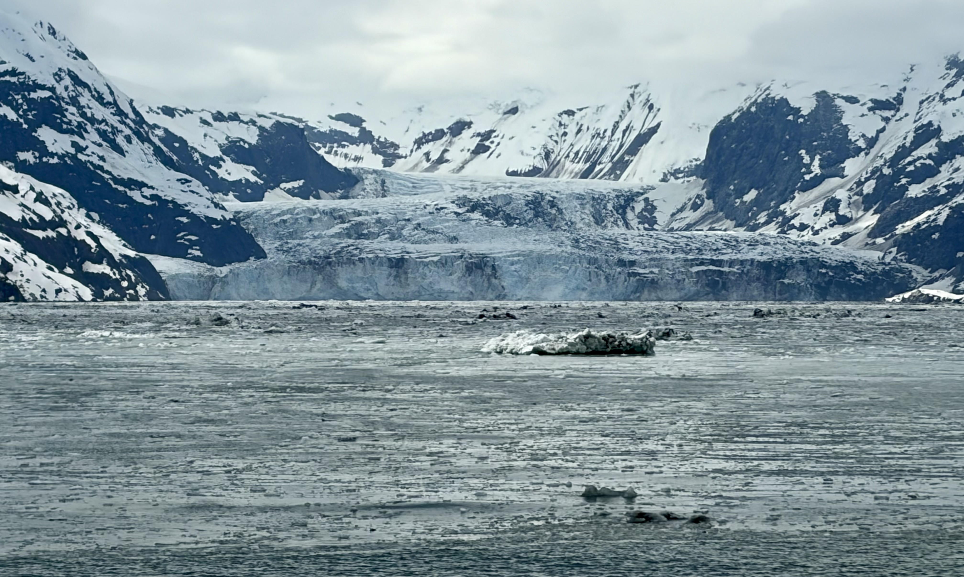
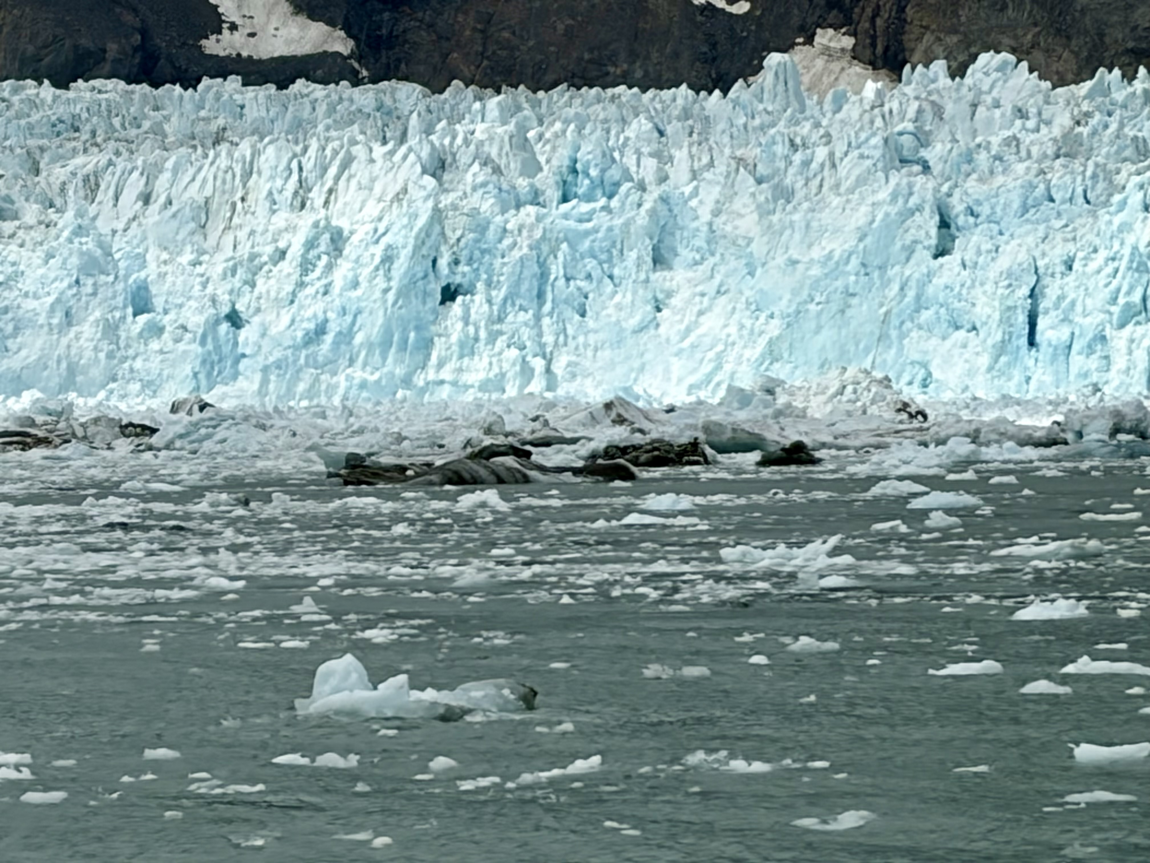
Glacier Bay is a great national park, a biosphere and part of a huge world heritage site with Canada. I arrived by Alaska Marine Highway ferry from Skagway via a night in Juneau, which took about 24 hours to the lodge. The ranger-narrated day boat tour out to see the last few tidewater glaciers was awesome. While I saw a humpback whale breeching, the highlight was definitely sliding through the icy waters to see glaciers like the Marjorie above and Johns Hopkins below.

While glaciers often cycle through advancing and retreating cycles, Glacier Bay makes it plainly clear how one way the retreat of ice has been since industrialization began. Tidewater glaciers are ones that normally advance into the water and then recede after the saltwater changes their freezing point. Once common below the arctic circle, now they’re rare, with the one above likely being one of the last. Although the huge bay was entirely full of ice when our country was founded, the bay—technically a fjord—is now virtually all open water. The many glaciers described by John Muir are still here, but most neither reach nor can be seen from the water. Over a hundred years of tourists have documented the dramatic retreat in millions of photographs from steamships to cruise ships.

Once, many people assumed that similar landscapes scraped clean around the world were evidence of a global Biblical flood, but they were caused by glaciers. Besides Muir, an ecologist named William Cooper conducted a historic and ongoing study of plant succession for decades here. While some might imagine that retreating ice will simply open up new fertile land in the north, the truth is that glaciers scrape the ground down to bedrock. It takes centuries to build up enough biological material to sustain even the short simple forest ecosystems found in the wintry northern latitudes. The Tlingit people have an oral tradition that describes how their productive valley was covered by an advancing glacier and was stripped bare when it finally retreated. But they’re still here, co-managing the park and conducting interpretive presentations on site. Be sure to visit their clan house next to the Glacier Bay Lodge.

Kenai Mountains – Turnagain Arm National Heritage Area

The Kenai peninsula today captures a lot of Alaska’s tourism especially by boat, from fishing boats in Homer, to float trips on the Kenai river, to Kenai Fjord tour boats in Seward, to the Alaska Marine Highway in Whittier and cruise ships on their way to Anchorage. The greater area around Anchorage is flat in the river delta of the Cook Inlet surrounded by mountains. To get from Anchorage to the Kenai peninsula, you drive around the Turnagain Arm, a branch of the Cook Inlet with the highest tides in the US. Watch for the tidal bore and telltale mud flats.

This heritage area celebrates the various communities from Coopers Landing in the west with river and lake guides, to the port of Whittier in the east, to the Iditarod trail connecting Seward in the south to mountain resorts like Girdwood north near Anchorage. Girdwood has an appealing upscale hippy take on Alaska, with popular summer festivals and winter Nordic spa experiences. Honestly, compared to where I grew up, the history is a bit sparse, but the tiny museum in Seward includes Native American artifacts and relates engaging stories showcasing how tough Alaskans are, including surviving bear attacks, a 9.2 earthquake, winter and running incredible endurance races for fun.

Mostly, you need to appreciate just how wild and seasonal Alaska is, in order to have an enjoyable visit. Winter can extend well into May on the mountains, and the short summer season is frenetic, with locals working long hours while the sun shines. Major hotel chains and national franchises have trouble adapting to Alaska, as their business models don’t normally allow for months of darkness, closing up and waiting for the thaw. Local businesses adapt much better, using the ample open spaces to run strings of seasonal businesses, often following fish and wildlife. Small villages like Moose Pass on Trail Lake below in the middle of the heritage area hold small communities tightly together during winter and then open up to visitors in summer.

Life in Alaska is both simple and also nuanced in how in tune it is with nature. Unfortunately, our carbon pollution is changing the environment, helping cause a devastating forest fire in the Kenai National Wildlife Refuge west of the heritage area. We need to respect our fascinating and fragile natural world more.

Iditarod National Historic Trail

Even a tiny dog walking by barked to tell his parents to take a photo of him with the sled dogs above at the start of the Iditarod Trail in Seward Alaska. The trail celebrates the broader history of travel in Alaska by dogsled, but today the Iditarod is famous for just one race. The Iditarod race starts north of Anchorage on the first weekend in March, and the dogs are the real star athletes of the race, of course, running in teams of a dozen or more over 1000 miles for a week or two to the Burled Arch on Front Street in Nome, near the Bering Strait.

During the various Alaskan gold rushes at the turn of the previous century, the winter dogsled trails connected ports like Seward with mining towns like Iditarod, now a remote ghost town (on the southern race route in odd years). Seward is an ice free deep water port, and in winter months mail, supplies and trade goods moved inland and back by dog sled. In 1925 a dog sled relay team delivered life-saving diphtheria serum from near Fairbanks to Nome running along the Yukon River in the middle and making the finishing lead dog Balto famous. The longest dogsled run was from Seward to Nome, which laid the historic path for mining communities, railroads, roadhouses and highways. Some of these remote communities are still roadless, going straight from dog sleds to bush planes after the gold rushes slowed in the 1920s.

The trail is the only winter trail in the national historic trail system, and it’s managed by the Bureau of Land Management. My great, great uncle Norman Vaughan started competing in the Iditarod at age 70 and ran it 13 times. He also organized a commemorative event for the 1925 serum run, ran dog sleds in the 1932 Olympics, and helped Admiral Byrd on his first Antarctica expedition, later returning to climb Mount Vaughan at 89. The Iditarod has a special place in the hearts of explorers.

Kenai Fjords National Park

This month I will be covering my trip to Alaska earlier this year. The Harding Icefield dominates the highlands of the Kenai Peninsula feeding dozens of glaciers that still carve the fjords. Due to regular heavy snowfall in the mountains—30’ is not unusual—, a number of large glaciers still reach the sea, although the Exit Glacier near the park entrance requires a longer hike to see than in the recent past. I drove to the visitor center in Seward, but I didn’t come here to hike.

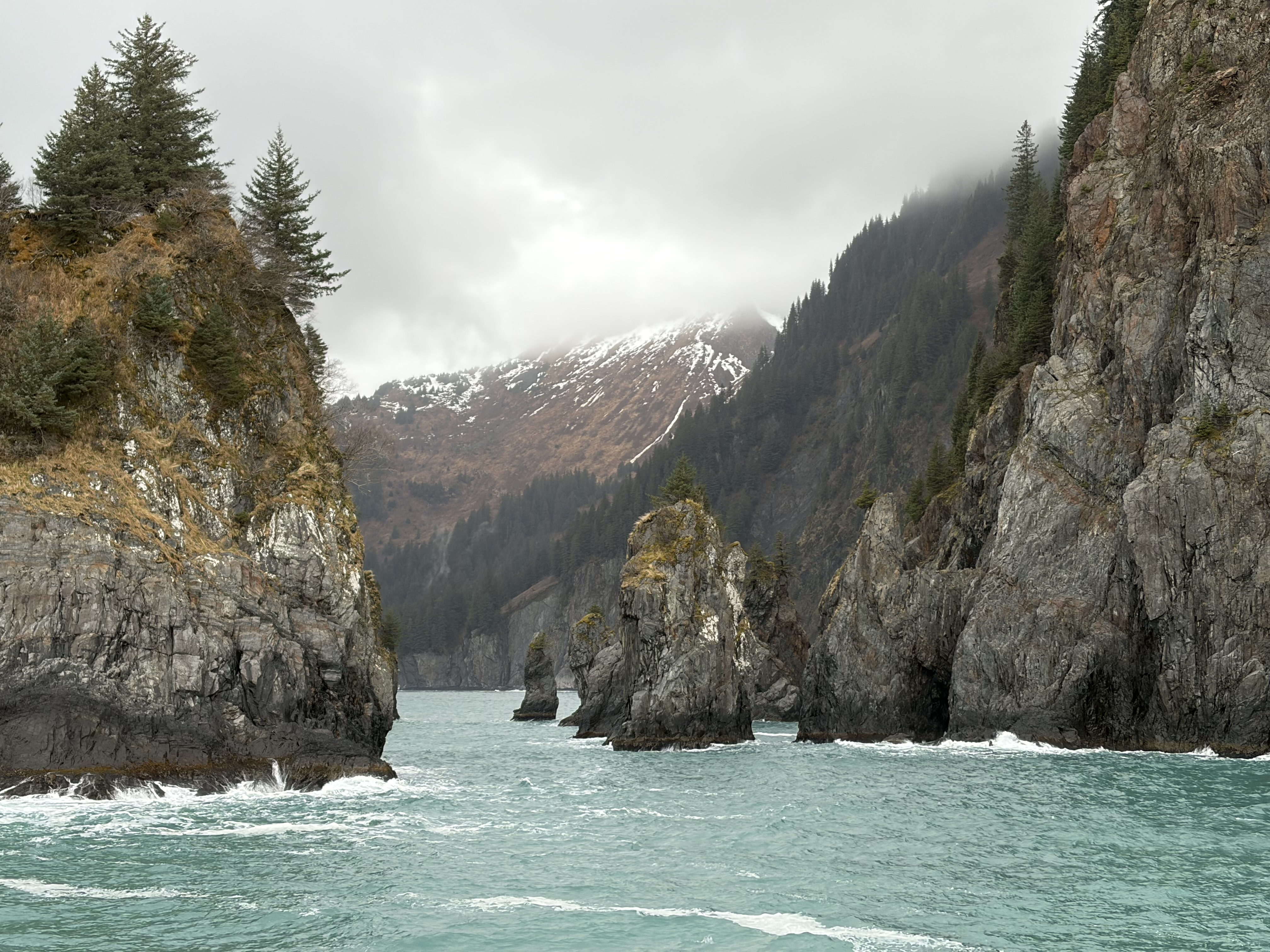
I recommend a boat tour out of Seward to explore places like Porcupine Cove above. Not only are the fjords best viewed by boat, but there’s a lot of wildlife to see. A humpback whale proudly swam by the boat showing off her newborn calf. Two otters were making out in the waves. Steller sea lions—a first for me—lounged to port and starboard. Common murres did their best penguin impressions, and ancient murrelets flew by in tight formation. Coastal mountain goats sauntered across waterfalls mid cliff. A black bear cub followed mom across the highland, not far from Bear Glacier, the largest in the park. This is a magical place to explore.