Northern Rio Grande and Sangre de Cristo National Heritage Areas

Quick logistical update: until summer, Mondays are Mexican World Heritage Sites, Thursdays are eclectic, and Saturdays are bonus park photos. I took the photos above yesterday in New Mexico and Colorado.

While technically in different regions, both National Heritage Areas are linked by the river, the mountains and our cultural heritage. The Rio Grande begins in the San Juan Mountains in south central Colorado and flows east through the San Luis Valley where it turns south into New Mexico. The scenic north section is called the Río Grande del Norte to distinguish it from the southern section that defines the Texas-Mexico border. The river flows through the Rio Grande Gorge and is now popular for whitewater rafting (see three rafts above left). In the distance are the Sangre de Cristo Mountains (both photos).

Native Americans and Spanish explorers traveled up and down the river, settling on the fertile valleys. The native land was claimed by the Spanish, Mexicans, and Texans, and for a dozen years, the Río Grande del Norte defined the US-Mexico border in Colorado, before the US claimed the land all the way to California by treaty in 1848. In the Civil War, Texas secessionists battled Colorado volunteers at Glorietta Pass in New Mexico to decide the war in the southwest.

The Northern Río Grande National Heritage Area in New Mexico celebrates this magnificent natural scenery and the cultural heritage it guided. It also includes Taos Pueblo, wild & scenic rivers, historic trails, scenic byways, and several cliff dwellings. The area is both beautiful and fascinating, and I was not going to miss another chance to drive through on my way northeast.

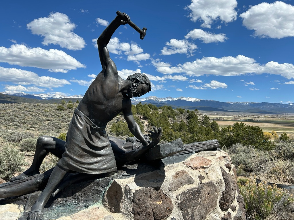
The Sangre de Cristo Mountains tower over the east side of the Río Grande del Norte from east of Santa Fe NM up into Colorado past the Great Sand Dunes. Meaning ‘blood of Christ’ in Spanish, the name likely refers to the scarlet colors of the mountains at sunset. The helpful illustration (above right) is on the Stations of the Cross trail up to a church that overlooks the historic San Luis Valley.

The Sangre de Cristo National Heritage Area in New Mexico borders the Northern Rio Grande National Heritage Area in Colorado, and includes the Cumbres and Toltec Scenic Railroad featured in Indiana Jones and the Last Crusade, the Monte Vista National Wildlife Refuge famed for Sandhill Cranes in March, and Fort Garland, a fine restored Kit Carson fort with an interesting museum on Buffalo Soldiers—one turned out to have been a woman who served for years as a man undetected. The area is lovely and pastoral amid snow-capped mountains, with many other worthy attractions, but I’m on the road again.

Biospheres of the Rocky Mountains

Biospheres are important ecological areas around the globe for protecting species diversity and for learning how to best sustain development ecologically, economically and socially. Science and solutions learned in each area are shared globally through the United Nations, and this is particularly important now that we face a global climate crisis. UNESCO currently recognizes three biospheres in the Rocky Mountain Region, and up to 2017, there were five more described below.

The Rocky Mountain Biosphere in Colorado roughly encompasses Rocky Mountain National Park and some of the Rocky Mountain Wilderness to the north. Some of the charismatic species in the biosphere are Bighorn Sheep, Elk, Mountain Lions, Pika and Snowshoe Hare. Scientists have studied species that have been wiped out of the area, like the Grizzly, Gray Wolf and Bison, as well as species that have moved in, like Moose. The exceptionally high altitudes define unique ecosystems of global importance.

The Crown of the Continent Biosphere in Montana includes Glacier National Park (see photo of author & son above). (Perhaps to de-emphasize the shrinking glacier problem, the Biosphere dropped the name “Glacier” in 2017). The biosphere is home to rare charismatic species like Grizzly Bears, Lynx and Wolverines. Over 100 years of scientific data on wildfires, snowpack, species populations, and more have been collected and shared from this park and its sister park Waterton Glacier in Canada. Like Rocky Mountain, the biospheres here cover the Continental Divide, which defines the direction of rivers across the US to the Atlantic & Pacific, but from here rivers also flow north to the Arctic, making these biospheres of particularly important for studying migrating species.

Yellowstone-Grand Teton Biosphere in Wyoming obviously includes Yellowstone and Grand Teton National Parks. One of the most intact predator-prey-scavenger biospheres on earth, with large herds of Elk and Bison, Grizzly Bears, Cutthroat Trout and Bald Eagles, and unrestricted rivers, this is an exceptionally important global biosphere.

Unfortunately, in 2017 the Trump Administration canceled 5 other biospheres in the Rocky Mountain Region. Apparently, the Israelis were upset that Palestinians were allowed to participate in UNESCO and used the place name “Palestine” in the name of a joint heritage site, so the US ended over forty years of scientific cooperation and research sharing with the world and removed many US biospheres from the global program.

The programs canceled in 2017 included three in Colorado: Central Plains Biosphere in the northeast, Fraser Biosphere in central, and Niwot Ridge Biosphere in the north. The Central Plains was particularly valuable in the study of short grass prairie ecosystems. Fraser was important in studying the interaction of forests, rivers and climate. Niwot Ridge contributed important research into alpine tundra ecosystems, glaciers, high altitude plants and climate change.

In Montana, the Coram Biosphere, west of Glacier NP ended in 2017. Coram was important in the study of forest regeneration and forest management. And in Utah, the Desert Biosphere, near Great Basin also ended in 2017. Desert, begun by President Hoover, contributed to our understanding of scrublands and pasturelands in hot and dry areas.

I’ve traveled in, through or next to all five canceled Rocky Mountain biospheres in my electric car, and they’re also uniquely beautiful places. But biospheres aren’t primarily meant for tourists, they’re meant for nature and for scientists. While some research continues at many of these sites, the international scientific and policy management cooperation was cut off. Especially facing a global climate crisis, we need to be actively cooperating to find global solutions to our ecological threats. Also, it seems bizarre to remove our own natural scientific research areas from participation in international science, due to deep-rooted political feuds in the Mideast. I hope these irrational mistaken biosphere withdrawals can be reversed by the current or future administrations, so that the global learning can continue.

Star-Spangled Banner National Historic Trail

Although his namesake bridge collapsed in Baltimore, Francis Scott Key is best remembered for capturing the spirit of renewed patriotism that grew out of the War or 1812, as he penned his description of the defense of Fort McHenry (above) that became our National Anthem. The War of 1812 was a national low point in many ways, as Congress had ended Alexander Hamilton’s National Bank, and Albert Gallatin’s budget cuts had eviscerated the military. The trail traces the British advances on land and sea, leading up to the siege of Baltimore. Many of the DC area sites are part of this trail, including Fort Washington, Greenbelt Park, Kenilworth Aquatic Gardens, the National Mall, Pennsylvania Avenue, the White House, the George Washington Parkway, and the Potomac Heritage Trail, but there are lesser known battlefields, forts, museums, plantations, gardens, parks, the Pride of Baltimore II, the house of Mary Pickersgill, who made the flag, and more throughout Maryland.

Dolley Madison may have been our greatest First Lady—especially compared to the feckless Congress and Cabinet, often only barely loyal to the US and open to surrender—, but Dolley did everything she could to support her husband and her country. She invented the Inaugural Ball, hosted Native American Chiefs, smoothed quarrels between European and African envoys, and, in our hour of need, stood fast in the White House, even as the marauding British Troops approached in 1814 and as her husband tried to rally the local militia to defend the Capitol. At the last possible moment, she evacuated, with the President’s papers, the curtains, china, an original copy of the Declaration of Independence, and a famous portrait of George Washington, torn from its immovable frame. The British burned the White House to the ground. Dolley’s famous diplomacy helped convince Congress not to abandon Washington DC and to rebuild the White House and the Capitol. And through the news reports of her defense of our country, the nation rallied, shocked that the British would burn down DC’s public buildings.

However, in the war’s aftermath came a new sense of national identity, including our national flag and national anthem, setting the foundation for a more aggressive and stronger nation. That nationalism was fatal to many Native Americans, as the British had tried to enlist them and as the USA became more assertive and expansionist. And today, there are self-proclaimed ‘nationalists’ who support the second attack on the Capitol.

Western Region National Heritage Areas

National Heritage Areas are run by local communities, with technical support and limited federal funding, so they’re not official park units. They’re certainly worth visiting, and they include some of my favorite places in the USA. Each has its own unique character, some preserve history, some culture and some nature, and together they showcase the tapestry of our country. I’ve visited the four NHAs in the Western Region by EV, so here’s a quick summary for you to explore.

The Santa Cruz Valley National Heritage Area in Arizona is part of the Gadsden Purchase of 1854. The NHA includes Saguaro National Park, Tumacácori National Historical Park—a small, but exceptionally beautiful place above—, San Xavier del Bac Mission, the Tucson Presidio Museum, the Arizona-Sonora Desert Museum, Native American tribal lands, and many other parks, preserves, ranches and gardens. The Juan Bautista de Anza National Historic Trail begins in the Santa Cruz Valley south of Tucson, at the Nogales Mexico border crossing.

Yuma Crossing National Heritage Area, in Arizona just across the Colorado River from California, is only a few blocks from Mexico, and it still carries some of that old frontier atmosphere. Yuma Territorial Prison, a state park, is a good place to start, and it figures in many of the old western tales of Tombstone and Hollywood. Be sure to visit the riverside parks, where 400 acres of wetlands have been restored, turning back time to before the Spanish came up river almost 500 years ago. The crossing is also part of the Juan Bautista de Anza National Historic Trail.

And the same trail ends up in San Francisco, where I used to live and work. One of my favorite escapes from that city was to explore the Delta, a huge area of farmlands, levees, and artificial islands upriver from the Bay. Built by Chinese laborers—later denied residency or citizenship—, the agricultural and boating area is sparsely populated, compared to the large cities nearby. My favorite town is Locke, which still has many old buildings used by Chinese laborers and merchants from over 100 years ago. It was one of the last towns of its kind, fortunately avoiding many of the “mysterious” fires that burned out other Chinese immigrant communities. While visiting John Muir’s home and Port Chicago, I took the opportunity to get lost there again, visiting Isleton and small harbors known only to locals. Fortunately, the entire area is part of the Sacramento-San Joaquin Delta National Heritage Area, including more civilized spots in Walnut Grove and Benicia California.

The last NHA in the Western Region is Great Basin National Heritage Area. While most folks think of Great Basin National Park, the Great Basin Desert is actually a huge geologic area, including a piece of southeastern Oregon, bits of California, the western half of Utah and almost all of Nevada. (Utah is part of the Rocky Mountain Region, but as most of the NHA is in Nevada, I count it here). So, anyone who’s followed the Pony Express or driven America’s loneliest road, Highway 50, knows the area. To call it sparsely populated is an understatement: one of the most populous places around is Eureka, Nevada, population 414. There is a remarkably undisturbed drugstore museum in McGill, and there’s a hot spring in Duckwater (pop 228). Topaz is in the Basin, as is part of the epic Pahvant-Valley Heritage Trail, one of the Mormon pioneer trails beyond the capability of my electric car. One of the trail stops is Hole-in-the-Rock in Glen Canyon, across from Rainbow Bridge. Good place to visit if you can get there and like solitude.

Tombstone

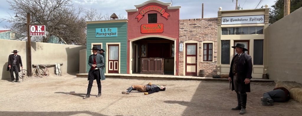
While not a national park site, I just had to stop to see the legendary Gunfight at OK Corral. The shootout was so quick I only got this photo of the aftermath. This Arizona town—named after a silver claim wrongly thought hopeless—is not far from a Butterfield Stage stop, and it has restored horse-drawn stagecoaches that take folks around the historic center of town. Boot Hill cemetery is another famous site here, but there are loads of historic saloons, re-enactments, museums, shops and more. The “world’s largest rose tree” is in a courtyard near the courthouse, and it’s amazing how large plants can get if we let them grow. Nellie Cashman ran a string of successful businesses here before moving on to the Klondike. Three Mexican Revolutionaries were convicted in the old county courthouse here, along with the Bisbee Massacre gang. And Geronimo had his famous photo taken by the photographer who had a studio above.

As mass shootings go now, I doubt this one from 1881 would make the news today. Today’s mass shooters kill more in one day than any old west gunslinger did in their lives.

Rohwer

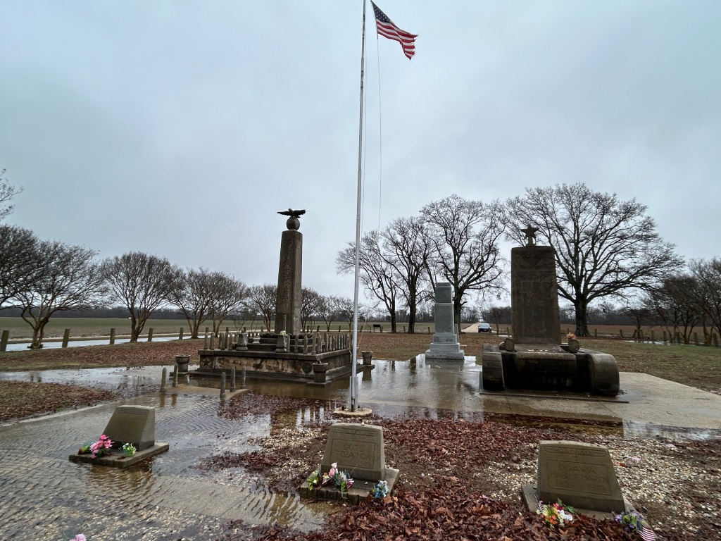
The last American concentration camp to close was Rohwer, Arkansas, deep in the delta near the Arkansas Post. There’s an echo of history, since that site is part of the Trail of Tears, when another group of Americans were forcibly removed from their homes unconstitutionally and sent to live in government reservations. The vast camp soon returned to farmland, so little remains besides the cemetery above. Several of the graves mark infants and elderly inmates. The monument to the right is to the 442nd Regimental Combat team, the most highly decorated unit in US military history. They served in Europe, while their families were imprisoned. 

The neighboring town of McGehee maintains the excellent WWII Japanese American Internment Museum about both Rohwer and Jerome. The sculptor Ruth Asawa was imprisoned here. Another inmate at Rohwer was a 5 year old boy named George Takei, who later played Lt. Sulu on the original Star Trek. 

“And it became normal for me to go to school in a black tar-paper barrack
and begin the school day with a pledge of allegiance to the flag.
I could see the barbed wire fence and the sentry tower
right outside my schoolhouse window
as I recited the words,
‘with liberty and justice for all’.”

George Takei, speech at the museum on 16 April 2018

Jerome

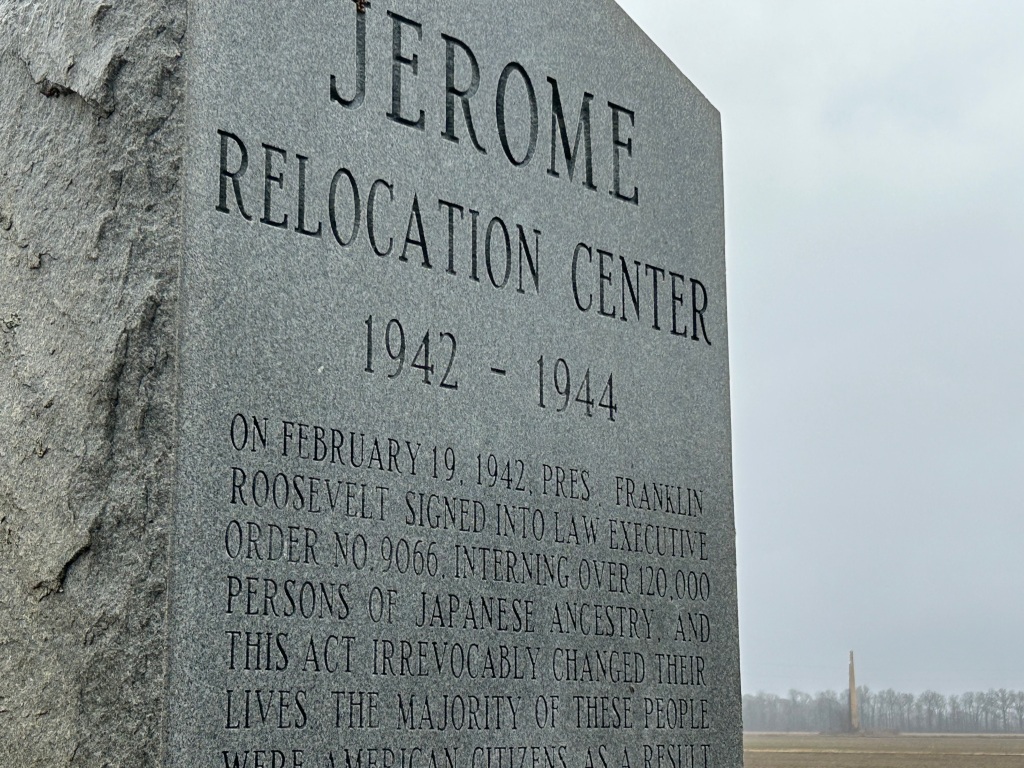
Jerome was the last American concentration camp to open and the first to close, as it was converted into a POW camp for Germans. The military acquired the land as a result of a tax default, and over 8,000 Americans of Japanese descent were incarcerated here in the southeast corner of Arkansas, deep in the Mississippi Bayou. The Governor of Arkansas insisted that none of the prisoners be allowed to remain in his legally segregated state after the war and that all of the guards be white. When it closed, the prisoners here were mostly transferred to the other camp in Arkansas, with some sent to Amache, Gila River and Heart Mountain; ‘trouble makers’ who protested had already been sent to Tule Lake. Besides the monument above, there is a deteriorating old smokestack from the infirmary visible in the distance to the right. Nothing else remains, and the land is now a working farm. 

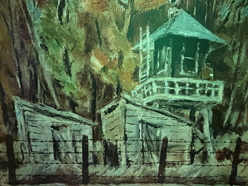
Nothing except a shameful unconstitutional history, a duty to be better Americans, and memories. Below is detail from a painting by Henry Sugimoto showing how he remembered his time at Jerome. The painting is on display with many other exhibits at the WWII Japanese American Internment Museum in McGehee about 20 miles north. The museum is excellent, open Thursday to Saturday, and is the result of talented, caring and dedicated townspeople working to preserve this important history without federal funding. 

Selma to Montgomery National Historic Trail

Dallas County Alabama systematically denied its 15,000 African American residents from registering to vote, using poll taxes, literacy tests, white-only primaries, and grandfather clauses, which made registration easier for those whose ancestors voted when only whites could vote. In 1963, with older people intimidated by murderous KKK raids or being fired for speaking out, organizers asked local high school students to protest. They did, meeting in churches—the only places they could safely assemble—and they were trained in non-violent protesting. Students marched by the thousands, staged lunch counter sit-ins, were beaten and arrested. All civil rights meetings were then banned by a local judge in 1964. Then, the Reverend Dr Martin Luther King, Jr came to Selma to speak in defiance of that ban, bringing national media attention. The contrast between black citizens, old and young, assembling peacefully to try to register to vote, and the police who denied their rights violently—criminals with badges—was to play out on TV. 

The teachers marched with their students. The police filled the jails with hundreds of students. Beatings outside churches turned uglier, and on 18 February 1965, while protecting his family, Jimmy Lee Jackson was shot to death by a police officer who was not punished. In response, the people decided to march 54 miles to the state capital in Montgomery. The police responded at the Edmund Pettus Bridge—the first step in the march—with billy clubs, horses and tear gas. Bloody Sunday, 7 March 1965. The TV coverage made the protest national overnight. Dr King organized a second march, but stopped on the bridge to avoid violence and due to a federal injunction. Rev James Reeb was killed on 11 March. LBJ called out the national guard, saying “we shall overcome” in a major speech 15 March. On 17 March, a judge cleared the injunction. Then Dr King led a third march, all the way from Selma to Montgomery from 21 to 25 March. Singers like Sammy Davis Jr, Nina Simone, and Harry Belafonte encouraged 25,000 marchers along the route. Upon arrival at the statehouse, Dr King gave his “How Long, Not Long” speech, including the phrase, “the arc of the moral universe is long, but it bends toward justice”. LBJ signed the Voting Rights Act on 6 August 1965. 

Selma may have been the turning point that enfranchised millions of African Americans, but the city and surrounding ‘black belt’ in central Alabama has suffered economic exclusion. Burned out buildings are common there today. The national park service is currently renovating several historic buildings in Selma including an interpretive center, and there’s also a Voting Rights Museum just across the Edmund Pettus Bridge which has an excellent, detailed display. Selma’s sights include the churches, lodgings and offices used by the organizers, and the jail where they were incarcerated. Halfway on the trail, near where Viola Liuzzo was murdered by the KKK, the park service has another interpretive center with an excellent multimedia film. Along US 80 are the four campsites used by the marchers.  And on the campus of Alabama State University in Montgomery, there’s another interpretive center with a different, also excellent film. And Montgomery sights include the state Capitol, a memorial designed by Maya Lin, and the Rosa Parks Museum, along with various archives and gathering areas. The drive is easy, and I recommend all three stops for the complete experience. 

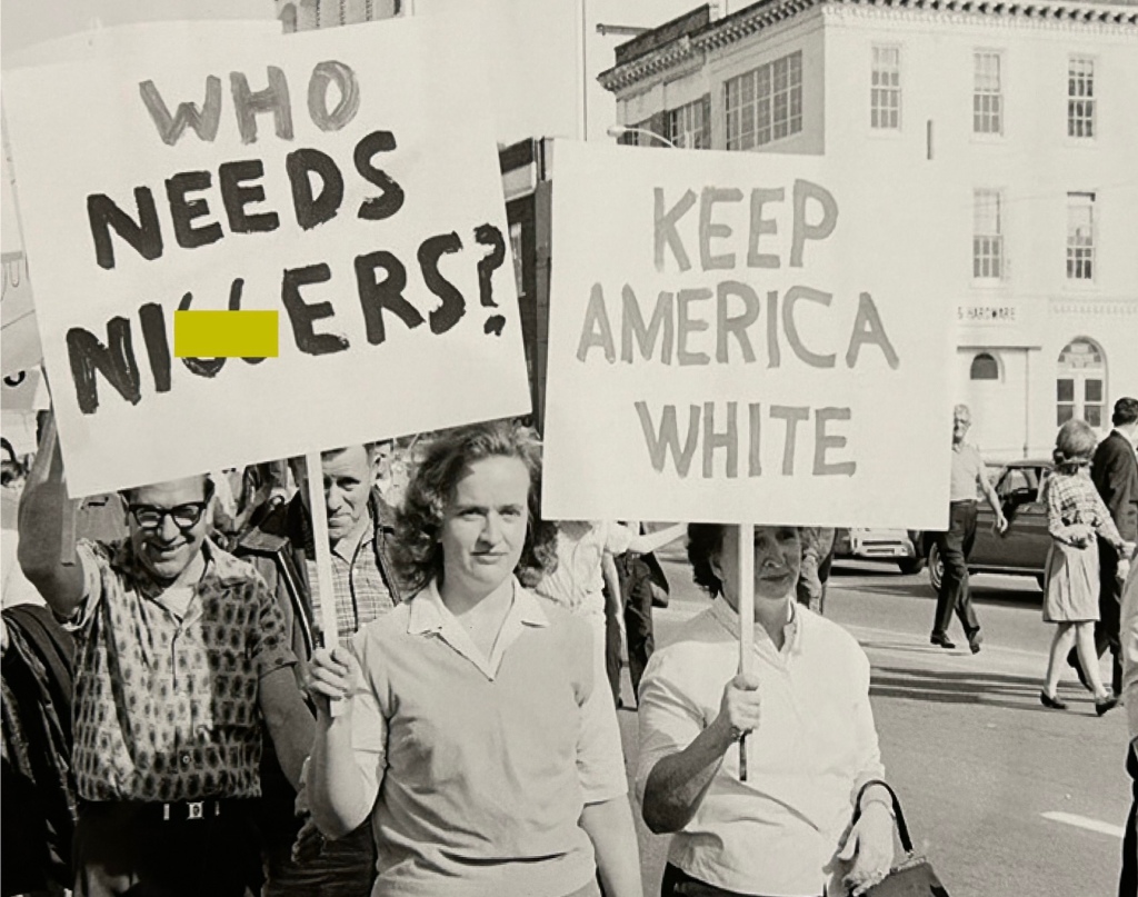
The King Center in Atlanta gives a broad and deep view into the life and works of Dr King, as well as the ongoing non-violent international justice movement. The Birmingham Civil Rights Institute explores how deeply segregation divided society, how violent the oppression became both across the street in the park and at the 16th Street Baptist Church where four young girls were killed by the KKK in a bombing, and how strong the Civil Rights Movement became. But the Selma to Montgomery trail, with its searing photos and video testimony of foot soldiers, brings history to life. The open racism (see photo) is shocking and revealing. In one of the films, a white woman argues that since Jefferson Davis was their president, Lincoln’s Emancipation Proclamation has no effect, that slavery is still the law. Such vile hatred does not dissipate overnight. Indeed, in both subtle and ugly ways, racism still divides our society. So we must feel this history again to continue fighting more effectively. 

Emmett Till and Mamie Till-Mobley National Monument

”Let the people see what they did to my boy.”

Mamie Till-Mobley

The animosity against African Americans, especially in the Deep South, is hard to comprehend, but it is deep, real, persistent and extremely dangerous. Emmett Till’s mother warned him, but even she underestimated the risk. In late August of 1955, Emmett Till was kidnapped from his great uncle’s home by a shopkeeper’s husband and his half-brother, who accused Emmett of whistling at the shopkeeper, a white woman. From past midnight to pre-dawn, the two men, along with several others, held Emmett, aged 14, in the back of a pickup truck, drove around the county, terrorized him, tortured him, shot him and dumped his body in the river. Witnesses reported hearing Emmett’s screams all over town for hours. His great uncle reported the kidnapping, the men were arrested, and the body was found a few days later. His mother, saying “let the world see what I see”, insisted on an open casket at the funeral in Chicago. Jet magazine published photos of his brutalized body. His mother became a lifetime activist, author and motivational speaker on education, poverty and Civil Rights with the NAACP. Many consider Emmett Till’s killing to be the beginning of the Civil Rights Movement, not least because Rosa Parks cited Emmett as the reason she kept her seat on the bus in Montgomery on 1 December 1955. 

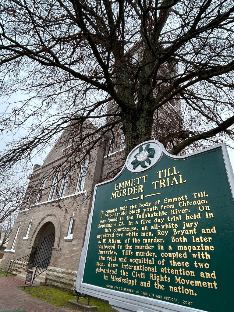
The trial was a foregone conclusion. Outside the courthouse (below) stood a statue dedicated to the “Heroes” of the Confederacy. Inside there was no justice. Instead of jurors, police, court officers and elected officials defending the Law, the courthouse became the focal point of a deep criminal conspiracy, based on racism. Witnesses were intimidated, hidden, immunized and silenced. Emmett’s great uncle testified at the trial, pointing out the kidnappers and murderers, and then he left town immediately and went into hiding under a false name. And for many years afterwards, there has been a concerted effort to conceal the truth. Evidence lost. Signs have been repeatedly shot and torn down. Historic artifacts and structures intentionally left to ruin or demolished. One witness, in hiding for decades under another name, still received death threats demanding silence. The confederate statue still stands in front of the courthouse, just left of the photo. 

But despite the legacy of lies, terror and violence, people still work to tell the truth about Emmett Till. Especially if you’re exploring the new monument’s sites in Illinois and Mississippi, I recommend reading the darkly fascinating stories in the Emmett Till Memory Project app, after being introduced to it by one of the contributors at the Emmett Till Interpretive Center across from the courthouse in Sumner, MS. Emmett Till’s coffin is on display at the National Museum of African American History and Culture in Washington DC. His name was given to the Anti-Lynching Act of 2022. And this new national monument was established by President Biden on 25 July 2023, on what would have been Emmett Till’s 82nd birthday. 

Gulf Islands National Seashore (& Admiral Farragut)

While I like the park and plan to visit it again in warmer weather, the seashore skips over the most important section in the middle. In Mississippi, the park includes the Davis Bayou (photo below) with a nice visitor center and park film, and from mid-March to October you can take a ferry out to Ship Island, look for bottlenose dolphins, explore the beaches and visit a Civil War fort. In the Florida section of the park, there are also birds, long stretches of storm-swept and once segregated beaches, old forts first built by the Spanish and later used by the Confederacy, and another visitor center (closed when I tried to visit) to explore near Pensacola. But the Gulf Islands of Alabama are not part of the national park unit. Forts Gaines and Morgan, the guardians of Mobile Bay, are Alabama State Parks. But that’s where the action was. 

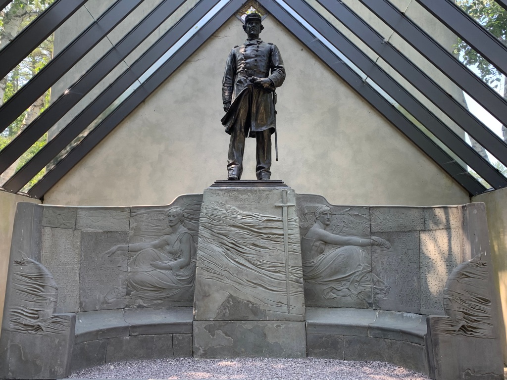
General Grant relied on combined naval and land forces to take Fort Donelson in February 1862, which cut off the Cumberland River from the Mississippi. In April, Flag-Officer David Farragut (depicted by Gaudens above) began his gulf coast campaign by sailing up past the forts guarding the Mississippi and taking New Orleans. After the Union freed the city, three regiments of African American troops were quickly organized, and many of those men first served on the Gulf Islands, helping retake the forts along the gulf coast. In June, Farragut was wounded near Vicksburg. 

The Confederacy’s last large port was Mobile Bay. In 1863 the Union took Vicksburg, but to speed the end the war, now Rear Admiral Farragut needed to sail past the forts guarding Mobile Bay. In 1864, the Confederacy, having learned from their mistakes in New Orleans, had heavily reinforced Mobile Bay’s naval defenses among the many fortifications along the Gulf Coast. Fort Gaines guarded the shallower west side of the bay, and Fort Morgan guarded the deep water ship channel from the east side. The gaps were filled with floating sea-mines, called ‘torpedoes’ at the time. And the port was guarded by the massive ironclad CSS Tennessee, the most powerful warship in the world. 

Farragut had four small new ironclad ‘monitors’ leading his fleet: the Chickasaw, Manhattan, Tecumseh, and Winnebago. He decided to run the gauntlet up the main channel into the large bay, boldly trying to move fast and far enough to get out of range of Fort Morgan’s guns. Under fire from the fort, the Union navy advanced with its ships lashed in pairs with the monitors on the side taking the heaviest fire. Farragut climbed into the rigging to get a view above the thick smoke. The Tecumseh crossed a mine field to engage the Tennessee, exploded one and sank immediately with 93 lost. 

Seeing his fleet hesitating and the Tennessee closing in, Farragut yelled down something to the effect of “damn the torpedoes, full speed ahead!” The remaining monitors surrounded the Tennessee, disabled her and eventually blasted a hole, injuring the Confederate Admiral. The rest of the fleet entered the bay, got behind the forts, and shelled them. The Army, including African American regiments from New Orleans, approached the forts, which surrendered, first Gaines without much of a fight, and then Morgan after a heavy siege. 

Mobile Bay was closed, cutting off supplies to the Confederacy. And the Confederate Army was tied down defending the city, helping open up Sherman’s march to Atlanta. While Alabama’s Gulf Islands are not part of the national park service site, they are in the middle of the line of hurricane barrier islands and sandy peninsulas where this major Civil War battle was fought on land and sea. Admiral Farragut and the Union Navy’s contributions to ending the Civil War must not be forgotten.