St. Croix National Scenic Riverway

Defining much of the border between Minnesota and Wisconsin, this river and its tributary the Namekagon were among the first rivers protected by the Wild & Scenic Rivers Act, supported by Walter Mondale and many other locals 55 years ago. The forest was quickly and heavily logged 150 years ago, but the water remained clean. Even though there are several dams, including a hydroelectric one at Taylors Falls, the river is much healthier than most, especially the upper St Croix. Below the dams, near the Mississippi, there are power boats, a power plant and non-native mussels, but higher up there are dozens of native mussel species, various fish, otters, bald eagles, kingfishers, great blue heron, several different colorful warblers and more.

The forests have regrown too, so it can be difficult to get a decent view of the river. The photo is from the Minnesota state park ($5 to park) below Taylors Falls, and it has a a canoe & kayak rental, picnic tables and camping. Nearby you can catch the scenic riverboat pictured that offers views of the basalt cliffs shattered by glacier melt. I’m going to have to return a third time, since my first trip was during spring floods and this summer during extreme low water. I believe the best views will be paddling the upper St Croix from the Namekagon confluence to highway 70, but I need good conditions for the rapids.

The Wisconsin parks are $11 to park with very similar views and features. There’s also a waterfall at Osceola, but the bluff trail there is now called the Falls Bluff Trail Loop, or the Cascade Falls Trail or the Eagle Bluff Trail or maybe the Simenstad Trail or the Osceola Rivertown Trail, but not the Osceola Bluff Trail like the park map says. Fortunately, you can also see the waterfall from the road, and the Watershed Café is quite good.

Ross Lake National Recreation Area

Ross Lake is atop three dams on the Skagit River which provides power to Seattle, but it still has some old growth forest near the visitor center which you can hike through on the River Loop and To Know a Tree Trails. Since the park is managed and surrounded by the North Cascades National Park, they run the visitor center. The Gorge High, Diablo & Ross Dams can all be seen in short hikes, and the good news this year after decades of tribal petitioning is that ‘fish passage’ will be added to all three dams! Hydroelectric power is zero carbon, but it must not be at the expense of salmon and other species that we’re driving extinct.

Anyway, I highly recommend those two hikes which total about three miles, and include waysides explaining the different types of trees, their niches in the forest and the natural cycle of wildfire. Another improvement would be building wildlife bridges along the highway & over the river, so that animals like Grizzly Bears could migrate between north and south sections of the park more easily. Well, in any case, Ross Lake extends to the Canadian border and has many paddle-in campsites for folks who rent gear from the resort or somehow portage their kayak around the Ross dam after paddling across Diablo Lake. Seemed like too much work to me to explore an artificial lake, but maybe if I had more time to try fishing, it would make a nice vacation.

Ozark National Scenic Riverways

Nature requires pristine conditions to sustain diverse species, and here they exist undiminished. Cave Spring above is fed from Devils Well, a huge underground lake in a Karst cavern 100’ below the surface. The water is so clean and cold that bright green watercress grows in thick clumps underwater. I saw baby swallows above the cave mouth, baby ducks following their mother down the rapids, a river otter, great blue heron and bald eagles. The air was thick with mayflies over the water and butterflies on the wildflowers. Lovely.

Carr’s, aka Current River, offered to provide their equipment for the same price as a shuttle, so I paddled from Akers Ferry to my campground at Pulltite. There’s tubing downstream, but when the water is high enough, upstream is more scenic. There’s an excellent cave tour at Round Spring where I saw cave salamanders, but tickets are limited. The other river in the park is the Jack’s Fork, and there’s a scenic mill at Alley Spring where I saw baby skunks. The largest spring is unimaginatively called Big Spring, and it’s strikingly beautiful with hundreds of millions of gallons of aquamarine water pouring out of the rock daily. Blue Spring is one of the deepest in the world, but I didn’t have time to explore everywhere. This Missouri park is one of my favorites, so I’m planning on returning to paddle another stretch soon.

Big South Fork National River & Recreation Area

The Big South Fork is a 76 mile tributary from the Cumberland Plateau in Tennessee that joins the Cumberland River between Cumberland Falls and Lake Cumberland in Kentucky. The Falls are the second largest east of the Rockies and are the best place to see a moonbow on this side of the planet. Unfortunately, Kentucky has a littering problem, so Cumberland Falls State Park is also a place you will see trash in and along the river.

The Big South Fork looked better when I kayaked from Blue Heron to Yamacraw above (Sheltowee Trace Adventure Resort has a shuttle). Non-native insects killed many pine trees years ago, so the forest has more hardwoods now. Pollution upstream still degrades the water, but Appalachia is recovering from the damage done by coal mining. Blue Heron campground made a good base to charge my car and explore the old mine exhibit there, even though the tourist rail line to town is under repair.

The gorges and remote roads make it difficult to get around, so I recommend paddling if there’s enough water. I saw a young deer and a bald eagle on the river and enjoyed looking up at the cliffs. The hiking is excellent too, and my favorite was hiking under the huge rock shelter behind 113’ Yahoo Falls. There’s also a large natural bridge called Twin Arches. The area is thick with trees, which makes it difficult to see all the geological features of the gorges, but the lush dense foliage gives the river a primordial feel, especially since I saw not a single person while kayaking.

Obed Wild and Scenic River

Lilly Bridge is down to the left from the Lilly Bluff Overlook above. There’s a short trail from the small parking lot, a medium trail down to the bridge and longer trails too. The timing didn’t work out for me, but in theory on weekends you can ask at the Lilly Pad Hopyard near the bridge to help shuttle you to a kayak launch or pick you up. There’s a 2 mile class II trip on Daddy’s Creek and several longer and more challenging trips on the Obed & Emory Rivers and on Clear Creek, all depending on river flow levels, of course, and understanding the limited put in/ take outs available in these protected waters.

The park film showcases the paddling, climbing, hiking and wildlife, with a Tennessee ‘mountain dew’ vibe, and the area feels remote, with hog hunting permitted in the area. Moonshine distilleries must have operated around here for centuries (which may explain why I prefer Tennessee moonshine to their rye whiskey). The US also secretly enriched uranium nearby in Oak Ridge for the Manhattan Project. It’s a lovely area, and I should have budgeted more time to visit.

Big Thicket National Preserve

Best paddling day yet! I took the Cooks Lake to Scatterman Paddling Trail, and the middle section is like a slalom through the trees. A local canoe guide told me about the old trees above, several of which are over a hundred and fifty years old. The loop is about 5 miles and goes up through some low current dead ends and back downstream via the Naches River, so it’s not a difficult paddle. The only trick is to explore the flat water, try to get a close up of the snapping turtles before they jump back in the water and try to quietly sneak up on the wood ducks before they take flight. Blue skies, green leaves and muddy water. Glorious.

After so much frustration trying to kayak the Rio Grande, this has been a slice of paradise in the Big Thicket, supported by another excellent Texas State Park (Village Creek) and an exceptional local restaurant (Tia Juanita’s Fish Camp). Remind me to winter here for the rest of my life. My main suggestion is to budget more time for this area. There are roughly eight different sections of Big Thicket to explore, miles of paddling trails and nearby state parks including beaches. My final Texas park unit is also my favorite.

Timucuan Ecological and Historic Preserve

Let’s catch up on where we were in Florida, at this fascinating, multilayered site that preserves not just nature but also native, colonial and freed slave cultures. As I learned here at Fort Caroline, which hosts the visitor center for the preserve, the Timucuan people either were killed, converted or escaped to join other tribes, after contact with the Spanish. But this was once their land (and water). And at the small exhibit in the Ribault Club, a partner site & wedding venue, I learned that thousands of years ago the Native Americans built shell mounds and large, complex rings of shell structures throughout these coastal islands, some of which remain here. So the preserve does help protect Native American archaeological sites, in addition to protecting critical breeding grounds and nurseries for fish, flyways for migrating birds, habitat for endangered wildlife and the plants which literally hold the land together. I saw many different birds on my hike in the Teddy Roosevelt area (above), including wood storks.

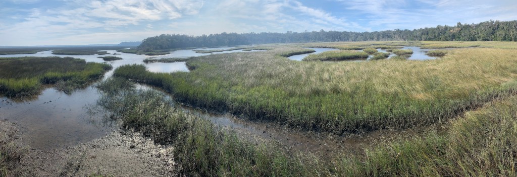
These islands (pictured) are the southern end of these low-lying coastal delta islands that run to Moores Creek in North Carolina. The whole area is now known as the Gullah Geechee Cultural Heritage Corridor, where some African traditions and culture survived, and a unique Creole was created, called Gullah in an echo of slave roots in Angola. That culture developed separately from the mainland, since some of the first Africans brought here were free, some slaves purchased their freedom (or their children’s) from the French, Spanish & British who allowed that, and some escaped. Unlike the larger plantations in the southeast, the coastal rice, cotton & indigo sea island plantations were run more loosely, with free time allowed after tasks were completed and many families kept intact.

The complexity of slavery in Florida is revealed in Anna’s story. She was born as Anta Ndaiye, a Senegalese royal, but was captured and sold into slavery at age 13. She was purchased in Havana in 1806 by a planter and trader who promptly impregnated her and brought her to Florida. Five years and three children later, the planter granted freedom to her and her biracial children. Florida was Spanish at the time, and she received her rights under their law. Her nominal husband owned other properties (and had other wives), so he left the management of the plantations near here to Anna. When US rebels tried to seize their property, she burned the plantation and was rewarded with new property by the Spanish. Anna ran the Kingsley plantation here for 25 years, overseeing 100 slaves. Her fourth child was born free. After Florida became a US territory, new laws were passed making interracial marriage illegal and jeopardizing the rights of Anna and her children. So her husband moved the family to Haiti, which had been free since the end of their revolution in 1804. After her husband died, Anna returned to the US to claim her inheritance, which was contested by her husband’s sister, who argued that Anna couldn’t own property in Florida. Anna argued that she was Spanish, since she had been recognized by the Spanish government as free (and a hero) and noted that the US government had promised to protect the rights of all Spanish citizens under the Florida treaty signed by John Q. Adams in 1819. Anna won. She fled to New York for the duration of the Civil War returning to Florida afterwards.

“To deny people their human rights is to challenge their very humanity.”

Nelson Mandela

Congaree National Park

Congaree is one of my favorite parks, so I saved it for my last entry of the year. Once, every river in the southeast was filled with hardwood forests like this, supporting many species of birds, fish and wildlife, and keeping our air and water clean. Now, this may be the last great one left. Around late May, the fireflies blink in synch, so you’ll need to plan months ahead if you want a campsite then. The 2.5 mile boardwalk hike from the main Harry Hampton visitors center takes you past a few of the tall trees that fill the swamp: beech, bald cypress, water tupelos and loblolly pines. The latter are the largest, most massive pines in the eastern half of the US. Congaree may have been saved much more recently than some of the more famous parks in the west, but for biodiversity, it is exceptional.

Of course, being basically a swamp or flood plain forest in the middle of a giant watershed stretching from the Blue Ridge Mountains to the Atlantic, the best way to see the park is by paddling. I dragged out my trusty OruKayak and spent several glorious hours exploring Cedar Creek by myself. There were folks on tour at the boat launch, but once on the water, I didn’t see anyone. Longer trips can be arranged on the Congaree River. Several people asked about my kayak, including a couple that happened to be from my old hometown, and I explained that it is lightweight, a bit tippy, and fits easily in the trunk of my Tesla Model 3. (I know everyone is hating on Elon right now, but he made a good car, as long as you don’t use the autopilot).

Apologies for botching another photo, but I should point out that the knobby things sticking up from the bank on the left are the knees of the bald cypress. They say it’s a mystery why the tree has knees, but obviously, the knees help dry out the roots, preventing rot. Above them, you can see some dwarf palmetto illuminated by the sun, and further upstream, the creek was blocked by falling trees, which are becoming more frequent with climate-crisis fueled storms. I also heard a variety of birds, although most of them flew away as I approached. Definitely worth bringing a map & GPS, since there are many side routes and obstacles that may require changing plans on the water. Beautiful.

Chattahoochee River National Recreation Area

The park runs along the riverside in 16 different mostly contiguous sections, just north of metro Atlanta. The view above is from an overlook in the East Palisades section, specifically between EP 10 and EP 14 near the Indian Trail entrance. The treacherous whitewater mild shoals in the river above are known as the Devil’s Race Course, not for downstream paddling difficulty, but because it used to be “a devil” to move cargo up the river here.

Parks near urban areas means more people enjoying nature, and even on a chilly autumn day there were plenty of folks out jogging, hiking, biking and dog walking. One young lady appeared to be in deep meditation at the river’s edge, while her dog intently watched some geese on a sand bar in mid stream. It would have been fun to kayak through the park, but I couldn’t figure out a good way to get all my gear back to my car. With limited time to visit other sections, I spent my time on a beautiful long hike along the river and up in the wooded hills.

Crunching through the leaves reminds me of running cross country as a boy during the fall in New England and leaves time to reflect on loss and letting things go. Life is not perpetual youthful summers, and the decay that comes with the passage of time prepares the ground for new life and the next generation. The bittersweet changes of seasons and life should be learned from, embraced and cherished, not denied nor medicated away.

“Good night, good night! Parting is such sweet sorrow,
That I shall say good night till it be morrow.” 

— Juliet

Lake Mead National Recreation Area

Apologies for the twisted Pano, but I’m still getting the hang of my new kayak. This is Black Canyon, and the hand-pulled cable car was built so the guy in charge of gauging the river could get from his house to the gauge station via the catwalk on the cliff to the left. I paddled up part of the Black Canyon National Water Trail a couple miles from Willow Beach to get a decent photo of Emerald Cave, which also failed (I blame the low water level and too many people). But in the sunlight, the shallows along this stretch of the river do turn a beautiful green, and seeing the fish and ducks helps emphasize the importance of the Colorado River to life in the desert.

There are many different ways to recreate in the area, but this self-guided kayak tour appealed to me. I think I’ll keep my OruKayak in my trunk for trips just like this. There are longer paddling tours from Hoover Dam, a paddle wheeler, boating on Lake Mead, backcountry horseback riding, hiking, biking, scuba diving (historic plane wreck) and many more. I took the kids to tour Hoover dam years ago, and it’s fascinating. This trip I stayed just outside the park downstream below Davis Dam (which forms Lake Mojave) at the Pioneer in Laughlin, which was cheap and had free overnight EV charging (ClipperCreek). All the Colorado River lakes are in trouble now, due to the climate crisis and misuse of water, so I wanted to visit before things get worse.

100 years ago yesterday, the Colorado River Compact was signed. Ecology, Native Americans and Mexico had no input. Today, more water exists on paper than in the river. The states say they are unwilling to renegotiate, but every year the cities get bigger and the water levels drop. Like other human activities, our use of the river is unsustainable. As thankful as I am that this area is preserved for recreation, unless we do something, it won’t be for long.