San Miguel de Allende

Santuario de Atotonilco

Above is one of a half dozen side chapels in the UNESCO World Heritage Site of Atotonilco which includes nearby San Miguel de Allende. While most tourists luxuriate in the colorful town, this whole area is historic, beautiful and fascinating!

By all means, visit Ignacio Allende’s house next to the church founded by San Juan de Miguel, who founded the town. You will learn how Allende, the hero of Mexican Independence, lost his eldest son in battle defending his father and see how the Creole elite lived when the Spanish King decided to take the lion’s share of the treasure in silver from the mountains. The mixed race locals were furious that some overseas French-backed King was against the Jesuits educating them, and they rebelled.

Was Allende the mastermind or the Priest Hidalgo, who cried for independence? The smart money is on Allende, but the poor must have listened to Hidalgo. Either way, they were captured and executed, both becoming martyrs. And the people rose up and won their independence from Spain. There’s much to explore!
Amistad National Recreation Area

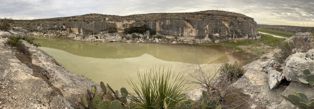
In 1969, just below the confluence of the Rio Grande, Devils and Pecos Rivers, a dam was built, creating Lake Amistad (friendship en Español). The lake caused the mouths of the Pecos River and Seminole Creek (above) to silt up, and now that the water level has fallen (like Lake Mead and Lake Powell) they’re cut off from the Rio Grande (see far right). Most of the boat ramps, like the small dock at the cave above, are no longer accessible. The lake is far below minimum expectations, because the US diverts virtually all the Rio Grande water before it even reaches Big Bend. From there most of the river comes from Mexico’s Río Conchos. The park is run in partnership with many agencies, and the two towns that share the border are friendly and have joint cultural festivals annually. Mexico maintains a small fishery, US residents enjoy bass fishing, and the border is marked with buoys. I took one of the old highway ‘spurs’ straight down to the water, but it was too hot to kayak in winter.

Panther Cave, across the canyon above, is on the far western park boundary. While the park film absurdly claims that “no Native Americans have any ties to the area”, the canyon is Seminole Canyon, and the cave is an important site for prehistoric cave art. The Amistad visitor center has information and large reproductions of the cave art, and the excellent Seminole Canyon State Park has morning ranger-led tours to another similar cave and a few miles of hiking trails to see the view above. Before man dammed and drained the rivers and destroyed the riparian ecosystems, Native Americans must have traveled up the Rio Grande to Albuquerque, where some of the oldest petroglyph art was created at the same time as the art here. Sitting on the cliff above observing the wildlife, I imagined prehistoric people hunting, traveling by canoe, drawing on the cave walls and protecting their families from panthers, until thunder warned me to seek shelter.

Rio Grande Wild & Scenic River

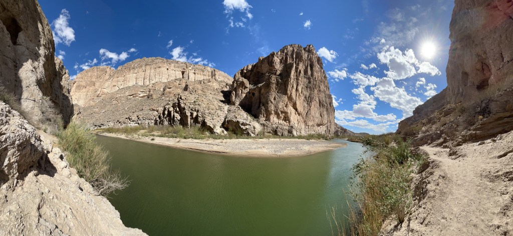
The Rio Pequeño (not grande with this low water) enters the Boquillas Canyon here and continues down to Amistad. Hiking into the canyon along the border, there are few signs of the modern world, and I suddenly felt like I was in a classic western movie when I heard horses approaching. Three horse riders offered handcrafted souvenirs and chicken tamales as they passed, and when one was crossing back to Boquillas Mexico on horseback, his horse had to bend down to knee level to drink from the middle of the river. Hardly worth crossing by rowboat at the port of entry, when folks were wading across the river. (Yeah, yeah rules, but no harm no foul with kids just playing in the water).

The Climate Crisis is playing havoc with my plans. Not sure when I’ll get the kayak wet this trip. A few days ago, I was trudging through the snow in Zion, and here in winter the temperature hit over 100 degrees on the trail. Best to visit in February, and always bring plenty of water. Last year I just carried a water bottle, but now I use a 3L hydration pack with another 5 gallon container in my car. The heat is no joke; a hiker died here just a few days ago, one more of many.

Due to low water and logistics, I’m only exploring the river from the dusty trails and grand overlooks within Big Bend. The US and Mexico protect 200 miles of land alongside the river, including the canyon above, another at Santa Elena and a big reserve on the south bank opposite Big Bend. In particular, there’s a nature trail at Rio Grande Village, where I spotted a half dozen bird species in minutes, including a Great Blue Heron and my first sighting of a Black Phoebe flycatcher. It’s unfortunate that so many communities take most of the river water without considering the downstream impact on birds and other species. I know people pay extra for golf courses, ornamental plants and water features, but national nature reserves suffer directly as a result. Americans need to invest in solar desalination facilities and leave rivers alone.

Chamizal National Memorial

Unlike any other park, Chamizal memorializes diplomacy. When the Rio Grande shifted course at the end of the 1800’s, it created an island and a seven decade long border dispute with Mexico. President Kennedy went to Mexico to finalize an agreement, and LBJ later participated in the joint ceremony at the border here. There’s a beautiful mural on the visitor’s center, and I remember from a previous visit that there’s a film that explains the importance inside.