Biospheres of the Southwest

This is a photo of a photo of a Texas Horned Lizard in the arid Chihuahuan Desert scrubland, from a roadside plaque near Las Cruces, New Mexico. The actual habitat is within the White Sands Missile Range and is off limits to the public. This UNESCO recognized special biosphere, Jornada—meaning day’s journey without water—, is open to scientific researchers from USDA, USFWS and NMSU, with limited school trips to the Chihuahuan Desert Nature Park in the southernmost corner. For many decades, the Department of Agriculture has been studying the climate here, gathering useful data about the fragile desert ecosystem. The Fish and Wildlife Service mostly focuses on the Bighorn Sheep and other species in the adjacent San Andres Mountains. New Mexico State University organizes research efforts and assists student scientists. 

While you can’t visit the Jornada biosphere or disturb the wildlife, these scientific research zones are extremely important for understanding global climate change and the ecosystems that support unique species. But the southwest region has two internationally recognized biospheres that you can visit: Big Bend and Big Thicket. Big Bend, like Jornada, is part of the Chihuahua Desert, and it also includes a biodiverse riverine ecosystem. Big Thicket is one of the most biodiverse places in the US, where the bayous, leafy forests, pine forests, plains and sand hills intersect and provide habitat for thousands of species. While these areas provide enjoyable excursions for Americans, they are also important beyond our borders. Scientists from all over the world actively support protecting and studying these areas to ensure the survival of species globally.

Poston

In Arizona, across the Colorado River from California, there’s a desert hamlet called Poston in an area governed by the Colorado River Indian Tribes. Spanish Missionaries visited in 1775 and their King recognized tribal sovereignty. Mexico lost the whole territory after the War, and the US government established reservations to ‘protect’ the Mohave, Chemehuevi and others here. Today, despite some irrigation improvements, much of the population is poor, and each winter many RVers spend months living cheaply in the desert nearby. 

But from 1942 to 1945, the US concentrated as many as 17,000 US citizens of Japanese ancestry forcibly relocated from their homes on the west coast to three camps, known as Roastin’, Toastin’ and Dustin’. The highs are over 105° all summer long. Besides the 50 year memorial (pictured above) to the families, children and highly decorated WWII veterans once incarcerated here, there’s not much left to see, except a few origami cranes left by visitors. 

But there’s much to think about. Constitutional rights and freedoms, so cherished in this country, are an ‘all or nothing’ deal. For you to enjoy a right or freedom, you must recognize that same right belongs to all your fellow citizens, regardless of their background or beliefs. Our legal system depends on the idea that the law applies equally to everyone, that no one man is above the law and that there are no permanent classes of people entitled to extra privileges. If we want to continue to enjoy our own full rights as citizens, we must make sure that no other US citizens are trammeled, as they were here, ever again. 

Arizona National Scenic Trail

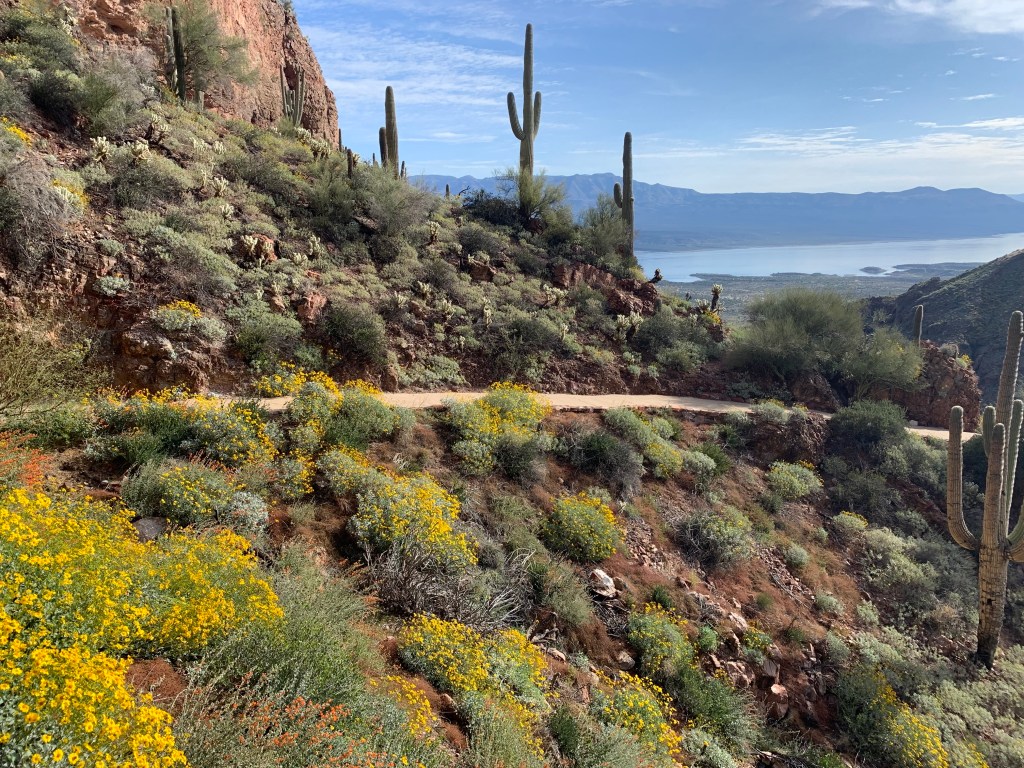
This forest service trail runs between the borders of Mexico and Utah. The southern Sky Islands section includes Coronado National Monument and Saguaro National Park near Tucson, and the terrain ranges from low desert to 10,000’ mountains. The next Sonoran Uplands section crosses seasonal desert rivers and passes by the Tonto National Monument (see photo). The Volcanic Field & Ponderosa Pine Plateau includes Walnut Canyon near Flagstaff. And the northern Plateaus & Canyons section crosses through the southern part of the new Grand Canyon National Monument and both south and north rims of the Grand Canyon before reaching Utah.

While I’ve visited the park units along the way, hiking long sections of the trail is too challenging for me, with risks from heat stroke to flash floods. But it would be an adventure! Driving to the parks along the trails is an easy way to see a few of the highlights, and I will be posting about several more trails this fall.

Guadalupe Mountains National Park

Even after planning, I still check with the rangers for suggestions on good hikes and photo ops. I originally planned to hike McKittrick Canyon, but the ranger suggested the trail at Frijoles Ranch instead, as its shorter and quite similar this time of year. The trail passes two different springs, including the mountainside one pictured.

Guadalupe is large, mountainous and mostly dry, which makes it both difficult to explore and also more barren than many other parks. But that’s what makes the occasional oasis above especially sweet.