Forest Wildfires

I know it’s winter, but we need to talk about wildfires. There is a common, simple-minded view—popular among those who deny climate change—that overzealous park employees unnaturally suppressed fires, causing wildfires today. End of story. Once we ‘catch up’ on the ‘fire deficit’ everything will be fine. This is bunk.

Last year Canada had a record-smashing year of wildfires, and the frequency of wildfires far exceeds what is normal, considering the naturally slow growth rate of trees in boreal forests. Most of these fires were in remote northern Canada, where historic fires were not even reported, let alone suppressed. The estimated number of fires was not too high, but many of the fires were mega fires, burning over seven times as many acres as the modern historic average. There is only one explanation for the scale of the wildfires last year, and it isn’t Smokey the Bear. The primary cause of increasingly severe forest fires is carbon pollution. 

The first humans to change natural fire ecology in North America were natives who for centuries used fires in the valley for agriculture and to attract game with new grass. The most destructive humans by far were loggers who clear cut whole forests. During the Great Depression, roads and campgrounds were developed in both old and regrown forests, bringing millions of visitors who parked their hot cars on dry grass, dropped their cigarettes on pine needles and left their campfires unattended, causing a dramatic increase in forest fires. Firefighters responded by putting out fires when they threatened nearby communities.

We changed forest fire ecology in complex ways over centuries, so the simple ‘fire suppression’ explanation is false. We don’t know exactly what the forest’s natural ecology was like before man started playing with fire here, but man’s brief experiments for a few decades last century—causing wildfires due to camping and suppressing some fires at the edges—all account for maybe 2% of the life of a Giant Sequoia. Yosemite park rangers tracked all fires within the park since the 1930’s, and for decades none of the fires were large enough to matter to the overall health of the forests until recently. Past fires were often 100 or maybe 1000 acres, but recent forest fires are 100,000 or 1,000,000 acres. Our hotter climate has changed everything. Now we need to change our perspective from our recent past to the consequences of our carbon pollution on the future. Extinction is not a mistake we can correct later. 

California has the most national parks with 28 park units, and about 12 of them have some type of large forest, often wilderness. I’ve been in all of those forest parks in the past year or so, and 9 now have huge swaths of dead trees from recent wildfires. 

Only Muir Woods, a small coastal redwood forest park along a creek surrounded by wealthy suburbs, has been spared. Pinnacles has had multiple wildfires in the past three years, but firefighters managed to contain them quickly. Even foggy Redwood park lost 11,000 acres in 2003 due to the Canoe Fire. 

This level of wildfire is not normal; it is out of control, and it is getting worse. Discussing past firefighting efforts and increasing the rate of manmade fires is not going to fix the problem. If we do not stop our carbon pollution, then 100 years of environmentalists’ efforts to save these forests for future generations will be wasted. 

No Time To Wait

The warmest time of the day is from 3-5 pm, not noon when the sun peaks. The warmest week of the year is between mid July and mid August, not the summer solstice in June. Similarly, the peak year of manmade global warming will come years after we stop increasing carbon pollution. The delay in feeling the full effects means, if we wait until the climate gets intolerable before acting, then we will have to endure many years beyond that intolerable level before our actions take effect. 

We know we are abruptly shifting our climate out of the comfortable zone that enabled human evolution, and we don’t know how bad it will get. We only know that we must act long before the climate becomes intolerable, in order to avoid catastrophe. 

Some say we should wait for more evidence about global warming before acting, such as scientific proof showing the damage caused by carbon pollution. This is like refusing to stop smoking and start taking medicine, until after the disease kills you. Climate scientists have already diagnosed the problem and prescribed the solution, but too many of us are unwilling to face the truth, change our behavior and take our medicine. 

Kings Canyon National Park

John Muir loved the view from Panoramic Point above, as did Stephen Mather, the first national parks director. I visited the park years ago with my family, and the scenery was stunning. But the view was less inspiring when I visited this summer. Smoke from a wildfire shrouds the view of Kings Canyon in the distance. You can hardly see the lake in the photo above. Behind me stand acres of dead trees burned in the huge wildfires of the past few years, and the main road into the heart of Kings Canyon wilderness was still closed this summer due to fire damage. If Muir & Mather visited now, they would be as heartbroken as I.

Experts employed at this California park have long argued influentially in favor of more fires, have implemented prescribed burns in forests across the west, and they chose to let the wildfire above burn itself out. Their dogma blamed past firefighters for causing today’s wildfires. Even though park rangers are not allowed to smoke, leave campfires unattended, burn out shelters in trees, or use fire to hunt, this park’s scientists used to argue that we needed those ‘Native American burn practices’ for forest health, even though these forests evolved without humans. Too many forest rangers and climate change deniers use this illogical nonsense to ignore and dismiss the danger of carbon. 

This year 46 million acres of wilderness forests burned in Canada in roadless wilderness areas consistently ignored by firefighters in the past. How could these wildfires have been caused by past ‘fire suppression’? The dogma is wrong. After the unprecedented recent wildfires, park scientists here have belatedly begun to recognize the predominant threat of climate change, far worse than any prior suppression errors. 

When Muir & Mather described the area, they did not remark on seeing any large areas of burned trees, made no note about any fires that regularly demolish many thousands or even a million acres every few years, and they did not write about the supposed benefits of Native Americans regularly setting fires while pelt hunting. Instead, they were inspired by the beauty of huge swaths of living forests and pledged to protect them forever. Scheduled fires, tree density limits, species removal, reseeding, and other human intervention are not what Stephen Mather had in mind when he called such places ‘untrammeled wilderness’. Muir would have harsh words against the ~$250 million annual timber sales in the forests he and Teddy Roosevelt protected. 

If Muir & Mather could return, they would notice that the whole forested range has changed dramatically, the air and ground are drier, the temperature is unseasonably hot, the rivers and creeks are dry, and that the snow is gone from the mountaintops. They would be dismayed by the decline of once abundant wildlife. Muir, who never rode in cars, preferring horses or hiking, would see the lines of buses, RVs and cars burning gasoline, and he would shout ‘STOP’!

In the future, doubtless people will be horrified to learn that in the face of climate change fueled wildfires, we chose to burn our remaining forests ourselves, releasing even more carbon into the air. It’s like using leeches to cure people, even though they make the patient weaker. Or like destroying the village to save it.

Forest science must face the future, not misrepresent the past. We need national policies to limit carbon pollution, not taxpayer-funded ‘prescribed burns’ that increase carbon pollution. If new conditions require fire breaks or dead trees need to be removed, then why can’t trees be cut down and buried with sand, instead of being burned? If certain types of trees will no longer survive in the future hotter climate, then we shouldn’t be paying people to plant seedlings for more of the same trees in the same places that burned down two years ago. We need to charge visitors in gas-burning vehicles a carbon surcharge to encourage people to switch to electric vehicles (and to mitigate some of the damage they do). 

We ended wilderness. Our carbon pollution is trammeling every species on earth. We have precious little time remaining to figure out how to save species before they go extinct forever.

Without wilderness, we will eventually lose the capacity to understand America.
Our drive, our ruggedness, our unquenchable optimism and zeal and elan
go back to the challenges of the untrammeled wilderness.

Harvey Broome, founder of the Wilderness Society

Oregon, California & Mormon Pioneer National Historic Trails

The first recorded pioneers to take the trail with wagons were the Whitmans in 1836, who settled in Washington 11 years before the massacre. In 1841, the Whitmans were followed by the Bidwell-Bartleson party, which split midway and settled in both Oregon and in California, after a harrowing journey. In 1843, a thousand pioneers made it to Oregon, finding a safer path through southern Idaho. In 1846, the Donner party got caught in early, heavy snow near Lake Tahoe and engaged in cannibalism before being rescued. That same year Brigham Young led 500 Mormons to Salt Lake City, leaving from Nauvoo, Illinois, two years after a mob broke into jail and killed Joseph Smith.

Gold was discovered near Sacramento in January 1848, and then Mexico ceded the state in February after the Mexican-American War ended. So, there was a flood of migrants to the mountains in California. To be clear, ox-driven wagons were used for gear. Pioneers walked. Many miners did not have wagons. And most Mormons pushed their carts by hand. Cholera and other diseases spread rapidly on the trail. Many of the pioneers were economic migrants or seeking freedom from persecution, and some did not have legal rights to settle where they did. As we celebrate our pioneer heritage, let’s not close the door on today’s migrants.

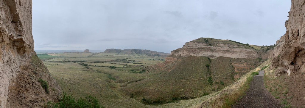
All three trails were heavily traveled in the 1850s and 1860s, and all passed through Scotts Bluff—see photo above & read how coffee saved lives—and Fort Laramie. The Mormon trail ends at Salt Lake. The Oregon trail goes past Hagerman Fossil Beds in Idaho and on to Fort Vancouver in Washington. The California trail breaks into different routes in Wyoming, with some passing through City of Rocks in Idaho, before the trail joins together to cross central Nevada. And then, the route depends on the destination: some north through Lassen to Whiskeytown, some through Carson City Nevada to Sacramento, and others south near Yosemite to the central valley.

Naturally, the trails only cover the most common routes, and there are pioneer trails all over the west, including some carved into cliffs. But all three main historic trails were used heavily, in both directions, until the railroad was completed in 1869. Our history includes many changes and challenges in transportation. Today, the Climate Crisis demands that we switch to electric vehicles. Compared to the pioneer stories, that should be easy.

Yosemite National Park

In 1859 John Muir built a Sugar Pine cabin some yards from the spot above and lived in the Valley for 2 years. Sugar Pines can live 500 years, so the decades John Muir spent saving this valley are just a fraction of their long lives. Muir saved Yosemite, lost neighboring Hetch Hetchy to a dam, and influenced Teddy Roosevelt who ended up protecting 150 million acres of forests nationally. Now the park is a World Heritage Site too. But in the near future, the crown jewel of John Muir’s legacy may still be lost forever.

Some species of trees still living here evolved in the Jurassic, long before the Chicxulub asteroid wiped out most dinosaurs and millions of years before humans arrived. Millenia ago, natives started fires for hunting and agriculture, and over a century ago, the timber industry clear cut forests throughout the Sierra Nevadas. But humans now present a threat bigger than any logging or dam. Now the threat is carbon pollution, which dwarfs all others, even logging. Fires burn hotter, more frequently and many times larger, because we have changed our planet’s climate dramatically—and it’s still getting worse. Species here, despite evolving 1000 times earlier than humans, are now threatened with extinction by our vehicle exhaust.

10 years ago, the 250,000+ acre Rim Fire burned over 10% of Yosemite, killing many Sugar Pines and Sequoias that had survived fires for centuries or millennia. At the time, it was the second largest fire in California history. Now it doesn’t even make the top ten. I visited the park with my family before that fire, and the park was undamaged. Now, the park is still beautiful, but it is still scarred badly, with many areas still closed.

Yosemite Falls should not be so glorious in the photo above taken in July. The snow should still be on the mountain tops, melting slowly over many months. Instead, every decade is warmer than the last and the rate of temperature rise in increasing. The Lyell Glacier that Muir saw in Yosemite has lost over 95% of its mass, no longer moves and will be gone in a few years. Man has messed up the climate, and many of the species, including the largest trees, can no longer live here safely. And it’s not the fault of Smoky Bear telling people to put out their campfires, it’s the fault of people who continue to drive gas powered vehicles. And yet the park is full of them, blithely surveying the damage they contributed to and continue to cause. If I were in charge of the park service, I would convert the shuttle buses to electric and ban all fossil fuel vehicles.

Lassen Volcanic National Park

This boiling mud pot in the Sulphur Works area is so close to the road that the shoulder has collapsed. There’s a parking area a minute walk away and the views include many other steamy volcanic features, rough landscapes broken by eruptions and snow in July. The trail to the larger Bumpass Hell area was blocked by snow from the parking lot. I didn’t care, since I’ve been there before with my kids, before the fire. We stayed at Drakesbad Guest Ranch with their amazing natural hot spring pool where we swam and floated under the Milky Way, one of my fondest memories of any national park.

In 2021, the 1 million acre Dixie Fire severely burned 70% of this Northern California park, mostly the wilderness area. With Mount Lassen over 10,000 feet, many of the trees in the park grow extremely slowly, so the fire damage will be visible for up to a century, assuming we don’t have another fire before the forest can recover. Like much of the park, Drakesbad Ranch is still closed, although most buildings were saved. The devastation is terrible to see.

The park newsletter does not mention the Climate Crisis in a complete denial of reality, but it did congratulate itself for ‘30 years of fuel reduction that decreased burn severity’. We now live in the Pyrocene Epoch, the Age of Fire, where man has created conditions for multiple million acre fires each year, when the most beautiful places can be destroyed in a few hours. Once we imagined our parks would be there for future generations to enjoy. Now we wonder if they will still be there for our next vacation.

Ice Age National Scenic & Ice Age Floods National Geologic Trails

The Ice Age National Scenic Trail in Wisconsin is now a NPS unit. The trail will link most Ice Age National Scientific Reserves in the area, which are NPS affiliates. The Ice Age Floods National Geologic Trail runs from Montana to the Pacific Ocean. I’m keeping all three together here.

Wisconsin’s scenic trail curves around the edge of the last ice age glacier 26,000-10,000 years ago, which covered the north near Lake Superior and east near Lake Michigan with a massive ice sheet. The trail extends from near the confluence of the Mississippi and St Croix Rivers east towards Michigan’s upper peninsula, south to Madison and back up the Door Peninsula between Green Bay and Lake Michigan. South and west of the trail contains both an area that had glaciers before that and a ‘driftless’ area without signs of glaciation. The glaciers stripped the earth of many layers of soil, leaving a flat land of lakes with short forests. The Wisconsin Dells, with its horizontally carved lines in the rock, is at the edge of the last glacier and the driftless area, where the ice sheets pressed and cut into landscapes that had not been glaciated before. From there the Wisconsin River flows down through the gentle driftless area to meet the Mississippi near Effigy Mounds. Frank Lloyd Wright build Taliesin in the driftless area, which reminded him of the verdant rolling hills of Wales.

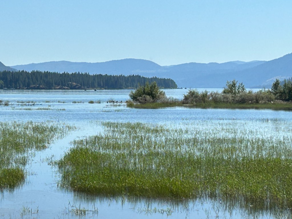
The massive glaciers ran west along the Canadian border all the way to the Pacific, past Glacier and Lakes Roosevelt (see photo) and Chelan. The ice covered what is now Seattle and down between Olympic and Mt Rainier. The floods geologic trail refers to the stretch from Grant-Kohr’s Ranch and Big Hole Battlefield in western Montana, through Idaho’s panhandle, across the giant flood plains between the Grand Coulee Dam and the Nez Perce park, down past the Whitman Mission, down the Columbia River Gorge to Fort Vancouver, up the Willamette Valley and finally down past Lewis & Clark’s fort through the wide mouth of the Columbia.

The simple geologic explanation for the vast floodplains and dramatic gorges, is that the ice melted, repeatedly collapsing ice dams between mountains, releasing huge waves of water and reforming the landscape. Much of the rich farming soil we depend on was placed there in a natural climate change event. Washington state produces billions of dollars worth of produce annually on those floodplains, including apples, milk, potatoes, wheat, beef, hops, hay, cherries, grapes and onions.

What some folks don’t seem to understand is that while the end of the last ice age was ‘sudden’ in geologic terms, man-made climate change is exponentially more abrupt. Imagine a deer seeing a hiker slowly approaching on foot and choosing to flee by jumping into the woods. Now imagine a deer seeing a truck approaching at 75 miles an hour and not having time to respond. That’s the difference between natural and man-made climate change. We don’t have time to stare into the headlights.

Whiskeytown National Recreation Area

The 220’ three-tiered Whiskeytown Falls were a local secret known only to loggers and a few others until rediscovered by the park service staff in 2004. The ‘strenuous’ trail opened in 2006, and, since the shaded trail is in the 3% of the park not completely burned by the 230,000 acre Carr Fire in 2018, I decided to hike it earlier this summer, rather than broil on the water in my kayak.

But then these folks from Cal-Fire Bully Choop & Sugar Pine CC #9 passed me on my way up. Rather than complain, I gave them a bit of applause and thanked them for their heroism. They were taking turns cooling off in the 50° water. Of course, it’s not fair to expect these young people to risk their lives to protect our forests and property from the Climate Crisis we are all guilty of making worse, so they deserve our thanks all the more.

At the visitor center, I noticed that they are using an underwater curtain to block the warm surface water from continuing downstream from the dam. This innovation helps keep the water temperature low enough for Chinook salmon eggs and fry in the Sacramento River. I’m not sure how long it will work given the Climate Crisis, but it’s the least we can do after damming Clear Creek. Maybe we could ban gas-powered boats too?

I was disappointed to read the park newsletter with three long articles about the fire and zero mention of the Climate Crisis. I expect my tax dollars to be used more wisely. Denying the crisis only gives us less time to act.

Buffalo National River

[Sorry to hop around so much, but I want to wrap up a region]. Last year folks celebrated the 50th anniversary of the river’s designation, but somehow Arkansas allowed a concentrated 6,000 hog feeding operation on Big Creek to pollute the Buffalo River with runoff from tons of pig crap. The resulting increase in algae and e-coli bacteria was damaging water quality in the park significantly. After protests, the hog operation was halted (and paid off handsomely), but local politicians have not been willing to make the ban permanent.

I woke in Tyler Bend Campground all ready to paddle 10 miles of the middle section from Baker Ford to Gilbert (where someone from the General Store would leave my car), but a sudden line of thunderstorms dissuaded me. That storm system killed three people in Texas with tornadoes and brought lots of lightning to this river in Arkansas, so I was glad to hit the road early instead. Pollution from either industrial ranching or fossil fuel burning is taking the fun out of some of my best trips.

Despite rural development—like Branson—, the Ozarks are still very beautiful, and the river is 135 miles of free-flowing nature. Nearby there’s a 100 foot wide natural bridge, one of many alcoves and interesting geologic features in the area that likely caused the French trappers to describe the area as having arches or “aux arcs” (say it out loud).

Americans, being poor linguists and unaware of the remote arches and bridges upstream, have long been confused about the origin of the name “Ozarks”, speculating that the French were talking about natives with curved bows or some bend in the river. This is moronic, as all bows and rivers are curved, so the French explorers would have no reason to use such a useless description. Americans had similar problems in understanding the French name for the Canadian River, which obviously derived from the Spanish word cañada, as the river passes Texas’ Palo Duro, the second largest US canyon. Rather than try to understand foreign languages, Americans assumed the French explorers did not know how to Canada by river.

Fort Frederica National Monument

Upon arrival, I remembered visiting by small boat as a teen many years ago. All along the southeast coast, displaced Native Americans and escaped slaves endeavored to remain free in these low-lying delta barrier islands. Although threatened, the evocative old oaks, the Spanish Moss and the shell-filled archaeological ruins are still hauntingly beautiful.

In the 1730’s the British built a pair of forts, both named after Frederick, Prince of Wales, to develop and defend their colonies against the Spanish. Fort Frederick’s ruins are 125 miles north, next the Reconstruction Era Camp Saxton in South Carolina. Fort Frederica here in Georgia, defined the southern boundary of their colonies, north of Spanish Florida.

The British commander Oglethorpe was considered enlightened (for the time) and enthusiastic. Rather than slavery, he proposed work be done by indentured servants mostly from debtors prisons in England, making Georgia a type of penal colony where workers could gain their freedom over time. The Methodist founder John Wesley and his brother Charles first attempted a church under one of the large, mossy oaks here, and the settlement had various tradespeople, including a Native American interpreter, a blacksmith and a doctor/barkeep.

In a remarkable historical echo of the French colonial experience at Fort Catherine, Oglethorpe also tried to seize St. Augustine in Florida, besieging the Castillo de San Marco and being stopped at Matanzas. Again, the Spanish counterattacked, but faring better than the French, Oglethorpe successfully defended this fort and cleverly routed the Spanish in Bloody Marsh, despite being outnumbered. After the Spanish retreated and conceded Georgia, the British cut their military presence here and the remote island village faded away in a decade or two.

Now, while driving through these remote islands, I can’t help but be amazed by the fancy houses. Not because they’re decadently ostentatious, but because they’re so close to sea level. It is astonishing to think that many of America’s most successful retirees choose to develop luxurious estates within the zone that is most certainly going to be erased by the climate crisis. The collapse of Thwaites ‘Doomsday’ Glacier is accelerating, and rising seas will take all the land here. They may have inherited much wealth, but they won’t be leaving these houses to future generations. Apparently, you don’t need much intelligence to be rich.