[Quick note: beginning next week, Thursday and Saturday posts are both moving to Friday].
Polar bears are among the most charismatic species to be threatened by the climate crisis, which sadly is driving high-carbon tourism to see them before they become too few or far away. When the ice melts, the polar bears can’t reach their primary prey, seals. The effects of carbon pollution are currently warming the arctic quickly, and many bears are starving while they wait for the ice to return. One of the most popular spots to see wild polar bears is in Churchill Manitoba in Canada, and most visitors arrive by plane, usually taking at least two flights to get there. Once here, they take large tundra buggies or even helicopters out to see the bears gathering on the shore of Hudson Bay.
Bear viewing peak season is short, between the first snow fall in October and when the ice is thick enough for hunting. Come too early, you won’t see the bears; come too late, and they’re all out to sea. Still, you might see beluga whales or the northern lights. Besides tourism, there’s a lot of scientific research conducted up here, describing in detail how our rapidly changing climate is disrupting the lives of various species, especially the polar bears at the top of a fragile food chain. The scientists obviously understand the implications, and they offer virtual tours and are working on electric tundra buggies to try to limit the carbon pollution of tourism.
Even though this is not a world heritage site—and I’m not a carbon jet-setter—seeing polar bears in their natural environment is irresistible to me. Concerned about contributing to the carbon pollution that threatens polar bears with extinction, I decided to drive my EV up to northern Manitoba and take the train to see them, instead of flying. The town of Churchill on Hudson Bay has no road, so I drove to the regional center of Thompson to catch a 16 hour train ride to Churchill. Even Thompson is challenging for an EV, as it is 239 miles from the next closest charger.
Churchill—named for an illustrious ancestor of the UK’s wartime Prime Minister—has a Hudson Bay Company fort, a shipwreck, a small museum of the people who have lived here for ~3,000 years, and a brief-stay polar bear jail—for bears that won’t keep out of the town. While it took me longer—and cost far less than a package tour—, I made it to Churchill, taking a guided van tour into Wapusk national park, and I saw them, real polar bears living in the wild—a dream come true.
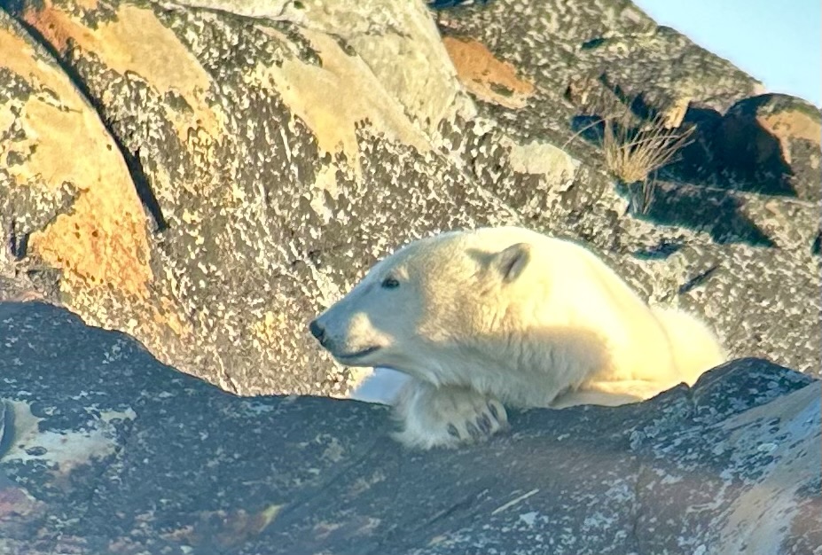
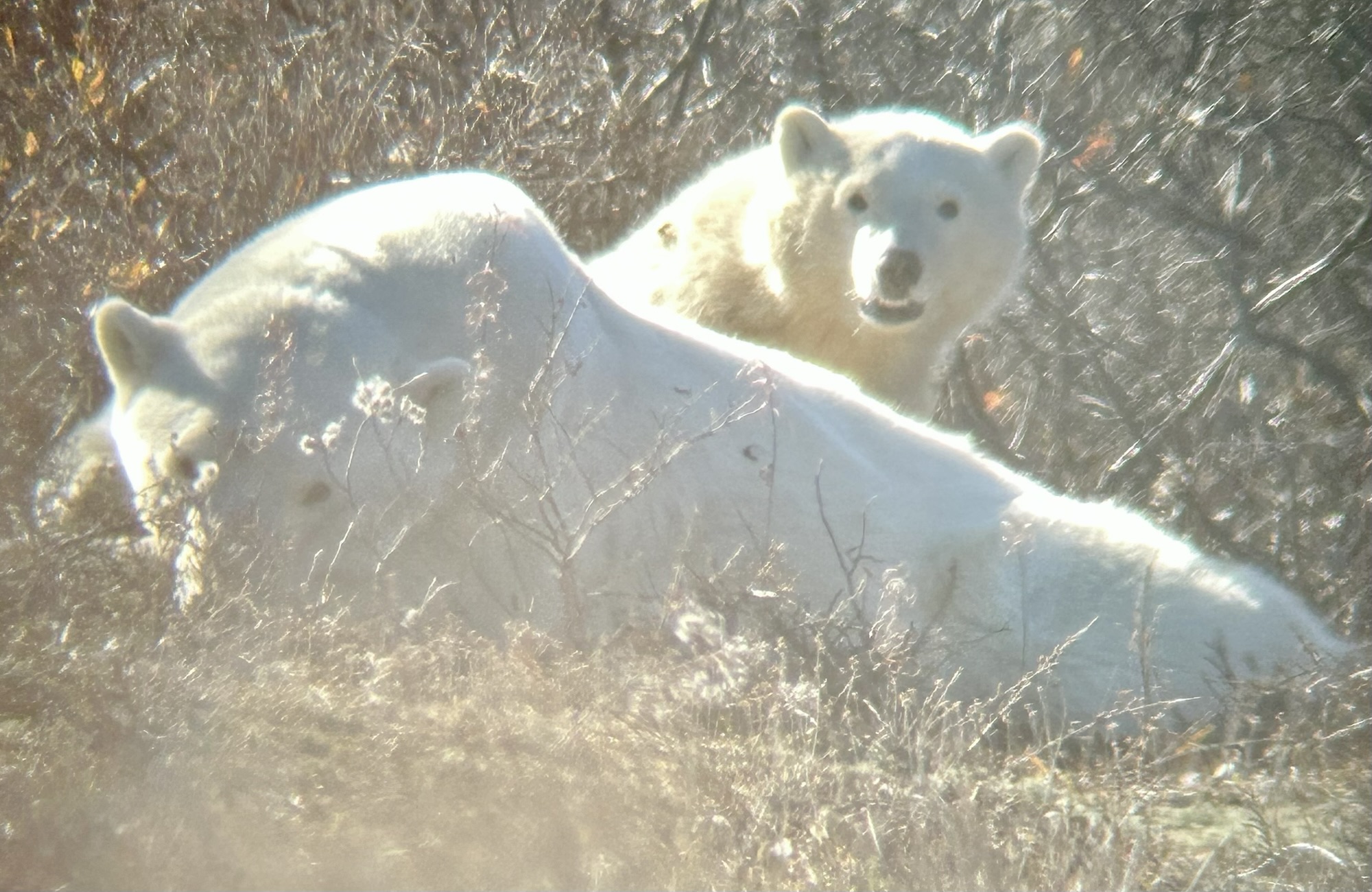
Above is a young male polar bear we observed chilling on the rocks and later walking to the water. I also saw a couple of arctic hares and dozens of Ptarmigan, an arctic or alpine bird with feathered feet. Below are a mother and cub who were resting in the sun, occasionally looking up curiously. I hope people make an effort to reduce their carbon pollution, so that these magnificent animals aren’t wiped out forever by our thoughtlessness.
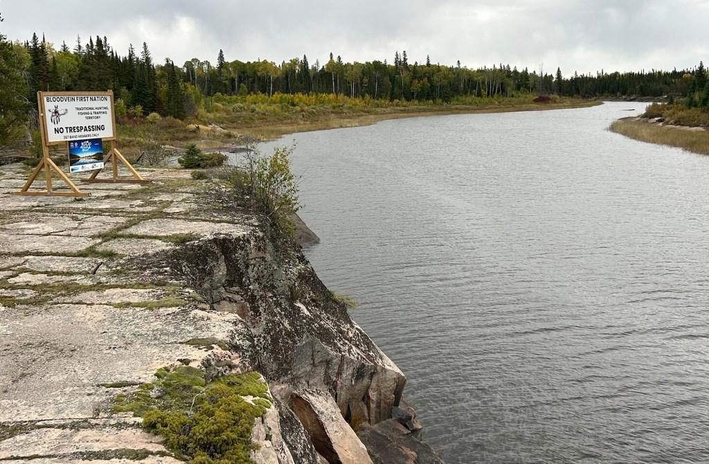
This 10,000+ square mile world heritage site in Manitoba and Ontario is over 100 miles from the nearest slow charger, and most of the road is unpaved and washboarded in some sections. That made the round trip challenging for my Tesla which no longer has the range it used to. I shouldn’t complain, as the all season road is less than 10 years old; before that, there was only an ice road. The site is both the largest protected boreal shield in North America and home to four First Nations, making it a rare dual natural and cultural UN site. Unless you hire a guide on some multi day paddling trip or stay at Loon Strait, there’s really no tourist infrastructure yet. If you want to try First Nation cuisine, I recommend Winnipeg. Still, I made it into the core area of this remote UNESCO heritage site and into the community of Bloodvein itself.
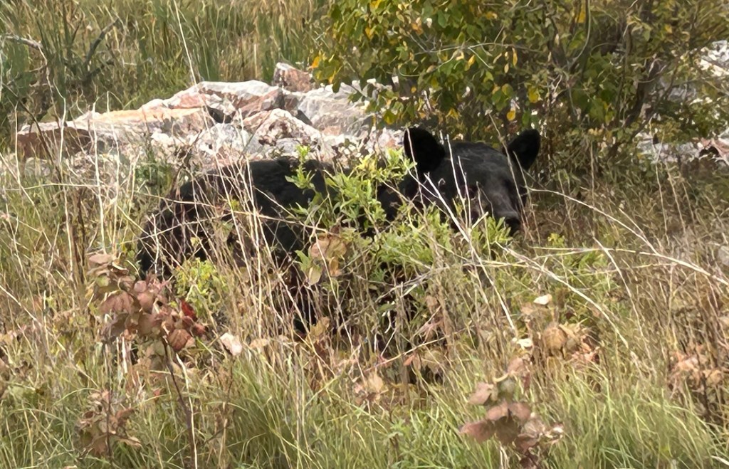
They were checking cars and ids at the gate, and they added a few questions about my travels. Just past the checkpoint I spotted a bear, and for once I managed to get a photo, above. I also saw many beaver lodges, but missed a picture of a beaver playing near a mud slide. A bald eagle flew over the Bloodvein River below, but as usual, I couldn’t get a decent picture of the majestic bird in flight. Still, three wildlife sightings in such a short visit is exceptional. I credit the First Nations community for protecting wildlife, as well as members. The road in town was very muddy that day, challenging my all wheel drive, and the coffee place was closed. On my way out, they didn’t seem impressed by my wildlife sightings, but they were interested in the range and cost to charge my car. Hopefully, visiting places like this in my EV gets more people thinking about how to lower their own carbon pollution to protect such beautiful natural areas.
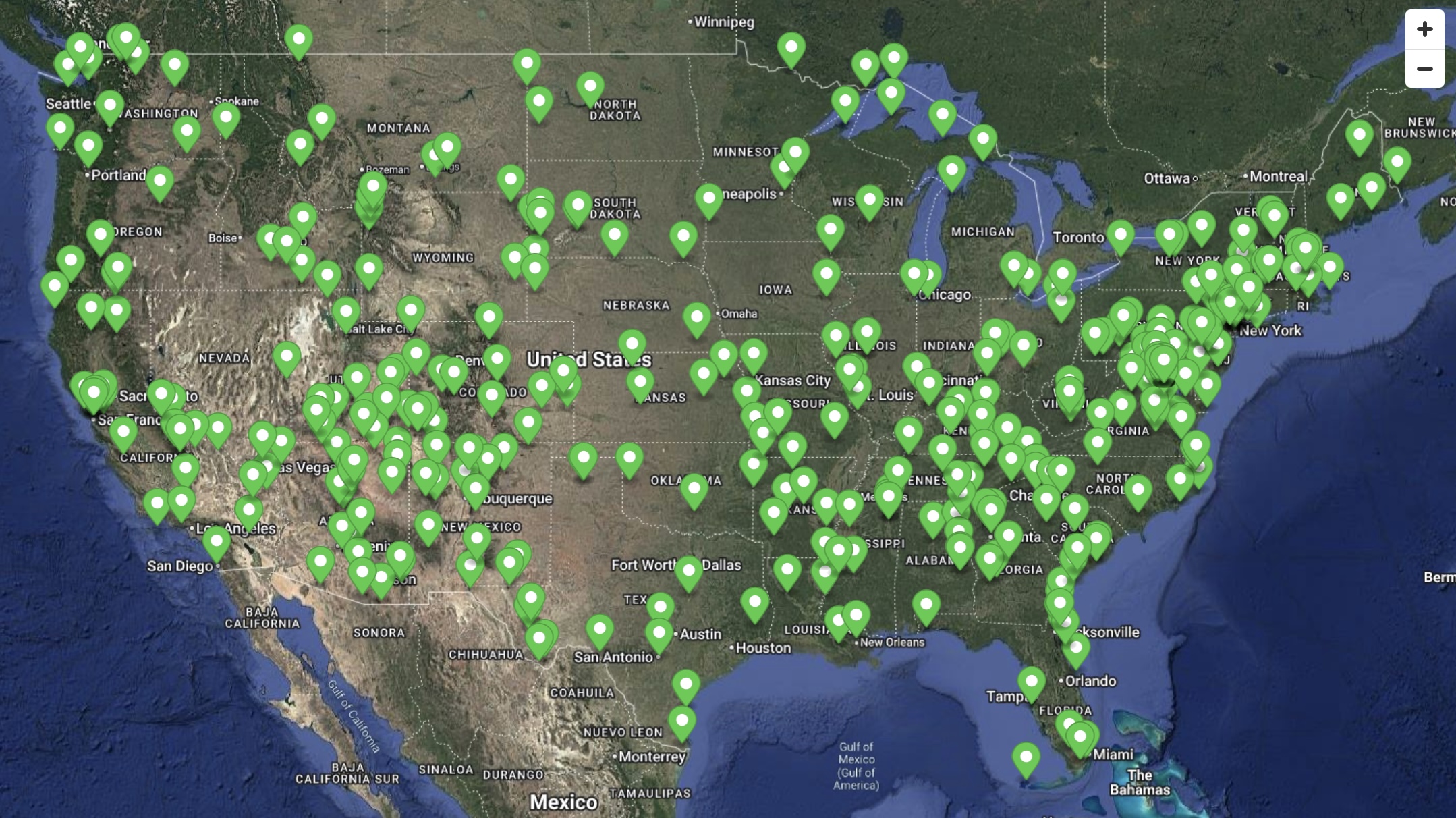
Late this year, I visited my 395th park site, earning a rare park stamps award for all official NPS sites in the 48 contiguous states (see map). Plus I drove my EV to 29 NPS affiliates, 60 heritage areas, and 24 national trails (not on map). Read about my favorite sites below.
‘Best’ is subjective, as it depends so much on your individual taste and experience. If you are lucky enough to have great weather, a lucky wildlife sighting, or an inspiring ranger-led tour, that day will be one of your favorites. Click on the links to read my past favorites from 100, 200, and 300 park units visited, and here are favorites from 400 park sites, including affiliates, heritage areas and trails. I have no changes to my previous favorite park units, but I have a few additions.
Once I get to a park, I like to explore, preferably without burning carbon. I have a folding e-bike (Gocycle G4) and a folding kayak (Oru Bay) that fit in my car (Tesla 3LR). I also bring an old packraft (Kokopelli) for remote camping trips. [To be clear, I receive zero compensation related to any products or services, neither referral bonuses nor discounts.] Despite some wonderful experiences, I would not recommend anyone buy any of these products, which all have drawbacks. Instead, pick what works best for you.
In many parks—especially for normal folk who don’t visit a hundred a year—the smart paddling choice is to rent. Often the only way to get a pickup / drop off is free with a rental. If you don’t paddle frequently, this ends up being relatively cheap, with less hassle and without maintenance. Many places are very concerned about invasive species, so careful cleaning and drying of your own equipment is time consuming too, not to mention fees for licenses and mussel stickers.
My folding kayak works well for shallow, flat water. I have a spray skirt for whitewater, but it’s best in swamps like Congaree and Big Thicket or in long relatively flat rivers like the Delaware or Big South Fork. Because it tracks straighter than my packraft would go, I can cover a lot of ground, frequently passing younger, fitter raft paddlers. It’s a bit expensive, tippy, and it doesn’t carry a lot of gear, so I use it for day trips. But folks renting $90 a day gear often say ‘good idea’ when they see me pull my kayak out of my car trunk, not realizing this is possible. Their guides look much less pleased with the idea.
I wish I had a lighter packraft, as mine is almost as heavy as my 25 pound folding kayak. But it packs up small and carries much more gear, so that’s the only option when the campsites are far from the car. The Kokopelli is also more appropriate for whitewater than my Oru.
Which brings me to my new inflatable boat (Takacat 260) with electric outboard (E-propulsion Spirit Plus). Charging my new outboard battery with a solar panel (above) is easy, and the battery floats. While heavier than I would like, this is the lightest combo I could find. With a solar panel, I can run this at low speed all day, even charging underway. I find it works best when carrying gear across open bays or trying to cover longer distances when time is short. One surprising benefit is that I can approach birds very quietly and closely both in the water and on rocks or shore, with a more stable platform for photos. If everyone switched to electric, the shores would be much quieter and cleaner.
My favorite place in Baja is Loreto, above. It’s a magical town, both Mexican and touristy, with good restaurants, not too big nor crowded, near beautiful beaches and with quality tours to explore the bay. The bay and islands are part of a national park, where I saw blue whales. Simple restaurants on nearby beaches have the freshest seafood: try Vista al Mar.
Winter is the time to see the gray whales in their favorite lagoons, mating and raising their calves. And some of the tour operators offer rock painting and other tours, if it’s too cold or windy for watching whales. Ensenada has vineyards with wine tasting in the surrounding valleys. And folks enjoy biking, fishing, hiking, horseback riding, kayaking and more along the whole peninsula. More folks should make the drive from the US state of Alta—‘upper’—California to the Mexican state of Baja—‘lower’—California and Baja California Sur—‘south’.
Everyone who has driven to Baja has stories, but there’s a lot of BS from people who want to make it sound more rugged and dangerous than it is. Americans often drive big expensive campers with all sorts of extra gear, imagining they’re on some challenging off-road expedition, like one of the Baja races. They talk about camping at some perfect remote cove only accessible with a specialized vehicle and extreme skills, even though many beautiful beaches are on easily driven roads. I saw a van roll over after swerving to avoid a pothole on the highway, so I think the last thing you need is some top-heavy monstrosity. (Driver said he was fine, but I asked the police nearby to check on him).
While I saw several large motorcycle packs of ‘rugged individuals’ staying at comfortable hotels, I drove my Tesla 3, with a low center of gravity that steers well, and I visited some of the most wonderful places in Mexico, without drama. As on my drive to Mexico City, I was neither asked for bribes nor witnessed any crimes. There’s much less traffic in Baja, and there’s no need for a car permit in Baja or neighboring Rocky Point. I crossed the border at Tecate, where I simply drove through without a wait. There are a few checkpoints, but—besides asking questions about my car—they typically just wanted to know my destination, to be sure I wasn’t trying to drive at night. (Due to politics, returning to the US is far more time-consuming than it was last year, as inspections have increased significantly).
50 years ago maybe, you needed a small private plane to stay at Hotel Serenidad, one of John Wayne’s old favorites, but I just drove there. The restaurant still has delicious food, and the atmosphere is tranquil. The road was a little bumpy, but I charged my Tesla 3 at a nearby hotel, while playing with their dogs. Then, down the coast, I had one of my favorite meals, aquachiles mixto, at Ana’s restaurant on Playa Santispac, while mesmerized by the view from my table below.
The plain truth is that Baja is drivable by electric vehicle, and I was surprised to see only two Teslas south of Ensenada. Even the US CBP officer was surprised that I had driven my Tesla 3 all the way to La Paz and asked about road conditions and charging. There are two routes from the last Supercharger in Ensenada, either via Hotel Cataviña and the pacific highway or via San Felipe on the more recently paved ’faster’ route. I took the pacific route, since it’s a few miles shorter. Sure, my car lost signal for the whole round trip between Ensenada and LaPaz, so it missed the time zone change between north and south Baja. But I used my iPhone to navigate, entering my next destination whenever I was in a town large enough to have cell service or at a place with WiFi.
The destination chargers I found on PlugShare are much slower than superchargers: +42 miles/hour, but some are free with lunch or $20 to charge. La Paz to Loreto can be done in one drive, and both ends have hotels with free charging for guests. (Here’s a tip. If you’re charging overnight, don’t set a full charge as ‘one time only’. When I woke up, a power outage during the night had reset my charge level from full back to daily 80%.) I drove Bahía de Los Angeles to Ensenada in one long day, charging in San Quintín. The trick is to obey the speed limits and take your time. Since charging is so slow, there’s no point in saving 40 minutes speeding, only to have to charge for an extra hour when you arrive. Besides, you need time to avoid potholes.
Although too many people have thrown trash along the roads and too many developments and small buildings have been abandoned, Baja is still very scenic, with beautiful beaches, craggy peaks, canyons, deserts, dunes, farms, salt flats, volcanoes, date palms, countless cacti, osprey, and more. OK, it can be dusty and dirty, but not everywhere. Mexico is an informal country, and Baja is even more so, where folks just do things their own way. (Every margarita I drank, tasted different than the last). But if you put a smile on your face, be patient, thoughtful and keep your eyes open, then Baja is a beautiful place to visit, especially in a small electric car!
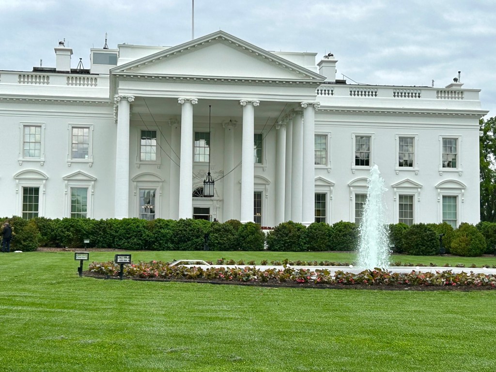
The park service commemorates six parks for Teddy Roosevelt, from his childhood home in NYC, to the ranch in North Dakota where he mourned, to his family home on Oyster Bay, to the room where he was sworn in after an assassination, to the DC island that celebrates his legacy and to the monument that rightly places him among our greatest presidents. The carbon crisis threatens to end the environment Teddy Roosevelt saved for us, so he would want us to switch to electric vehicles to enjoy all his parks, as I did.
I like Mount Rushmore, but it’s in the wrong place.…
At least a dozen current National Parks began with Teddy Roosevelt protecting their land, besides his namesake park above. His friendship with John Muir inspired our entire national park system. We owe a debt that we can only repay by continuing his legacy of preservation for the future.
As President, Teddy Roosevelt protected 230 million acres for us in 20+ states, including national forests, rivers, preserves and more, such as around the beautiful San Luis Valley. He’s directly responsible for all the units listed below, plus others, as well as for signing the Antiquities Act by which presidents still designate national monuments.
“The civilized people of today look back with horror at their medieval ancestors who wantonly destroyed great works of art, or sat by slothfully by while they were destroyed. We have passed that age, but we are, as a whole, still in that low state of civilization where we do not understand that it is also vandalism wantonly to destroy or to permit the destruction of what is beautiful in nature – whether it be a cliff, a forest, or a species of mammal or bird. Here in the United States we turn our rivers and streams into sewers and dumping-grounds. We pollute the air, we destroy forests and exterminate fishes, birds and mammals – not to speak of vulgarizing charming landscapes with hideous advertisements. But at last it looks as if our people were awakening. Above all we should realize that the effort toward this end is essentially a democratic movement! Now there is a considerable body of opinion in favor of our keeping for our children’s children, as a priceless heritage, all the delicate beauty and all the burly majesty of the mightier forms of wildlife. Surely our people do not understand, even yet, the rich heritage that is theirs!”
Butterflies are free. Monarchs may arrive at their winter home late, be choosy about where to land, and may leave early. At around 10,000 feet, the dormant volcanic peaks are covered in trees and flowers, with the specific temperatures the Monarchs need. Despite the distance and dangers, the fragile butterflies still manage to fly from Canada to Mexico every year in an extraordinary migration, one of the coolest natural events on earth.
Everyone loves the monarchs, and between the states of Mexico and Michoacán the reserve is both a UNESCO Biosphere and a World Heritage Site. During the November to March season, crowds of locals take bus day trips to see them fly, cluster, feed, mate and fly again. Since the flighty monarchs are unpredictable, day trips can visit their chosen forest at the best times. Overseas visitors often stay for a few days in lovely spots—like Cerro Pelón B&B run by a family of original butterfly rangers—to enjoy the picturesque villages and relaxing environment while recovering from high altitude hiking, as I did.
Humans can impact these glorious butterflies in many ways, both positively and negatively, and we need to be much smarter about making small changes that can help: reduce pesticides, grow butterfly friendly plants and drive slower when butterflies are present. But also, we need to make big, global changes to reduce our carbon emissions, so that this species can survive.
Which brings me to an Earth Day question. Is it worth flying and driving here to see the butterflies, knowing that your carbon pollution will contribute to their extinction? Better to drive an electric car.
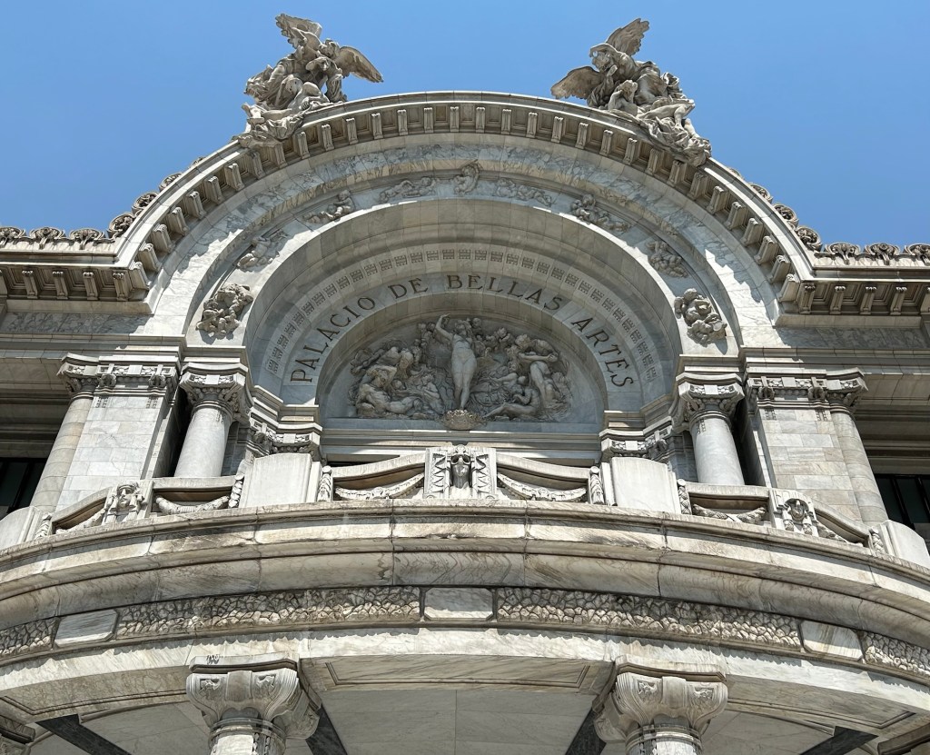
Welcome to Mexico! Above is the statue of Miguel Hidalgo y Castilla, the parish priest who on 16 September 1810 cried for independence—Grito de Dolores—in front of his church in Dolores (now Dolores Hidalgo in Guanajuato) sparking Mexican Independence. Mondays for now are World Heritage Sites, while eclectic Thursdays still include US park posts.
How to Drive Across the Border from US to Mexico
This post will cover my border crossing experience, including getting a permit for my car, and I hope it helps others who may be planning a similar trip.
I crossed the border at Puente Anzalduas, near McAllen Texas. I chose this place for several reasons. McAllen is a nice city with all the conveniences. There’s a supercharger in McAllen and another one 85 miles away in Mexico. This border crossing has everything I need to legally drive my car in Mexico, all in one room, with plenty of parking, and it isn’t too crowded. The bridge allows an easy trip around the city of Reynosa, and quickly puts me on the toll highway directly to my route to Mexico City. Even though I drove from California, it’s faster to drive through Texas on the freeway at 80 mph than to drive tollways in Mexico, especially as the supercharger network isn’t nationwide in Mexico yet. I recommend this crossing if you’re planning on driving to Mexico City, especially in a Tesla!
I found a lot of wrong information (see below) about driving across the border, which caused me delays and frustration. If you’re just driving in Baja California or to Rocky Point or just along the border inside Mexico, you don’t need any paperwork. But if you want to drive elsewhere, then here’s the real story: first, my recent experience, and then, all my failures. Read and learn!
I crossed the border at around 9:30 am last Tuesday (27 February 2024), and there was virtually no wait. US Border Patrol checked my car, and then I drove across the bridge with a $3.50 toll. On the Mexico side of the border, take the left lane, since you need to declare your vehicle. If you miss the turn (like me), stay left and turn sharp left to go behind the buildings. Either way you end up in the same place, the Aduana, or Customs office. There’s a line of cars here that arrived from the other direction who are waiting to return their permits at the kiosk. Ignore them, park, and walk around to find the front door.
Customs is there to collect taxes on goods you import, including your car. But, since you’re just using your car temporarily during your visit before leaving with it, you don’t have to pay taxes. Customs checked my vehicle, including taking a photo of the VIN, and then they checked that I was the registered owner. California’s registration card includes my name, address, VIN and plate, and I had both my current card and my new one effective next week. Satisfied, they told me to walk across the room to Immigration.
Immigration is there to admit you into the country. These days, Americans like me can visit Mexico for up to 180 days without paperwork. But, since I need a permit for my car, they make an exception, give me an entry card to fill out, and they issue the 180 day form (FMM) for 717 pesos ($42) on my credit card. Satisfied, I walk back across the room to the copy desk, where they charge me $1 for a copy of my passport, my new FMM, and my registration cards. The copies are for the final step, the Banjercito.
The Banjercitois the government bank that issues the official vehicle permit that you must show at highway checkpoints. Here, they’re in the same room, right between Customs and Immigration desks, so they’ve already seen me walking back and forth. The permit proves that your identity, vehicle ownership and temporary status in the country have already been thoroughly checked by the right authorities, and the permit (TIP) contains all the relevant information. After signing several forms and providing my contact details, they took $468.30 (8,000 pesos) on my credit card, but supposedly I get almost all of that back when I return the permit. (When you leave Mexico, hand over the permit at the Banjercito kiosk and either cancel for a refund or tell them you intend to reuse it before it expires).
Satisfied, I drove deep into Mexico. I was stopped by the National Guard highway patrol twice on my first day, and all they want to see is this permit before quickly sending me on my way. I hope this all seems logical to you and clears up some common confusion, especially for first time drivers to Mexico. Plenty of folks do this every day, so you can too. But you might want to learn from my mistakes.
What Not To Do
Don’t cross from California or western Arizona if you’re driving throughout Mexico. From the Baja Peninsula to Puerto Peñasco and the Lukeville Arizona crossing, Americans enjoy a document free zone, so don’t expect the Mexican officials to issue documentation for elsewhere in Mexico, after they eliminated all the documents. If you really want to take the ferry from La Paz, then why not do that on the way back? It’s theoretically possible to get the paperwork to drive from Baja to the rest of Mexico, but in practice, I found it didn’t work this year.
Don’t park on the US side and walk across to get documents for your vehicle. They want to see your vehicle and check the VIN. Again, it may be possible, but you’re depending on officials giving you a break, which you may or may not deserve. At San Ysidro California, I walked across the border a couple weeks ago to ask for documents, but they didn’t have anyone there during working hours midweek that could issue the paperwork. I spent over an hour in line in Tijuana waiting to walk back.
Don’t cross at some remote location or in the middle of a busy city, especially if it’s your first time. I crossed last year at a tiny place west of El Paso, but the Banjercito was closed (again, midday, midweek). Juarez, across the border from El Paso, is a big city, and I found it difficult to drive around and park, before walking the streets looking for various government offices that I knew little about. Laredo Texas is across from Nuevo Laredo, which is also a busy city crossing. The bridges each have different traffic rules and allow different vehicles, and there are precious few parking spaces at Customs, if you’re lucky enough to be in the correct lane. Otherwise you’re driving and walking around in a strange city. You want to find a border crossing that handles everything in one place, with parking, without too much traffic, and without city traffic driving.
Don’t go to a Mexican Consulate in the US. I went to San Bernardino, and they looked at me like I was an alien. They only handle paperwork like that for an hour a day after lunch on certain days of the week and only for residents of the county and not for neighboring counties and they only give paperwork for students and others who need long term temporary residency and they need bank statements and photos and two dozen other documents. Didn’t I know that I don’t need paperwork to visit Mexico normally? I know there’s a web page that claims you can make an appointment at various consulates, but it doesn’t work.
Don’t try to get your documents online. I hired a company to get my documents, and I had to demand my money back when they couldn’t deliver. Then I tried to use official websites. I got far enough to create accounts at two agencies, upload documents, pay a fee and choose my crossing date and place, but then I didn’t receive anything. And when I tried contacting them through the email and websites, I got an automated response saying “sorry, we can’t help you.” I’m never getting that fee refunded.
Even if you can get your documents online, at some point maybe two months in advance, what if you are delayed by a day or the crossing that you picked is closed (as happened twice to me)? And when you get there, you still need to get your VIN & registration checked by customs, you still need your FMM checked and stamped, you still need to make a copy of your stamped FMM, and you still need to show everything to the Banjercito, who will still want to see the original documents too. The folks next to me had done everything online, and I had done nothing. But I finished faster, because they had someone with them who translated everything. I just pointed, used simple English, and handed over my credit card.
Don’t make three copies of everything. I needed one black and white copy of my passport, one of my registration, and one of my FMM. I didn’t need three copies of anything. Nobody looked at my Mexican car insurance. Nobody looked at my car title. I wasted several trips to the UPS store and Office Depot making copies of documents that I never used. There’s no way to avoid making a copy of your FMM at the border, so you might as well just wait until they tell you what copies they need.
Plan your route and pick a good crossing point, but don’t drive yourself crazy. Culture shock, anxiety, official warnings and anti-Mexican horror stories made me overthink everything. I read that Columbia Bridge near Laredo was a great place to cross, since it’s one of the few places where you enter into Nuevo León. But when I checked the map, I would still have to drive back through Tamaulipas on a much longer route. Eventually I picked the shorter straight route above. Take your time, travel by daylight, watch for speed-bumps, and be patient. Oh, and have fun!
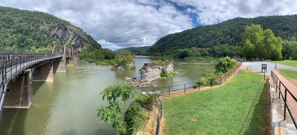
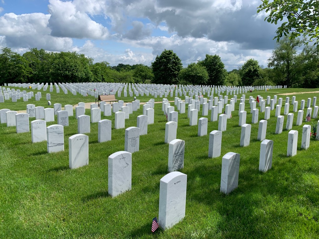
The precursor to the Civil War was John Brown’s raid on Harpers Ferry arsenal in 1859. Lee, Jackson & Jeb Stuart were all there in uniform, before they turned against our country. Douglass & Tubman were not in the raid, although they were involved. Booth arrived to witness Brown’s execution. The government may have quickly restored order in town, but across the country people divided into abolitionists or secessionists. Lincoln, arguing against slavery, was elected in 1860, and southern states began to secede to protect slavery.
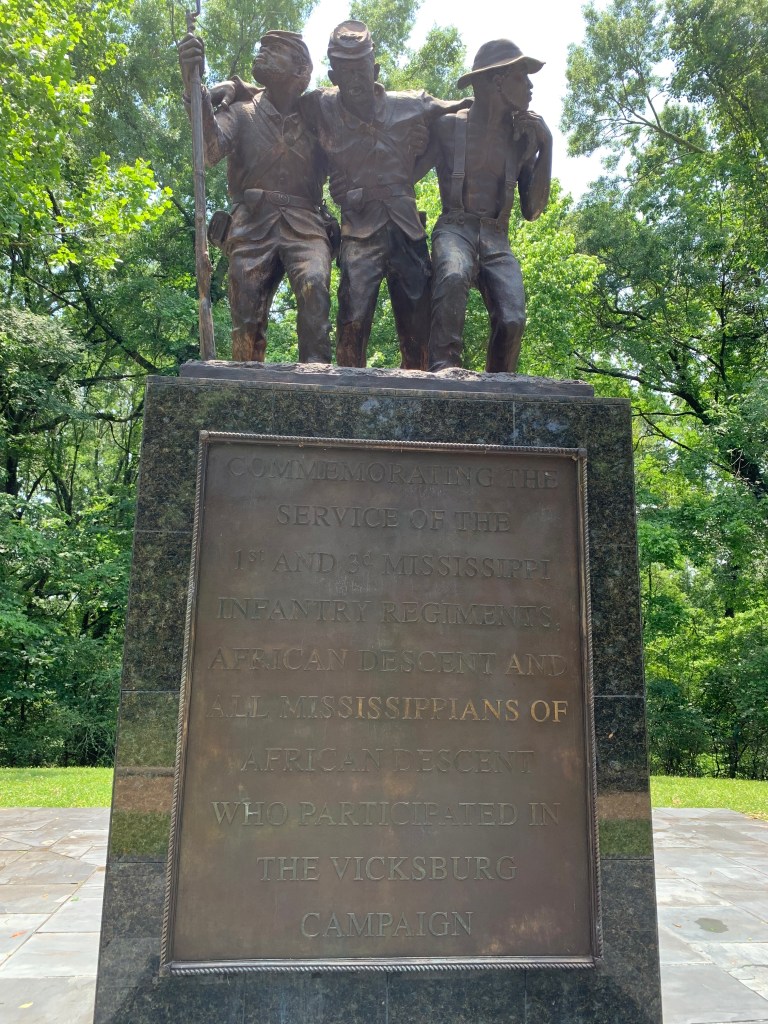
The Confederacy raised an army and attacked Fort Sumter in April of 1861. That same month, Union soldiers were attacked by Confederate sympathizers in Baltimore, leading Clara Barton to begin her service as a nurse. In May three escaped slaves were granted protection as ‘contraband’ at Fort Monroe in northern Virginia. Lincoln sent troops south where they were incompetently led into battle at Manassas in Virginia in July. The Confederates also won at Wilson’s Creek but were unable to take Missouri. The Union won at Carnifex Ferry in September, causing West Virginia to split from Virginia and become a state in 1863. In November, the Union Navy took Port Royal South Carolina, liberating 10,000 slaves, many forming the first African American regiment there one year later.
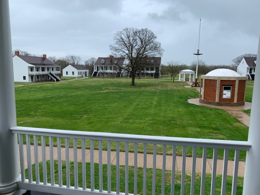
In January 1862 the Union won at Mill Springs Kentucky, followed the next month by Grant taking Fort Donelson on the strategic Cumberland River in northwest Tennessee. In March the Union won again at Pea Ridge in Arkansas and at Glorietta Pass in New Mexico, supported by Fort Union cavalry. In Tennessee in April, Shiloh (above) was a costly victory, followed by naval victories at Fort Pulaski blockading Savannah Georgia and the capture of New Orleans in Louisiana, where three more African American regiments would form within a year. In May the Union took Yorktown in Virginia, but in June the Union failed in its approach to Richmond. Then in August another loss at Manassas again. The Confederates marched into Maryland, but lost at Antietam in September. In December, the Union failed again in Virginia at Fredricksburg.
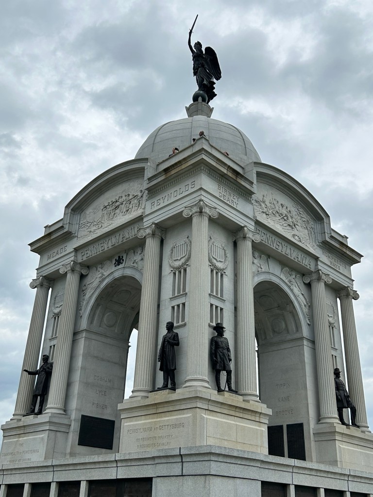
On the 1st of January 1863, the Emancipation Proclamation was read first with immediate effect to the SC 1st Volunteers, freeing them, their families and friends forever. Many more emancipated and free African American men would join the Union army at bases like Camp Nelson in Kentucky, Fort Scott in Kansas, and New Bedford and Boston in Massachusetts. That same winter the Union won at Stones River in Tennessee but lost at Chancellorsville in Virginia in spring. On June 2nd, Union spy Harriet Tubman led 150 African American soldiers to free 700 slaves at Combahee Ferry. Lee marched north again, losing decisively in July at Gettysburg in Pennsylvania. Grant concluded his siege of Vicksburg the next day, July 4th. In the fall the Union advanced to the border of Tennessee and Georgia at Chattanooga and Chickamauga.
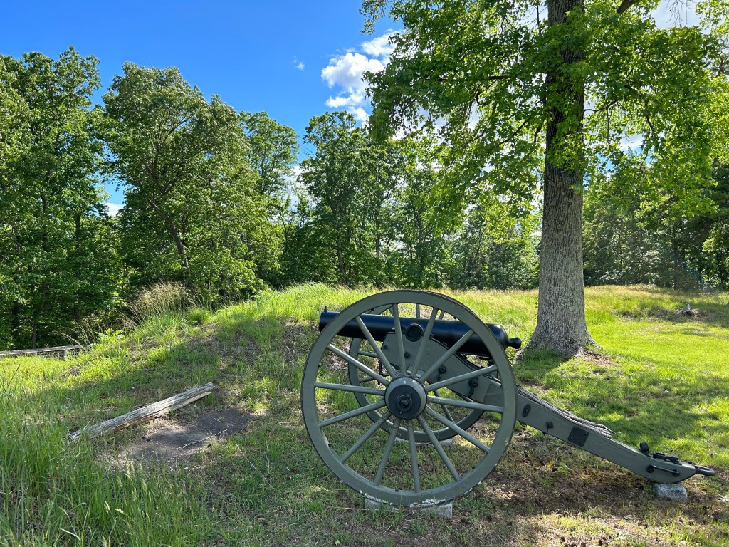
In 1864 the Union took northern Virginia with extensive fighting in Spotsylvania county. Slowly Grant was advancing towards Richmond, at one point outmaneuvering Lee at Petersburg and beginning a long siege of both cities. Meanwhile, Sherman was advancing in Mississippi, despite delays at Brices Cross Roads and Tupelo. In Georgia, Sherman was stopped at Kennesaw Mountain in July, before resuming his march to the sea. With the Confederate capital under siege, Lee ordered a sneak attack on the Union capital in July, crucially delayed at Monocacy in Maryland, after which snipers fired at Fort Stevens in DC. In August, Farragut took the last major southern port of Mobile Bay in Alabama. And in October, the Union defended the Shenandoah Valley at Cedar Creek in Virginia.
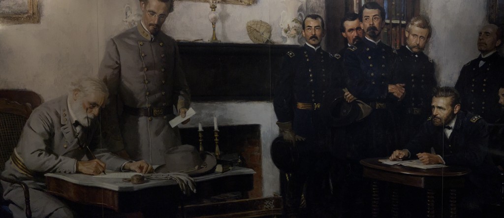
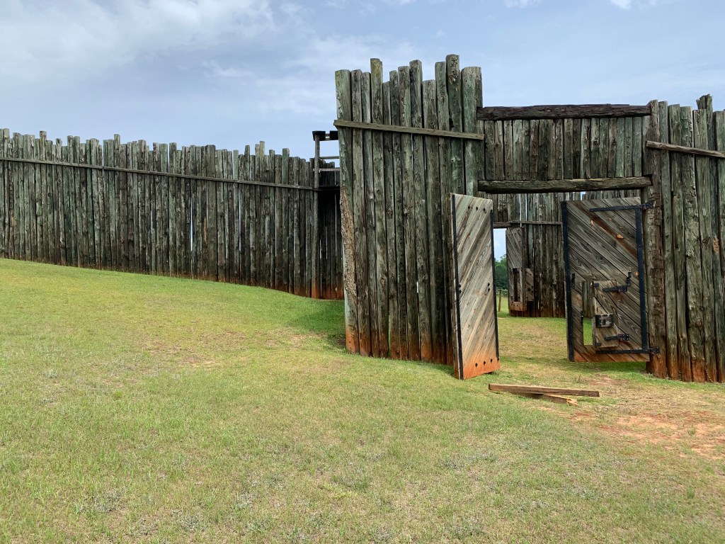
In the spring of 1865, after a months-long siege, Lee abandoned both Petersburg and Richmond, retreated and then surrendered in Appomattox in April. Andersonville was liberated in May. The CSS Shenandoah, which circumnavigated the globe during the war seizing African American crews from whaling ships, surrendered in Liverpool England in November, the last act of the war.
The precursor to the Civil War was John Brown’s raid on Harpers Ferry arsenal in 1859. Lee, Jackson & Jeb Stuart were all there in uniform, before they turned against our country. Douglass & Tubman were not in the raid, although they were involved. Booth arrived to witness Brown’s execution. The government may have quickly restored order in town, but across the country people divided into abolitionists or secessionists. Lincoln, arguing against slavery, was elected in 1860, and southern states began to secede to protect slavery.
The Confederacy raised an army and attacked Fort Sumter in April of 1861. That same month, Union soldiers were attacked by Confederate sympathizers in Baltimore, leading Clara Barton to begin her service as a nurse. In May three escaped slaves were granted protection as ‘contraband’ at Fort Monroe in northern Virginia. Lincoln sent troops south where they were incompetently led into battle at Manassas in Virginia in July. The Confederates also won at Wilson’s Creek but were unable to take Missouri. The Union won at Carnifex Ferry in September, causing West Virginia to split from Virginia and become a state in 1863. In November, the Union Navy took Port Royal South Carolina, liberating 10,000 slaves, many forming the first African American regiment there one year later.
In January 1862 the Union won at Mill Springs Kentucky, followed the next month by Grant taking Fort Donelson on the strategic Cumberland River in northwest Tennessee. In March the Union won again at Pea Ridge in Arkansas and at Glorietta Pass in New Mexico, supported by Fort Union cavalry. In Tennessee in April, Shiloh (above) was a costly victory, followed by naval victories at Fort Pulaski blockading Savannah Georgia and the capture of New Orleans in Louisiana, where three more African American regiments would form within a year. In May the Union took Yorktown in Virginia, but in June the Union failed in its approach to Richmond. Then in August another loss at Manassas again. The Confederates marched into Maryland, but lost at Antietam in September. In December, the Union failed again in Virginia at Fredricksburg.
On the 1st of January 1863, the Emancipation Proclamation was read first with immediate effect to the SC 1st Volunteers, freeing them, their families and friends forever. Many more emancipated and free African American men would join the Union army at bases like Camp Nelson in Kentucky, Fort Scott in Kansas, and New Bedford and Boston in Massachusetts. That same winter the Union won at Stones River in Tennessee but lost at Chancellorsville in Virginia in spring. On June 2nd, Union spy Harriet Tubman led 150 African American soldiers to free 700 slaves at Combahee Ferry. Lee marched north again, losing decisively in July at Gettysburg in Pennsylvania. Grant concluded his siege of Vicksburg the next day, July 4th. In the fall the Union advanced to the border of Tennessee and Georgia at Chattanooga and Chickamauga.
In 1864 the Union took northern Virginia with extensive fighting in Spotsylvania county. Slowly Grant was advancing towards Richmond, at one point outmaneuvering Lee at Petersburg and beginning a long siege of both cities. Meanwhile, Sherman was advancing in Mississippi, despite delays at Brices Cross Roads and Tupelo. In Georgia, Sherman was stopped at Kennesaw Mountain in July, before resuming his march to the sea. With the Confederate capital under siege, Lee ordered a sneak attack on the Union capital in July, crucially delayed at Monocacy in Maryland, after which snipers fired at Fort Stevens in DC. In August, Farragut took the last major southern port of Mobile Bay in Alabama. And in October, the Union defended the Shenandoah Valley at Cedar Creek in Virginia.
In the spring of 1865, after a months-long siege, Lee abandoned both Petersburg and Richmond, retreated and then surrendered in Appomattox in April. Andersonville was liberated in May. The CSS Shenandoah, which circumnavigated the globe during the war seizing African American crews from whaling ships, surrendered in Liverpool England in November, the last act of the war.