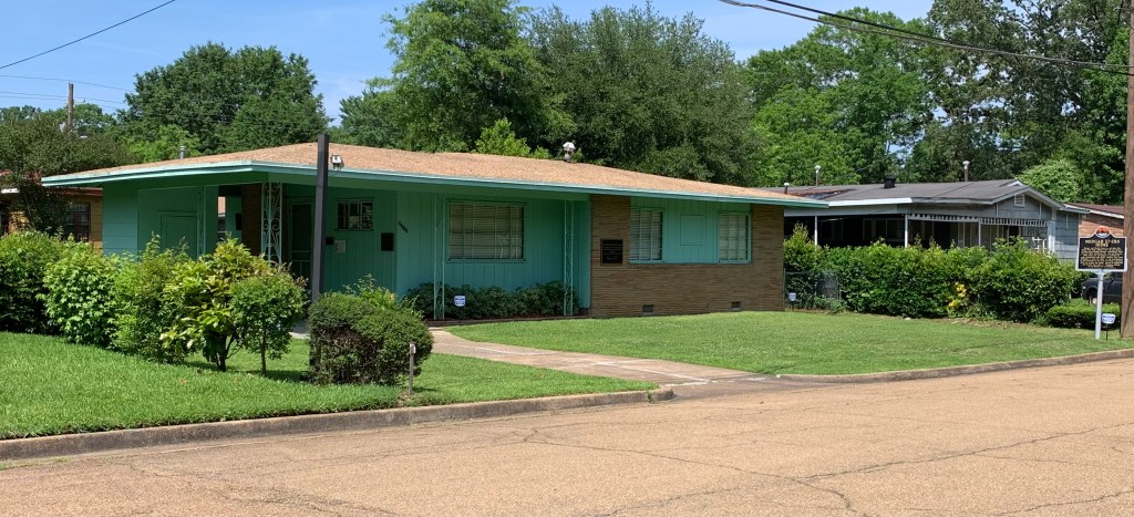
National Heritage Areas are run by local communities, with technical support and limited federal funding, so they’re not official park units. They’re certainly worth visiting, and they include some of my favorite places in the USA. Each has its own unique character, some preserve history, some culture and some nature, and together they showcase the tapestry of our country. I’ve visited the four NHAs in the Western Region by EV, so here’s a quick summary for you to explore.
The Santa Cruz Valley National Heritage Area in Arizona is part of the Gadsden Purchase of 1854. The NHA includes Saguaro National Park, Tumacácori National Historical Park—a small, but exceptionally beautiful place above—, San Xavier del Bac Mission, the Tucson Presidio Museum, the Arizona-Sonora Desert Museum, Native American tribal lands, and many other parks, preserves, ranches and gardens. The Juan Bautista de Anza National Historic Trail begins in the Santa Cruz Valley south of Tucson, at the Nogales Mexico border crossing.
Yuma Crossing National Heritage Area, in Arizona just across the Colorado River from California, is only a few blocks from Mexico, and it still carries some of that old frontier atmosphere. Yuma Territorial Prison, a state park, is a good place to start, and it figures in many of the old western tales of Tombstone and Hollywood. Be sure to visit the riverside parks, where 400 acres of wetlands have been restored, turning back time to before the Spanish came up river almost 500 years ago. The crossing is also part of the Juan Bautista de Anza National Historic Trail.
And the same trail ends up in San Francisco, where I used to live and work. One of my favorite escapes from that city was to explore the Delta, a huge area of farmlands, levees, and artificial islands upriver from the Bay. Built by Chinese laborers—later denied residency or citizenship—, the agricultural and boating area is sparsely populated, compared to the large cities nearby. My favorite town is Locke, which still has many old buildings used by Chinese laborers and merchants from over 100 years ago. It was one of the last towns of its kind, fortunately avoiding many of the “mysterious” fires that burned out other Chinese immigrant communities. While visiting John Muir’s home and Port Chicago, I took the opportunity to get lost there again, visiting Isleton and small harbors known only to locals. Fortunately, the entire area is part of the Sacramento-San Joaquin Delta National Heritage Area, including more civilized spots in Walnut Grove and Benicia California.
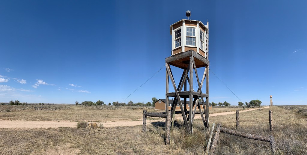
The last NHA in the Western Region is Great Basin National Heritage Area. While most folks think of Great Basin National Park, the Great Basin Desert is actually a huge geologic area, including a piece of southeastern Oregon, bits of California, the western half of Utah and almost all of Nevada. (Utah is part of the Rocky Mountain Region, but as most of the NHA is in Nevada, I count it here). So, anyone who’s followed the Pony Express or driven America’s loneliest road, Highway 50, knows the area. To call it sparsely populated is an understatement: one of the most populous places around is Eureka, Nevada, population 414. There is a remarkably undisturbed drugstore museum in McGill, and there’s a hot spring in Duckwater (pop 228). Topaz is in the Basin, as is part of the epic Pahvant-Valley Heritage Trail, one of the Mormon pioneer trails beyond the capability of my electric car. One of the trail stops is Hole-in-the-Rock in Glen Canyon, across from Rainbow Bridge. Good place to visit if you can get there and like solitude.
Feathered and fire serpents adorn the steps of the Quetzalcóatl Pyramid. Some weathering has occurred in the past 17 centuries, but once the eye sockets held black obsidian volcanic glass, the flames were painted bright red and feathers adorned with green jade. The museum (show your gate ticket for admission) near the Sun Pyramid shows murals, artifacts and has a large model of the site, which helps add details to the huge structures outside. None of the three pyramids can be climbed now, but I still walked a couple miles round trip, including the Moon Pyramid near where I started. I arrived early at 9 am, just as the hot air balloons were descending after their dawn tours. It’s an awesome place, but it can get hot and crowded by midday. I recommend staying nearby the night before.
At its peak, Teotihuacán was the largest city in the Americas, 6th largest in the world. Roughly, the city began sometime around 200 BC and fell around 550 CE. Much of their wealth came from obsidian tools, weapons and art, mined from local volcanoes and expertly knapped. The pyramids and related buildings show an elaborate religious class, but few signs of military or monarchs. The pyramids are designed to make observations for the Mesoamerican calendar, so the priests likely derived their power by determining the seasons. Best guess is that their civilization’s collapse was internal, with signs of drought and starvation, before simultaneous fires burned out the elites. The priests essentially had one job—to monitor the climate—, and they failed. Human success, growth, unsustainable use of natural resources, crop failure, and collapse, is a common pattern in ancient civilizations, and we are likely on a similar path due to carbon pollution.
The day after Pearl Harbor, an angry FDR called it ‘a date which will live in infamy’, and he began to restrict the rights of Japanese Americans. First there was a curfew, then bank accounts were seized overnight, businesses shuttered, homes were searched, guns were collected, cameras and radios were taken, Japanese language schools were closed, and travel was restricted. US citizens of German and Italian descent were free to live their lives, but US citizens of Japanese descent were not.
In February of 1942, first generation adult male immigrants in the Japanese American fishing community on Terminal Island—between the Ports of LA and Long Beach—were incarcerated by the FBI, followed by a 48 hour notice for all remaining inhabitants to evacuate. The whole community was the first to be incarcerated after FDR signed Executive Order 9066, and their entire neighborhood was razed. Then, at noon, on 30 March 1942: any person of Japanese descent found on Bainbridge Island—opposite Seattle—would be arrested and charged as a criminal. Families were given short notice, allowed two small bags—or one and a baby—, and were sent to the state fairground at Puyallup—near Tacoma. Barbed wire fences and armed soldiers surrounded the ‘assembly centers’. There, they were lined up by family, with their family number tags tied to their clothes, oldest in front, youngest in back.
San Francisco residents went to Tanforan—now a shopping mall on the peninsula. Los Angeles residents were sent to Santa Anita or Pomona. Some were housed in racetrack horse stalls, which they needed to clean out themselves. California and half of Washington, Oregon and Arizona were declared ‘exclusion zones’ by the military, and no person of Japanese descent was allowed to remain there. Instead, they were transported from the assembly centers to one of ten camps. The American woman and her baby above were sent to Manzanar in California and then to Minidoka in Idaho. Others went to Amache in Colorado, Rohwer & Jerome in Arkansas, Topaz in Utah, Heart Mountain in Wyoming, Poston & Gila River in Arizona, and some were sent to the ‘segregation camp’ at Tule Lake in California near Oregon. Some male inmates were ordered to build their own barracks, latrines and other buildings. Women prepared meals for thousands. Guard towers were raised along barbed wire fences with searchlights and machine guns pointed inward. There was no privacy, not among family, not at meals, not in the group latrines and not in the group showers. The camps were in remote, desolate, dusty, unpopulated areas away from towns, many were deserts, some mountains and all were sabishii—lonely and forsaken.
Many Americans, including those incarcerated, were lied to about the program by our government: “temporary”, “for your own safety”, “normal” and “happy”. Even today, the program is referred to as “Japanese Internment Camps”, but the vast majority of those incarcerated were not Japanese, they were US citizens, mainly by birth, many never having been to Japan. Propaganda films lied and stated that “household belongings” were shipped to “pioneer villages”, that only those “within a stone’s throw” of military bases were forced to move, that people were “given jobs and more space in which to live” and “managed their own security”. The program was sold as being exemplarily generous, that the military provided for all needs and that the Japanese Americans “approved whole-heartedly”. Journalists and others were periodically given limited access only to the barracks of the most cooperative inmates.
In fact, there were water shortages, food shortages, food poisoning, unsafe living and working conditions, military brutality, unfair punishments, false charges, and inmates fatally shot, including a dog walker at Topaz, a truck driver at Tule Lake, and two protesters at Manzanar where guards fired into a crowd. Some elderly patients had been taken to the camps from their hospital beds, and over 1,850 died of disease and medical problems, including many infants. Complaints were discouraged or mocked. Pressure campaigns were used to enlist men into active combat in Europe. And always, anyone suspected of being disloyal was encouraged to renounce their citizenship and leave the country. In this system, particularly at Tule Lake, some reacted to their treatment by trying to be more Japanese, organizing protests and yelling Banzai—‘long live the Emperor’—at the guards.
They were Americans, and their Constitutional Rights of speech, to be secure in their homes and to due process were all violated for years. The root of this program was racism. Americans of Japanese descent were assumed to have loyalty to a foreign power, and even when they were natural born American citizens, they couldn’t be trusted and would have to prove their loyalty again and again. The Issei—1st generation—chose this country rather than the one of their birth. The Nissei—second generation—were born here, but some parents sent their children back for schooling Japan to preserve their language and culture. These children were called Kibei—returnees to America—, indicating that their parents wanted them to live here. All were Americans, either by their own choice or by their parents’. Only their fellow citizens refused to see them as truly Americans.
Although I quote Eleanor Roosevelt below, FDR and many other Americans believed in the ‘melting pot’—meaning melting metal to forge steel—, that Americans had a duty to assimilate and that their cultures would be purified into one culture. But the price of citizenship does not include giving up one’s culture, whether your name is Ohara or O’Hara. Imagine something happens in the future, and people of your family background are herded up and sent to Guantanamo. Even though you did nothing wrong, your guilt is suspected based on your family cultural background. Your communications are censored, and you are treated the same as foreigners or prisoners of war. And when you finally are freed, all your property has been taken, and nobody will help.
Visit national park sites for camps like Manzanar, Minidoka, Amache and Tule Lake, and interpretive sites in Seattle like the Klondike visitor center which partners with Bainbridge Island and the Wing Luke Museum. Topaz has a museum in Delta Utah (off I-15 towards Great Basin). Poston (off I-10) has a historic marker placed by internees & the Colorado River Indian Tribes near Parker on the Arizona border with California. Heart Mountain has an interpretive center between Cody and Powell in Wyoming (on the road between Yellowstone and Bighorn Canyon). Gila River is on restricted reservation land near Hohokam Pima—neither are open to the public—but the Huhugam Heritage Center has a small free exhibit, not far from Phoenix. There’s a museum in McGehee Arkansas for Rohwer and a monument for Jerome; both are just south of Arkansas Post. The Hawaiian experience was very different, but Honouliuli will eventually open as a historic site. Please encourage your elected representatives to preserve the history at all the camps.
I encourage you to read more about the experiences of the Americans who were sent to American Concentration Camps during WWII: Farewell to Manzanar, Only What We Could Carry, Journey to Topaz, Snow Falling on Cedars, and They Called Us Enemy, among many others. And take a moment to think about how you would feel, if it happened to your family.
“We have no common race in this country, but we have an ideal to which all of us are loyal: we cannot progress if we look down upon any group of people amongst us because of race or religion. Every citizen in this country has a right to our basic freedoms, to justice and to equality of opportunity. We retain the right to lead our individual lives as we please, but we can only do so if we grant to others the freedoms that we wish for ourselves.”
Eleanor Roosevelt, after visiting Gila River during WWII
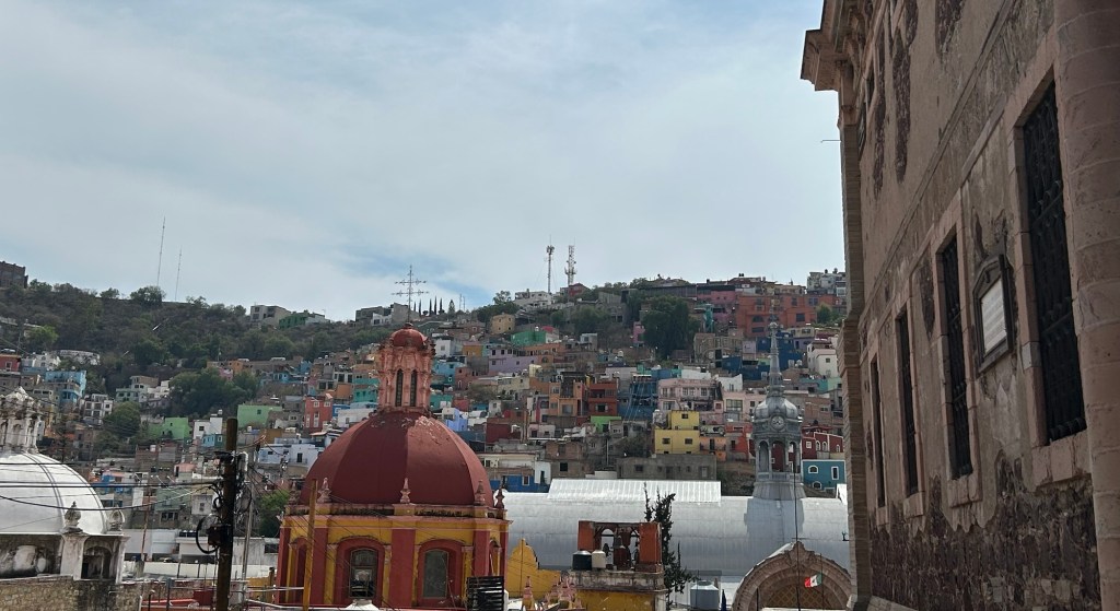
UNESCO recognizes this colorful, artistic city for its historic zone reflecting its native and colonial combined roots. Otomi musicians and doll vendors walked in the narrow alleyways winding around grand churches, much as they have for hundreds of years. Beautiful public plazas with historic groves of trees, Baroque churches, vibrant architecture, and galleries fill the spaces. And art flows into the streets, with public displays of famous paintings, both local and international exhibited outside. While I intended to focus on the history of revolutionary conspirators, the trial of Maximillian and the drafting of the Mexican constitution, the fascinating streets pulled me away from the Teatro de la República and had me wandering around in circles taking in the atmosphere amazed. This is a cultural feast!
From 1991 to 1993, eight people lived in this huge sealed greenhouse or giant terrarium in Arizona, growing their own food and attempting to live without outside intervention. Built at a cost of some $250 million, the complex includes the artificial ocean above, multiple tropical growing zones, industrial HVAC, and even a unique, massive ‘lung’ to equalize air pressure at different temperatures. Results were mixed, but there are important lessons to be learned.
Humans like to believe we can control our environment and that we have conquered nature. The truth is that we don’t completely understand nature, and when we try to control it, there are unintended consequences.
The most serious problem was a gradual reduction in oxygen, which threatened to kill the participants by around day 500 and required emergency intervention. Despite all the plants, overall, the system produced too much carbon dioxide. Also, the participants complained of constant hunger, unable to eat enough calories per day, which made it difficult to complete their extensive daily chores. Many plants and pollinators did not survive, but stowaways like cockroaches thrived. Still, they survived for two full years. Others later managed shorter stints, but bickering and mismanagement soon ended fully sealed living experiments.
From 1995 to 2003, Columbia University managed the site and completed groundbreaking research here scientifically proving up to 90% declines in oceanic coral due to artificially high levels of atmospheric carbon dioxide. Unfortunately, the coral later died when the site went back on the market, although there are plans to try to reintroduce it. Today the site is run by Arizona State University, which offers both a general self-guided tour and specialized guided tours, in addition to hosting students and researchers. When fully funded, the semi-tropical desert forests are very well controlled and measured, enabling many scientific experiments on micro ecosystems to be carried out under laboratory conditions. Tracers can be added to water and carbon dioxide, so researchers can figure out exactly what plants are doing in different conditions. Unfortunately, the whole complex is extremely energy intensive, and it is run on diesel and natural gas, which both contribute carbon pollution to exacerbate the climate crisis.
Some believe that technology will allow us to adapt to the worst effects of climate change. The truth is that we need to spend our time, energy and money trying to protect Biosphere 1 (Earth) from carbon pollution. This massive, extremely expensive, carefully engineered and scientifically researched project could barely take care of eight people for two years. That’s neither an efficient nor effective use of resources, but it quickly illustrates how difficult it is to scale environmental technologies to the point that they are practical. How big of a terrarium would we need to feed eight billion people? Far better to take care of the Earth, while we still have hope.
On the right is the Alhóndiga, an old grain exchange, which houses a history museum, has a stunning Morado mural, was stormed by Hidalgo during the Independence War, and was where the heads of Hidalgo, Allende, Aldama & Jiménez were later hung, one from each corner, including above, top right.
The old town center and churches are part of the UNESCO World Heritage Site, and the churches are particularly lavish, due to the rich silver mines in the hills around the city. There’s also a decadent theatre, built for the dictator Porfirio Díaz, who impoverished millions. The independence leaders would have been furious with the ostentatiously royal display.
I love the town, climbed the narrow alley stairs to see from above and also walked through a long dark tunnel to loop back to my car. Diego Rivera’s childhood home has been extended upwards to become an exceptional museum of his life and art. Highly recommended.
While not a national park site, I just had to stop to see the legendary Gunfight at OK Corral. The shootout was so quick I only got this photo of the aftermath. As mass shootings go now, I doubt this one from 1881 would make the news today. Now mass shooters kill more in one hour than any old west gunslinger did in their lives.
This Arizona town—named after a silver claim wrongly thought hopeless—is not far from a Butterfield Stage stop, and it has restored horse-drawn stagecoaches that take folks around the historic center of town. Boot Hill cemetery is another famous site here, but there are loads of historic saloons, re-enactments, museums, shops and more.
The “world’s largest rose tree” is in a courtyard near the courthouse, and it’s amazing how large plants can get if we let them grow. Nellie Cashman ran a string of successful businesses here before moving on to the Klondike. Three Mexican Revolutionaries were convicted in the old county courthouse here, along with the Bisbee Massacre gang. And Geronimo had his famous photo taken by the photographer who had a studio above.
West of town is the San Pedro Riparian conservation area, which protects nature and both Native American and Spanish sites. Further west on the other side of Apache Peak is Las Cienegas—the marshes—conservation area, which is a beautiful protected grassy lowland in a historic ranching area. Since many tourists fly around burning carbon these days, they miss these distinct and fascinating features of the old west.
Above is one of a half dozen side chapels in the UNESCO World Heritage Site of Atotonilco which includes nearby San Miguel de Allende. While most tourists luxuriate in the colorful town, this whole area is historic, beautiful and fascinating!
By all means, visit Ignacio Allende’s house next to the church founded by San Juan de Miguel, who founded the town. You will learn how Allende, the hero of Mexican Independence, lost his eldest son in battle defending his father and see how the Creole elite lived when the Spanish King decided to take the lion’s share of the treasure in silver from the mountains. The mixed race locals were furious that some overseas French-backed King was against the Jesuits educating them, and they rebelled.
Was Allende the mastermind or the Priest Hidalgo, who cried for independence? The smart money is on Allende, but the poor must have listened to Hidalgo. Either way, they were captured and executed, both becoming martyrs. And the people rose up and won their independence from Spain. There’s much to explore!
Women’s contributions to our history have too often been ignored or downplayed. Several of the official national park sites primarily focus on telling women’s history, but the park service maintains a far longer list of women who deserve more recognition. The park service says that ‘women’s history can be found in all parks’, but that’s another way of saying that women’s history is secondary in most parks.
First listed are official park sites that focus on telling important women’s history well, and it includes suffragettes, abolitionists, business women, laborers, and political leaders.
Adams (MA) has much more on Abigail than I mentioned
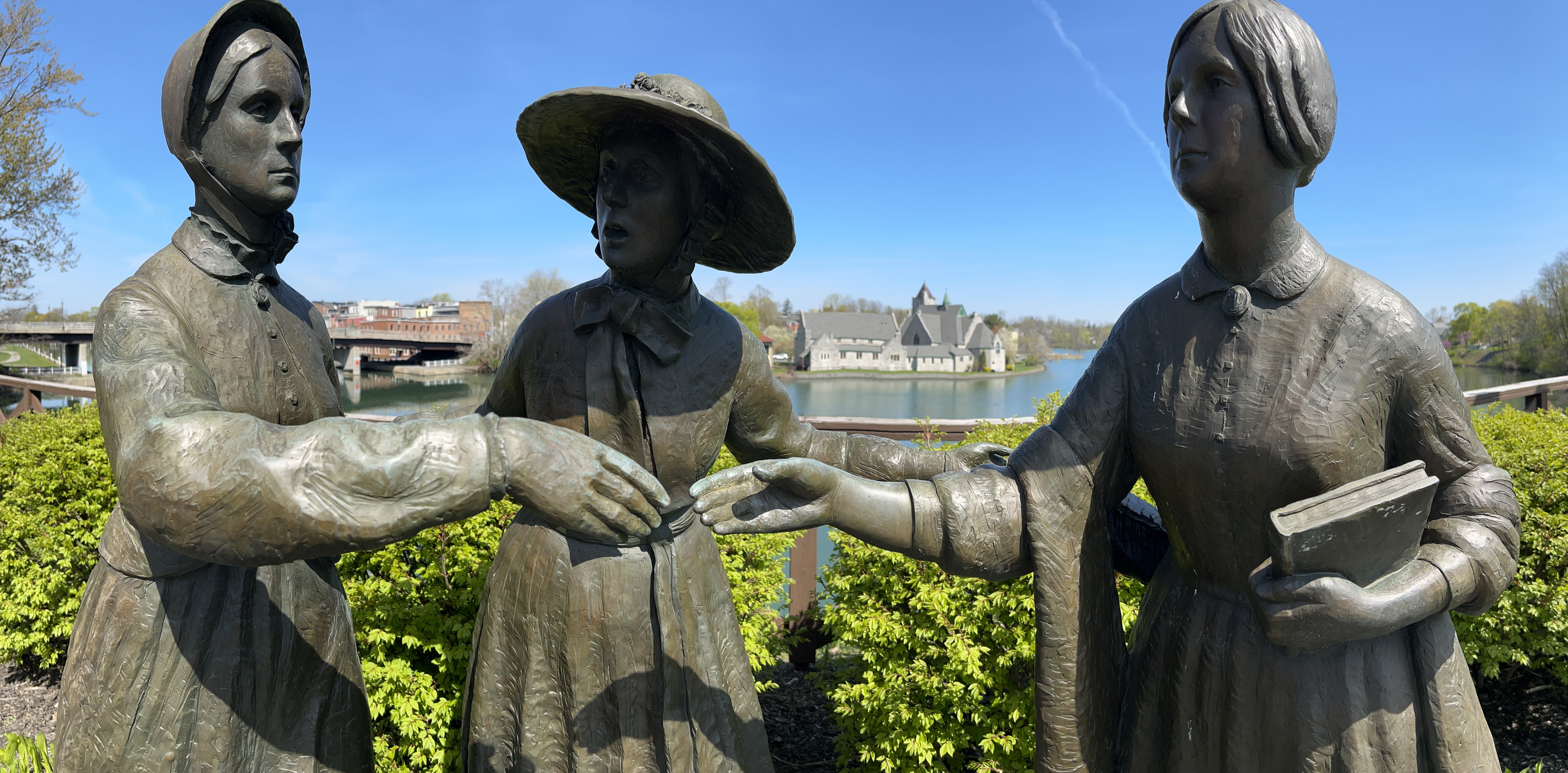
Women’s Rights (NY)—photo shows Bloomer introducing Stanton to Anthony in Seneca Falls.
Second is a very incomplete list of historically important women often mentioned at national park sites (links go to NPS articles), but without the recognition of their own official park sites. The list below has suffragettes, scientists, and women who fought for the rights of others, and all who must be remembered. A few of these are currently being considered for park recognition, along with a Votes for Women History Trail. My apologies for those I know I’m leaving off the list below.
Who was the first American woman to win the Nobel Peace Prize? The only woman to win the Medal of Honor? Our first Congresswoman, elected before women could vote? If there’s a woman on this list you haven’t heard about, please do yourself a favor and click her link below.
Many famous women also are at rest in Arlington National Cemetery, including astronauts, code-breakers, a Pulitzer-winning journalist and a Supreme Court Justice. But there’s just one memorial—Military Women’s Memorial—for all the women who served in war, despite the diverse stories of women in the Revolution, War of 1812, US-Mexican War, Civil War, WWI, WWII, WASPs, and the rest. We all need to do a better job of remembering and telling Women’s History, with more official, public recognition.
Welcome to Mexico! Above is the statue of Miguel Hidalgo y Castilla, the parish priest who on 16 September 1810 cried for independence—Grito de Dolores—in front of his church in Dolores (now Dolores Hidalgo in Guanajuato) sparking Mexican Independence. Mondays for now are World Heritage Sites, while eclectic Thursdays still include US park posts.
How to Drive Across the Border from US to Mexico
This post will cover my border crossing experience, including getting a permit for my car, and I hope it helps others who may be planning a similar trip.
I crossed the border at Puente Anzalduas, near McAllen Texas. I chose this place for several reasons. McAllen is a nice city with all the conveniences. There’s a supercharger in McAllen and another one 85 miles away in Mexico. This border crossing has everything I need to legally drive my car in Mexico, all in one room, with plenty of parking, and it isn’t too crowded. The bridge allows an easy trip around the city of Reynosa, and quickly puts me on the toll highway directly to my route to Mexico City. Even though I drove from California, it’s faster to drive through Texas on the freeway at 80 mph than to drive tollways in Mexico, especially as the supercharger network isn’t nationwide in Mexico yet. I recommend this crossing if you’re planning on driving to Mexico City, especially in a Tesla!
I found a lot of wrong information (see below) about driving across the border, which caused me delays and frustration. If you’re just driving in Baja California or to Rocky Point or just along the border inside Mexico, you don’t need any paperwork. But if you want to drive elsewhere, then here’s the real story: first, my recent experience, and then, all my failures. Read and learn!
I crossed the border at around 9:30 am last Tuesday (27 February 2024), and there was virtually no wait. US Border Patrol checked my car, and then I drove across the bridge with a $3.50 toll. On the Mexico side of the border, take the left lane, since you need to declare your vehicle. If you miss the turn (like me), stay left and turn sharp left to go behind the buildings. Either way you end up in the same place, the Aduana, or Customs office. There’s a line of cars here that arrived from the other direction who are waiting to return their permits at the kiosk. Ignore them, park, and walk around to find the front door.
Customs is there to collect taxes on goods you import, including your car. But, since you’re just using your car temporarily during your visit before leaving with it, you don’t have to pay taxes. Customs checked my vehicle, including taking a photo of the VIN, and then they checked that I was the registered owner. California’s registration card includes my name, address, VIN and plate, and I had both my current card and my new one effective next week. Satisfied, they told me to walk across the room to Immigration.
Immigration is there to admit you into the country. These days, Americans like me can visit Mexico for up to 180 days without paperwork. But, since I need a permit for my car, they make an exception, give me an entry card to fill out, and they issue the 180 day form (FMM) for 717 pesos ($42) on my credit card. Satisfied, I walk back across the room to the copy desk, where they charge me $1 for a copy of my passport, my new FMM, and my registration cards. The copies are for the final step, the Banjercito.
The Banjercitois the government bank that issues the official vehicle permit that you must show at highway checkpoints. Here, they’re in the same room, right between Customs and Immigration desks, so they’ve already seen me walking back and forth. The permit proves that your identity, vehicle ownership and temporary status in the country have already been thoroughly checked by the right authorities, and the permit (TIP) contains all the relevant information. After signing several forms and providing my contact details, they took $468.30 (8,000 pesos) on my credit card, but supposedly I get almost all of that back when I return the permit. (When you leave Mexico, hand over the permit at the Banjercito kiosk and either cancel for a refund or tell them you intend to reuse it before it expires).
Satisfied, I drove deep into Mexico. I was stopped by the National Guard highway patrol twice on my first day, and all they want to see is this permit before quickly sending me on my way. I hope this all seems logical to you and clears up some common confusion, especially for first time drivers to Mexico. Plenty of folks do this every day, so you can too. But you might want to learn from my mistakes.
What Not To Do
Don’t cross from California or western Arizona if you’re driving throughout Mexico. From the Baja Peninsula to Puerto Peñasco and the Lukeville Arizona crossing, Americans enjoy a document free zone, so don’t expect the Mexican officials to issue documentation for elsewhere in Mexico, after they eliminated all the documents. If you really want to take the ferry from La Paz, then why not do that on the way back? It’s theoretically possible to get the paperwork to drive from Baja to the rest of Mexico, but in practice, I found it didn’t work this year.
Don’t park on the US side and walk across to get documents for your vehicle. They want to see your vehicle and check the VIN. Again, it may be possible, but you’re depending on officials giving you a break, which you may or may not deserve. At San Ysidro California, I walked across the border a couple weeks ago to ask for documents, but they didn’t have anyone there during working hours midweek that could issue the paperwork. I spent over an hour in line in Tijuana waiting to walk back.
Don’t cross at some remote location or in the middle of a busy city, especially if it’s your first time. I crossed last year at a tiny place west of El Paso, but the Banjercito was closed (again, midday, midweek). Juarez, across the border from El Paso, is a big city, and I found it difficult to drive around and park, before walking the streets looking for various government offices that I knew little about. Laredo Texas is across from Nuevo Laredo, which is also a busy city crossing. The bridges each have different traffic rules and allow different vehicles, and there are precious few parking spaces at Customs, if you’re lucky enough to be in the correct lane. Otherwise you’re driving and walking around in a strange city. You want to find a border crossing that handles everything in one place, with parking, without too much traffic, and without city traffic driving.
Don’t go to a Mexican Consulate in the US. I went to San Bernardino, and they looked at me like I was an alien. They only handle paperwork like that for an hour a day after lunch on certain days of the week and only for residents of the county and not for neighboring counties and they only give paperwork for students and others who need long term temporary residency and they need bank statements and photos and two dozen other documents. Didn’t I know that I don’t need paperwork to visit Mexico normally? I know there’s a web page that claims you can make an appointment at various consulates, but it doesn’t work.
Don’t try to get your documents online. I hired a company to get my documents, and I had to demand my money back when they couldn’t deliver. Then I tried to use official websites. I got far enough to create accounts at two agencies, upload documents, pay a fee and choose my crossing date and place, but then I didn’t receive anything. And when I tried contacting them through the email and websites, I got an automated response saying “sorry, we can’t help you.” I’m never getting that fee refunded.
Even if you can get your documents online, at some point maybe two months in advance, what if you are delayed by a day or the crossing that you picked is closed (as happened twice to me)? And when you get there, you still need to get your VIN & registration checked by customs, you still need your FMM checked and stamped, you still need to make a copy of your stamped FMM, and you still need to show everything to the Banjercito, who will still want to see the original documents too. The folks next to me had done everything online, and I had done nothing. But I finished faster, because they had someone with them who translated everything. I just pointed, used simple English, and handed over my credit card.
Don’t make three copies of everything. I needed one black and white copy of my passport, one of my registration, and one of my FMM. I didn’t need three copies of anything. Nobody looked at my Mexican car insurance. Nobody looked at my car title. I wasted several trips to the UPS store and Office Depot making copies of documents that I never used. There’s no way to avoid making a copy of your FMM at the border, so you might as well just wait until they tell you what copies they need.
Plan your route and pick a good crossing point, but don’t drive yourself crazy. Culture shock, anxiety, official warnings and anti-Mexican horror stories made me overthink everything. I read that Columbia Bridge near Laredo was a great place to cross, since it’s one of the few places where you enter into Nuevo León. But when I checked the map, I would still have to drive back through Tamaulipas on a much longer route. Eventually I picked the shorter straight route above. Take your time, travel by daylight, watch for speed-bumps, and be patient. Oh, and have fun!