The photo is from the moose exhibit upstairs at the visitor center. I failed to photograph a bald eagle flying right in front of the reconstructed fort, which includes a great hall, kitchen, warehouse, lookout and wooden palisade. The monument is surrounded by Anishinaabe (Ojibwe/Chippewa) land, and the tribe co-manages the unit, a first for the NPS. I stayed at the casino to catch an early ferry from Grand Portage, and I had a delicious ‘lunker’ (big fish) for dinner. From the dock, you can see Isle Royale in the distance, and there are various demonstrations of the fur trading life during the summer season.
Traders wanted access to the western rivers and lakes, and the easiest way to get there was to carry their canoes on the ~10 mile Grand Portage Trail around some impassable waterfalls (including Minnesota’s largest) on the Pigeon River at the border with Canada. At a site called Fort Charlotte, the voyageurs entered the Pigeon River—now the US-Canada border—and continued with shorter portages upstream on the Athabasca, English & Saskatchewan Rivers. They would pass through what’s now Voyageurs National Park, Rainy Lake, Lake of the Woods, and deep up into the Canadian Rockies to the Athabasca, Great Slave, and Winnipeg Lakes. The trail carried beaver and other pelts, typically trapped by natives, in 90 pound packs from inland Canada down to Montreal (skipping the polar bears around Hudson Bay), bound for global markets in Europe, Russia and China. Vast fortunes were made wiping out the abundance of our wildlife.
While not the largest rock formation in the west, Chimney Rock above, was the first exceptional one seen by the pioneers on their journey across the wide open prairie, so many pioneers elaborately described it in their journals. Judging by the old photos, it has lost some of its point, but it still towers over the landscape. Chimney Rock also made a clear landmark for the prairie schooners navigating on the Pioneer Trails from the Platte River to the nearby pass at Scotts Bluff. The site is affiliated with the NPS, but it is managed by the Nebraska State Historical Society.
Reports of a two ton boulder of pure copper lying in a river bank on the Keweenaw peninsula of the upper peninsula of Michigan were dismissed as tall tales, until proven by a geologist in 1840. The boulder wound up at the Smithsonian Natural History Museum, a huge mining boom rush erupted, and the closest port town was named after the geologist, Houghton. Most of the small mines failed, but eventually a large consolidated firm found and mined the largest pure copper lode in the world.
Technically the copper was “rediscovered” (or stolen) as the Native Americans here had been mining it for at least 7,000 years and traded it as far as Effigy Mounds, Hopewell, and other prehistoric sites around the country—so don’t accept the common misconception that Europeans introduced metal work to this continent. However, European immigrants did expand the mines here to an astounding scale. The deepest part of the Quincy Mine above is over 9,000 feet below ground, which is over 6 times deeper than the Empire State Building is high, with huge rooms left behind after the copper seam was excavated (see photo), and 92 levels mostly flooded after the mine closed in 1945 due to competition from western mines.
The huge equipment includes many rare and once record-breaking pieces of industrial machinery, and the Quincy Mine tour is fascinating and essential to understand miners’ lives. Be sure to get a big Cornish Pasty at Roys in Houghton. There are some museums and a visitor center in Calumet, including a magnificent old theater with lovely murals, but since most of those tours are only in the afternoon, it may be smarter to tour the mine in the morning. There are a couple dozen interesting sites on the Keweenaw peninsula, but for me the most haunting exhibit was the description of the Italian Hall disaster at Christmas in 1913.
While capitalists are allowed to organize freely under the law, labor was not. Thousands of copper miners went on strike, and the mine owners hired ruthless, violent strikebreakers. Someone—an anti-unionist according to eight witness who later testified to Congress—yelled ‘fire’ into a crowded Christmas party on the second floor of the Italian Hall in Calumet. There was no fire, but 59 children and 14 adults died. Woody Guthrie explained what happened below.
“The copper boss’ thugs stuck their heads in the door, One of them yelled and he screamed, “there’s a fire” A lady she hollered, “there’s no such a thing. Keep on with your party, there’s no such thing.”
A few people rushed and it was only a few, “It’s just the thugs and the scabs fooling you, “ A man grabbed his daughter and carried her down, But the thugs held the door and he could not get out.
And then others followed, a hundred or more, But most everybody remained on the floor, The gun thugs they laughed at their murderous joke, While the children were smothered on the stairs by the door.”
Thomas Jefferson’s Monticello home has maps and mementos from Lewis & Clark’s expedition all over his front hall, showing how interested he was in the Native Americans, geography, flora & fauna, and other discoveries. He also had strategic interests in mapping both the huge Louisiana territory he purchased from France and the further lands to the Pacific. Having read Captain Cook’s voyages, he was interested in discovering any practical, cross-country trading routes.
And there was plenty of competition. De Anza had explored up the coast to San Francisco in 1776, and the Spanish were busy establishing missions in California. The Russians staked their claim in Alaska before 1800 and were beginning to explore down the coast. The Scottish explorer Mackenzie had already followed Native American travel routes to the Arctic along the river later named for him and crossed the continent in 1793, arriving within months of the naval expedition of Vancouver. The British made no secret of their intention to expand their fur trading to the Columbia River.
So Jefferson scraped together $2,324 from an uncooperative Congress and gave the money to Captain Meriwether Lewis and William Clark, younger brother of the famous war hero. Jefferson personally tutored Lewis in geography, hiring experts to assist in medicine, navigation, botany and taxidermy, giving Lewis full access to his legendary library, likely the largest private one in the US. Jefferson was fascinated by the reports of the expedition, following it closely, but he spoke little about the full plan publicly—except to justify the expense to Congress—to keep the reports from foreign rivals.
The first boat was completed in Pittsburgh, and Lewis launched into the Ohio River there at the end of August, 1803, with some crew, arms from Harpers Ferry, 200 lbs of dried soup, tobacco, wine, trade goods, med kit, and his Newfoundland dog, Seaman. He met up with Clark’s team in Louisville, KY, including Clark’s slave York, who became the first African American explorer known to cross overland to the Pacific. They traveled down the Ohio to the Mississippi and then up the Missouri, past Ste. Geneviève and St Louis, where they spent the winter. Then they paddled up river past the confluence of the Niobrara to Knife River (see photo), ND, where young Sacagawea joined the expedition with her French husband and their baby, after the expedition wintered nearby.
In the spring, they continued up river past what would become the Fort Union Trading Post, past the Milk River confluence, and each time they came to a fork, they would need to decide which was the Missouri River, often exploring both forks. Eventually, they reached the headwaters and traveled overland past what would later be the Big Hole Battlefield, before finding their way down the Clearwater, Snake and Columbia Rivers, with help from the Nez Perce. Mapping that Native American trade route over the Rockies was one of the expedition’s key accomplishments. Finally, they reached the Pacific and wintered at Fort Clatsop, beating a Russian explorer who arrived that spring.
On their way back, Lewis took a more northerly route, close to Glacier, and Clark southerly, along the Yellowstone River, before meeting again on the Missouri. The Spanish sent troops to arrest them, but couldn’t catch up, as traveling downriver back the way they came was much quicker. Jefferson was very pleased with the expedition’s success, grew corn samples at Monticello and reported Lewis & Clark’s scientific discoveries to Congress.
Jefferson appointed Lewis Governor of Louisiana Territory, but many hated Lewis for protecting Native American rights and spread conspiracies against him. Lewis’ territorial secretary and rival smeared him in letters to Washington, causing the government to refuse to reimburse Lewis for expedition expenses, which bankrupted Lewis, only two years after the expedition returned. On a trip to Washington to clear his name and his debts, he was likely murdered on the Natchez Trace, suspiciously described as a ‘suicide’ despite multiple injuries. Seaman survived the expedition, but the faithful dog refused food and died immediately after Lewis’ mysterious death.
Sacagawea, their teen interpreter and diplomat, died at 24, but Clark helped support her children. Clark was less generous with York, who had expected to gain his freedom but was refused. Clark lived longer than Lewis and was Governor of Missouri territory from 1813 to 1820. A credible report later placed York in Wyoming, living among natives as a Chief.
The replica of Fort Clatsop, winter camp 1805-6, above helps imagine the rough conditions for 32 men, a woman, her baby and one dog, when it rained or sleeted 94 days out of 105. Several visitors brought their Newfoundland dogs in a regular event to honor Seaman, the valued, four-legged expedition member.
Jaden and his friend—not yet park service employees—explained the story of the stolen canoe, the eating of dogs and how Sacagawea was purchased and impregnated around age 15 by her ‘husband’ who had other ‘wives’. These facts didn’t make my history book. Jaden’s canoe story was one of the best talks I’ve heard in any national park.
I missed the guided paddle trip, but I walked to Canoe Landing and saw most of the short Lewis & Clark ‘river’ from shore. The pilings in the water here and in much of the Pacific Northwest are old logging organizers.
The park also includes various nearby sites visited by the expedition, including Washington state’s Cape Disappointment—misnamed by someone who mistakenly thought the bay too large to be the mouth of the Columbia River. A Japanese sub briefly bombed Fort Stevens on the Oregon side. The charming seaside town of Astoria, once famous for furs, canneries and TheGoonies, makes a good base to explore with some good restaurants and reasonably priced hotels.
Portland Oregon has always confused me geographically. What kind of port is over 100 miles from the coast on a tributary of a major river? The history of this site explained it. George Vancouver, a British explorer who sailed with Captain Cook, explored the Pacific Northwest coast in the 1790s, and both the both the huge natural harbor in British Columbia to the north and this deep water site to the south on the Columbia River were named after him. Vancouver Washington was perfectly located at the confluence of the Willamette River to be an inland trading post still reachable by ocean vessels. The Chinook have long lived here and traded with other tribes, regularly traveling hundreds of miles by canoe. When the Pacific Northwest was British, this was all one territory from Sitka Alaska to San Francisco. Portland was built later as Vancouver’s port. When it became US territory, Oregon and Washington states split the growing city here on the Columbia. As the Willamette (Wil-AM-it) Valley developed in Oregon, Portland became the city and Vancouver became the tax-dodging suburb (lower income taxes in Washington within easy bridge distance to lower sales taxes across the river in Portland).
The British Hudson Bay Company built its corporate territorial headquarters here in 1825 to capitalize on the fur trade with tens of thousands of local Native Americans and a great many more via their ancient trade routes along the coast, up the rivers and deep into the mountains. The British contracted with many French fur traders who typically married natives. British ships brought workers from Hawaii after rounding Cape Horn. The fort (reconstructed on location above) was the center of a thriving cultural melting pot that developed its own language and challenges. Unfortunately, many natives died of disease, particularly malaria, which the ‘gentlemen’ who lived in the fort knew could be treated with Quinine, which they had in limited quantities. The company man in charge, Dr McLoughlin, was married to a biracial woman, and he was violently furious when newly arrived missionaries spoke derogatorily of her.
McLoughlin nevertheless extended credit to the many destitute white settlers who arrived on the Oregon Trail. He lost money, was forced to retire, became a US citizen and is now considered the ‘father of Oregon’. His house is part of the site south of Portland. White settlers took over and made the state ‘whites only’ by law until 1926, prohibiting others from property ownership etc. It’s worth reflecting honestly on this history when considering the recent Supreme Court decision against affirmative action: white ‘pioneers’ gave themselves every legal and economic advantage possible, from slavery, to the Rogue River Wars against natives, to ‘whites only’, to the Chinese exclusion act, and to taking property during the Japanese internment. It’s shameful that the Court ignored the long history unfair privileges given to white people—many whose families benefited over two hundred years from stolen land, labor and opportunity from so many people of color—and decided against providing a few seats in college in order to enrich the diversity of education for all students.
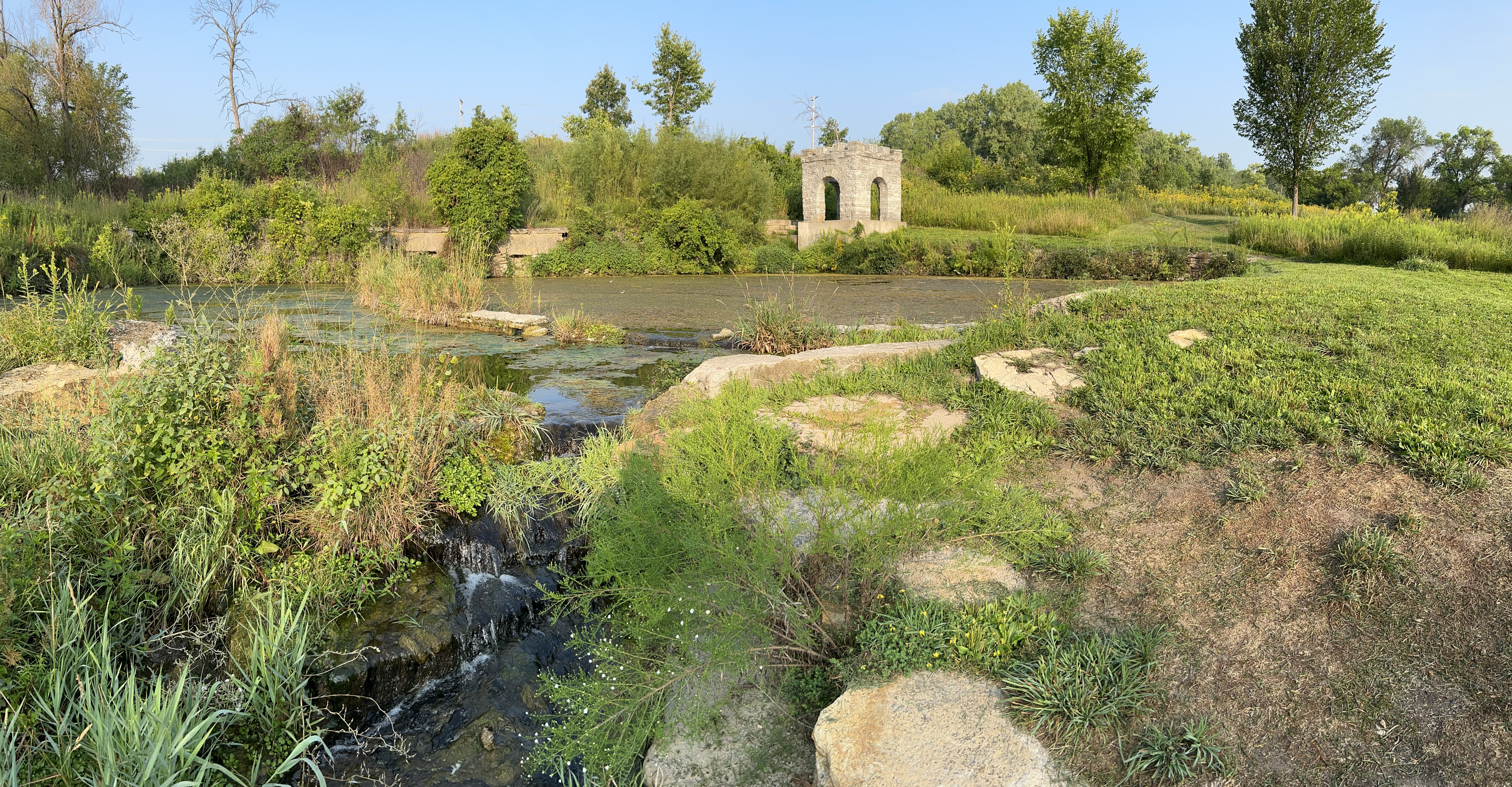
The tiny tributary (above) of the Mississippi River is Coldwater Spring, one of the few parcels of land the park service owns here except for islands. Buildings were removed, plants planted, and the birds and butterflies have already returned. A mink was sighted a few days ago. Having a good spring near the confluence of the Minnesota River made it ideal for an early trading post. Eventually the twin cities of Minneapolis and Saint Paul arose, but, even though you can hear traffic, the spot is mostly wildflowers, prairie grasses, and old Live Oaks.
The trail will be ready in September, so I wasn’t able to walk down to the floodplain to see the Cottonwoods here, but they’re visible in other locations. Nearby are the Minnehaha Falls, named after Hiawatha’s love in Longfellow’s 1/2 imagined and 1/2 native lore mashup epic “Song”. Hidden Falls / Crosby Farm and Lilydale-Harriet Island / Cherokee park partner sites are also recommended for views and other activities. The main visitor center is in the science museum and has mainly kid-friendly exhibits.
Seattle is a fascinating city, and this park offers a free walking tour of the Pioneer Square Historic District which teaches you about how the city overcame various challenges to grow. But the focus here is on the Gold Rush of 1897. To just report the numbers, 100,000 people rushed off to find gold, 70,000 bought supplies in Seattle, 40,000 reached the Klondike (mid-border of Alaska and Canada), 20,000 tried prospecting, 300 ‘struck it rich’ finding over $500,000 in gold, and only about 50 didn’t waste their money away digging for more. So the store above represents the only real winners of the rush, Seattle’s merchants. The stories are fascinating, although darkly tragic in many cases.
There’s another section of the park on Bainbridge Island across from Seattle, which is a memorial to the first US citizens of Japanese descent to be forcibly removed from their homes and sent to Manzanar and Minidoka. There is a beautiful cedar and stone memorial wall there along with names of the ‘interns’ and origami cranes, each representing a fragment of hope that a wish comes true. More than in some other places, many of the victims returned to their homes after the war. The main Klondike visitor center in Seattle also has a small exhibit about this American experience.
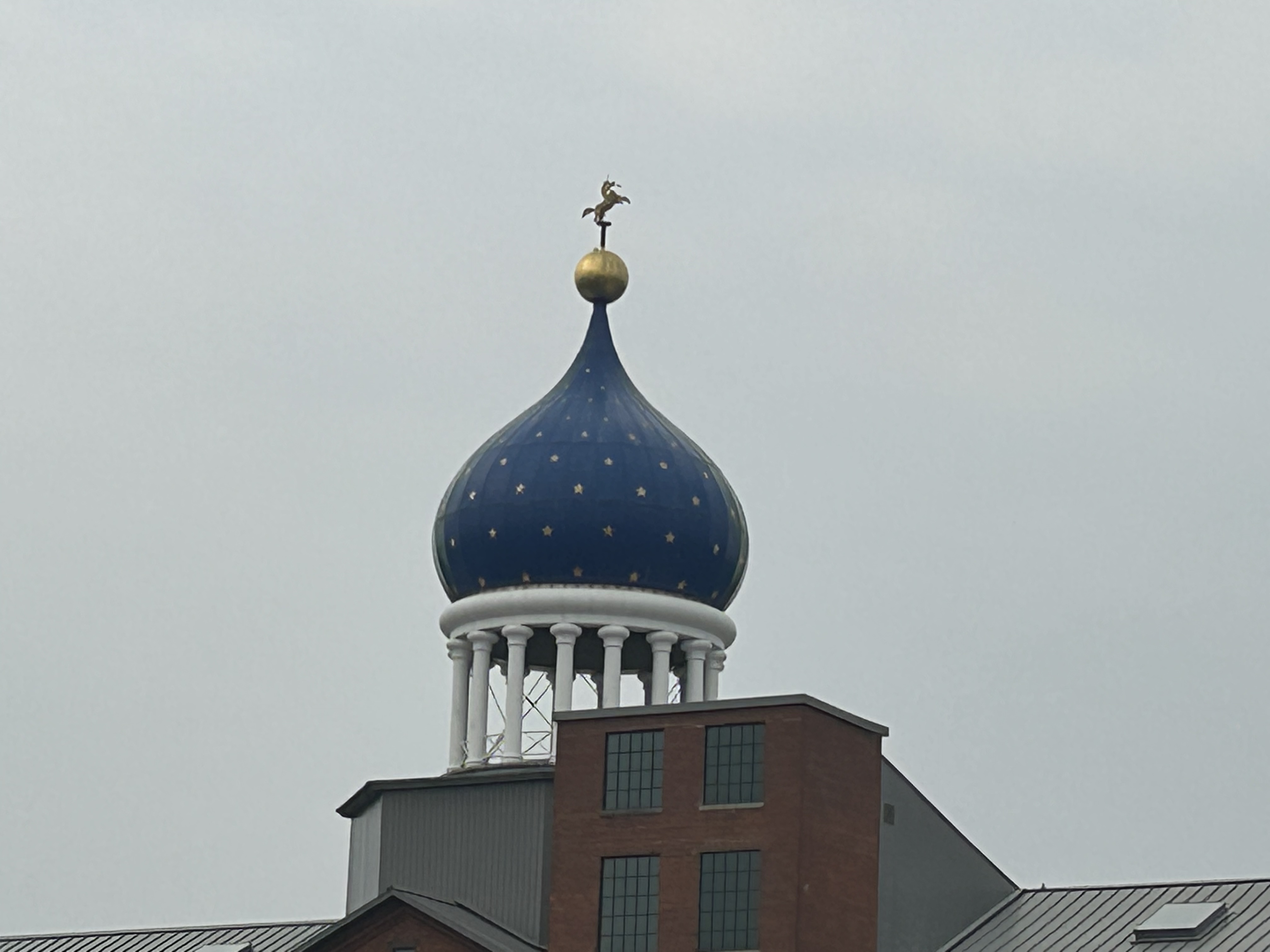
Samuel Colt sold a lot of guns to Russia, one of their first major clients, so he built the original iconic onion dome that defines the Hartford CT skyline (the one above is a replacement after a fire). You may notice the “rampant colt” on the top, which symbolizes loyalty, as the animal is breaking a lance to defend its fallen knight. The dome is actually one reason for the delay in converting the park to full status, as leaseholders control access to the dome which the park service needs. The two original brick buildings that the park service owns are in dire need of restoration too. There’s a nice walk through the large recreational Colt park to find his estranged brother’s house and through the company town to a church commissioned by the widow Elizabeth Colt, who ran the company for decades. Until this park opens officially, you may want to visit the Springfield Armory to learn more about the development of guns in the Connecticut River Valley.
The island itself is off limits, but there’s a viewpoint, a visitor center, some statues, and a rocky cove. The lighter land in the background is Canada. As is often the case in New England, I visited here as a child, although I had forgotten. Rediscovery is rejuvenating.
The French were determined to establish a trading post here in 1604, but the winter killed half of them. One of the survivors was Samuel Champlain, who went on to found Port Royal in Nova Scotia—the first successful colony north of Florida—and Quebec. He also accurately mapped the coastline, opened fur trade with the natives and was de facto Governor of New France.