Favorites from 400 Park Sites*

In 2022, I visited 200 national park units: see my first 100 favorites and my second 100 favorites.

In 2023, my total reached 300: third 100 favorites.

In 2024, my total reached 400 *including 3 extra types*—affiliates, heritage areas and trails—even though they aren’t official national park units. My official total is 385 (out of 433).

My earlier favorites mostly hold, with several important changes.

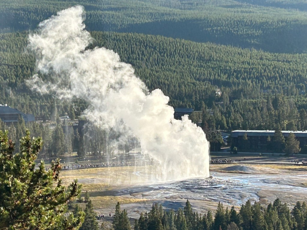
Yellowstone takes best national park from Theodore Roosevelt.

And, Yellowstone’s geysers also take best geologic feature from Arches/ Natural Bridges.

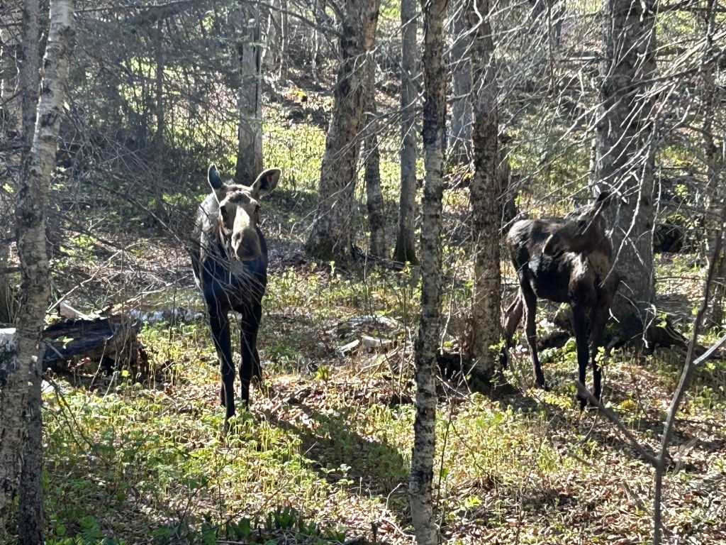
Best wildlife experience goes to Isle Royale from Great Smoky Mountains.

Best kayaking goes to Ozark NSR from Big Thicket.

And best trees splits into 3 categories: oldest Great Basin, largest Sequoia and tallest Redwood.

Here more of my fourth 100 favorites.

Best annual festival / fairytale: May Day at Amana Colonies in Silos & Smokestacks NHA.

Best place to follow Zane Grey: Rainbow Bridge below.

Best tea: Campobello.

Best trail: Pacific Crest NST.

Best trail stop: Mahaffie Santa Fe stagecoach ride.

Best waterfalls: Yosemite.

Favorite photo is above from Sangre de Cristo NHA: [strictly non-commercial use].

Mossiest hike: Olympic.

Most iconic park: Statue of Liberty.

Big South Fork National River & Recreation Area

The Big South Fork is a 76 mile tributary from the Cumberland Plateau in Tennessee that joins the Cumberland River between Cumberland Falls and Lake Cumberland in Kentucky. The Falls are the second largest east of the Rockies and are the best place to see a moonbow on this side of the planet. Unfortunately, Kentucky has a littering problem, so Cumberland Falls State Park is also a place you will see trash in and along the river.

The Big South Fork looked better when I kayaked from Blue Heron to Yamacraw above (Sheltowee Trace Adventure Resort has a shuttle). Non-native insects killed many pine trees years ago, so the forest has more hardwoods now. Pollution upstream still degrades the water, but Appalachia is recovering from the damage done by coal mining. Blue Heron campground made a good base to charge my car and explore the old mine exhibit there, even though the tourist rail line to town is under repair.

The gorges and remote roads make it difficult to get around, so I recommend paddling if there’s enough water. I saw a young deer and a bald eagle on the river and enjoyed looking up at the cliffs. The hiking is excellent too, and my favorite was hiking under the huge rock shelter behind 113’ Yahoo Falls. There’s also a large natural bridge called Twin Arches. The area is thick with trees, which makes it difficult to see all the geological features of the gorges, but the lush dense foliage gives the river a primordial feel, especially since I saw not a single person while kayaking.

Devils Postpile National Monument

The park is only accessible for zero carbon travel for a few weeks after the required shuttle service ends (mid September) and before the road closes (early to mid October). Shuttle buses are useful for reducing carbon pollution, but unless they’re sustainably fueled, they’re out of bounds to me. Red’s Meadow Cafe was still open, but the resort was closed when I arrived late September.

Since both the John Muir and Pacific Crest Trails run together through the park, I recommend you hike in a loop around the base of the broken basalt columns, across one of the two bridges across the Middle Fork of the San Joaquin River, along the combined JMT & PCT trail ridge where I got the photo, and back across the other bridge. There are also pretty waterfalls at both the north and especially south ends of the monument, but be careful hiking as the park is at around 7,500 feet in altitude up near the Mammoth Mountain ski area. There’s also a trail up through the trees to the top of the columns, which were formed 80,000 years ago when a diabolically molten lake cooled and cracked deeply in hexagonal and similar shapes and which were revealed by glaciation 15,000 years ago. Enjoy!