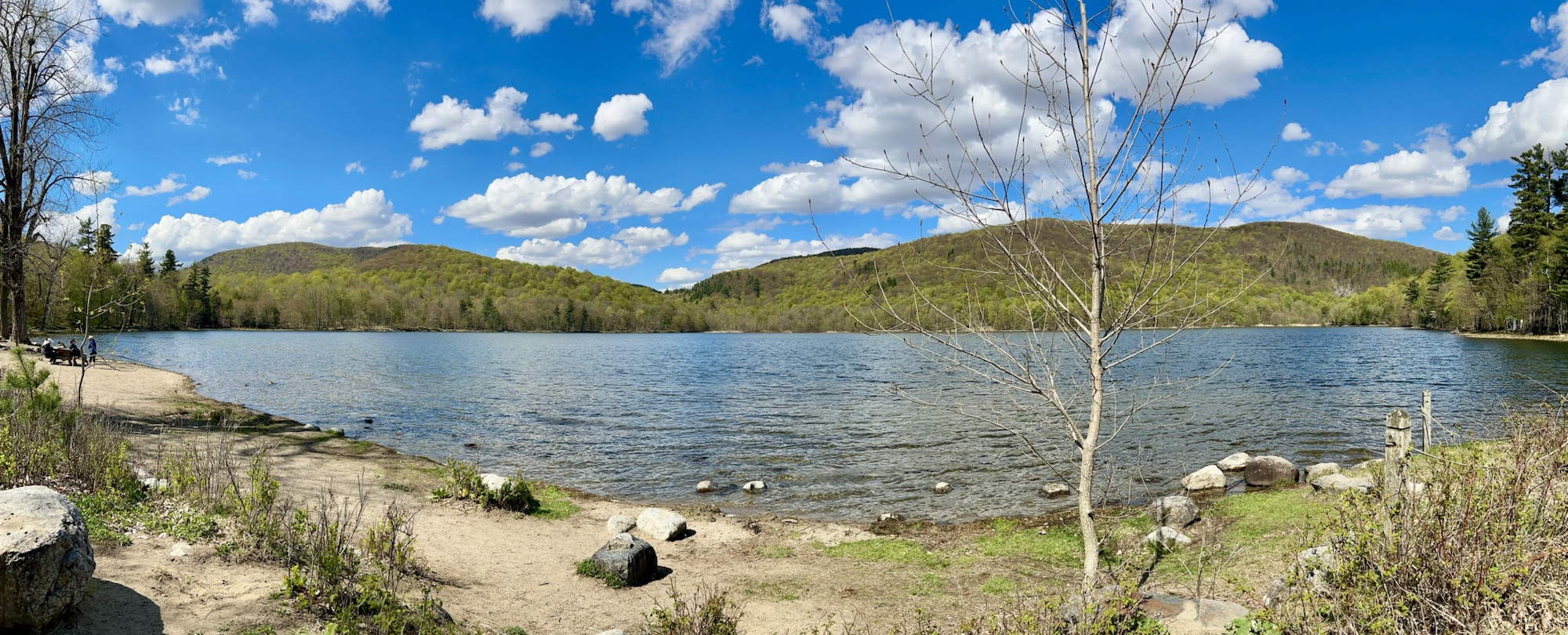
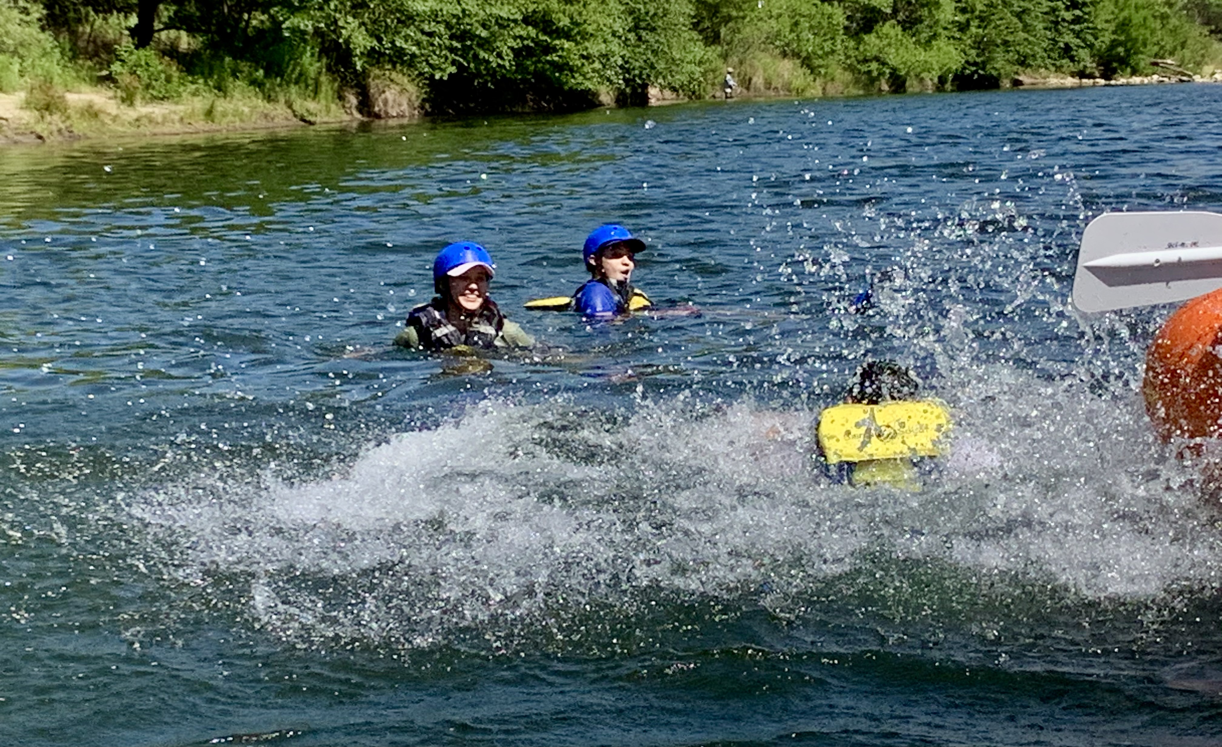
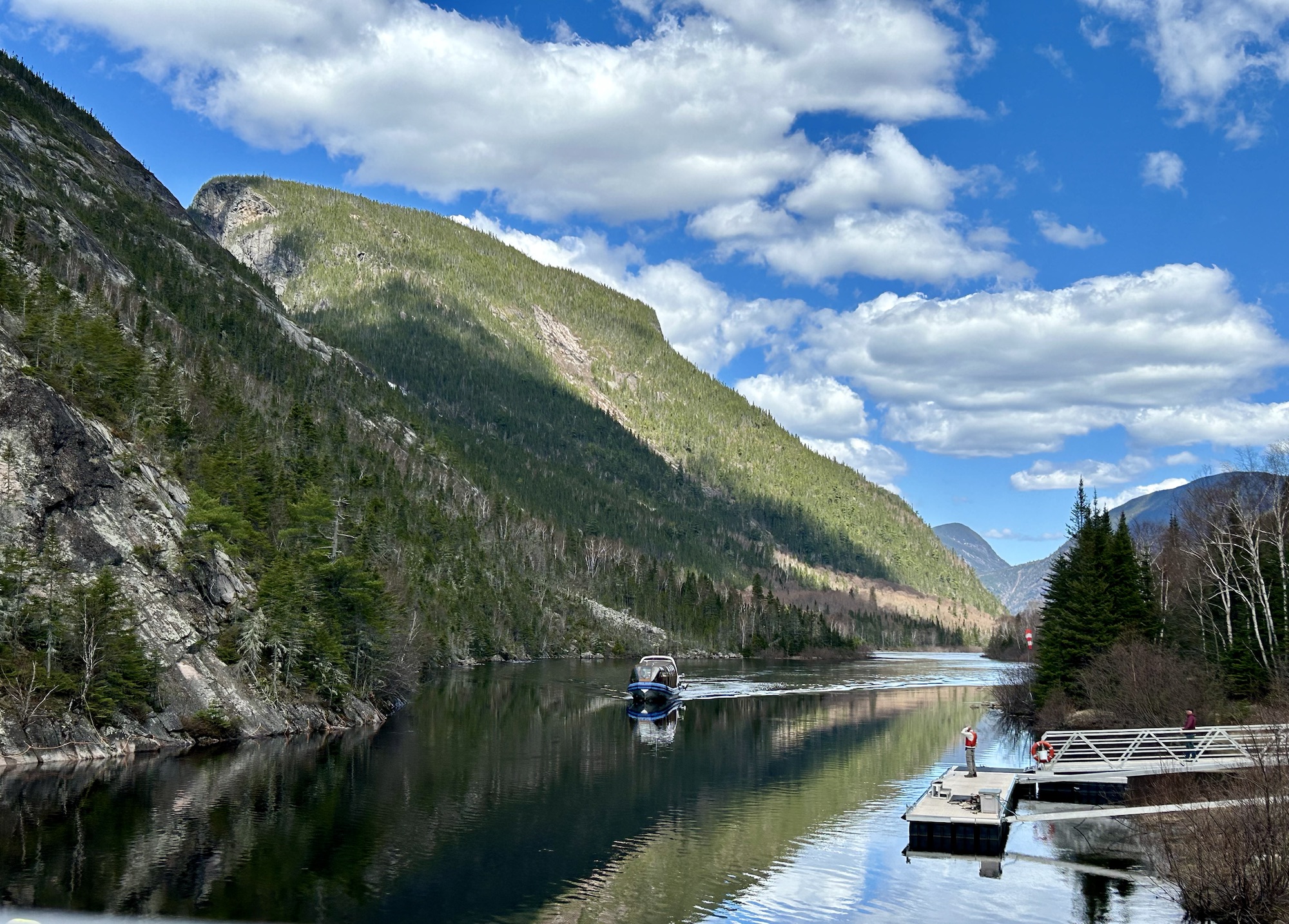
Lac Saint-Pierre Biosphere Reserve

Between Montreal and Quebec City is the beginning of the St Lawrence Estuary, near the city of Trois-Rivières. (One of the dozen tributaries here has islands at its mouth, making it look like three rivers). The UNESCO Biosphere includes this large wetland lake and many islands in the seaway and tributaries, making it an excellent site for birds. Its great blue heron rookery is quite famous, but may be difficult to access. I chose to visit the Ecological Park of Anse du Port, because it has a very long boardwalk out through the wetland all the way to the lake, with a three story viewing platform to view container ships passing in the main channel. From the boardwalk, I saw several great blue heron, two beaver, a raccoon, a woodpecker, ducks (above), bittern, and a half dozen other types of birds. Binoculars or a telephoto lens camera would be helpful, but sometimes the birds come quite close.

Mont Saint-Hilaire Biosphere Reserve

Between Lake Champlain New York and Lac Saint-Pierre Quebec is tiny Lac Hertel (above) in the Gault Nature Reserve of McGill University in this UNESCO Biosphere. The hills are covered in Sugar Maple, Beech and Hemlock, some of which are hundreds of years old, plus some other species that have become quite rare recently. Being close to Montreal, the hiking trails were busy, so I didn’t see much wildlife besides ducks and geese. But there are bats, beavers, red foxes, grass snakes and turtles, among others. Advance, timed entry tickets are required, and there are well developed trails, boardwalks, picnic areas and camp sites. Very pretty nature reserve in the middle of a rural farming river valley.

All NPS National Recreation Areas

There are 18 NRAs managed by the park service for biking, boating, camping, fishing, hiking, horse riding, swimming and other activities. (I should note that there are also 13 NRAs managed by the US Forest Service, and I plan to visit some of those too.)

Two are in the North Atlantic region: Boston Harbor Islands and Gateway, which is shared with the Mid-Atlantic region. Both are great for birdwatching and hiking along the shorelines.

The Mid-Atlantic has two more: Delaware Water Gap and Gauley River, plus the Upper Delaware Scenic and Recreational River. All are great for paddling, although Gauley is more challenging.

Three are in the Pacific Northwest: Lake Chelan, Lake Roosevelt and Ross Lake. All have great lakeside camping.

Three are in the Rocky Mountain region: Bighorn Canyon, Curecanti and Glen Canyon, which is shared with the Western region. Each has great views.

The Western region has four more: Golden Gate, Lake Mead, Santa Monica Mountains and Whiskeytown, each unique.

The Southeast has one: Chattahoochee River, which is great for hiking and maybe tubing near Atlanta. Plus they have the Big South Fork National River & Recreation Area, which is great for paddling.

And the Southwest region has Amistad, Chickasaw and Lake Meredith, which all take advantage of dams for boating.

Oh, and while the Midwest doesn’t have any NRAs, they do have the Mississippi National River and Recreation Area and the Missouri National Recreational River, both with lovely hiking and paddling.

Tennessee in Photos

Celebrating completing the Volunteer State!

Andrew Johnson NHS, Chickamauga & Chattanooga NMP (partly in Georgia), Fort Donelson NB (partly in Kentucky), Great Smoky Mountains NP & WHS (partly in North Carolina), Obed WSR, Shiloh NMP (partly in Mississippi), and Stones River NB are above. Big South Fork NRRA, Cumberland Gap NHP, Natchez Trace Parkway & National Scenic Trail, Overmountain Victory NHT, and Trail of Tears NHT are also partly in the state. Tennessee is an NHA dedicated to the Civil War, which includes the affiliate site, Parkers Cross Roads.

Best of the Midwest

Best Park: Isle Royale. Wildlife, wilderness, multi-day hiking, boating, camping, forests, mountains, waters. Isle Royale, above, is the best Midwest park in many categories, despite being the least visited national park in the lower 48.

Best State: Missouri. Under-appreciated Missouri has Ozark Scenic Riverways, a karst-cavern, spring-fed paddling, sparkling gem, and Ste. Geneviève, a cultural midwestern marvel, not to mention Gateway Arch and more.

The Midwest specializes in history, exemplified by these best-in-class parks.

Best Bicycling: Cuyahoga Valley.

Best Heritage Area: Freedom’s Frontier.

Best Museum(s): Dayton Aviation.

Best Native American Site: Pipestone.

Best Place to Lose Yourself in Nature: Voyageurs. (Get a boat-in campsite.)

Best Ranger: Nicodemus. She’s part of the living heritage.

Best Scenery: Pictured Rocks.

Best Trail: Learn About all the Pioneer Trails at Scotts Bluff.

Best World Heritage Site: Taliesin.

Most Tragic Folk Song: Keweenaw.

Read more about all parks in the Midwest region.

Mid-Atlantic Trails

5 historic trails link multiple sites in the region, and 3 scenic trails are park units. Here’s a quick summary in case you are interested in exploring the trails in the region.

Historic trails

Scenic trails

Susquehanna National Heritage Area

The Zimmerman center above is the launching point for summer boat rides on the river in the background, a colonial era museum, the trailhead through a Susquehannock tribal area, local HQ for the Captain John Smith Chesapeake NHT, and the HQ for the Susquehanna NHA. I’m glad I stopped here last month, since the staff cleared up some of my misconceptions.

The museum here does a good job in describing the contact between the colonial explorer John Smith and the natives. The staff also confirmed my suspicion that Captain Smith could not have traveled to all the points up river shown on his trail. Even his small exploring boat could not sail up waterfalls and over rocky shoals. So Smith’s historic trail map does not match the explorer’s actual historic trail. The NPS describes the trail as “a water-based trail following the coastline of the Chesapeake Bay and its tributary rivers”, which would be great, if this were a scenic trail, but it’s a historic trail, named for a real explorer. [No word yet from the NPS on fixing this.]

Amidst handling school groups with aplomb, the staff also nicely answered my questions about the broad heritage area. If you’re interested in the colonial era, you should visit the county history museum in York, which has several colonial buildings, including a tavern, where our revolutionary leaders, the Continental Congress, fled during the British occupation of Philadelphia from 1777 to 1778. While exploring, you will likely see both Mennonite and Amish community members, such as around Loganton in the scenic area up the west branch of the river.

Rocky Mountain Trails

8 trails cross the Rocky Mountain region, including 6 National Historic Trails and a National Geologic Trail that link multiple sites, plus the North Country National Scenic Trail that is an individual park unit. Here’s a quick summary in case you are interested in exploring the trails in the region.

Ice Age National Scenic Trail

The trail is not straight. It meanders through Michigan’s wooded hills, green valleys and along its rivers and lakes. The trail begins along the Niagara Escarpment that separates Green Bay from Lake Michigan, then south below Madison, before crossing the Wisconsin River at Lake Wisconsin. Then it passes up across the bluff on the right with its characteristic rough rock glacial remnants on the steep slope to the north beach of Devil’s Lake above before continuing north to the Wisconsin Dells with iconic eroded rocks. Eventually it crosses the state to end at the St Croix River.

President Biden elevated the trail to a full national park unit, but many of the most scenic sections are in state parks or affiliated scientific reserves. Wisconsin Dells itself is quite commercialized, with water parks and pricey tours, even though the layered rock can be seen in several different places along the Wisconsin River. State parks like above or Mirror Lake have fine scenery, camping and miles of maintained trails. I tend to rush around and then spend too much time at supper clubs, but it’s worth slowing down a bit here to enjoy the natural beauty. For more, read my earlier post about the Ice Age Trails.

Adirondack Biosphere & Champlain Valley National Heritage Partnership

Much of upstate New York belongs to the Adirondacks, with old mountains, lakes, forests, wildlife and scenery. Two of the more famous tourist spots are the High Falls Gorge (above) and the Ausable Chasm (below), both on the Ausable River—from the French ‘au sable’ meaning ‘sandy’—which is fed from Lake Placid and flows down to Lake Champlain. Since they’re well developed old trails, walking along the secure walkways and overlooks costs about $20 each, but I think they’re still worth it, though neither is quite the scale I imagined for the ‘Grand Canyon of the East’.

Lake Champlain is part of the water route from New York City to Quebec, so several key battles were fought in the area, including at Saratoga and during the War of 1812. The British were winning in 1814, having sacked DC, but Thomas Macdonough won the Battle of Lake Champlain aboard his ship, the USS Saratoga, thwarting a British invasion down the Hudson in 1814.

This National Heritage Area preserves both history and beautiful nature, including Marsh-Billings-Rockefeller in Vermont. The Champlain-Adirondack Biosphere is also recognized by UNESCO for its forests, wetlands and mountains in both upstate NY and about 1/2 of Vermont. Unfortunately, the Trump administration ended the only other UNESCO Biosphere in the North Atlantic Region at New Hampshire’s Hubbard Brook hardwood forest research. Still, there are many other fascinating places to visit in this diverse heritage area, such as the Antique Boat Museum in Clayton New York on the St Lawrence River, as well as the scenic homelands of the Algonquin and Iroquois people near the Canadian border.