Georgian Bay Biosphere Reserve

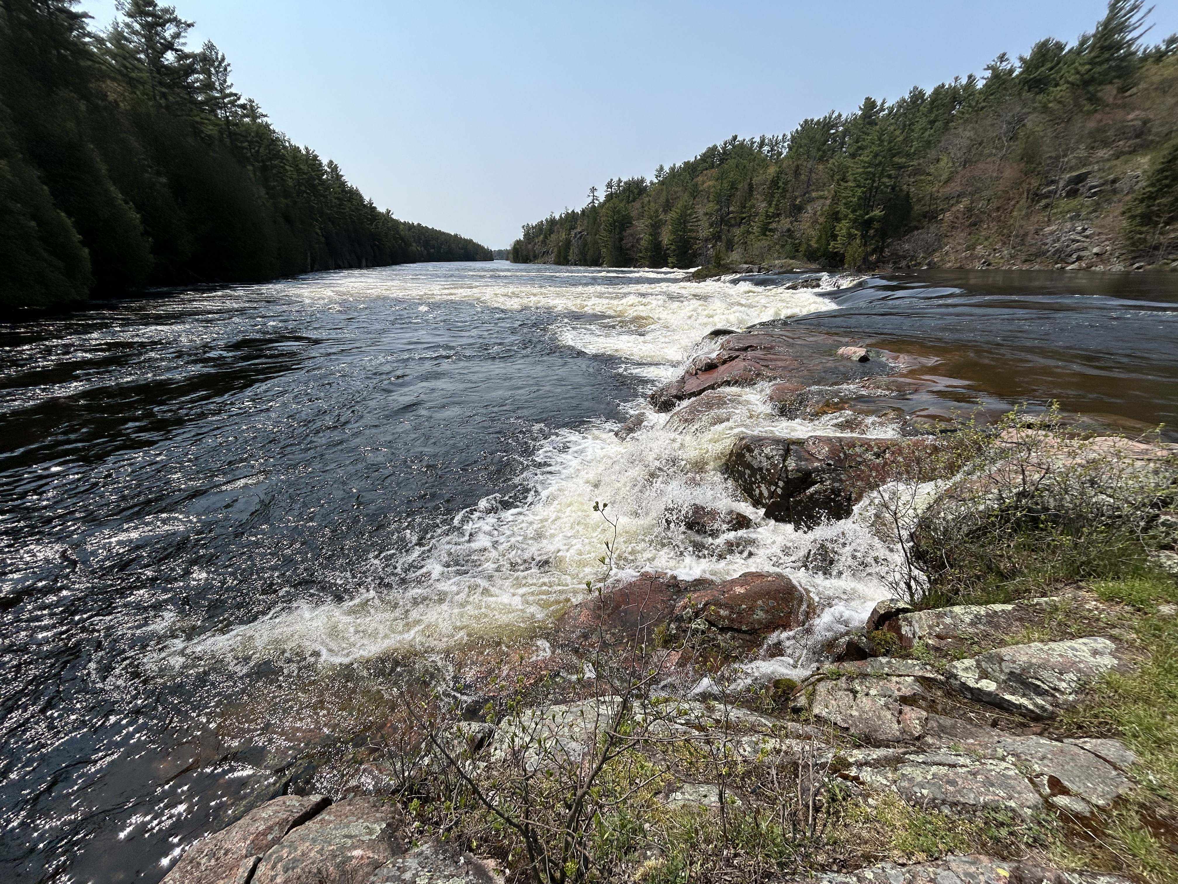
Georgian Bay is almost as big as Lake Ontario, but it’s still just considered a bay of Lake Huron. The Niagara Escarpment separates the bay in the form of the Bruce Peninsula and Manitoulin Island. Above are the Recollet Falls on the French River at the north end of the biosphere. Most of the famous explorers of Canada passed this way: Brûlé who lived with the Huron as a teen around 1610, Champlain and Mackenzie, among others. Radisson and his brother-in-law may have been the most consequential, as they realized the economic potential of Ojibwa fur trading canoe routes. Unlike the licensed voyageurs, the pair were outlaw traders, known as coureur des bois, ‘runners of the woods’. When the French declined to support their venture, they turned to the English and formed the Hudson Bay Company.

The south end of the biosphere is at the Severn River, where there’s an impressive canal/ boat-railway system for transiting small craft between Lakes Huron and Ontario. Much of the biosphere belongs to the Anishinaabek people, who call it the Mnidoo-gamii, the ‘spirit of the lake’. The lakeshore is well protected, remote and home to a great many species. As ages ago, boat is still the best way to explore this ‘30,000 islands’ area. Still, I managed to spot two black bears just outside the park where I hiked to the falls above. Fortunately I didn’t see any of their rare local rattlesnakes. Northwest of Georgian Bay, on Manitoulin Island, I saw a bald eagle, six sand hill cranes, and a variety of smaller birds. Georgian Bay is a lovely area, and I’m glad it’s protected.

Niagara Escarpment Biosphere Reserve

Ignore the famed waterfalls and focus on Goat Island cliff in the middle. That wall is the Niagara Escarpment, caused by relatively hard rocks at the top holding the land underneath together, until it erodes away from the side. This two level land break—all erosion and not earthquake fault—is the key geologic feature to understanding the Great Lakes.

Much of the escarpment is in Canada, and even where it crosses the border to form Niagara Falls, it’s easier to see from the Canadian side as above. It runs along the south shore of Lake Ontario, across Niagara Falls (above) where it sets the level of Lake Erie, northwest through Ontario where it guides the Bruce Trail, up along the north shore of Lake Huron where it splits off Georgian Bay and shapes Lakes Huron and Michigan, along Michigan’s Upper Peninsula where it separates Lake Superior, and down the Door Peninsula past Green Bay in Wisconsin. After driving around the Great Lakes, it’s apparent how the water levels depend on the escarpment: Superior is the highest above both ends, Michigan and Huron are the same level in the middle, and shallow Erie is a little lower, held back at Niagara Falls, before that river drains into the lowest lake, Ontario.

UNESCO defines the Biosphere as the mostly forested area of Ontario between Niagara Falls and Tobermory on the tip of the Bruce Peninsula next to Georgian Bay, roughly 500 miles along the escarpment. The geologically interesting landscape holds great biodiversity in wetlands, coastline, deciduous & conifer forests, and rocky bluffs, perhaps the most in Canada. And there are many opportunities to explore, photograph wildlife, hike, drive or boat nearby. I hiked on the Cup & Saucer Trail on Manitoulin Island, the world’s largest freshwater island, when traveling around the Great Lakes. There, the escarpment is eroded on both sides, providing many views along its edge, including Lake Manitou below.

Sleeping Bear Dunes National Lakeshore

The small lake on the right is Glen Lake, and Lake Michigan is at the top left. If you zoom in to the right, you might see tiny people climbing the middle dune from the parking lot. I got up to this vast view on the pleasant Cottonwood Trail (less than 2 miles round trip) from the Pierce Stocking Scenic Drive, which also takes you to the breathtaking Lake Michigan Overlook and the splendid Sleeping Bear Overlook. Many folks seem to want to do things the hard way, but I definitely recommend hiking from the scenic drive. The impressive Sleeping Bear Dune itself is over 1000 feet high, and folks frequently need rescuing ($3,000) after climbing down to the lake and not being able to climb back up. A few extreme winter folk ski down the steep dune to the lake. Not sure how they get back up. Please stay on the trails, as past humans caused much erosion damage to the fragile ecosystem here. This is a beautiful park with wildlife, deep Native American roots, and it is part of a new UNESCO Biosphere across northern lower Michigan.