Old Town Lunenburg

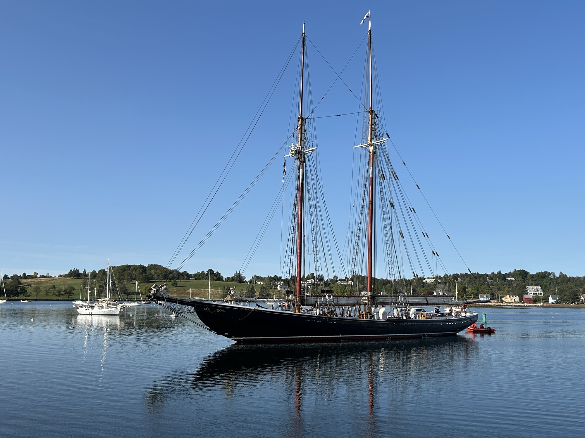
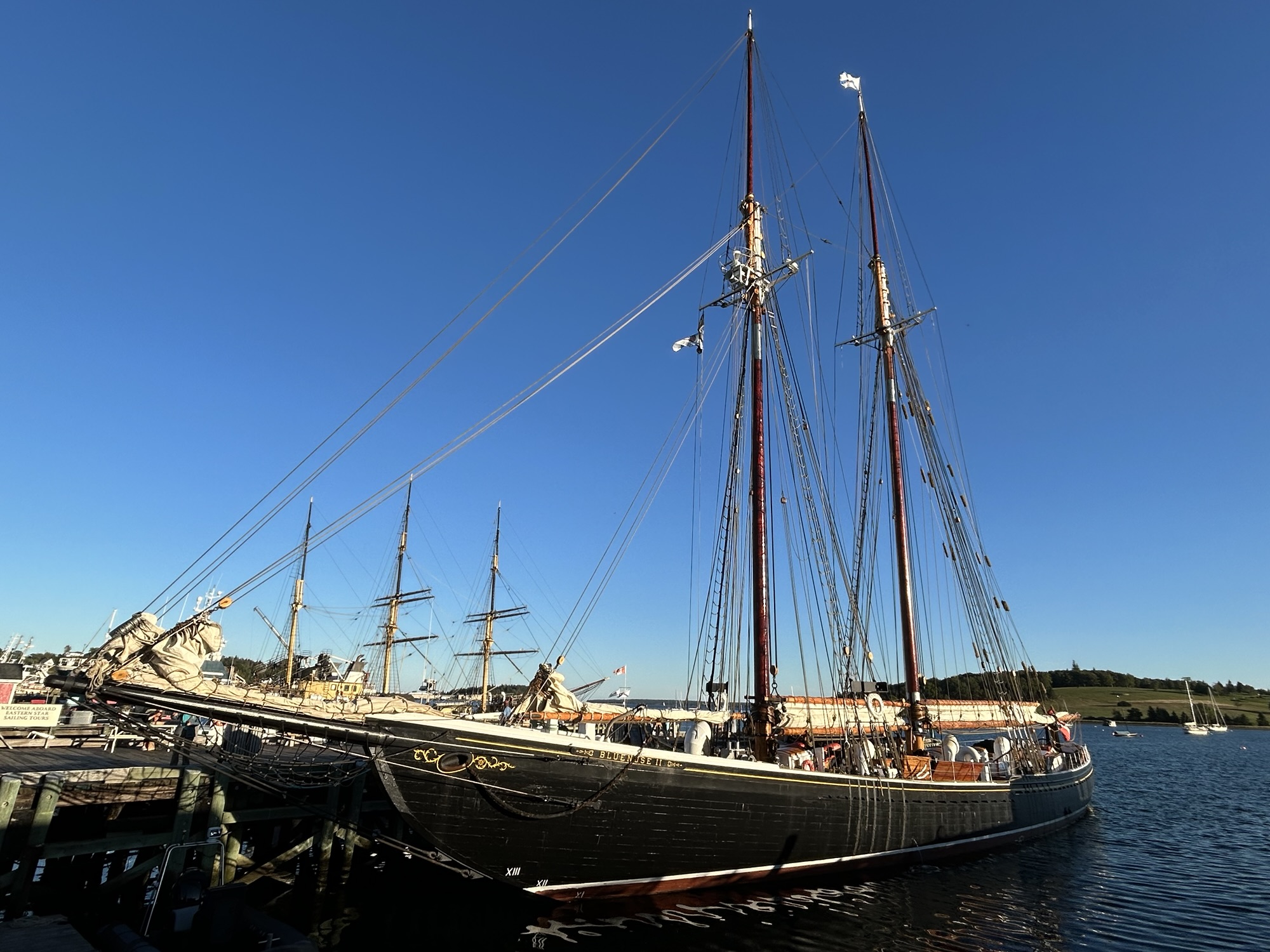
UNESCO recognized Lunenburg Nova Scotia for being a well-preserved example of a British planned town, including many lovely, colorful historic buildings. I think that’s missing the point. The town was a success due to its natural harbor, grew quickly and earned its fine buildings by fishing and trade during the age of sail. Plenty of other towns have grid streets and colorful Victorian architecture. But the beauty of the place is its harbor, where two large sailing ships were docked when I arrived. One, the Picton Castle, is a training ship (in background above), and the other is the Bluenose II (foreground), a replica of one of the fastest fishing sailboats in the world. The Bluenose won 5 consecutive world fishing ship races during the 1920s and 30s, before being lost in the Caribbean in the 40s.

If landlubbers come here to see an old church and some other old buildings, then they’re missing the best of Lunenburg. Sit by the harbor and watch the boats. Eat some locally caught seafood in one of the many harborside restaurants. Go to the maritime museum and learn about fishing during the age of sail. My hotel room had a view of tall ship masts to help me dream of adventures, and I caught the Bluenose II on its way out to sea early in the morning, below. This is one of my favorite places to visit.

South Park and Cache la Poudre National Heritage Areas

South Park City, an old western summertime tourist trap in Fairplay Colorado, is only an hour and a half drive southwest from Denver, and yes, the cartoon is based on this tiny town surrounded by mountains. The mining and ranching town is at ~10,000 feet, and there’s an old railway roundhouse nearby. Some of the ranches organize riding tours, and there are plenty of scenic mountains, canyons, creeks and old mining sites to explore. The trout fishing is renowned. The South Park National Heritage Area is building a good track record of saving old buildings, protecting natural areas and boosting tourism.

About an hour drive north of Denver in Fort Collins is the Cache la Poudre River (French for Gunpowder Stash). Below is the Poudre River Whitewater Park, perhaps the best example of a how planning can turn an urban river into a recreational star. Due to a long-term cooperative water district that balances various stakeholder interests, the river is surprisingly well managed. The wild and scenic section up in the mountains preserves nature, protects wildlife and is enjoyed by whitewater rafters and kayakers. But I saw a kayaker preparing to raft the short stretch of whitewater in town, after changing out of work clothes. The Cache la Poudre River National Heritage Area also includes museums, historic sites and open natural areas in and around Fort Collins.

Padre Island National Seashore

I joined a few kayakers at Bird Island Basin to explore the Laguna Madre on the calm inland side of Padre Island in perfect conditions and enjoyed close up views of well over a dozen bird species fishing in the murky salty water, resting on the muddy beach and hopping around in the low grasses & brush. As usual, I wasn’t able to take good photos while bobbing along in my kayak, so here’s one I took from my car window of a Laughing Gull. With a number of birders in my family, I tried to identify at least a few of the endangered species: Reddish Egret, Least Tern, Brown Pelican, White Tailed Hawk, and at least two of their three endangered Plovers. Including the ocean side and sprawling grassland, there were Ruddy Turnstones, Curlews, Willets, a Tricolored Heron, and various ducks, sparrows, and raptors, and who knew there were so many different types of terns?

After the birds, Padre Island belonged to Native Americans first, and the visitor center and beach nearby are named after the Malaquite. The Spanish claimed it next, and silver treasure was found from one of their shipwrecks. Then the Republic of Texas claimed it, and finally the US won it in the Mexican American War. A Padre who collected funds for Rio Grande missions built a home here, prompting the name as well as the companion name for the lagoon. The Laguna Madre stretches into Tamaulipas Mexico and is the largest hypersaline coastal lagoon in the world, a critical stop on the flyways for many migratory birds in the Americas.

Prior ranching, military use and driving on the beach make the island less than pristine, but the park service has helped recover Ridley and other sea turtle populations here. There are specially adapted birds, fish, crabs, shellfish, reptiles, bugs, and other animals here, some of which live nowhere else. Unfortunately, fossil fuel drilling is still allowed in this area, which threatens all species in many ways, especially by climate change and rising seas.

Amistad National Recreation Area

In 1969, just below the confluence of the Rio Grande, Devils and Pecos Rivers, a dam was built, creating Lake Amistad (friendship en Español). The lake caused the mouths of the Pecos River and Seminole Creek (above) to silt up, and now that the water level has fallen (like Lake Mead and Lake Powell) they’re cut off from the Rio Grande (see far right). Most of the boat ramps, like the small dock at the cave above, are no longer accessible. The lake is far below minimum expectations, because the US diverts virtually all the Rio Grande water before it even reaches Big Bend. From there most of the river comes from Mexico’s Río Conchos. The park is run in partnership with many agencies, and the two towns that share the border are friendly and have joint cultural festivals annually. Mexico maintains a small fishery, US residents enjoy bass fishing, and the border is marked with buoys. I took one of the old highway ‘spurs’ straight down to the water, but it was too hot to kayak in winter.

Panther Cave, across the canyon above, is on the far western park boundary. While the park film absurdly claims that “no Native Americans have any ties to the area”, the canyon is Seminole Canyon, and the cave is an important site for prehistoric cave art. The Amistad visitor center has information and large reproductions of the cave art, and the excellent Seminole Canyon State Park has morning ranger-led tours to another similar cave and a few miles of hiking trails to see the view above. Before man dammed and drained the rivers and destroyed the riparian ecosystems, Native Americans must have traveled up the Rio Grande to Albuquerque, where some of the oldest petroglyph art was created at the same time as the art here. Sitting on the cliff above observing the wildlife, I imagined prehistoric people hunting, traveling by canoe, drawing on the cave walls and protecting their families from panthers, until thunder warned me to seek shelter.