Progress Report

  • 95,000 miles traveled in locust-covered, long range electric vehicle above
  • 3rd set of tires, 2nd windshield, and 1 speeding ticket
  • 48 states visited
  • 30 states completed all national park units
  • 3 of 9 regions completed: Mid-Atlantic, National Capital & Southwest
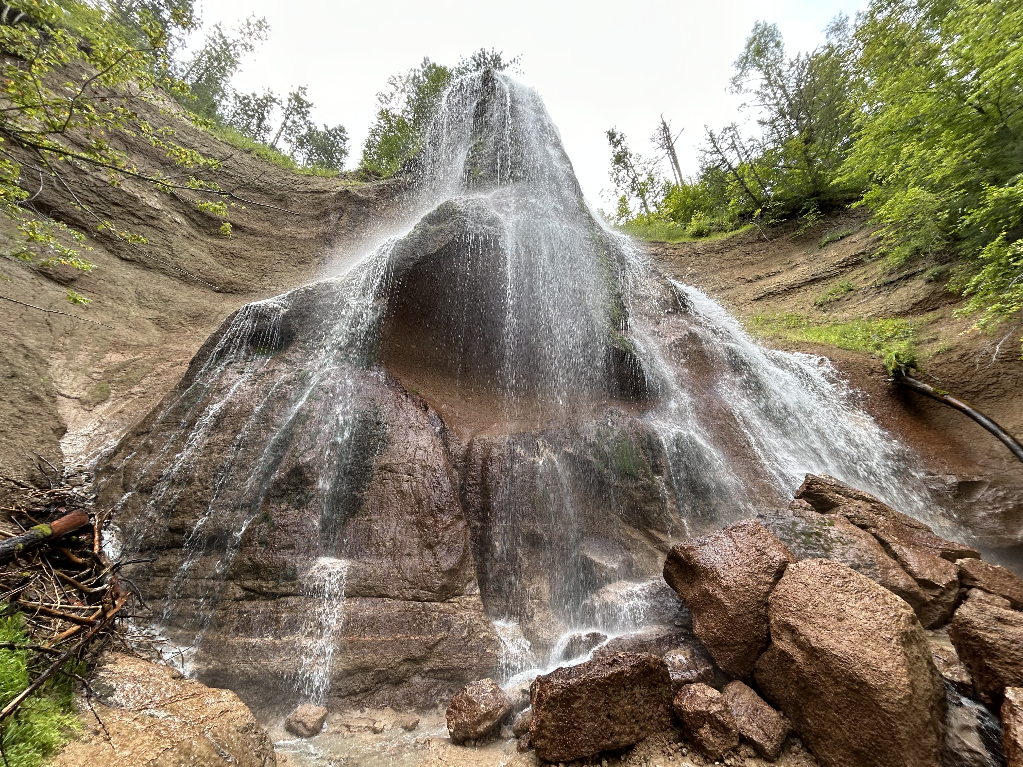
  • 42 of 63 national parks visited
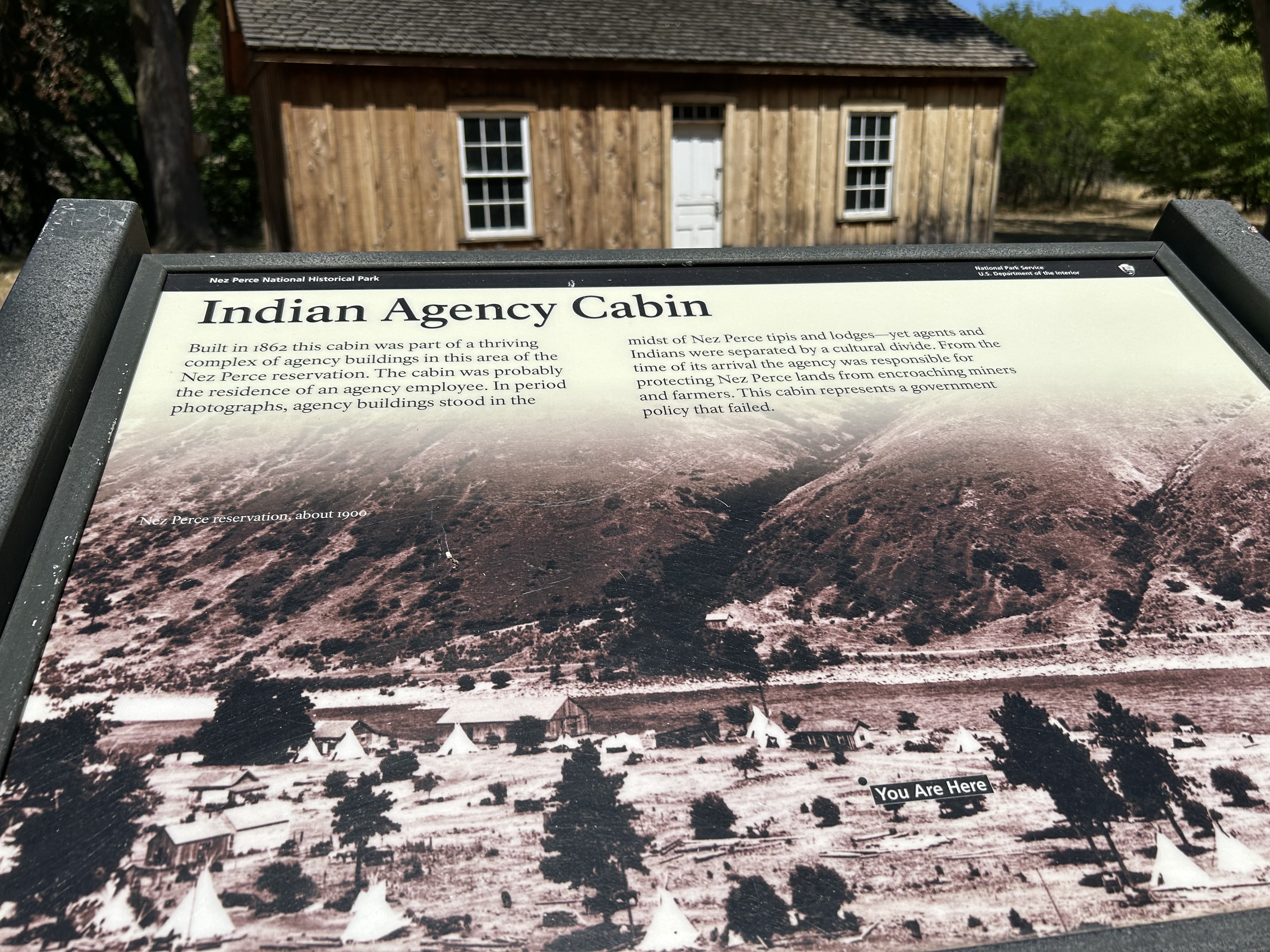
  • 25 of 25 battlefields & military parks visited: e.g. Revolutionary War
  • 40 of 42 memorials visited
  • 71 of 75 historic sites
  • 55 of 62 historical parks (broader than historic sites)
  • 77 of 84 monuments
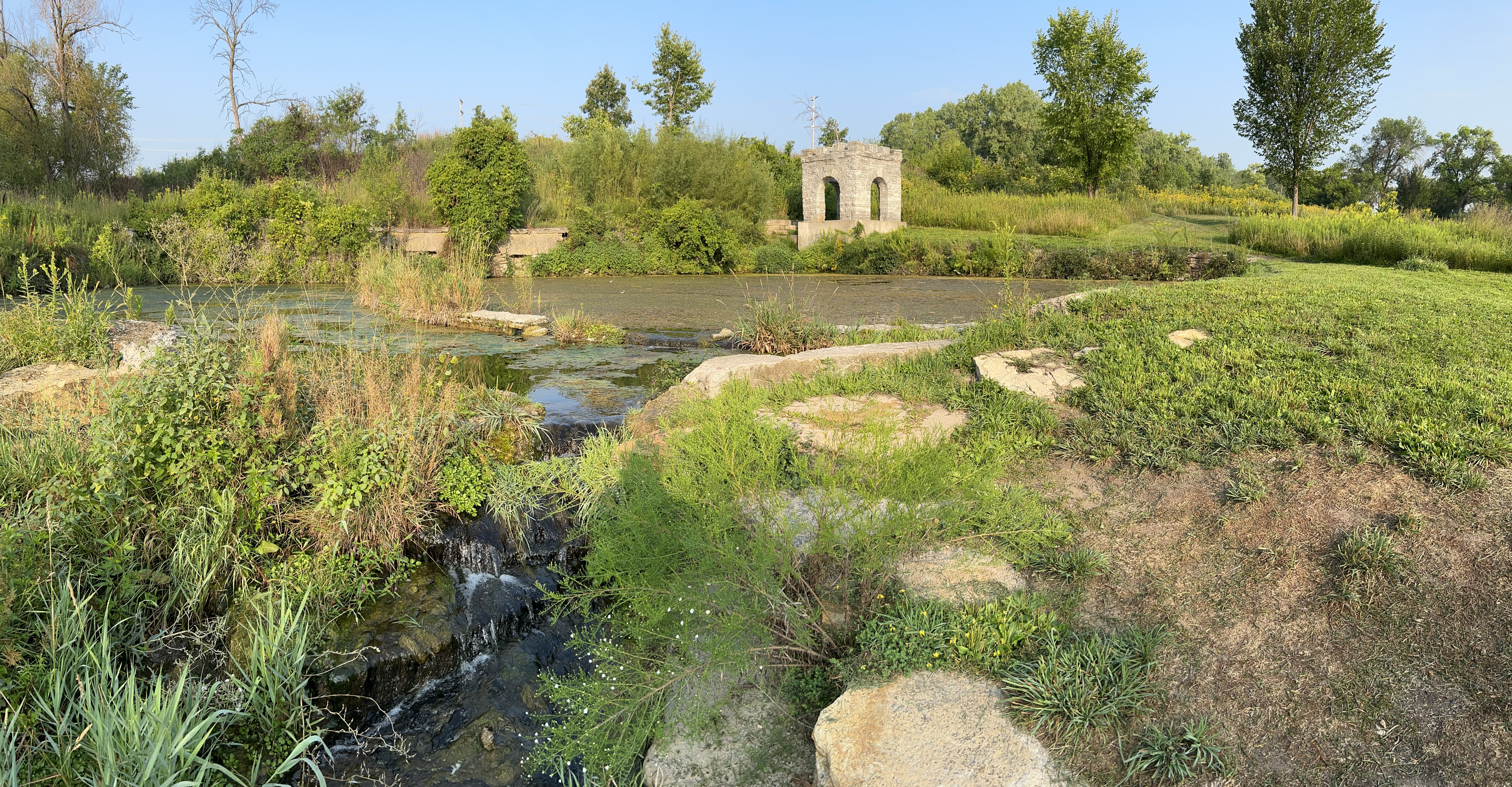
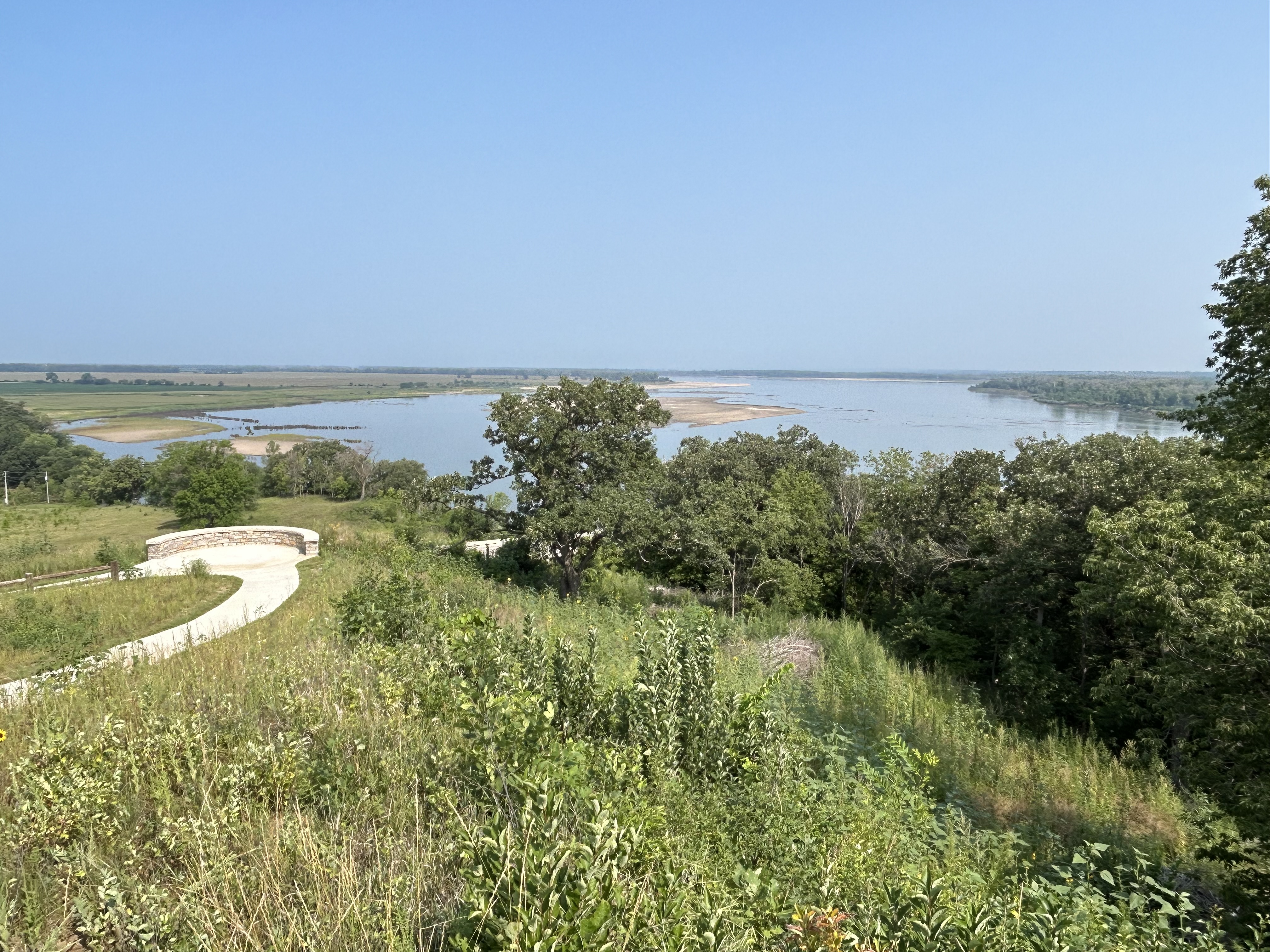
  • 48 of 73 recreational areas, reserves, rivers and others
  • 24 of 31 world heritage sites in USA, plus 5 in Canada

I spent $9,000 on charging, over 85% at superchargers. Heavy use of superchargers beyond the recommended daily limit has also reduced my battery capacity by 9%. Most electric car drivers charge overnight at home, so their costs are far lower. I should have cut costs with more free chargers and better route planning, but I drive capriciously, rushing around depending on weather and my curiosity. Like my mileage, my charging cost excludes borrowing an S when my 3 was in the shop and includes driving to visit family. A comparably priced new pickup truck for the same distance would have cost at least $16,000 for gas, based on average mpg and $/ gallon, more if they carried a boat or a bike like I do.

In September I plan to post a few of the affiliated trails I’ve stopped along, more west coast parks, a couple others I still need to edit, and hopefully some more Rocky Mountain parks from the road. Posting schedule will slow down in Q4 but each week will include a national park. Stay tuned for more adventures!

Lewis and Clark National Historical Park

The replica of Fort Clatsop, winter camp 1805-6, above helps imagine the rough conditions for 32 men, a woman, her baby and one dog, when it rained or sleeted 94 days out of 105. Several visitors brought their Newfoundland dogs in a regular event to honor Seaman, the valued, four-legged expedition member.

Jaden and his friend—not yet park service employees—explained the story of the stolen canoe, the eating of dogs and how Sacagawea was purchased and impregnated around age 15 by her ‘husband’ who had other ‘wives’. These facts didn’t make my history book. Jaden’s canoe story was one of the best talks I’ve heard in any national park.

I missed the guided paddle trip, but I walked to Canoe Landing and saw most of the short Lewis & Clark ‘river’ from shore. The pilings in the water here and in much of the Pacific Northwest are old logging organizers.

The park also includes various nearby sites visited by the expedition, including Washington state’s Cape Disappointment—misnamed by someone who mistakenly thought the bay too large to be the mouth of the Columbia River. A Japanese sub briefly bombed Fort Stevens on the Oregon side. The charming seaside town of Astoria, once famous for furs, canneries and The Goonies, makes a good base to explore with some good restaurants and reasonably priced hotels.

Here are my visits to all parks in Oregon and Washington.

Fort Vancouver National Historic Site

Portland Oregon has always confused me geographically. What kind of port is over 100 miles from the coast on a tributary of a major river? The history of this site explained it. George Vancouver, a British explorer who sailed with Captain Cook, explored the Pacific Northwest coast in the 1790s, and both the both the huge natural harbor in British Columbia to the north and this deep water site to the south on the Columbia River were named after him. Vancouver Washington was perfectly located at the confluence of the Willamette River to be an inland trading post still reachable by ocean vessels. The Chinook have long lived here and traded with other tribes, regularly traveling hundreds of miles by canoe. When the Pacific Northwest was British, this was all one territory from Sitka Alaska to San Francisco. Portland was built later as Vancouver’s port. When it became US territory, Oregon and Washington states split the growing city here on the Columbia. As the Willamette (Wil-AM-it) Valley developed in Oregon, Portland became the city and Vancouver became the tax-dodging suburb (lower income taxes in Washington within easy bridge distance to lower sales taxes across the river in Portland).

The British Hudson Bay Company built its corporate territorial headquarters here in 1825 to capitalize on the fur trade with tens of thousands of local Native Americans and a great many more via their ancient trade routes along the coast, up the rivers and deep into the mountains. The British contracted with many French fur traders who typically married natives. British ships brought workers from Hawaii after rounding Cape Horn. The fort (reconstructed on location above) was the center of a thriving cultural melting pot that developed its own language and challenges. Unfortunately, many natives died of disease, particularly malaria, which the ‘gentlemen’ who lived in the fort knew could be treated with Quinine, which they had in limited quantities. The company man in charge, Dr McLoughlin, was married to a biracial woman, and he was violently furious when newly arrived missionaries spoke derogatorily of her.

McLoughlin nevertheless extended credit to the many destitute white settlers who arrived on the Oregon Trail. He lost money, was forced to retire, became a US citizen and is now considered the ‘father of Oregon’. His house is part of the site south of Portland. White settlers took over and made the state ‘whites only’ by law until 1926, prohibiting others from property ownership etc. It’s worth reflecting honestly on this history when considering the recent Supreme Court decision against affirmative action: white ‘pioneers’ gave themselves every legal and economic advantage possible, from slavery, to the Rogue River Wars against natives, to ‘whites only’, to the Chinese exclusion act, and to taking property during the Japanese internment. It’s shameful that the Court ignored the long history unfair privileges given to white people—many whose families benefited over two hundred years from stolen land, labor and opportunity from so many people of color—and decided against providing a few seats in college in order to enrich the diversity of education for all students.

Here are my visits to all parks in Oregon.

Nez Perce National Historical Park

The visitor center in Idaho is on a hill above where the Lapwai Creek flows into the Clearwater River, which joins the Snake River a few miles downstream in Lewiston. The river banks were an excellent place for salmon, berries, edible flowers, and game, and the Nimiipuu used to arrive in the fall and stay through winter. By summer, they would be hunting up in the hills, forests & mountains. French trappers called the tribe Nez Perce or ‘Pierced Nose’, although that wasn’t a traditional tribal practice. When Lewis & Clark passed through, the Nimiipuu assisted the expedition and helped them make canoes. When the missionaries and other settlers arrived, they were forced to change. Many tried desperately to compromise and adapt. After the nearby Whitman mission ended in a massacre, racist demagoguery fueled far more excessive violence across the west, bringing the US military, war, exile and restricted reservation life, including here around the Spaulding mission, pictured circa 1900.

The affiliated Nez Perce National Historic Trail, which marks the flight of the tribe from the US Army, is now part of the broad official Nez Perce NHP, including Big Hole in Montana, a refuge near Lake Roosevelt, the White Bird & Clearwater Battlefields, through Lolo Pass, Yellowstone, Billings and up to Bear Paw Battlefield. Over the years, I’ve visited these places on roadtrips, read several of the books, from I Will Fight No More Forever to Chief Joseph & the Flight of the Nez Perce and pondered the mistakes and tragedy. There is simply no excuse for breaking treaties, stealing land, or killing defenseless people, including women, children, the elderly and infants. When leaders take advantage of popular anger to focus attacks against a community, the result is often far more evil than any original sins. I encourage you to learn more, since the problem of demagoguery is still with us.

But the Nez Perce tribe is still here with us, like the flowers they used to cultivate here. They are re-learning the language that they used to be punished for speaking. They self-govern, petition the US government, sing songs, dance, teach their kids to gather plants, hunt, fish and carry on their cultural traditions and exercise their treaty rights. The lessons of their forefathers and their oral traditions continue to be remembered, spoken aloud and passed down to future generations. The park preserves petroglyphs, artifacts and sites of mythology. Their culture is vibrant and contributes a valuable perspective to all of us. They are not doomed to be permanent prisoners of tragedy, and the park film here is a refreshing reminder of the resilience and life of their culture and of the human spirit.

Here are my visits to all parks in Idaho, Montana, Oregon and Washington.

Whitman Mission National Historic Site

The Cayuse had heard from the east about what happened to natives after settlers arrived, so they predicted death, loss and suffering were on their way. The Whitman missionaries left in 1836, five years before others started arriving overland in Oregon. They were allowed to start a farm here, and with the fervor of the second awakening, they preached that the Cayuse were going to hell after death unless they adopted Christianity. As it turned out, gathering newly arrived settlers and native converts in church weekly to break bread and sing songs together, helped spread diseases like measles that killed most of the native population. So the Whitmans were sort of correct, except for the order: first they adopted Christianity, then they went through hell before finally dying.

Unfortunately for the missionaries, the natives had a tradition of killing bad medicine men. Now, much has been written of the Whitman massacre (especially by the other missionary Spaulding who settled nearby with the Nez Perce), but imagine if immigrants come to your town and demand that you copy their strange new ways and beliefs, with threats if you did not. Many more immigrants arrive each year, talk with the missionary doctor, take over and spread disease. When the doctor treats his own people, they usually survive, but when he treats yours, they die. How many of your friends and relatives would die before some angry grieving parent would try to kill the doctor? I’m not excusing criminal behavior based in ignorance, but similar senseless vengeful murders still occur today.

When half of the Cayuse had died of disease, a group of natives killed Doctor Whitman, his wife and 11 other men. There’s a memorial on the hill in the photo above. 5 natives were later found guilty and hung. The mass murder was a terrible crime, but the response was just short of genocide. For the next 12 years, the Cayuse and many other natives in the territories were hunted down by militias and by the military, driven from their lands, harassed and in many cases slaughtered, including women, children and the elderly. When the dust settled, most of the remaining natives were on small reservations with a few escaped to Canada. For every white person killed, hundreds or likely 1000s of natives died. More lost everything they owned, including their freedom, despite not having anything to do with the original conflict or the Cayuse.

Here are my visits to all parks in Washington.

St. Croix National Scenic Riverway

Defining much of the border between Minnesota and Wisconsin, this river and its tributary the Namekagon were among the first rivers protected by the Wild & Scenic Rivers Act, supported by Walter Mondale and many other locals 55 years ago. The forest was quickly and heavily logged 150 years ago, but the water remained clean. Even though there are several dams, including a hydroelectric one at Taylors Falls, the river is much healthier than most, especially the upper St Croix. Below the dams, near the Mississippi, there are power boats, a power plant and non-native mussels, but higher up there are dozens of native mussel species, various fish, otters, bald eagles, kingfishers, great blue heron, several different colorful warblers and more.

The forests have regrown too, so it can be difficult to get a decent view of the river. The photo is from the Minnesota state park ($5 to park) below Taylors Falls, and it has a a canoe & kayak rental, picnic tables and camping. Nearby you can catch the scenic riverboat pictured that offers views of the basalt cliffs shattered by glacier melt. I’m going to have to return a third time, since my first trip was during spring floods and this summer during extreme low water. I believe the best views will be paddling the upper St Croix from the Namekagon confluence to highway 70, but I need good conditions for the rapids.

The Wisconsin parks are $11 to park with very similar views and features. There’s also a waterfall at Osceola, but the bluff trail there is now called the Falls Bluff Trail Loop, or the Cascade Falls Trail or the Eagle Bluff Trail or maybe the Simenstad Trail or the Osceola Rivertown Trail, but not the Osceola Bluff Trail like the park map says. Fortunately, you can also see the waterfall from the road, and the Watershed Café is quite good.

Mississippi National River and Recreation Area

The tiny tributary (above) of the Mississippi River is Coldwater Spring, one of the few parcels of land the park service owns here except for islands. Buildings were removed, plants planted, and the birds and butterflies have already returned. A mink was sighted a few days ago. Having a good spring near the confluence of the Minnesota River made it ideal for an early trading post. Eventually the twin cities of Minneapolis and Saint Paul arose, but, even though you can hear traffic, the spot is mostly wildflowers, prairie grasses, and old Live Oaks.

The trail will be ready in September, so I wasn’t able to walk down to the floodplain to see the Cottonwoods here, but they’re visible in other locations. Nearby are the Minnehaha Falls, named after Hiawatha’s love in Longfellow’s 1/2 imagined and 1/2 native lore mashup epic “Song”. Hidden Falls / Crosby Farm and Lilydale-Harriet Island / Cherokee park partner sites are also recommended for views and other activities. The main visitor center is in the science museum and has mainly kid-friendly exhibits.

Here are my visits to all parks in Minnesota.

Missouri National Recreational River

“O, Shenandoah, I love your daughter,
Away you rolling river.
I’ll take her ‘cross yon rolling water.
Ah-ha, I’m bound away, ‘cross the wide Missouri.”

American folk song

Above looks upstream from the hill above Mulberry Bend in the 59 mile eastern park district, where Lewis & Clark scouted some 219 years ago, along with other places introduced by the Yankton Sioux, one of many tribes that helped the expedition. The Yankton Sioux relinquished most of their land 165 years ago before either South Dakota (right) or Nebraska (left) were states, but they are still considered defenders of Pipestone in Minnesota. Their reservation runs along the north bank of most of the 39 mile western park district, above the confluence of the Niobrara, and they are park partners. Both districts of the park preserve the natural river flow, without commercial traffic, and most power boaters stick to Lewis & Clark Lake in the middle.

Further up the ‘big muddy’ Missouri River, at the confluence of the Knife River in North Dakota, teen mom Sacagawea joined their expedition with her French fur trapper husband and their infant. Like Pocahontas, her story is part of America, and similar stories are part of our heritage. As a child, I loved the song “Shenandoah” but was confused whether it was about the Shenandoah River in Virginia or the Missouri River. Turns out, Skenandoa was an Iroquois Chief, whose daughter was stolen by a French fur trapper and taken away across the wide Missouri River. Romantic stories about natives are part of our cultural heritage, albeit often one-sided. Especially given current tragedies of missing and murdered indigenous women, more effort—and funding—is needed to protect these women and tell more stories from a Native American perspective.

Here are my visits to all parks in Nebraska and South Dakota.

Niobrara National Scenic River

Smith Falls above is the largest waterfall in Nebraska, and it makes a good picnic stop when floating down river. I got a ride with Little Outlaw from Brewer Bridge up to Fort Niobrara and kayaked back. Most people start at Berry Bridge and just float down on giant tubes ‘lazy river’ style, but they miss the pretty part at the beginning. I suppose the nature reserve doesn’t allow alcohol, so that may explain it. Either way, it’s very pleasant, with thick grassy banks, high bluffs, a couple of Great Blue Heron, several smaller waterfalls and no boat engines.

The interesting little town of Valentine is a decent base, with the small visitor center and places to stay. It’s in a well known Dark Sky county, which makes sense since the area is remote & peaceful. There’s a large nature reserve to the south, where I spotted a bald eagle but no bison. With all the space, they should have even more wildlife areas. Somewhere downriver were likely hideouts of bank robbers Frank & Jesse James. There are a number of reservations in the area, especially in South Dakota. There are not many places to charge, so I had to plan and drive a little slower than usual. Be sure to try a Runza—meat pie/ sandwich—if you see the local chain restaurant in one of the larger towns. I recommend mushroom Swiss.

Here are my visits to all parks in Nebraska.

Waterton Glacier International Peace Park

Canada is to the left of the mountain with the historic Prince of Wales chalet on the far left bluff, and to the right is Glacier National Park in the US. This World Heritage Site includes both parks. Waterton village is accessed from Canada, uses Canadian dollars, but is mostly on US soil. Not that it matters. I saw no border officials here, and it indeed very peaceful. There’s a classy old tour boat which runs down into Montana, as well as camping and lots of interesting trails.

Unfortunately, there was a terrible forest fire here in 2017, and the only glacier above is far off in the distance to the right, a shadow of its former self and a reminder that we all must reduce our carbon footprint. I was happy to spend several hours charging my car at the marina’s destination charger, walking the shoreline, eating, trying the local beer and just soaking in the view above. I enjoyed my detour to Alberta’s five world heritage sites very much, and I didn’t have any trouble charging in Canada. The Tesla even converts the speed limit to mph, so you don’t need to do any math.

Here are my visits to all parks in Montana.