The Hoosier State has a national park, Indiana Dunes, a historic park, Clark, and a national memorial, Lincoln Boyhood, all below, plus the Lewis & Clark NHT runs along the state’s southern edge.


The Hoosier State has a national park, Indiana Dunes, a historic park, Clark, and a national memorial, Lincoln Boyhood, all below, plus the Lewis & Clark NHT runs along the state’s southern edge.
The trouble with thinking these days is that few do it correctly. First, most Americans are chemically impaired, irrational or misinformed. Second, modern conveniences help us do many things every day without thinking. We act habitually, instinctively and follow others, and when nothing goes wrong, we declare ourselves ‘smart’. Third, we don’t know what real thinking requires. For most, ‘thinking’ starts with an unconscious desire, is validated by a childhood belief and is rationalized by something we once heard somewhere. However common, that’s mush.
Don’t feel bad. Few, if any, were taught how to think both methodically and comprehensively in school. Even well-trained academics are often either one-dimensional thinkers or at best employ self-developed, mismatched thinking techniques. After obsessing over mistakes for years, I finally recognized how haphazard and contradictory our way of thinking has become. So, on alternate Thursdays, I’m going to write about thinking: how to do it better, how to make fewer mistakes, and how better thinking is the way to a better future.
[That’s it really, but, if you want to read more, I belabor the point below.]
Most Americans are exposed to chemicals that reduce our cognitive skills. Self medication with products containing THC, the active ingredient in marijuana, is even higher than prescription antidepressants which have also soared, with over 20% of seniors consuming cannabis and 60+ million Americans consuming CBD. Long term exposure to THC can cause problems with memory, concentration, IQ, and ability to make decisions. 1/2 of American adults today were exposed to unhealthy amounts of lead as children, from leaded gas fumes and leaded drinking water pipes, lowering IQ a few points. And 2/3 of American adults drink alcohol regularly. Obviously all that presents an obstacle to thinking clearly.
But, even if folks got off dope and booze, most would still do the bare minimum of thinking. Our modern convenient lives are filled with routines, absorbing views from others and our habitual responses. Like Forrest Gump in the Army, not thinking is the path of least resistance. The Age of Reason lacks followers. We have returned to an age of Mob Rule, where illusions and emotions drive society. It’s very easy to become deluded today, surrounding yourself with whatever views you like: most Americans believe in aliens or ghosts, many believe in conspiracy theories, and unrealistic expectations are common. Critical thinking, weighing evidence and predicting consequences are ignored, and instead decisions are made by general feelings.
The climate crisis is a good example. Scientists agree that humans burned so much fossilized carbon from eons before we evolved, that we have caused global average temperatures to rise to levels that drive and will continue to drive mass extinctions for long beyond our lives, leaving our descendants to face unprecedented challenges to life on earth. That’s a fact. But even people who claim to be rational, logical thinkers find ways to downplay that threat and avoid taking action to help solve the problem. ‘Alternative facts’ are available online, you can simply refuse to believe evidence, or you can just ignore it and distract yourself with entertainment.
It’s easy and fair to blame politicians, biased media, hostile foreign governments and corporate lobbyists for lying to us. But how did we get to the point where most adults can’t tell fact from fiction, can’t see obvious consequences ahead, and can’t imagine how to solve basic problems like reducing carbon pollution? We can no longer simply raise a problem, discuss honestly, brainstorm and agree on the best solution. Sure, it’s a failure of leadership, but we’re all failing to face the truth and act appropriately. At this point we must admit we all have trouble thinking.
I will tell you the truth. I am neither an expert in human psychology nor intelligence. But I have way too much experience making and struggling with mistakes. Determined to understand what went wrong, I obsessively analyze my own mistakes, specific historic mistakes and the broader, general mistakes humans make. Frustrated, I travel, visiting sites of beauty and pain, of conflict and success, and of nature and destruction. Each day trying to see a better way. Isolated both by choice and by my own mistakes, eventually my view became as clear and honest as a distant peak on the horizon, emerging from the mist and hit by the sun above the wilderness.
So now I have a few worthwhile thoughts about thinking. Unfortunately, my realizations come a bit too late for me. Too late to save friendships, my first degree, marriage or my career. Too late to discuss with my father. But not too late for you to benefit, if you continue to read this blog.
We do not think how we think we think. Because we think wrongly, we make predictable mistakes. And we become depressed, which also decreases our cognition. But we could change how we think. We can become aware of how we really think and exercise more control over unhelpful ways of thinking. Better thinking could solve problems, help us make better choices, and help us come up with better ideas. Then we would all feel better about ourselves and our future, instead of medicating ourselves into false comfort in an increasingly troubled world.
While we quickly agree that others need to learn how to think better, our vanity makes us reluctant to believe that our own way of thinking could possibly be improved. I challenge you to read my insights about thinking on alternate Thursdays. Why do I care? I believe we’re on the same side, and I want us to stop making so many mistakes. So I will write for you, so you will think better. Thanks.
Old Sturbridge Village above in Massachusetts is emblematic of the Valley, which is delightfully wooded, rural and historic with mill villages, museums and natural preserves. In my youth I ran cross country through the area at small traditional New England schools, and I took many field trips to the living history museum pictured. There are old farmhouses, taverns, gardens, barns, gristmills, cider mills, meetinghouses, galleries, shops, pottery, bakeries, crafts and more, all through the valley, dozens of historic sites too. Patriots Clara Barton and Nathan Hale—‘I regret I have but one life to give to my country’—came from this valley. One uncommon benefit of preserving traditions here are the dark skies at night, perfect for star gazing. Much has been lost of the old ways in our sprawling busy modern developments, but not here.
November is Native American Heritage Month, and next week is the 403rd anniversary of the first Thanksgiving feast of the Pilgrims and the Wampanoag, when, as earlier in Jamestown, Native Americans helped starving English colonists. Contrary to the gauzy fabricated myth that natives peacefully welcomed Christian settlers and happily ceded their lands, tribes were decimated by disease and were massacred in both the Pequot War and King Philip’s War. Thanksgiving was first declared a national holiday by Abraham Lincoln during the Civil War, at a time when the US government was also at war with the Apache, Commanche, Navajo, Sioux, Ute and Yavapai, among other tribes. In the interests of truth, this post will focus on the NPS sites of the US War on Native America from the Revolution to 1924.
Our Democracy owes a debt to the Iroquois Confederacy formed 882 years ago, the oldest living participatory democracy. Ben Franklin was a student of Hiawatha’s Law of Peace which united 5 (later 6) tribes on issues affecting them all, while allowing them each to manage their own tribal issues separately. Thus, 13 colonies united to gain independence, becoming the United States. In 1794, George Washington signed the Treaty of Canandaigua recognizing our allies the Oneida, who fought with the Patriots at Fort Stanwix and Saratoga. The other tribes of the Iroquois Confederacy, many having fought for the British, had lost most of their lands in the 1783 Treaty of Paris.
For Native Americans, war with the US continued non-stop, moving northwest near Fallen Timbers and southeast near Chickamauga and Chattanooga. Despite winning the most successful native battle against the US army at the Wabash River, the pattern of natives losing their land regardless of whether they fought or which side they joined continued. The River Raisin set the stage for the War of 1812 and made the issue of claiming native land a mainstay of presidential campaigns. General Jackson leveraged his victory at Horseshoe Bend to become a popular national figure, and as President, he defied the Supreme Court to remove many tribes from the southeast to Oklahoma on the Trail of Tears.
As the country expanded out west, following the scouting trip of Lewis & Clark, the US military used a network of forts in their continuing war against natives along the Old Spanish Trails west of the Mississippi: Arkansas Post, Fort Smith, Fort Scott, Fort Larned, Fort Laramie, Fort Davis, Fort Union, and Fort Bowie. Each was involved in supporting hundreds of one-sided battles against Native Americans, often involving Buffalo Soldiers in remote places like Chiricahua. While there were a few forts, like Fort Vancouver and Fort Union Trading Post, that were peaceful, there were also other forts like Bent’s Old Fort, Hubbell Trading Post and at Pipe Spring that were involved in the destruction of native tribes, often by destroying their food supplies. And after being cleared of natives, the Homestead Act gave their land to settlers for free.
And there were massacres. Not the rare US military defeat like at Little Bighorn. Not the few sensationalized or many fictional stories of natives killing relatively small numbers of white settlers, like at Whitman Mission. But the illegal massacres of hundreds of peaceful villagers by US Army regulars and volunteers at Big Hole above, Sand Creek, and Washita Battlefield, among many others not yet memorialized by the NPS. Even our national monument to great presidents at Mount Rushmore is not far from the massacre site at Wounded Knee.
The US War on Native America is not usually considered as one continuous war, but rather as over 60 different military conflicts, often overlapping, between 1775 and 1924, when the last Apache raid was conducted in the US and when Native Americans finally got the right to vote 100 years ago. However, the US was at war with various Native American tribes in the years from 1775 to 1795, from 1811 to 1815, 1817-1818, in 1823, 1827, 1832 and from 1835 to 1924, or for 121 years of active fighting, plus 29 years of intervening “peaceful” forced removal by the US and state governments, even of tribes which had assimilated. Taken as a whole—including forcing dishonest treaties, abrogating treaties, suspending promised annuities, terminating trading relations, cheating tribes in unfair land deals, preventing private land deals with natives, relocating natives when gold was discovered on their land, revoking Indian land titles, seizing tribal land, annulling tribal constitutions, challenging their rights in court, dismissing their victories in court, dividing tribes, destroying crops, killing livestock, slaughtering bison, subsidizing exodus, rounding up tribal members into camps, locking them in forts, and forced marching them 1,000 miles over 5 months under US military guard—, the US government policy of removing Native Americans by force was a single policy, confirmed by multiple US presidents, passed into laws by Congress, and executed by the US military with deadly force against one group, known collectively as “Indians”—as in the “Indian Removal Act” of 1830—. So, rather than being dismissed as dozens of piecemeal conflicts, the US military actions against all the tribes should be considered as a single 150 year long, genocidal war.
It is horrifying to me that we do not recognize our nation’s longest war, even in the 100th anniversary since its end. We have largely forgotten the roughly 100 tribes that are now extinct, as well as the Pontiac War which used smallpox blankets, the Potawatomi Trail of Death, the Long Walk of the Navajo, the Yavapai Exodus, and others. And we in the United States—founded under a Native American democratic organizing principle and living on native land—do not admit that the long, costly war, devastating relocations and cultural destruction, was repeatedly approved by racist American voters.
“The wounded, the sick, newborn babies, and the old men on the point of death…
Alexis de Tocqueville, on witnessing the Trail of Tears in Memphis
I saw them embark to cross the great river and the sight will never fade from my memory.
Neither sob nor complaint rose from that silent assembly.
Their afflictions were of long standing, and they felt them to be irremediable.”

The 32 mile narrow island park is interspersed with small communities of folks who have taken responsibility for protecting their long and fragile wilderness. Around Watch Hill there’s a salt marsh, home to many birds. Near Sailors Haven, there’s a Sunken Forest of centuries old Holly trees below protected by a double row of dunes. There are beaches, boardwalks, small boat harbors and historic homes within the park too. In 2012, Hurricane Sandy temporarily breached the Fire Island Wilderness, cutting a path from the Atlantic above through the dunes to Long Island Sound. You can cross the Smith Point bridge—while its replacement is being built—at the eastern end of the park and hike in from the Wilderness Visitor Center.
If you’re driving in from NYC, navigation software might direct you across the Robert Moses Causeway to the west end where you can hike to the lighthouse. But be aware that park ‘roads’ are limited to authorized vehicles, and visitors typically arrive via passenger ferry from places like Sayville. After just such a detour, I barely caught the Sunday ferry to Sailors Haven, my last chance to see the Sunken Forest below for a week during the limited fall schedule. Besides a stand in Gateway NRA in Sandy Hook NJ, this is the only grove of its kind in the world, and there’s a lovely boardwalk nature trail to enjoy the trees, birds and scenery.


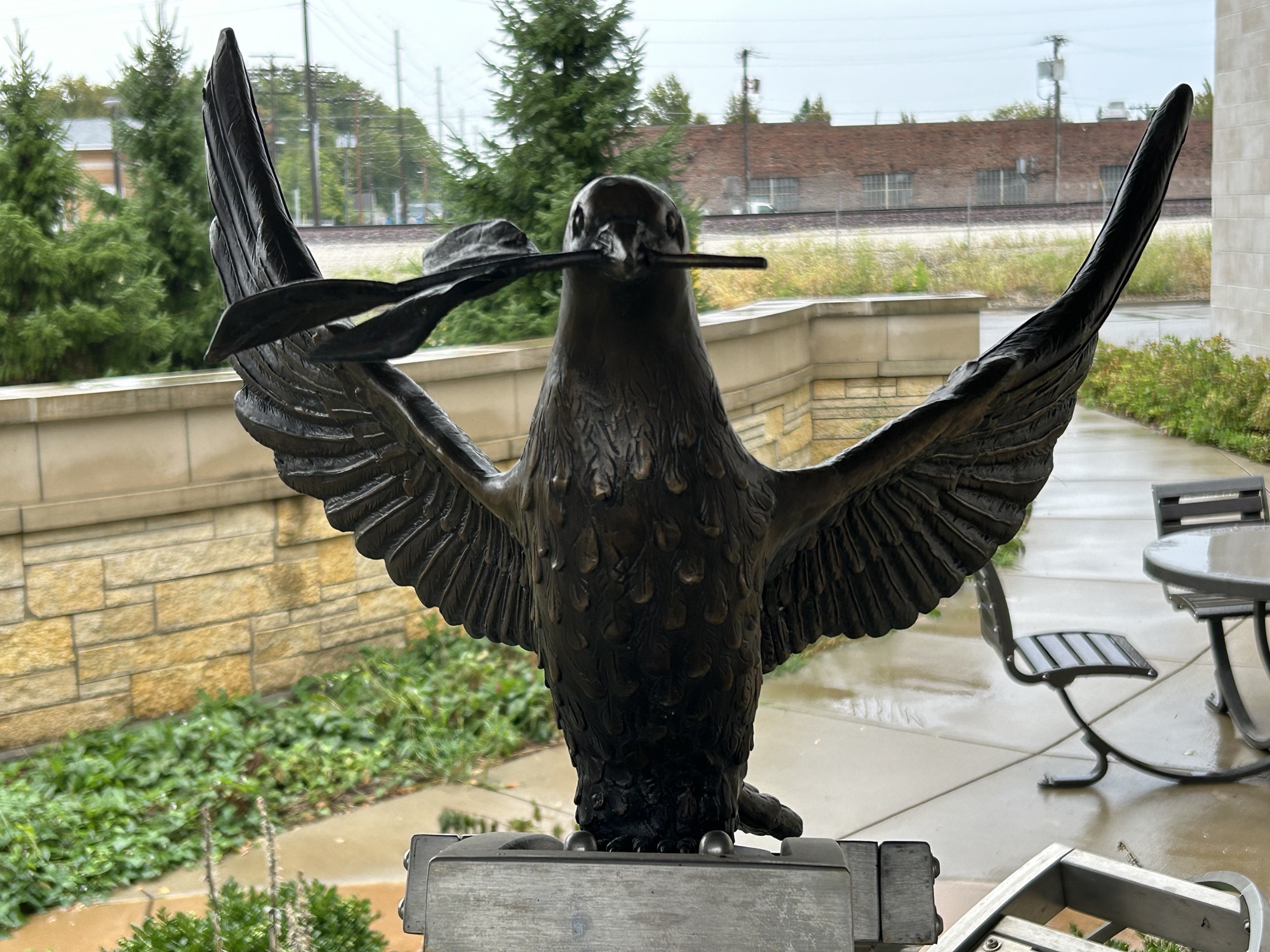


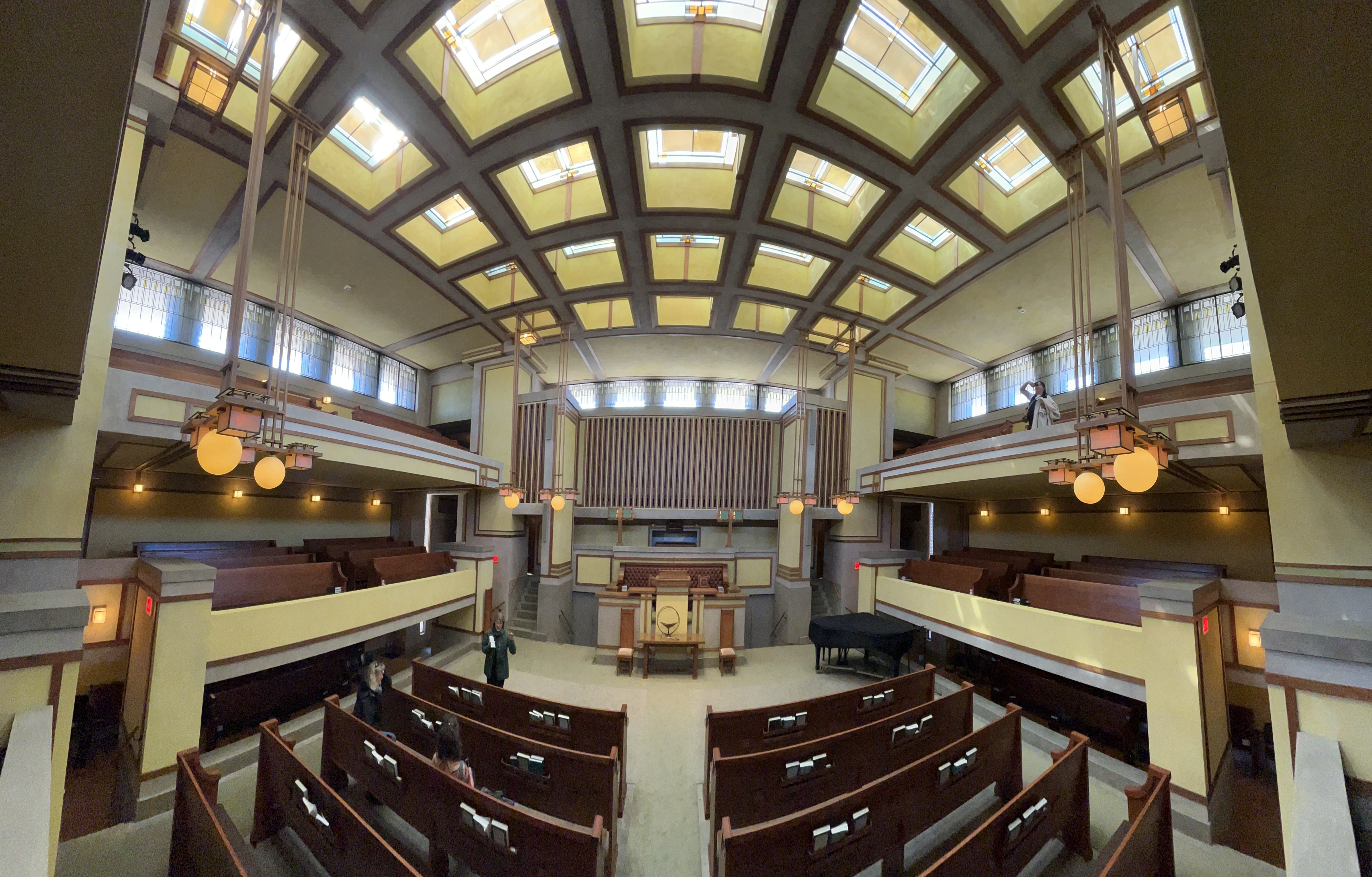
The Prairie State is home to 2 new parks, New Philadelphia NHS and Springfield 1908 Race Riot NM, as well as Pullman NHP and Lincoln Home NHS, all shown above. Part of the Emmett Till and Mamie Till-Mobley NM is in Illinois, though public access to the church is limited. Several national trails also pass through the southern tip of the state, including Lewis & Clark, Mormon Pioneer, and the Trail of Tears. There are also NPS related sites, Bronzeville NHA, Chicago Portage and the IL & MI Canal NHA, as well as—below—the WHS Cahokia Mounds and three Frank Lloyd Wright designs: Oak Park, Robie and Unity Temple. Enjoy!


Imagine a universe like ours, except devoid of life. Space, stars, planets, air, ocean and rock. Imagine our Earth, with waves on the beach, wind blown sand, lava, floating ice cap, canyons and waterfalls, spinning each day, heating or cooling each month, year after year, for eons. Structurally, very similar, but empty, without any living things, anywhere.
Nobody would explore it. None would appreciate its beauty, and no one could try to divine its purpose. Without any living creatures to inhabit it, and without us, such a world would be meaningless, neither studied, understood nor experienced. Without life, there is no knowledge.
Without knowledge, there is no life. Every living thing contains within it a recipe, the ingredients and the drive to cheat death. The recipe is our genetic code, passed down from our ancestors. Every living cell in our bodies carries this knowledge, which includes hidden traits and alternate characteristics for future generations, a master cookbook of the adaptations our successful ancestors employed to live, including our survival instinct. All living things carry such ancestral knowledge. Life began when some tiny process replicated itself in a repeatable way—an accident, a trick or a miracle. Life began when the knowledge of that trick was passed on to create the next generation. Life is that knowledge, plus every other trick that worked to keep life going for generations, in all forms, through billions of years of evolution.
Some such knowledge may be useless, dangerous or doomed to fail. In nature, failed ways of life die out, and such mistakes are forgotten. But species that have survived many times longer than mere humanity, have proven their success far longer than we have proven ours. Their lineage is noble, deserving of a place among earth’s great tapestry of living creatures. Our more recent genealogy is dubious, as we have used our supposed ‘superiority’ to create both weapons and pollution that could extinguish most life on earth, including ourselves. In our arrogance, we dismiss all wild species for not having adapted to us, when in truth we should adapt ourselves to sharing this earth with them. The mistake is ours, not theirs.
Life is knowledge. Many living things have learned to communicate, to call for help, to warn, locate and comfort each other. The tactics learned by observation, communication and mimicry become living knowledge of ways to outwit death, shared in community and thus kept alive for the next generation. Our species created written records as yet another path, besides our genetic code and our learned behavior. Some trivial knowledge may offer only a scant promise to enhance some future life with a minor convenience or comfort, while other knowledge may redesign human civilization, if we have the wisdom to discern it. We pursue knowledge to survive, to improve life and to pass it on. Because knowledge is life.
So extinction is the permanent loss of the secrets of life, both the code and the living behaviors. Most species have carried that knowledge for millions of years, long before humans evolved. We have learned from many species, observing how they act, adopting their tactics, and we have used tens of thousands of species to make medicines. We neither know the present value nor can estimate the future value of this accumulated knowledge.
Prematurely and unnaturally extinguishing masses of species, is far worse than simply killing. We do not know which species’ removal will affect other species’ survival in the indirectly connected, mutually evolved web of life. Extinction is the permanent end of life, and the erasure of all the accumulated knowledge used to create, to sustain both that life and the other species that depend on it, and to evolve further into some unrealized beautiful future. It is the silencing of tongues we do not understand, before we could learn what they were trying to tell us. And it is permanent. Forever. Never to be seen or heard again, despite eons of outwitting death. Extinction is the loss of what was, what is and what could have been. Artificial extinction is the ultimate betrayal of life.
By recklessly causing extinctions, we are like barbarians burning down the only ancient library of a lost civilization, full of wonderful ideas, miraculous cures, and priceless books, before we learn to read. E. O. Wilson, Harvard professor of evolutionary biology, once said, “destroying rainforest for economic gain is like burning a Renaissance painting to cook a meal.”
The world’s largest rainforest, the Amazon, is being cut down for logging and ranching. We are literally destroying rainforest for hamburgers. Besides the direct extinction of species, we are tipping this critical ecosystem towards desertification, releasing more carbon, raising temperatures, increasing fires, and changing our global climate. There is no wisdom in this course of action, no moral justification, no long-term net economic gain, no rational reason to give up so much for so little gain, no scientific approval, and no appreciation of the beauty of so many forms of life lost forever. And apparently, there is insufficient concern among people today to stop making this colossal mistake.

Just up the hill here past the Port Byron dry-dock/ lock is an old tavern. Maybe that’s why so many locals contracted to build the original canal: everyone knew life would be better with a canal. Once there was a passenger & freight shipping route between New York City and the Great Lakes, cities grew all along the canal. Turns out there have been several versions of the canal, from the original crowd-sourced 4’ deep, the bigger one (above) and the current large barge canal that a local brewery and many other folk still use now.
The canal connects the scenic and historic Hudson Valley to Lake Erie, below the Niagara Escarpment, or ‘from Albany to Buffalo’. I’ve driven the route many times in my electric car and visited the park sites in the heritage area, like Fort Stanwix, Saratoga, Women’s Rights and more, but I ignored the canal. Not because I don’t like it or discount its importance, but because I thought I might do the Great Loop someday and travel the length by boat. Anyway, I finally stopped along the way to chat with the seasonal staff and take a photo. It’s a wonderful 500 mile stretch of Americana. If you didn’t learn the song in Kindergarten, listen to Bruce Springsteen sing it on YouTube.
I’ve got a mule and her name is Sal
Fifteen miles on the Erie Canal
She’s a good old worker and a good old pal
Fifteen miles on the Erie CanalWe haul’d some barges in our day
Filled with lumber, coal, and hay
We know every inch of the way
From Albany to BuffaloLow bridge, everybody down
Low bridge, yeah we’re coming to a town
And you’ll always know your neighbor
And you’ll always know your pal
If ya ever navigated on the Erie Canal

I recently completed EV visits to all 47 park units in the 10 states of the Midwest region, as well as 5 affiliated sites, 8 heritage areas, trails and biospheres. The region also has Cahokia Mounds, Hopewell Culture and 4 Frank Lloyd Wright world heritage sites.
Illinois
Indiana
Iowa
Kansas
Michigan
Minnesota
Missouri
Nebraska
Ohio
Wisconsin

The view above is from the Ramparts at Fort Warren on Georges Island, one of the 34 beautiful & fascinating islands. The fort didn’t come into play in the Civil War, except as a prison for Confederate soldiers. When I was here in my youth, I heard the spooky story of the Lady in Black, who haunts the cliffs and corridors. With the help of local sympathizers, she snuck into the fort, whistled a tune that her husband knew, found him but accidentally shot him during the escape. She was tried and executed for treason, in a dress she had sewn herself from black curtains in the commander’s office. Her shadowy ghost has been seen by many since the Civil War.
Alas for fans of the supernatural, the story is nonsense. Despite the obviously dramatic appeal, there are no contemporary records of the women herself, the escape attempt, the death of her husband, the arrest, the investigation, the trial or what would have been the first official hanging of a woman for treason during the Civil War. The story began in the 1950s or 60s to encourage folks to visit the old fort in summer. But apparently we prefer lies to the truth. And nothing cools you off on a hot day like sitting in a dark 65° man-made cave listening to a ghost story.
The islands have been also been used as summer fishing grounds by Native Americans, by pirates, smugglers, for quarantine, as schools or asylums, and as way-stations on the Underground Railroad. Outward Bound holds one of its programs on Thompson Island, which Nathaniel Hawthorne once described as “a little world by itself”. The School for Field Studies once hosted me (photo) and a few other whale watchers for a month on a boat, including a day writing up our research in the church on Peddocks Island. A few of the islands remained relatively unchanged since the glaciers receded leaving steeply eroded drumlin cliffs and long low sand-spits. But Spectacle Island had to be completely reclaimed from “trash island” to beautiful natural recreation area.
The Boston Harbor of Tea Party fame is in the inner harbor in the distance above. The Tea Party Ships & Museum on Griffin’s Wharf is not part of the park service, but it’s a fun hands-on spot to learn about ‘no taxation without representation’. The Harbor Island ferries mostly leave from Long Wharf near Faneuil Hall, which is on the Freedom Trail. The islands make a nice excursion if you’re visiting Boston during their open season from mid May to mid October. Since I had already traveled to the islands many times by sailboat, I simply rode the park-partner ferry out for a few hours to take some photos and reminisce. But as I write this today, I can’t help but think about tomorrow’s election. We owe it both to those who fought to create and protect our country and to our future, to hold tightly to our democracy, and vote.
