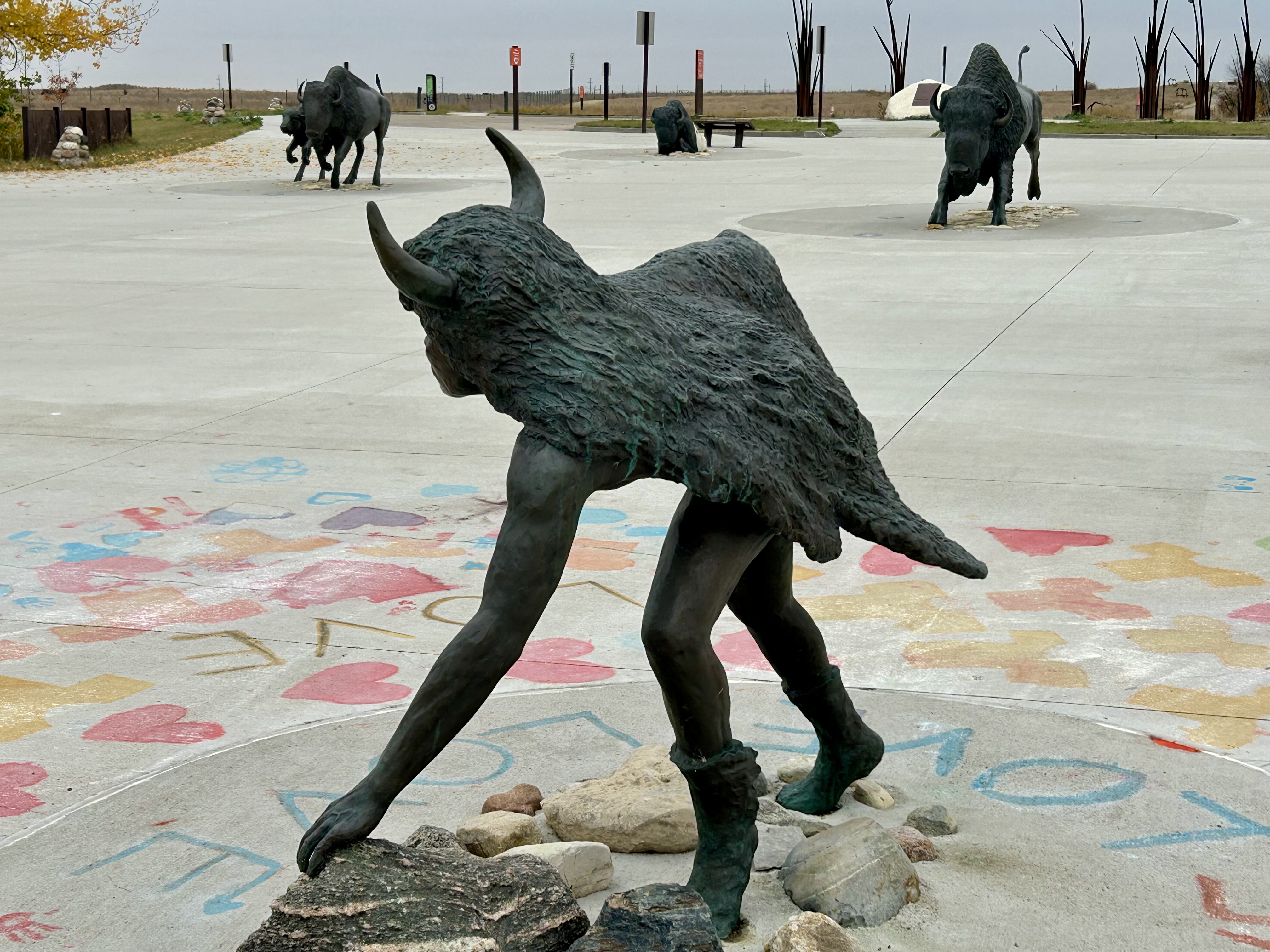
This tentative world heritage site in Saskatoon Saskatchewan offers a broad view of northern plains indigenous culture. While there are other sites that focus more on specific cultural aspects, like Head-Smashed-In Buffalo Jump or Writing-On-Stone, this site includes these elements and more all together. The exhibits here cover art, celebrations, ecosystems, language, and oral traditions, from ancient to contemporary, history and current creativity. I saw an original treaty #6 on loan here, one of the land agreements signed by the Canadian Crown and many First Nations in 1876. And the place serves as a community center, holding regular events, private and public, helping the culture continue to thrive. Walking the trails in the peaceful valley along opimihāw Creek, I felt connected to the place, the people who have lived here since pre-history, and their traditional way of life. Looking up at the sharp bluffs where bison were hunted, seeing the clearings, canoe launches, medicine trail, and out over the reintroduced bison paddock, you learn more from the experience than from reading. And the bison stew was delicious too!
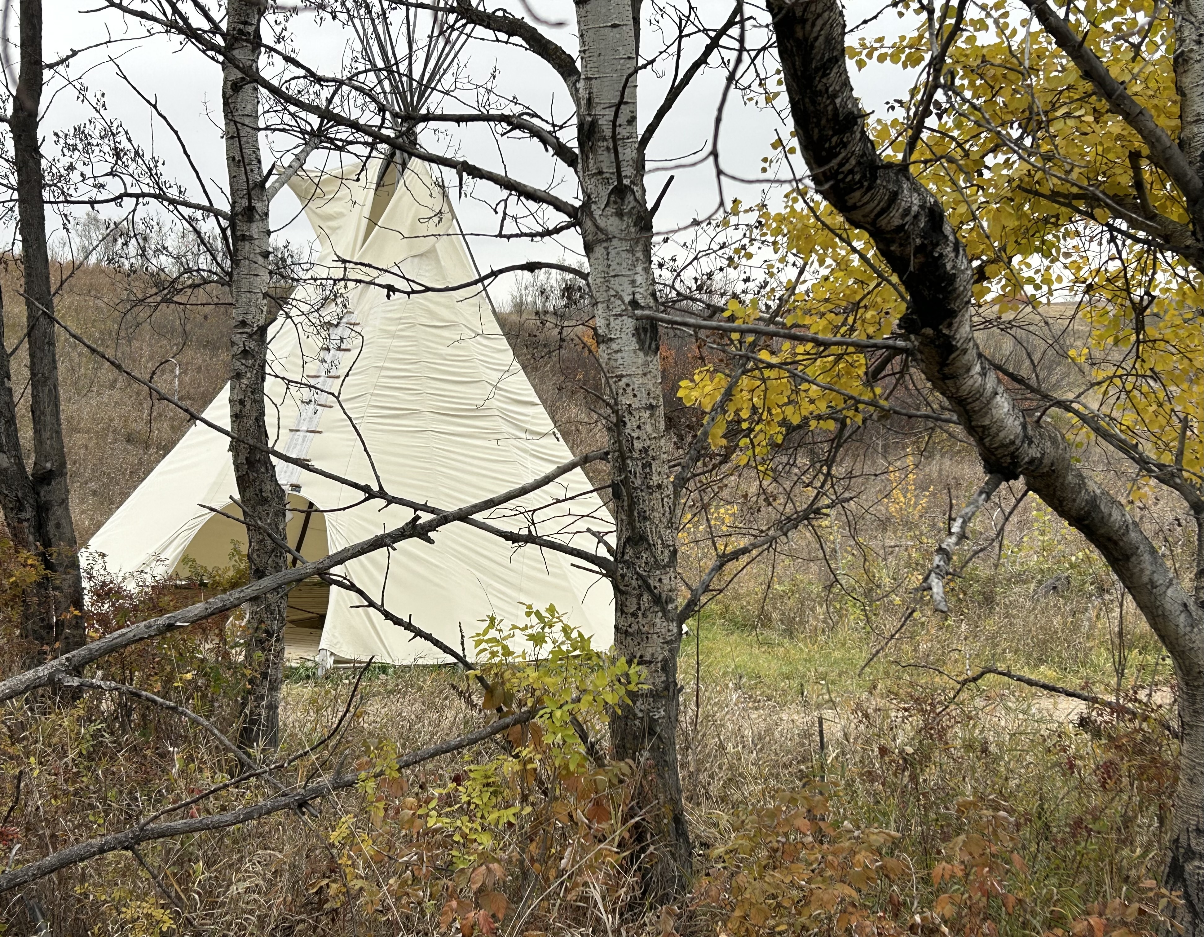
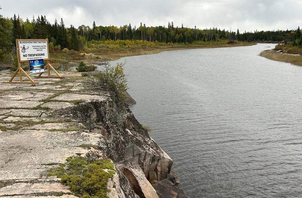
This 10,000+ square mile world heritage site in Manitoba and Ontario is over 100 miles from the nearest slow charger, and most of the road is unpaved and washboarded in some sections. That made the round trip challenging for my Tesla which no longer has the range it used to. I shouldn’t complain, as the all season road is less than 10 years old; before that, there was only an ice road. The site is both the largest protected boreal shield in North America and home to four First Nations, making it a rare dual natural and cultural UN site. Unless you hire a guide on some multi day paddling trip or stay at Loon Strait, there’s really no tourist infrastructure yet. If you want to try First Nation cuisine, I recommend Winnipeg. Still, I made it into the core area of this remote UNESCO heritage site and into the community of Bloodvein itself.
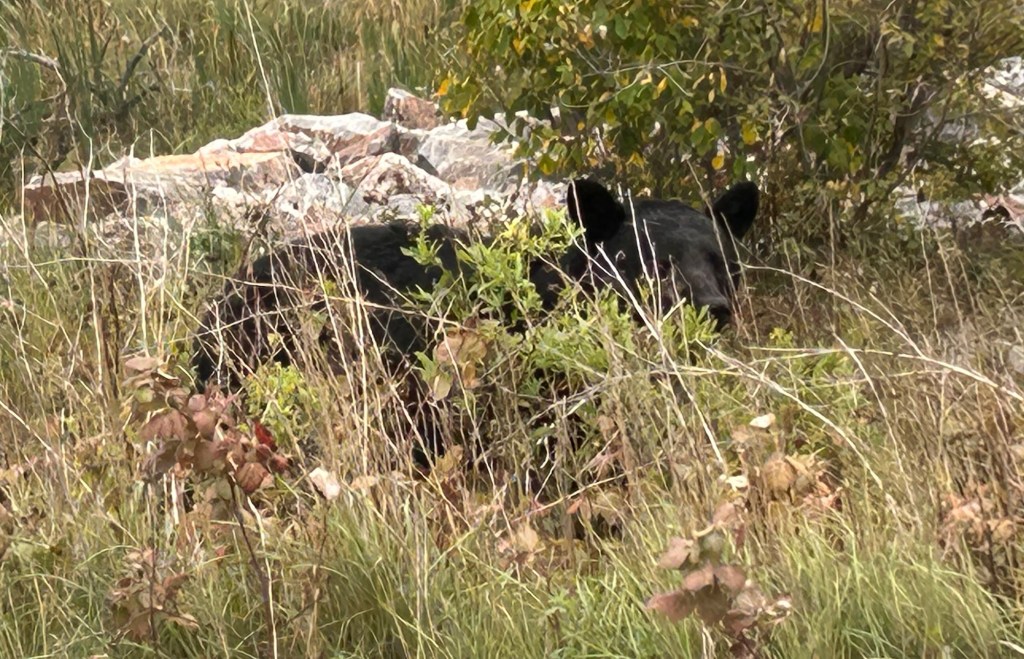
They were checking cars and ids at the gate, and they added a few questions about my travels. Just past the checkpoint I spotted a bear, and for once I managed to get a photo, above. I also saw many beaver lodges, but missed a picture of a beaver playing near a mud slide. A bald eagle flew over the Bloodvein River below, but as usual, I couldn’t get a decent picture of the majestic bird in flight. Still, three wildlife sightings in such a short visit is exceptional. I credit the First Nations community for protecting wildlife, as well as members. The road in town was very muddy that day, challenging my all wheel drive, and the coffee place was closed. On my way out, they didn’t seem impressed by my wildlife sightings, but they were interested in the range and cost to charge my car. Hopefully, visiting places like this in my EV gets more people thinking about how to lower their own carbon pollution to protect such beautiful natural areas.
My grandfather used to tell us to travel to Canada before going to any other country, because it has both wonderful nature and culture. Growing up in New England with Canadian relatives, we perhaps took Canada a bit for granted, not crossing the 500 mile border into Quebec as often as we could. Now, after having been to 6 continents and ~50 countries, I take my grandfather’s words more to heart. Quebec is Canada’s largest province and has three world heritage sites and four biospheres. The official language is French, but folks went out of their way to translate for me.
World Heritage Sites
Anticosti is a large island deer hunting reserve with many rivers and important fossils. Take the ferry and an island tour to see the many sights and wildlife.
Miguasha is an important fossil site with a very good museum and a nice hiking trail through the woods along the coastal bluff.
Old Québec is magnificent! In the largest walled city north of Mexico, explore the museums, parks and French restaurants.
Biospheres
Charlevoix is a mountainous area on the St Lawrence Seaway with great hiking. Ski in winter or take a tour boat in summer.
Lac Saint-Pierre in the St Lawrence estuary is a birding paradise. Take a boardwalk over the wetlands out to a viewing platform on the water.
Manicouagan-Uapishka has a ring lake that can be seen from space, native culture and a variety of ecotones down to the coast.
Mont Saint-Hilaire is near Montreal and preserves old growth hardwood forest. Hike through the lovely woods near McGill University.
This Canadian world heritage site reveals the age of fishes, the Devonian Period of evolution around 400 million years ago, when sharks and cod invented themselves. In 1938 in South Africa, a fishing captain showed a local museum curator a weird looking fish they caught, and it was identified as a coelacanth, despite being presumed extinct some 65 million years ago. That ‘living fossil’ also dates back to the Devonian Period, as does another fish you may have heard of, the African lungfish.
In evolution, we see the development of vertebrae and lungs as important, as we inherited them from fish. But obviously, we didn’t descend directly from cod, coelacanths, lungfish or sharks—except maybe lawyers. Paleontologists, or fossil folk, figure out such distant ancestry. And Miguasha is a good place to look for fossils, as it lies in the Canadian Appalachian Mountains. Americans may believe the trail ends in Maine, but the International Appalachian Trail continues into Canada, up to the Gaspé Peninsula and continues on Newfoundland. The Appalachians are much older than the Rockies, and they were a defining land feature during the age of fishes.
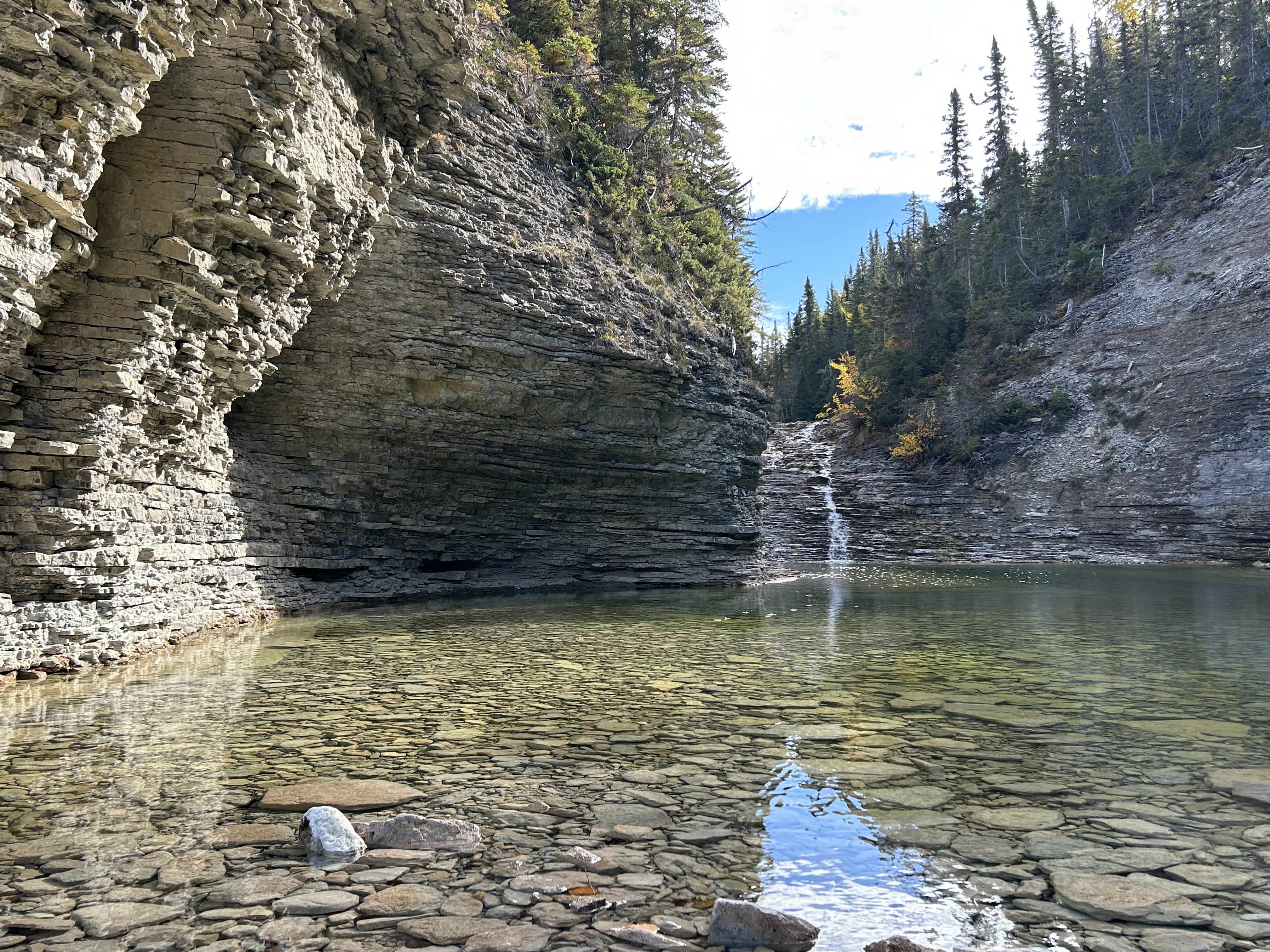
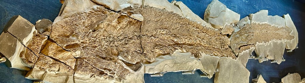
Miguasha is on the south side of the Gaspé, with high sedimentary cliffs, lots of pretty rocks, and many fossils, often well preserved in large flat layered rocks, like in the photo. Around 15 years ago, a visitor apparently found a rock at the water’s edge that had split, revealing a large fish tail. They did the right thing and left it for the local fossil experts to examine. Shortly thereafter, the experts found more pieces, fit them together with the earlier find, and put together a 5’ 3” fish fossil puzzle. While the site had been producing Devonian fossil finds for decades, this one was the King.
Not only was this a complete Epistostegalian, it also had the bone structure of a Tetrapod. In common words, that means it had vertebrae, lungs, and a bone structure resembling not just our arms, but our wrists and fingers as well. That put it within the strict definition of a tetrapod, previously believed not to include fish. This big guy used his fingery fins to climb up out of the water and breathe. Most of the animals you can think of have arms, wrists, and fingers bones, although they may appear very different on the surface: frogs, turtles, bats and horses. Oh, and whales too, although their ancestors decided life on land too hectic and returned to the sea trading in hooves for flukes. The fish fossil found here may have been our ancestor. Exciting evolution!
I learned (or relearned) a lot in the museum from the informative exhibits, and a bilingual guide was kind enough to answer a whole bunch of questions without throwing me off the cliff. Tours are mostly in French. There’s a 2 mile hiking trail on the bluff for exercise, but when the site is open, you can access the beach by stairs from the beginning of the trail. If you visit, note that the park is on Quebec time, not Atlantic, although most cell phones still show the latter. I used my unexpected extra hour to charge my car on the Flo-compatible J1772 charger, while I hiked around on my own.
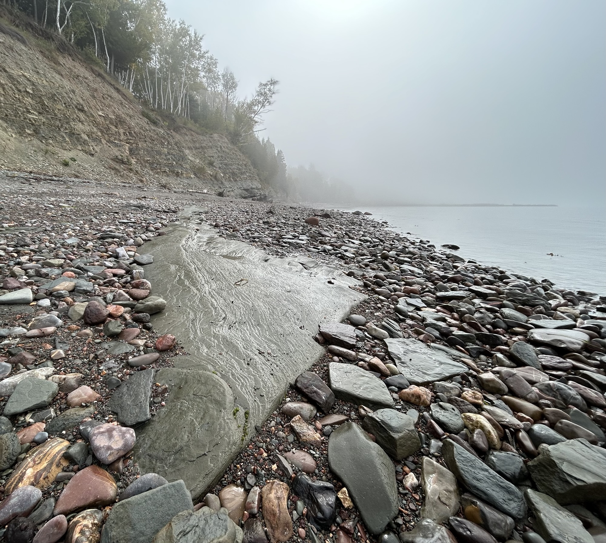
This windswept island in the Gulf of St Lawrence is larger than the state of Delaware and is now a UNESCO World Heritage Site, rich in early fossils from the Ordovician-Silurian extinction era when mollusks and arthropods thrived and land plants first emerged. With shallow shoals and terraced ledges, the island was known for shipwrecks, contributing to its isolation. In 1895, a French chocolate magnate, Henri Menier, bought the whole island as a private hunting and fishing game preserve. In 1974, Canada bought the island from loggers and set aside about 1/3 of the island for hunters, fishers and tourists. In 2023 the coastline and several deep river canyons were preserved for fossils as a WHS, with the north coast being the oldest. With 24 salmon rivers, canyons, waterfalls, fossils, shipwrecks, cliffs, an undeveloped coastline known for lobsters, and forests stocked with deer, the island is unique.
Now with a long wharf and an airport, the island is more accessible, although the most famous site, Chute Vauréal—the 250’ waterfall below—, is over 100 miles away from town over an unpaved but decent road. Most summer tourists take cruise ships or fly in on upscale package tours. Deer hunting is big business with off grid lodges; one offers a week with a personal guide, ATV driver, 3 meals per day, including a 5 course dinner of ‘renowned cuisine’, and all your game and fish packed up for you to take home. With about 1,000 deer per winter resident, it’s easy to find deer, who often show up at your door looking for handouts. And there are large, mixed-color foxes roaming around town too.
Yet Anticosti Island is so off-grid, off-radar and ‘off the beaten path’ that I couldn’t figure out how to visit, especially due to my lack of French and preferring DIY EV travel over hotel + flight package tours. But there is a boat on the north coast where roads are scarce with regularly scheduled stops at seaway ports up to Labrador. On the way upstream, the M/V Bella Descagnés goes from Havre Saint Pierre to Port-Menier on Anticosti, and it reverses the trip downstream a couple days later.
Though cabins are often booked months in advance, it occurred to me that they must take walk-on passengers between the closest two ports. Without a Canadian address, I couldn’t book my ticket online, and the hold times were depressing. So I just drove up the coast and arrived barely 10 minutes before they left. (The boat had gained almost an hour on its schedule overnight.) I parked on the wharf, walked on, paid my fare at the desk, and they welcomed me aboard! Some folks thought I was crazy and others thought I was a worker commuting cheaply to the mainland, but I had a pleasant time relaxing in the lounge and eating in both the cafeteria and the dining room. Optimistically, I had booked a B&B with an island day tour, and the everything worked out well. While the waterfall is less impressive in the autumn, it’s still taller than Niagara Falls, and the weather and foliage were lovely. On the way back, I even got a bunk for the overnight trip.
Ontario is Canada’s most populous and prosperous province, with over 1/3 of the population. Both the country’s capital, Ottawa, and its largest city, Toronto, are here. 1/2 the residents of Toronto were born abroad, making it one of the most multicultural cities in the world. Ontario borders Great Lakes Erie, Huron, Ontario, and Superior, plus Hudson Bay to the North.
Ontario has a World Heritage Site that is fascinating to explore. The Rideau Canal is the oldest continuously operating canal system in North America, and its quaint villages along the route connecting Lake Ontario to Ottawa are delightful, with treat shops, friendly restaurants and charming historic hotels.
Four UNESCO Biospheres protect the unique ecosystems defined by the Great Lakes ice age landscape.
Frontenac Arch is the geologic bridge to the Adirondacks that holds back Lake Ontario, best seen where the St Lawrence River cuts through the Thousand Islands area. Bitterns, Eagles, Heron, Loons and Osprey live here.
Georgian Bay, off Lake Huron, is almost as big as Lake Ontario, and it protects many rare birds, reptiles, butterflies and other species amidst First Nations land.
Long Point is on the north shore of Lake Erie, and it has birding, boating, hiking and more to enjoy.
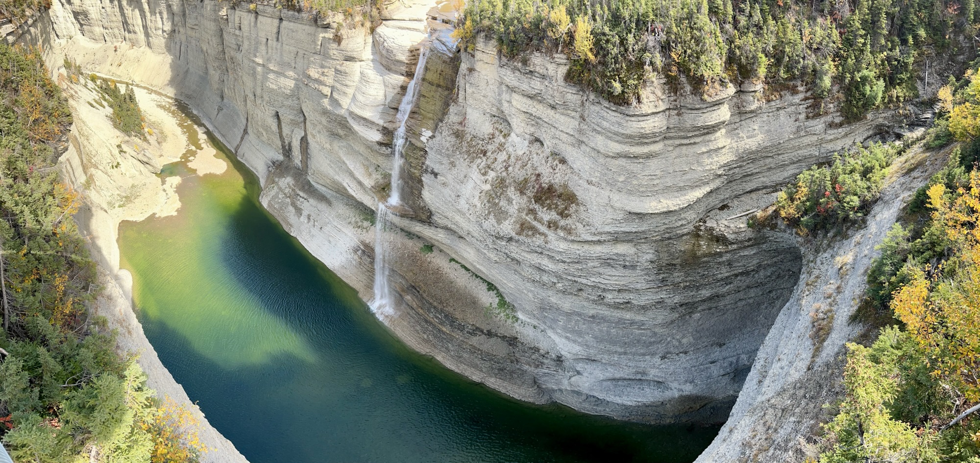
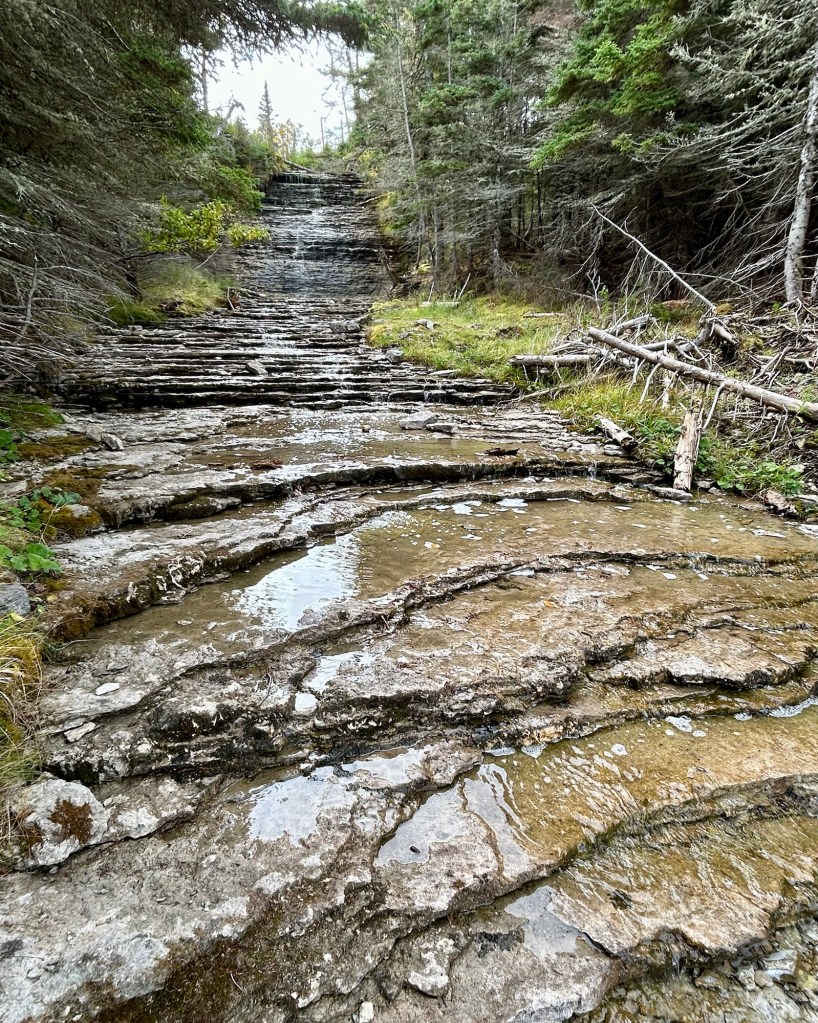
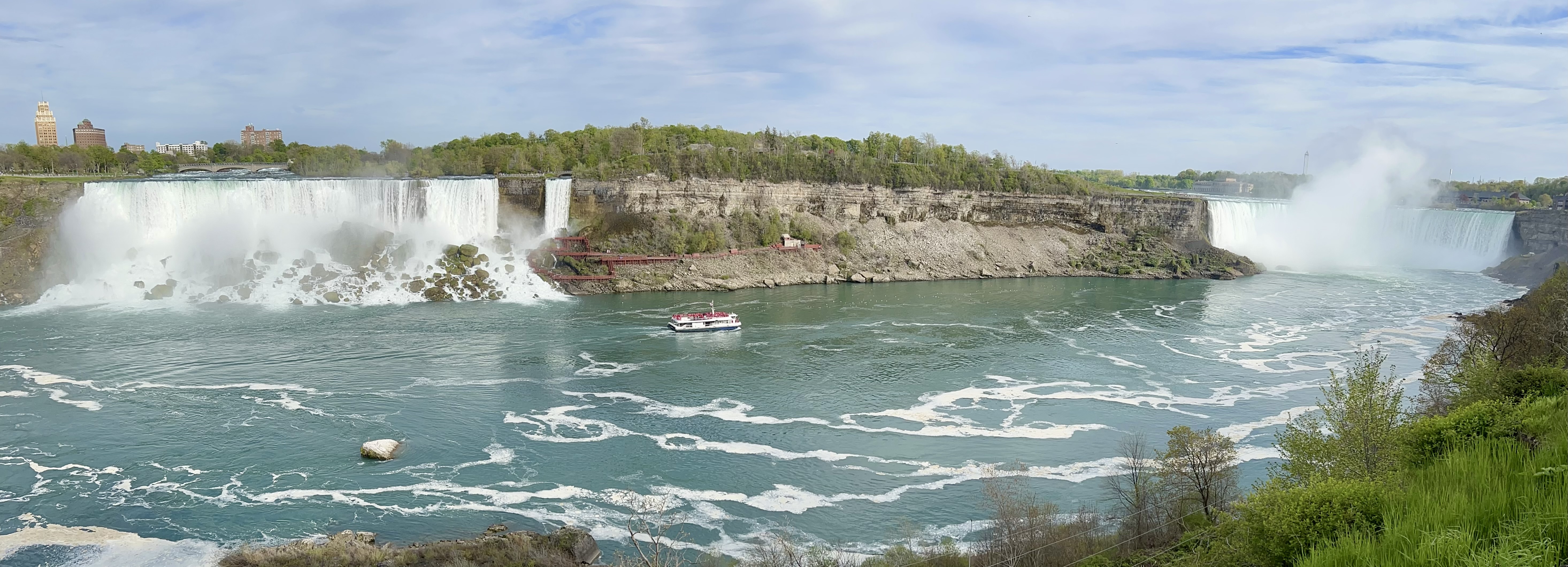
Niagara Escarpment is a massive geologic formation that forms the northeast shore of Lake Huron, stretching from Buffalo NY on Lake Erie to Green Bay WI on Lake Michigan. Its forests and coastlines contain more species than any other Biosphere in Canada.
500 years ago Basque whalers set up whaling operations here in Labrador for 600 whalers on 15 ships per year for about 100 years. They rendered the blubber of right and bowhead whales into oil, barreled it and returned it to ports in what is now France and Spain. Be sure to take a small boat out to Saddle Island to see where the whalers worked. Over 100 Basque whalers are buried on the island, and several shipwrecks have revealed the sophisticated marine designs they employed. The visitor center has a chalupa, a small whaling boat they used.
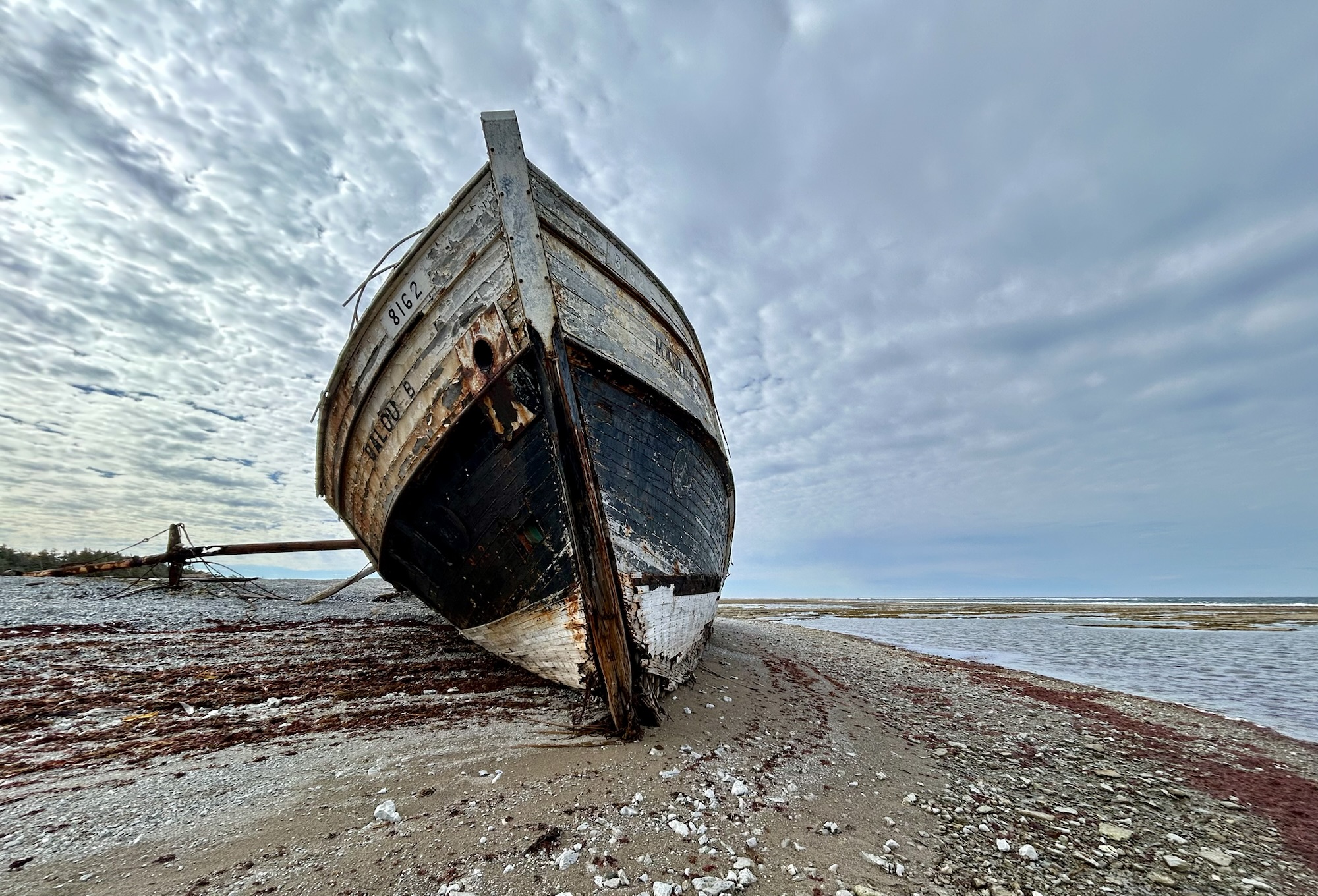
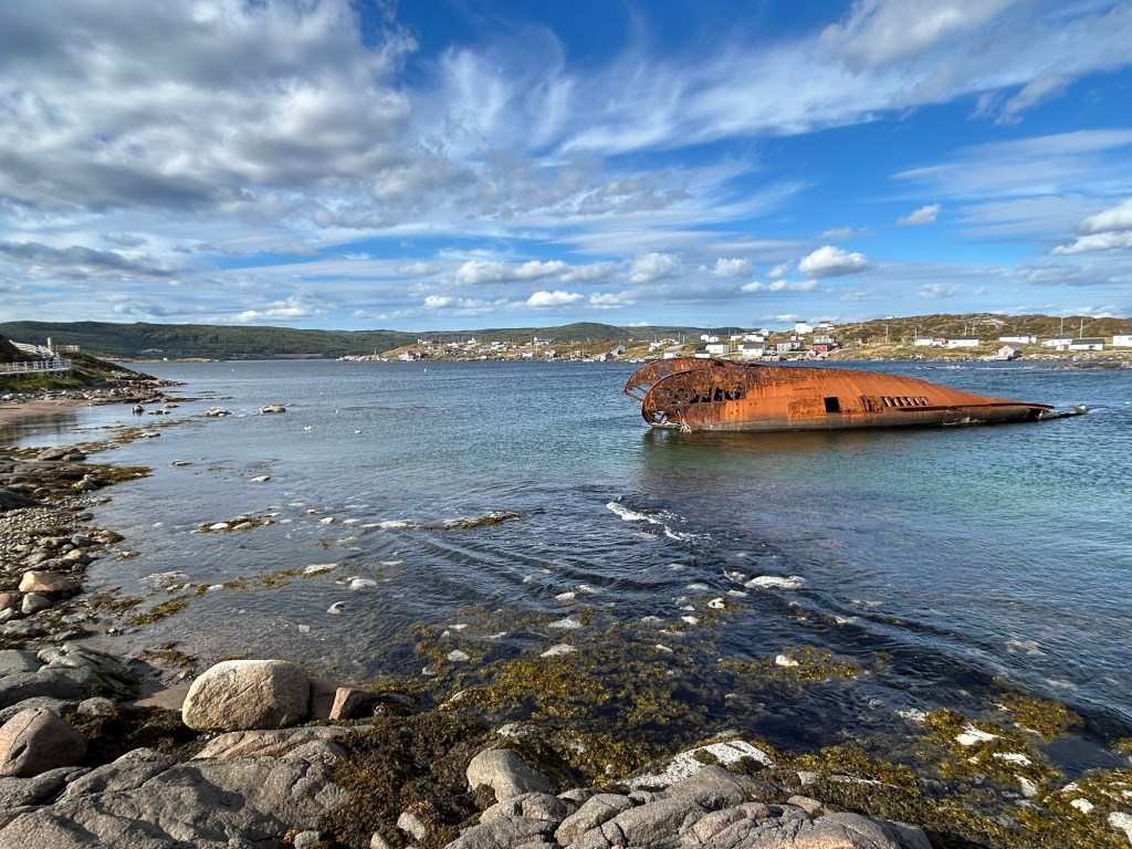
After some grim weather in Newfoundland, the sun came out in Labrador. On a pretty day, this UNESCO world heritage site is a particularly beautiful spot with lingonberries or partridge berries growing on the rocky island. On a bad day, I imagine it is inhospitable, as the crew of the pictured 1965 wreck knew too well. While walking around, I spotted a minke whale feeding in the harbor, splashing and putting on a show. I’m glad whaling is almost entirely a thing of the past.
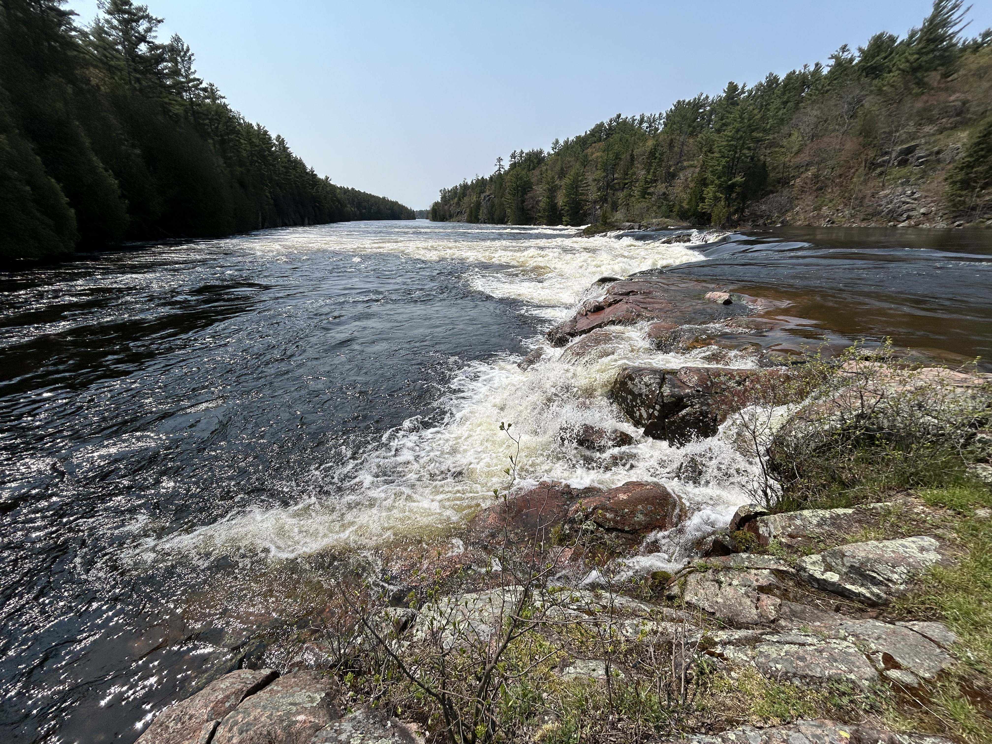
Georgian Bay is almost as big as Lake Ontario, but it’s still just considered a bay of Lake Huron. The Niagara Escarpment separates the bay in the form of the Bruce Peninsula and Manitoulin Island. Above are the Recollet Falls on the French River at the north end of the biosphere. Most of the famous explorers of Canada passed this way: Brûlé who lived with the Huron as a teen around 1610, Champlain and Mackenzie, among others. Radisson and his brother-in-law may have been the most consequential, as they realized the economic potential of Ojibwa fur trading canoe routes. Unlike the licensed voyageurs, the pair were outlaw traders, known as coureur des bois, ‘runners of the woods’. When the French declined to support their venture, they turned to the English and formed the Hudson Bay Company.
The south end of the biosphere is at the Severn River, where there’s an impressive canal/ boat-railway system for transiting small craft between Lakes Huron and Ontario. Much of the biosphere belongs to the Anishinaabek people, who call it the Mnidoo-gamii, the ‘spirit of the lake’. The lakeshore is well protected, remote and home to a great many species. As ages ago, boat is still the best way to explore this ‘30,000 islands’ area. Still, I managed to spot two black bears just outside the park where I hiked to the falls above. Fortunately I didn’t see any of their rare local rattlesnakes. Northwest of Georgian Bay, on Manitoulin Island, I saw a bald eagle, six sand hill cranes, and a variety of smaller birds. Georgian Bay is a lovely area, and I’m glad it’s protected.
If you visit Fort Raleigh, you’ll see a monument to the first English child born in America, but there’s no monument at Castillo de San Marco about the first African American child born 50 years earlier in Florida. In any case, some 600 years before those colonies began, the Norse established this base camp on the north coast of Newfoundland, and here they recorded the birth of Snorri Thorrfinnsson around 1000 CE. And of course the first people here were Native Americans whose ancestors left their mark on the land thousands of years ago, long before history began in the Americas.
The fine film in the visitor center explains the even greater significance of this Norse settlement. Here the circle of humanity’s exploration of the world completed the circle. Modern humans began in Africa roughly 1/4 of a million years ago, populating Eurasia next, the Polynesians spread humanity into the Pacific, and humans crossed the ice to North America some 25,000 years ago. The Vikings, meaning the seafaring raiders of the Norse people, explored the North Atlantic a thousand years ago. Although they did not settle permanently, the Norse left their foundations here. They traded cloth and milk with natives for furs, and they explored at least as far as New Brunswick on the border of what is now the US. That meeting reintroduced two distant branches of humanity for the first time since our common ancestors left Africa 100,000 years ago.
Apparently the meeting did not go well enough for the Norse to remain. The expeditionary camp was established primarily to provide wood for the colony in Greenland, but it was a long way away from Scandinavia. Outnumbered and without significantly superior weaponry, the Norse eventually packed up the sporadically used camp after a single generation. Then they mostly forgot about Vinland, leaving it for scholars to speculate without evidence about the Norse having visited North America centuries before Columbus. Until a Norwegian researcher started digging around some square foundations here with his family in the summer in the 1960s. And they found proof.
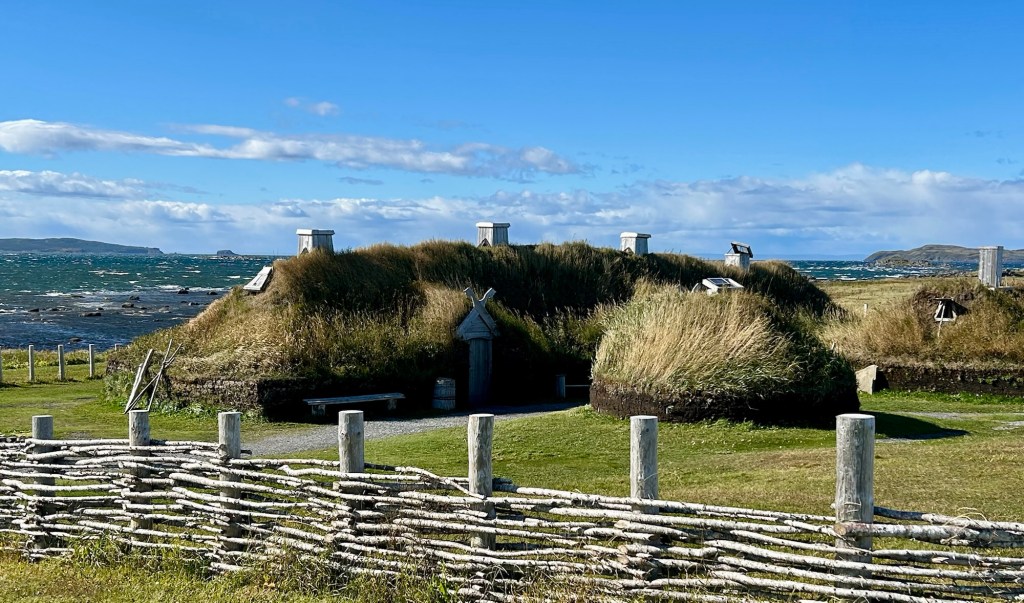
L’Anse aux Meadows, or Meadows Cove, is now a UNESCO world heritage site with living history interpreters, and the reconstructed longhouse village is an excellent place to visit, photograph and ask questions. There is a statue of Leif Ericsson at the small harbor and various Viking themed tourist attractions nearby.
I dropped off the Tesla supercharger network in Nova Scotia, and PlugShare has poor coverage up here. So I switched to ChargeHub to find CCS chargers and made good use of my CCS adapter in Newfoundland. Some road construction unfortunately had cut off power for most of the day both to the park and to a crucial fast charger on the way, but since I often plan to skip a charger if needed, I made it anyway. By the time I arrived at the visitor center, the power had been restored, and while chatting with docents in the wood framed peat-sod house above, I charged at the free Tesla destination chargers (at the second entrance). Canada has a reliable EV charging network coast to coast, including helpful chargers at sites like these, and they’re stretching it northwards too.
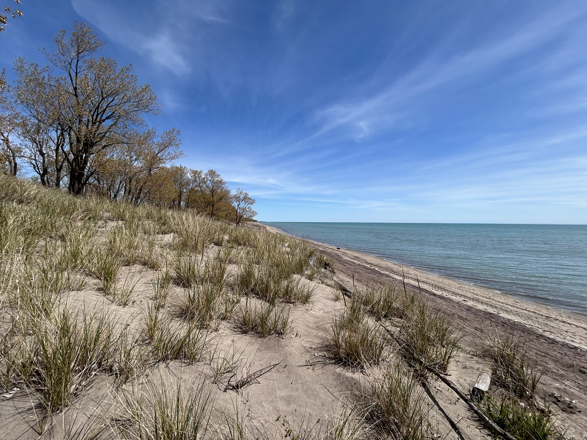
The Canadian side of Lake Erie is prettier. The spit of sand above goes 25 miles eastward into the lake, and around behind to the left are wetlands with many birds. I wasn’t really paying attention, but I saw doves, ducks, geese, grackle, gulls, a Harrier, a Great Blue Heron, sparrow, swallow, and several other species I couldn’t identify. I should have popped into the Bird Observatory, which is the oldest continuously operating one in North America, but the birders there looked much more serious than I. There are also wetland trails, campgrounds, unhealthy snack shacks, and many ‘cuts’ for small boats to runabout, go fishing and explore. The dunes are quite healthy, and there are a surprising number of different types of trees all mixed together. Unlike the US, Canada seems to do a better job of protecting, developing and promoting its Biospheres, so that regular people can learn and enjoy too.