While not a national park site, I just had to stop to see the legendary Gunfight at OK Corral. The shootout was so quick I only got this photo of the aftermath. As mass shootings go now, I doubt this one from 1881 would make the news today. Now mass shooters kill more in one hour than any old west gunslinger did in their lives.
This Arizona town—named after a silver claim wrongly thought hopeless—is not far from a Butterfield Stage stop, and it has restored horse-drawn stagecoaches that take folks around the historic center of town. Boot Hill cemetery is another famous site here, but there are loads of historic saloons, re-enactments, museums, shops and more.
The “world’s largest rose tree” is in a courtyard near the courthouse, and it’s amazing how large plants can get if we let them grow. Nellie Cashman ran a string of successful businesses here before moving on to the Klondike. Three Mexican Revolutionaries were convicted in the old county courthouse here, along with the Bisbee Massacre gang. And Geronimo had his famous photo taken by the photographer who had a studio above.
West of town is the San Pedro Riparian conservation area, which protects nature and both Native American and Spanish sites. Further west on the other side of Apache Peak is Las Cienegas—the marshes—conservation area, which is a beautiful protected grassy lowland in a historic ranching area. Since many tourists fly around burning carbon these days, they miss these distinct and fascinating features of the old west.
Frank Lloyd Wright’s winter home until his death in 1959, this World Heritage site is a remarkable example of his architecture. The architect preferred to build just below the top of a hill, on the ‘brow’ or taliesin in Welsh. The triangular pool brings the background mountains into the foreground, and the front walk forms a point like the bow of a ship to admire distant mountains, like islands across the undulating desert landscape where cholla cactus looks like coral. Besides the bright red door behind the rock and the small ornately carved scene to the right, there are Chinese influences throughout, including many more carvings, an elaborate story panel, a round garden door, a bell, a dragon and other architectural touches. Inside you can sit in his origami chairs and study the internal structure of a nautilus or the draft blueprint of the Guggenheim. Wright brought his students and apprentices to live and work, and he established an institute dedicated to his school of architecture. Situated in the tony Scottsdale neighborhood, the audio tour of the property is detailed, takes you around step by step and explains his architectural philosophy. Guided tours are also available, and schedules & numbers are strictly limited to keep a steady flow through the small parking lot and on the tours.
Like most people who travel through the crossroads of Page, I paid $10, walked 3/4 of a mile and took a picture of Horseshoe Bend. It’s an easy photo, especially around 2:30 pm, with the sun shining down over your left shoulder onto the deep oxbow canyon below. On a clear day the blue sky reflects in the river, and the height of the overlook makes a photo idiot-proof, easily framing the river bend from cliff to cliff and from horizon to bottom’s edge. Even I, a mediocre photographer at best, got the shot I dreamed about. But instead, I decided to show you the uglier view above.
“a curious ensemble of wonderful features —carved walls, royal arches, glens, alcove gulches, mounds and monuments. From which of these features shall we select a name? We decide to call it Glen Canyon.”
John Wesley Powell, explorer
When John Wesley Powell first explored this canyon in 1869, he and his crew were amazed by the varied beauty of the place. Above all the impressive geologic features, they decided the best part of the canyon were the narrow green glens, teeming with specialized flowers, birds and animals. Less than 100 years later in 1963, the beautiful glens of Glen Canyon were drowned, and in a cruel irony, the temporary bathtub was named “Lake Powell” after the explorer & geologist who most loved the living glens.
In retrospect, Glen Canyon Dam should never have been built. Lake Powell, above the dam at right, is a sad collection of marooned boats with ramps and docks that don’t reach the water, so most of the fossil-fuel burning jet skis, power boats, fishing boats and houseboats can’t keep polluting here anymore. The “lake” is more of a stagnant segment of river with bleached canyon walls and a bathtub ring. Due to low water, neither the ferry at Hall’s Crossing nor the tour boats to Rainbow Bridge run anymore. When the water drops another 30 feet—later this year?—the massive hydroelectric towers above the dam to the left won’t have any electricity to deliver.
Engineers no doubt consider the dam to be a victim of its own success, drawing too many people to Arizona with cheap electricity and “plentiful” water. Economists likely consider the dam a fiasco, since all the expensive infrastructure is practically useless now, long before returning on the investment. Common sense says that dam or not, you can’t have your river and drink it too. Environmentalists, who opposed the dam from the beginning, say “we told you so”. Climate scientists say, “it’s going to get worse”.
After all the park is desert—mostly remote canyons in Utah—, and the river isn’t big enough for people to waste. I drive past a lot of busy car washes and gas stations with patches of grass, while the shiny vehicles burn carbon and diminish the mountain snowpack. On my way southeast, I drove through Gilbert, Chandler & Ocotillo neighborhoods near Phoenix. While riff-raff like me aren’t allowed past the walls, gates and guards, satellite maps show private golf courses, lakes, and homes on private islands, all in the desert. It’s tragic to see glimpses of all that water wasted, while our national recreation areas run dry.
Apologies for the twisted Pano, but I’m still getting the hang of my new kayak. This is Black Canyon, and the hand-pulled cable car was built so the guy in charge of gauging the river could get from his house to the gauge station via the catwalk on the cliff to the left. I paddled up part of the Black Canyon National Water Trail a couple miles from Willow Beach to get a decent photo of Emerald Cave, which also failed (I blame the low water level and too many people). But in the sunlight, the shallows along this stretch of the river do turn a beautiful green, and seeing the fish and ducks helps emphasize the importance of the Colorado River to life in the desert.
There are many different ways to recreate in the area, but this self-guided kayak tour appealed to me. I think I’ll keep my OruKayak in my trunk for trips just like this. There are longer paddling tours from Hoover Dam, a paddle wheeler, boating on Lake Mead, backcountry horseback riding, hiking, biking, scuba diving (historic plane wreck) and many more. I took the kids to tour Hoover dam years ago, and it’s fascinating. This trip I stayed just outside the park downstream below Davis Dam (which forms Lake Mojave) at the Pioneer in Laughlin, which was cheap and had free overnight EV charging (ClipperCreek). All the Colorado River lakes are in trouble now, due to the climate crisis and misuse of water, so I wanted to visit before things get worse.
100 years ago yesterday, the Colorado River Compact was signed. Ecology, Native Americans and Mexico had no input. Today, more water exists on paper than in the river. The states say they are unwilling to renegotiate, but every year the cities get bigger and the water levels drop. Like other human activities, our use of the river is unsustainable. As thankful as I am that this area is preserved for recreation, unless we do something, it won’t be for long.
The white peak on top of the center red rock is Mount Hayden, 5000’ above the canyon floor, viewed from Point Imperial, North Rim, looking east. The Colorado River is down there somewhere, along with the Painted Desert and Marble Canyon to the left. Everyone should visit the Grand Canyon, and the grandest, widest and most awe inspiring views are from the popular South Rim. I took my family there years ago, and I’ll never forget ‘Ooh, Aah’ point, which was so windy that the name required exclamation marks of terror.
But the North Rim is more conducive to contemplation than the South Rim, because instead of development and crowds, there are bright yellow and gold Aspen forests, meadows and quieter vistas. The yellow Cliffrose was in bloom along the trail, and a large coyote crossed the road in front of me. Angels Window makes for a nice photo and has a great overlook on top. Bright Angel Point is just a few steps from the Grand Canyon Lodge, and it is one of several overlooks nearby that have spectacular panoramic views.
The season is shorter on the higher altitude North Rim, but fall is beautiful. There was wildfire damage and some smoldering burns in the Kaibab Forest, but overall the forests still look healthy. The ranger gave a talk trying to explain how difficult it is for them to respond to climate change locally, let alone nationally or globally. Logistically, my long range EV can visit the North Rim from Page AZ, where there’s a supercharger, round trip, but getting all the way out to Cape Royal would have been too far. The nearest destination chargers are at Cliff Dwellers Lodge at Lees Ferry (mean steak & eggs) and at Days Inn in Kanab Utah. I used both and continued northwest.
In the center of the alcove across the canyon is the cliff dwelling of Betatakin. Due to Covid, the five mile guided hiking tour is currently suspended, but a 1.3 mile round trip hike to the the view above is open and beautiful. There’s also normally a 17 mile permitted hike to Keet Seel, a large and well preserved village, where guided tours are also currently suspended. Navajo Nation is taking a cautious approach to the pandemic, and masks are required. Please respect their wishes and culture.
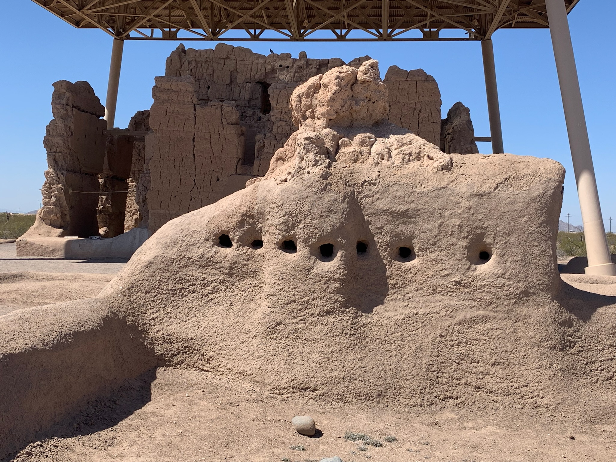
Many visitors confuse this site with Monument Valley Navajo Tribal Park, which has been featured in many western films, but that site is northwest of here and run by Navajo Nation, not the park service. This park service site is in the Tsegi Canyon area and preserves Ancestral Puebloan dwellings, culture and homeland. As well as builders, they were great traders of tools, pottery, turquoise, shells, parrots and macaws. The Hopi, Navajo, Paiute and Zuni are some of the tribes that trace their roots back to this site. The visitor center has some trade items on exhibit and a gift store.
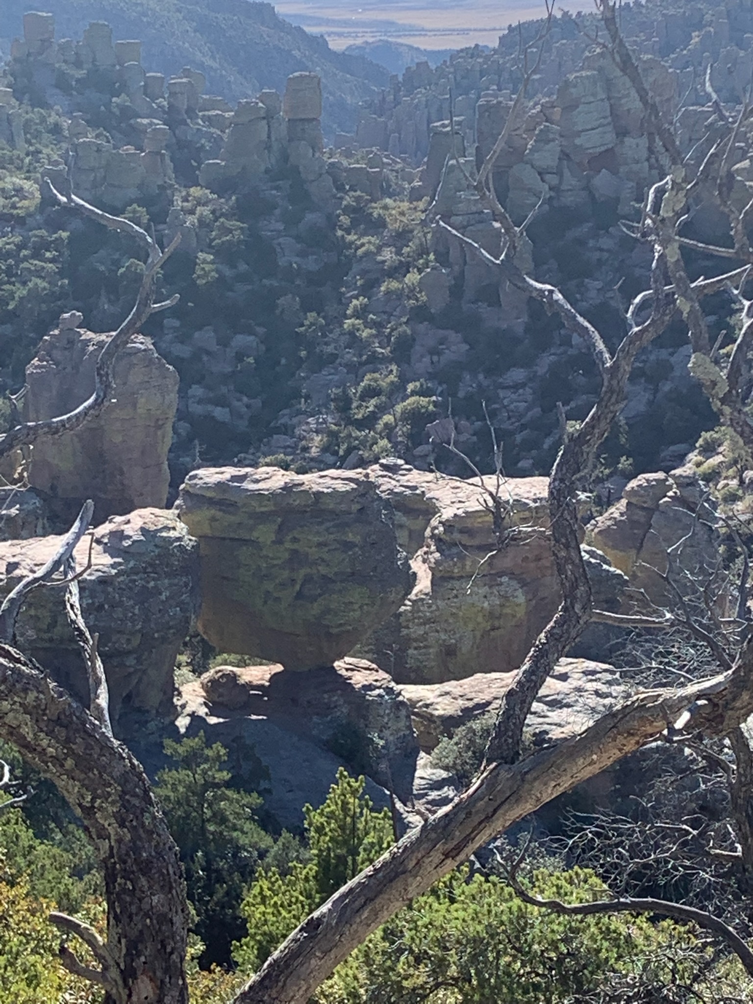
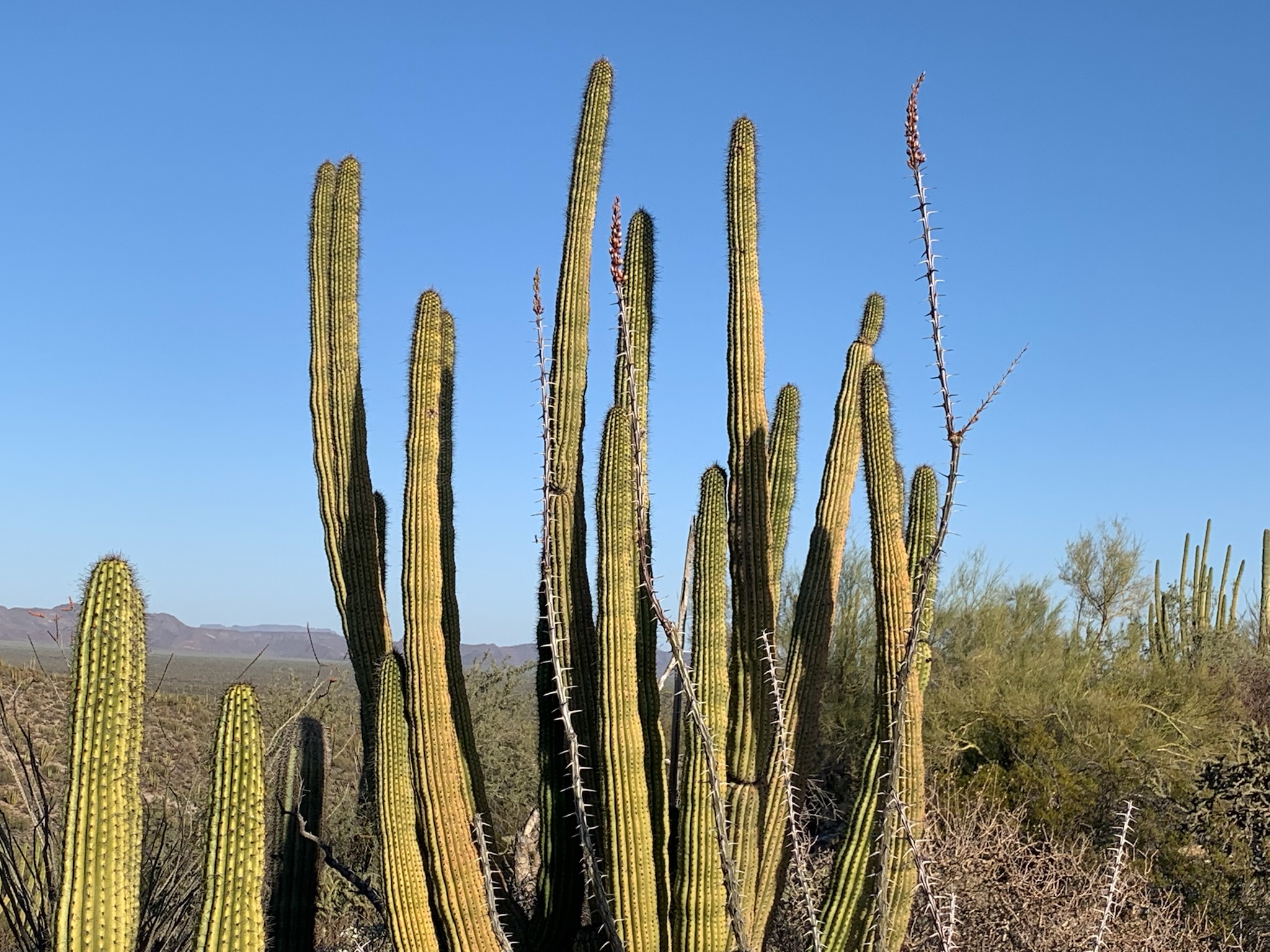
When I visited this park with my kids, we went to the east unit. Both units are in the greater Tucson area, but both are a decent drive away from the center of town in different directions. So, I was glad to have a chance to see the other side. Although the visitor center is a bit nicer in the west, the east unit has a scenic cactus forest drive where you can easily get out and take a closer look. Both have plenty of saguaro (suh-Wah-ro) to see.
The Spanish Mission is not far from the banks of the Santa Cruz River, where I came upon this beautiful spot. The trail near here has more hoof prints than footprints and is supported by the active local equestrians. A lovely broad-billed hummingbird swooped down to see what I was doing, but I almost never have time to take decent wildlife photos.
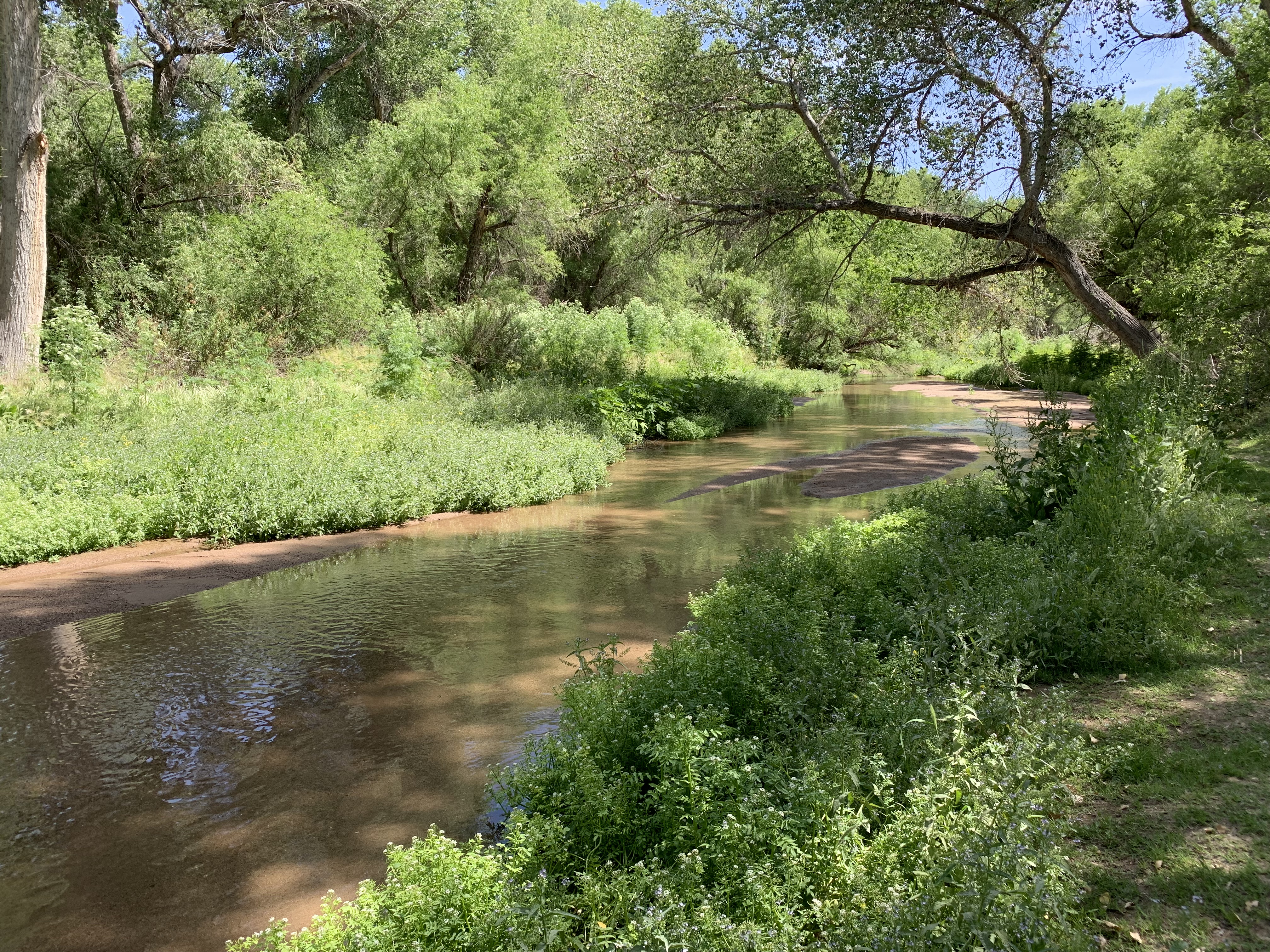
The church grounds are impressive, with a large orchard cultivated with help from a local university, a courtyard garden, a small museum with a long pair of moccasins, and the old church in an evocative state of decay. But, in a sign of our ecologically vulnerable times, the most rare part of the park is the lush riparian area pictured.