I don’t always plan my schedule well enough. I made it to this park about 30 minutes before closing, but just after they closed the volcano road to the top, which is why I took this photo from near the visitor center. Sometimes parks will let you drive out before sunset on your own after the visitor center closes, but apparently the volcano road is narrow and restricted to hikers for the last couple hours of daylight. I should have checked the hours more carefully, and I should have planned an extra day or two on this leg of my trip. I actually had to postpone two planned stops until next time in order to get back on track. I think volcanoes remind me of devastation more than renewal, so I tend to de-prioritize them when planning. Oh well, sometimes we need to admit our mistakes, so we can do better in the future, if we still have time. There’s a broader lesson in that.
Not much remains of the largest Union fort in the west. But there’s plenty of history here. This was a critical supply base to keep the Confederacy from expanding into the southwest. Some of the Navajo who were driven from their homes during the Long Walk were imprisoned here. Here was the largest and most advanced hospital in the west. Soldiers and cavalry guarded both branches of the Santa Fe trail from here, once trading and migration routes for Natives, then for settlers whose wagon ruts can still be seen in the earth, then for the mail, and finally for the railroad, which still bears the name in the logo BNSF.
On the drive out to the site, a pronghorn stood in the road and stared at me, perhaps not frightened by my relatively quiet and zero emission electric car. Although I didn’t get a photo, I got a careful look at it and confirmed its identity with the park volunteer. Turns out they’re not antelope but related to giraffe. Again, everything I learned about the west, where “the antelope play” was wrong. There aren’t any antelope in North America. The pronghorn are the last survivors of human hunting among similar species in North America, due to their speed. Humans are increasingly lethal to all other species, and by changing our climate so quickly, we will make most species on earth extinct within a few decades. I wonder what our ancestors who traveled this trail would say if they could see how quickly we are devastating the planet.
Yes, I know this is another Kiva photo. But I learned something important on the ranger tour down here. One of the visitors was an engineer, and he explained that one reason that the Native Americans built round buildings below ground level and square buildings above ground, even within the same pueblo, is that circular walls are the most efficient way to hold back the pressure of the dirt. When building up above ground, it’s easier to balance walls using right angles. That’s one reason why I saw round ball courts at Wupatki, round pit dwellings at more primitive sites and round kivas at important ceremonial sites, even as the majority of buildings at the same sites are rectangular.
Pecos is fascinating for multiple reasons, which explains why it was promoted to a historic park. One being that the archaeologists who excavated the pueblo roughly 100 years ago sent many human remains to Harvard University and Andover Academy for study, and they were repatriated in 1999, mainly reburied near relatives at a nearby pueblo community. Another is that here is where the Pueblo Revolt against the Spanish was planned and executed in 1680. Furious over their treatment by the domineering missionaries, the Native Americans orchestrated simultaneous uprisings across the southwest in the largest and only truly successful Native uprising against a colonial power in North America. And if that wasn’t enough, Pecos is also the site of the Civil War battle of Glorieta Pass, which prevented the Confederacy from taking over the southwest. As the Russians are belatedly learning in Ukraine, it all came down to supply line logistics. Kudos to the park ranger for explaining everything.
This is the third park unit right near Los Alamos, the others being the last two visits at Bandelier and Valles Caldera. There are Los Alamos National Labs units all around the area, and I was even stopped at a security checkpoint when Tesla’s navigation misdirected me (not the first time). I stayed in the neighboring town of Española, and there’s a Native American community right next door too. I got a bit of culture shock again seeing how different lives are between communities that are so close to each other physically.
Los Alamos is very strange. First, according to a local, most of the science workers are introverts and the other workers spend the weekends in Santa Fe nearby. So the town has all these big shopping plazas with a variety of (often Asian) restaurants, but they’re all virtually empty on weekends. The place is beautifully landscaped with flowering trees, manicured lawns, pristine sidewalks and a lovely park next to the visitor centers. If it weren’t so American, I would suspect it of being a Potemkin village. There are actually two small visitor centers practically right next door to each other, one for the park service and one for the town, so I visited both. They both recommended the exact same attractions in the same helpful and enthusiastic, smiling way with almost identical maps.
Also strangely, although it was atomic scientists who invented the atomic clock as a way to standardize time across all different clocks, the Bradbury Science Museum mobile website ironically doesn’t display its hours of operation (they said they would fix that). They have an incredible amount of information, but they won’t tell visitors when they’re open. Now that my trip is over, I can see the hours on my desktop computer: Tues-Sat 10am to 5pm and Sun 1 to 5pm. And while the museum had an exhibit on wildfires and an exhibit on climate change, they almost seemed to be avoiding making a connection between the two. The climate exhibit was all about Arctic research, implying that climate change was going on there, but the wildfire exhibit was about fire safety, implying that fires were simply natural and avoidable events. As I write this, the Cerro Pelado fire is six miles from the Lab and is over 20,000 acres, so they might want to reprioritize how they assess the threat of climate change.
And finally, I’m going to break my own rule and add a second picture. Dr Oppenheimer and several of the other top scientists lived in converted scouts’ cabins after the government confiscated an elite boys camp to build nuclear weapons. In his neighbor’s cabin, next to the kitchen, is a realistic display of a miniature version created in the 1980’s: the scariest thing I’ve seen besides the climate crisis, a nuclear bomb designed to be carried in a backpack.
Like much of the west, wildfires have burned large areas in and near the preserve. I didn’t see any wildlife, so we’re obviously failing at the “preserve”. As we irreparably damage the environment with climate pollution, the snowpack diminishes and living things die. Many people enjoy seeing national parks that focus on geologic wonders, culture and historic sites. But it is the wildlife that draws me most. Even besides the massive carbon burning that dooms most life on earth, we destroy habitats and hunt species to extinction.
As I drive across the country, I pass through forests I know will burn, I cross rivers and valleys that have been sucked dry, and I know that no matter how unseasonably hot it is, it will only get worse for the rest of my life. Once maybe we could have pretended that we wanted to live in harmony with nature, but now that the climate crisis is upon us and we’re still not doing anything about it, we should at least be honest enough to admit what we’ve done wrong and that collectively we’re too short-sighted, corrupt, selfish, ignorant and stupid to do anything about it in time. What makes me most sad is to listen to people who claim to care about nature, while they drive around in a big rig that is contributing to mass extinctions.
While it is easy to see the impressive semi-circular pueblo ruins on the valley floor and peek in the various rooms along the canyon wall, Alcove House was open to those willing to hike a bit further and climb the series of steep ladders 140 feet up. I imagine it would have been much more difficult carrying supplies, children or elderly relatives up the ladders when the Native Americans were living here. There’s a creek running down the canyon from the large volcano which makes a pleasant place to consider the climb or to cool down on the hike back.
I chose to visit Gran Quivara, since it has the largest pueblo ruins of the three missions, although the churches are better preserved at the other monument sites. The original pueblo ruins are in the foreground. The Spanish claimed the land for the King and forced the people here to build two churches, first the low ruin to the left and then the taller structure in the back. Some accounts describe the relations between the natives here and the Spanish as friendly and positive. From what I can tell, it’s hardly a coincidence that the pueblo was abandoned a few years after they started constructing the larger church for the missionaries. The local people endured Spanish diseases, grew Spanish plants that were ill adapted to the drought-stricken area, and other native tribes mistreated or attacked them as collaborators. They were prohibited from practicing their own religion, including singing native songs or performing dances, due to the strict rules of the Spanish Inquisition. If I had to go through any of that, I would leave too.
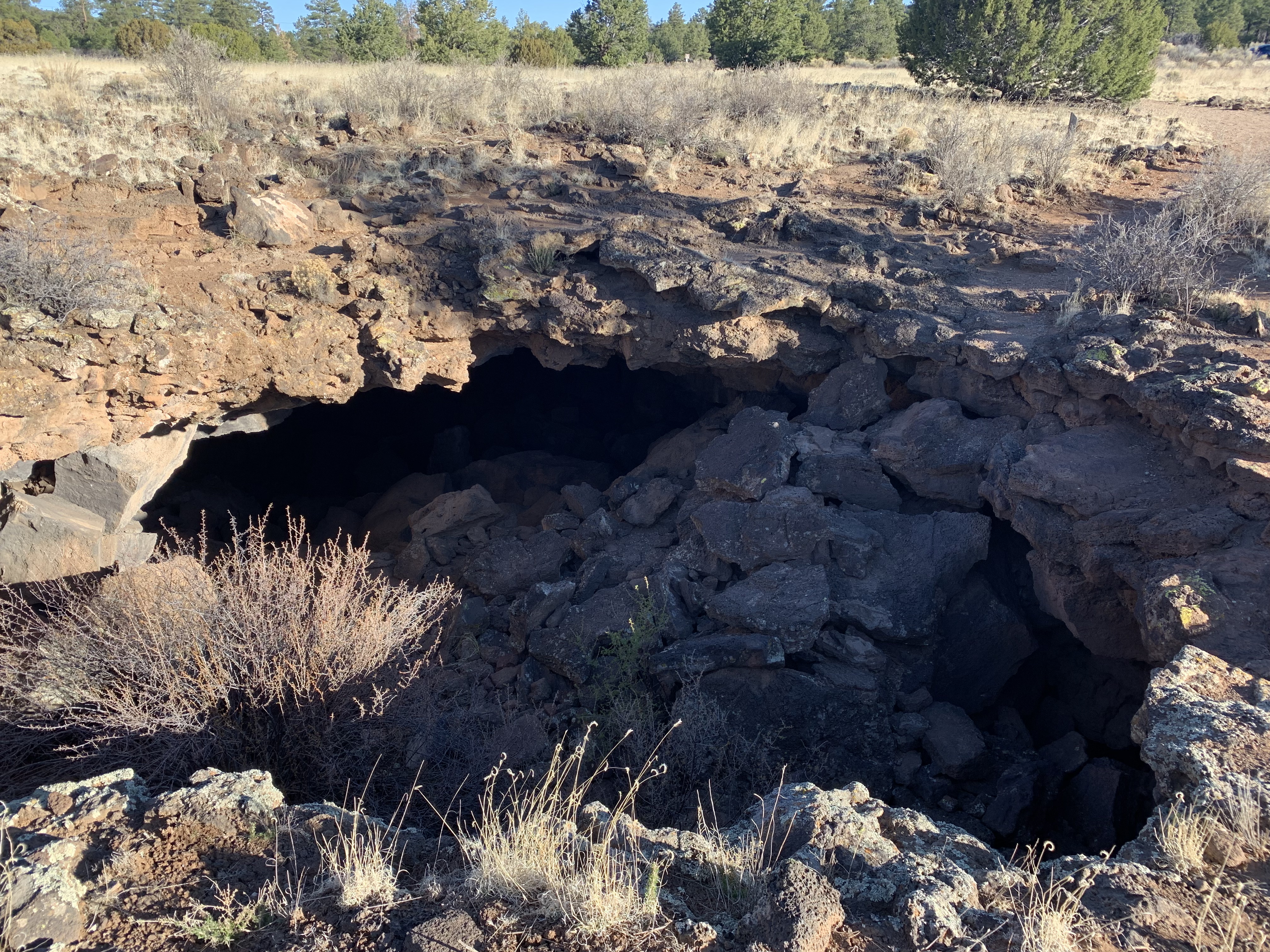
The caves were closed by Covid, but I enjoyed the hike and wildlife. There’s a private site nearby that apparently is still conducting “ice cave” tours. I’m happy to leave the bats alone underground and not risk introducing fungus or disease. I suppose it’s ironic to have the cave closed here when Covid likely originated from a bat cave in China. But the larger problem is that climate change is spreading more diseases globally, affecting both us and other species, so we need to be more responsible.
I should add that beyond the borders of the monument, there are both wilderness and conservation areas protected in El Malpais, meaning badlands.
This rock is interesting. Rock climbers would enjoy the many tall vertical crevices. There’s a spring with a pool in an alcove at the base. At the top, there’s a ruin with a good view of the surrounding valley. And all along the base there are carvings made centuries ago by travelers, from those who didn’t have a formal written language, to Spanish speakers who named this place ‘El Morro’ meaning ‘the hill’, to other pioneers.
This park unit has nine free campsites in a pleasant loop with toilets, tables and water (except during the winter). Since New Mexico offers many electric sites at their reasonably priced state campgrounds where I can charge my EV overnight, I generally try to stay there. Sometimes I stay at a private RV campground, and sometimes I stay at a hotel, especially when I really need a shower. The Tesla easily powers my 12v camping fridge. The least common denominator everywhere is a toilet and a trashcan. The model 3 is small, but I manage to sleep in it. Without a big rig to pull, I can easily park anywhere, and I don’t have to burn a gallon of fossil fuel every 10 miles.
This site, one of my favorites for native ruins, is also a UNESCO World Heritage Site. There are numerous pueblos located in the park, and the largest one pictured is actually missing a few rooms due to a rockslide from the cliff above. These great houses were several stories tall, including storerooms for trade and many ceremonial kivas. Due to the well preserved nature of the site, it’s easier to get a sense of the scale of human activity a thousand years or so ago. At other more degraded sites, you’re really looking at the small basement room foundations. Here, you can see that some of the rooms above were much larger with windows and wider passages. The road out here is miles of washboard dirt, which helps reduce human impact.
There’s an interesting display at the visitor center showing several of the other great builder civilizations around the world at the time Chaco thrived. For me the comparison that comes to mind is Rapa Nui, or Easter Island. They were also a civilization of great travelers and explorers who build large stone markers and then move on to other locations. Manmade ecological collapse contributed to the rapid population declines at these sites. Chaco no doubt boomed when it improved its agricultural yields by building a vast network of canals, but natural systems have natural limits that can break when pushed too far. Obviously, when the natural limits are pushed too far globally, the problem is that there will be nowhere to move that’s unaffected. And the crisis part of climate change is that we won’t have enough time to respond. For those unable to think more than a year or two into the future, it’s worth looking back over centuries since Chaco’s population collapsed due to over exploitation. We may think of ourselves as advanced, but we’re not (and won’t be) if we can’t avoid the coming climate catastrophe we created.