National Parks to Visit in January

In case you want to visit all the National Parks in the contiguous US, this year I’m sharing my recommendations for 3-5 National Parks to visit each month. By the end of the year, you’ll have a full list of all 51 parks, evenly spread out over the different seasons with as few compromises as possible.

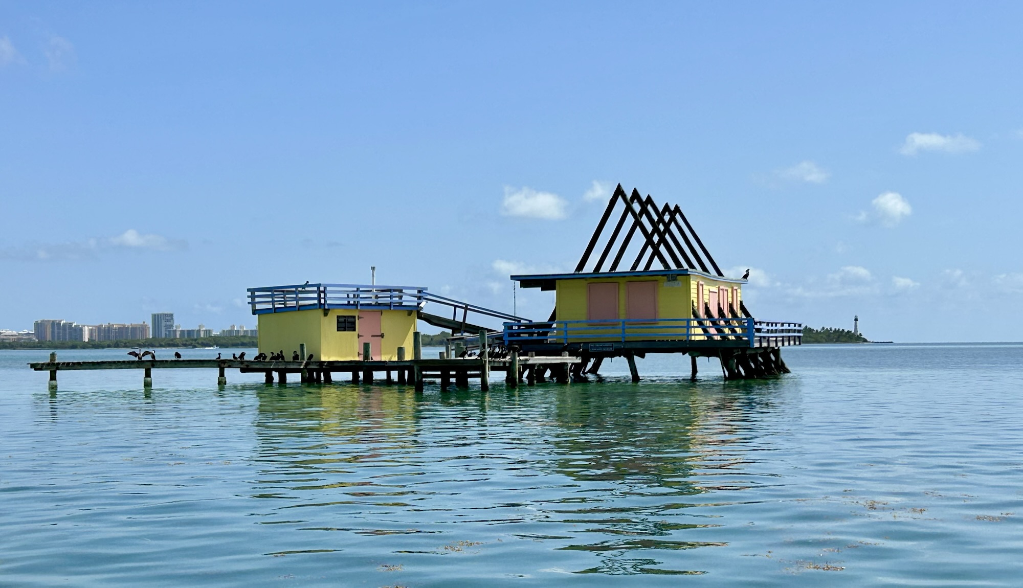
Since January is typically the coldest month, it makes sense to visit southern Florida, the only tropical climate in the continental US. That means Biscayne, the Dry Tortugas and the Everglades. These are beautiful parks for enjoying snorkeling, beaches and nature outdoors, so January is a great month for avoiding the hot, humid weather with afternoon thunderstorms that would bother you much of the rest of the year.

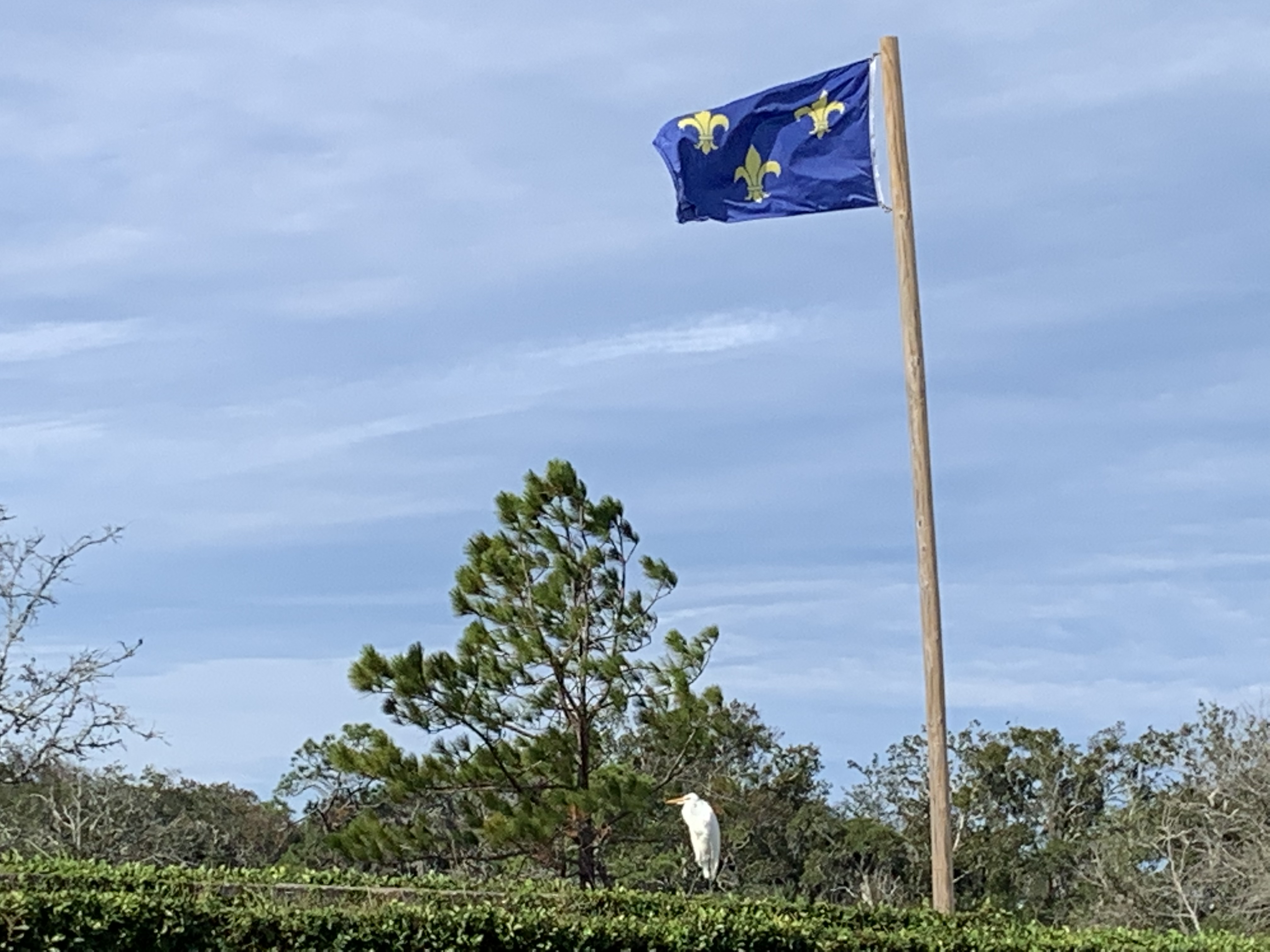
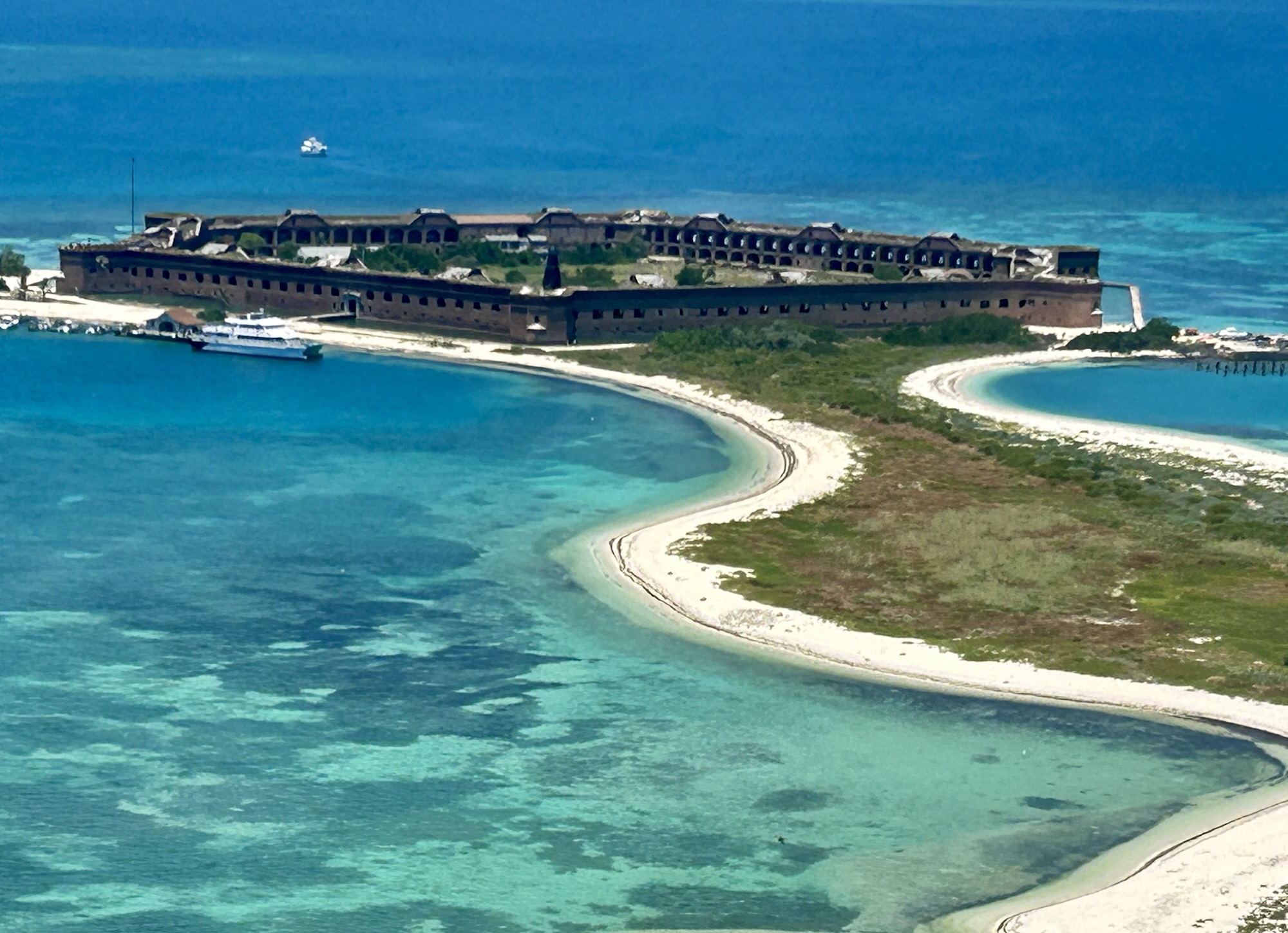
Hurricane season is lengthening, and now some tropical storms form in May before the official season of June through November. I visited the Dry Tortugas in May with an eye on the weather, and I was lucky. Some see sea turtles up close, but I was not lucky. Nesting beaches are often off-limits, and the water visibility wasn’t as clear for snorkeling as it would be in January. If you want to see the turtles, take the short, low altitude seaplane out to the Dry Tortugas, and you will see them swimming all year long.

Sometimes a winter storm will bring winds down to the keys with cold snaps in the 50s, but they don’t last. Many places that rent snorkel gear will have various wetsuits to keep you comfortable, if needed, but the water temperature usually stays above 70° F. Day highs are around 75° F, and most evenings are very mild.

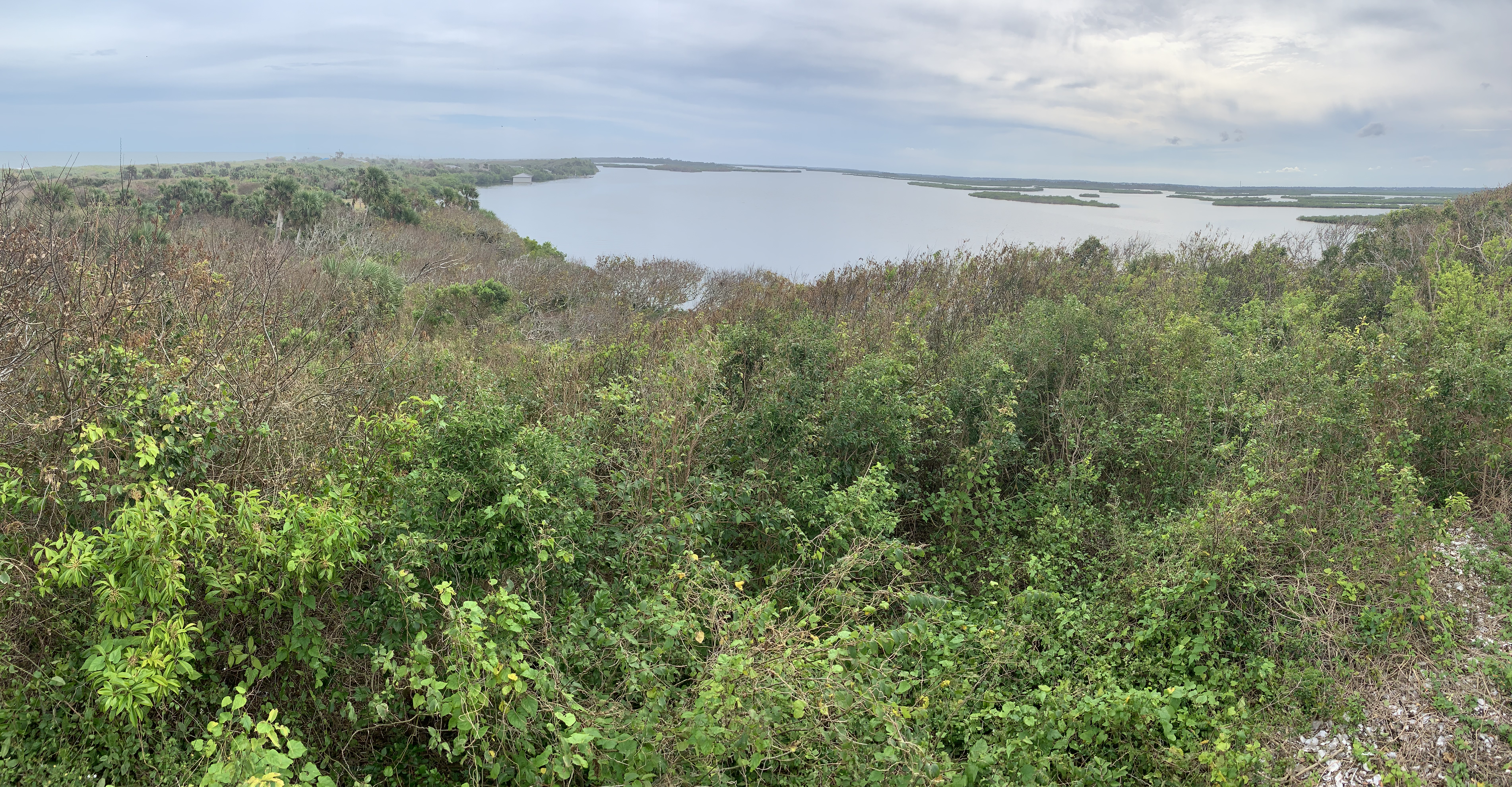
Since the Everglades are dry in January, wildlife tends to concentrate around reliable water sources, making them easier to spot. Birding is best in January, as many migratory birds are in the park, and large charismatic birds like roseate spoonbills and wood storks are laying eggs. And there are few mosquitoes in January.

Weather makes a big difference in how much we enjoy our park visits, so—despite the high season costs—, I recommend visiting these three tropical parks in January, when most other parks are cold, closed and difficult to access. Plan ahead, be flexible on where to stay, and be efficient with your time to save money. But enjoy your time on a tropical beach or amongst the mangroves while others are home shoveling snow.

All Southeast Sites *

The southeast region has more park units (70) than any other region, and I have visited all the units—*except 6 in US Caribbean territories—including all the affiliates, heritage areas and trails in Alabama, Florida, Georgia, Kentucky, Mississippi, North Carolina, South Carolina and Tennessee. Given the large number of states and parks involved, the summary below is organized by theme.

Natural Areas

All of the National Parks in the southeast preserve natural areas, including the reef area of the Florida Keys from Biscayne to the Dry Tortugas, the lowlands of Congaree and the Everglades, the Great Smoky Mountains, and even underground at Mammoth Cave. Other park units, Canaveral, Cape Hatteras, Cape Lookout, Cumberland Island and the Gulf Islands, protect barrier islands. Big Cypress, Big South Fork, Chattahoochee River, Little River Canyon and Obed River all protect diverse riparian areas.

Pre Civil War

Ocmulgee Mounds, Russell Cave and Timucuan stretch back before history, but Horseshoe Bend covers a tragic event in Native American history. Several sites cover early colonial history, including Castillo de San Marcos, De Soto, and Forts Caroline, Frederica, Matanzas and Raleigh. Cowpens, Guilford Courthouse, Kings Mountain, Moores Creek and Ninety-Six cover the Revolution. Blue Ridge, Cumberland Gap, Lincoln Birthplace, Natchez HistoricParkwayTrace, and Pinckney, trace the path of history in the southeast, culminating in the war to abolish slavery.

Civil War and beyond

Andersonville, Brices Cross Roads, Camp Nelson, Chattanooga, Forts Donelson, Pulaski and Sumter, Kennesaw Mountain, Mill Springs, Shiloh, Stones River, Tupelo and Vicksburg are Civil War sites. Johnson, Reconstruction, and Tuskegee Institute cover post war struggles. Carter, Sandburg & Wright Brothers are historic highlights. Birmingham Civil Rights & Freedom Riders, Emmett Till, MLK, Medgar Evers, and Tuskegee Airmen reveal the continuing struggle for Civil Rights.

I learned more traveling in the southeast than any other region, as the area is so rich in history and culture. And the preserved natural areas include some of my favorite park experiences, from underwater and underground, to rivers and shores, and to wildlife experiences in mountain forests. And they can all be explored without traveling in a carbon-burning vehicle.

Florida in Photos

Celebrating completing the Sunshine State!

Big Cypress N Preserve, Biscayne National Park, Canaveral N Seashore, Castillo de San Marcos NM, De Soto N Memorial, Dry Tortugas National Park, Everglades National Park, Fort Caroline N Memorial, Fort Matanzas N Monument, and Timucuan Ecological & Historic Preserve are above. Gulf Islands N Seashore and the Gullah Geechee Cultural Heritage Corridor are partly in Florida, plus there’s the Florida NST.

Apalachicola Biosphere

This remote basin along the Apalachicola River of the Florida panhandle is a UNESCO protected biosphere and, along with Okefenokee in Georgia, is the main production area for Tupelo honey. The Peter Fonda movie Ulee’s Gold is set here, and beekeepers frequently boat around keeping track of their bees. Many of the stumps in the photo are white tupelo gum trees, while others are cypress. Tupelo means ‘swamp tree’ in Muskogee, and Elvis’ hometown of Tupelo Mississippi has black gum trees.

Technically the photo shows the Dead Lakes on the outskirts of the preserve, but a bit past the Chipola River Bridge is the Gaskin Park boat ramp, where you can access the core area. Due to the high density of large reptiles, I decided against kayaking. But the river, swamp, floodplains, estuary, mudflats, forest, seagrass beds and barrier islands here comprise a uniquely diverse, remote, and unpolluted ecosystem, supporting many unusual and endangered species, including more reptiles and amphibians than anywhere else in the country, black bear, manatee, hundreds of species of birds, and a critical nursery for fish and shellfish. ⭐

This post marks the end of my trip to Florida and the Southeast region of the contiguous US. Next Monday I’ll post about a world heritage site in the Mid Atlantic region.

Dry Tortugas National Park

Fort Jefferson is an impressive 19th century structure, used to police ship traffic between Florida and Cuba. The island was named for the sea turtles that still nest here, and there are many seabirds too. There are lovely views of the courtyard above and all around the small island from the top of the walls. I was pleased to see a goliath grouper near the ferry dock, and despite the poor coral condition, the snorkeling was very good among the old dock pilings near the south beach. Together with the Everglades, Dry Tortugas is a large UNESCO Biosphere. I saw hundreds of fish and birds. This is one of my favorite national parks.

The flight is much more expensive than the ferry, but there are some benefits. I was kicking myself for not reserving ferry tickets enough months in advance, but when I realized that the seaplane only flies a hundred and fifty feet or so over the shallow waters, I decided the short flight was worthwhile for the views. From the air, we saw two shipwrecks, one a navy boat used for target practice and the other a famous treasure hunter’s floating guard shack, plus many sea turtles, some sharks, maybe a stingray, a pod of dolphin, and flying fish scattering over the surface. First time for me to see all that from the air. Also, the flight saved me a lot of time. If you’re just visiting Key West—I took the Conch Tour decades ago—to get to the Dry Tortugas, then you can drive in, catch a 10 am flight, and be on your way, saving two very expensive hotel nights on Key West. Plus, it’s less crowded when you first arrive, they include snorkel gear—definitely snorkel—, and you get the view of the fort below.

Biscayne National Park

A few stilt houses have survived hurricanes and are allowed to remain in this huge marine park just outside Miami. The lighthouse in the background was once part of the Underground Railroad, as boats would risk the reefs to come here at night to pick up escaped slaves and fleeing Native Americans to live in the Bahamas, which ended slavery in 1834. While the Key Biscayne in the background above is a barrier island, the Florida Keys are part of an ancient reef that begins here, includes Key West and runs to the Dry Tortugas.

The best way to see the park is by boat. I took a very small tour from Coconut Grove out to the flats, to snorkel on both ocean and bay sides of Elliot Key, and had lunch on Boca Chica. The reef I remember from the 1980s has been devastated by carbon pollution from fossil fuels—elkhorn & staghorn corals are functionally extinct here now—with widespread coral bleaching and only a fraction of the marine life. But it still has life. I counted dozens of species including a beautiful French angelfish, various colorful parrotfish, spiny urchin and a lobster. From the surface we saw mating loggerheads, a manatee, and many birds, but the vast majority of wildlife is just below the surface. Let me show you what I mean.

Everglades National Park

The southern end of Florida is home to Everglades National Park, which is also a UNESCO Biosphere and a World Heritage Site. Since 1900, the area has been both protected and threatened, with political battles needed to protect bird plumage, to create the park, and to protect the large, diverse ecosystem here. Marjory Stoneman Douglas wrote a book to explain how the Shark Valley River Slough runs as a “river of grass” through the Everglades. When summer rains fill Lake Okeechobee, a sheet of water overflows the low bank and floods the flat grasslands, revitalizing fish eggs and a whole ecosystem. A cross Florida road called the Tamiami Trail prevented that flow, and a political battle was fought to restore it partially. The fresh water eventually sinks through the limestone, filling the Biscayne Aquifer to provide drinking water for Miami. There are also canals crisscrossing lower Florida, including here, and that’s where these two young alligators were hanging out. Alligator Alcatraz, a temporary migrant detention center, is in the Everglades ecosystem, but it’s not in the national park. Alligator Alcatraz is north of the Tamiami trail in Big Cypress National Preserve.

The park is 1.5 million acres, including the mangrove islands that form the southern end of Florida, before the Keys. The best place to see the mangroves is by boat, either from Everglades City west of Big Cypress or by driving to Flamingo. I took my family to the latter, and we saw a large crocodile near the dock, plus much more wildlife on a quick cruise in the “submerged wilderness” of Florida Bay. Personally, I wouldn’t kayak these waters, but many people do, camping on the Chickees or raised bits of ground where natives camped seasonally and for different purposes for centuries at least. There’s even a paddling waterway to go between Everglades City and Flamingo. Before the highway was built out to Key West, visitors commonly took a similar route by boat.

The work of environmental protection is never done. Burmese pythons entered the park in the 1970s—likely as discarded pets—, and now they’ve wiped out most of the native animals, threatening the Florida panther with extinction. I was disappointed to see the dramatic decline in wildlife evident from the Shark Valley Tower, since I first visited decades ago and even since I visited again with my family not so many years ago. And since last year, the state government is not allowed to mention climate change, global warming or sea level rise, but that obviously won’t do anything to prevent rising sea levels from submerging much of southern Florida, including most of Miami and almost 1/2 the park in the coming decades. Especially if the government refuses to take action, climate science clearly shows that the environment will only continue to worsen more rapidly.

Florida National Scenic Trail

The southern terminus (above) of the Florida Scenic Trail is in Big Cypress National Preserve on the Loop Road. One of the two barely visible signs at the virtually unmarked entrance almost apologetically notes that the trail is maintained by volunteers. 1,500 meandering, swampy miles northwest is the northwestern terminus (below) at Fort Pickens in Gulf Islands National Seashore. While I’ve been to both ends of the trail, and crossed over it a few times, I have not hiked any significant sections. It’s reportedly a rather solitary experience likely requiring significant wading.

I should mention that Fort Pickens was a Union held fort during the Civil War, protecting Pensacola Bay. The Confederates tried taking it, but the fort is on a rare bluff in the area, giving it the high ground for miles. When the Confederates took some smaller forts across the channel, the Union guns expertly demolished the smaller positions. The beginning of the trail here is beautiful, with many birds and water on both sides.

Big Cypress National Preserve

In the bigger, more famous neighboring park in southern Florida, the paid guide assured me that the American alligator “is a solitary creature, you never see more than one or two together”. In Big Cypress, I counted 16 alligators in one puddle and 17 in the next. Unlike most other wildlife I try to photograph, the alligators don’t run away; they look you right in the eyes and even slowly move towards you. Some are easy to spot, but while I was counting, three more were sneaking up on me.

Most of the million acres in Big Cypress and its smaller partners are actually prairie habitat for the endangered Florida panther, but there was a devastating fire recently, in our rapidly heating world. I drove the loop road instead, looking for gators in the gullies, but I often found myself looking up at the various trees to look at the air flowers hanging on to trunks and branches. In the hardwood hammocks, you might see some tree snails. And I saw a lot of birds, especially wood storks and other large wading birds.

Coming from the Naples side, I stayed in Everglades City, which is tucked in between the Ten Thousand Islands, the Everglades western estuaries and mangrove islands, and Big Cypress. Before the highway was extended to Key West, many visitors took boats to Key West from Everglades City. They’re rebuilding the hurricane damaged visitor center there in the name of Marjorie Stoneman Douglas, who wrote the book, River of Grass, that led to the protection of 2.5 million acres of lower Florida. Fortunately, large commercial efforts to farm, graze and otherwise exploit the land had all failed, so the environmental coalition won. Carbon pollution raises sea levels, so the future is uncertain. But for now, this is a good place for adventure travel out into the mangroves.

Gulf Islands National Seashore (& Admiral Farragut)

While I like the park and plan to visit it again in warmer weather, the seashore skips over the most important section in the middle. In Mississippi, the park includes the Davis Bayou (photo below) with a nice visitor center and park film, and from mid-March to October you can take a ferry out to Ship Island, look for bottlenose dolphins, explore the beaches and visit a Civil War fort. In the Florida section of the park, there are also birds, long stretches of storm-swept and once segregated beaches, old forts first built by the Spanish and later used by the Confederacy, and another visitor center (closed when I tried to visit) to explore near Pensacola. But the Gulf Islands of Alabama are not part of the national park unit. Forts Gaines and Morgan, the guardians of Mobile Bay, are Alabama State Parks. But that’s where the action was. 

General Grant relied on combined naval and land forces to take Fort Donelson in February 1862, which cut off the Cumberland River from the Mississippi. In April, Flag-Officer David Farragut (depicted by Gaudens above) began his gulf coast campaign by sailing up past the forts guarding the Mississippi and taking New Orleans. After the Union freed the city, three regiments of African American troops were quickly organized, and many of those men first served on the Gulf Islands, helping retake the forts along the gulf coast. In June, Farragut was wounded near Vicksburg. 

The Confederacy’s last large port was Mobile Bay. In 1863 the Union took Vicksburg, but to speed the end the war, now Rear Admiral Farragut needed to sail past the forts guarding Mobile Bay. In 1864, the Confederacy, having learned from their mistakes in New Orleans, had heavily reinforced Mobile Bay’s naval defenses among the many fortifications along the Gulf Coast. Fort Gaines guarded the shallower west side of the bay, and Fort Morgan guarded the deep water ship channel from the east side. The gaps were filled with floating sea-mines, called ‘torpedoes’ at the time. And the port was guarded by the massive ironclad CSS Tennessee, the most powerful warship in the world. 

Farragut had four small new ironclad ‘monitors’ leading his fleet: the Chickasaw, Manhattan, Tecumseh, and Winnebago. He decided to run the gauntlet up the main channel into the large bay, boldly trying to move fast and far enough to get out of range of Fort Morgan’s guns. Under fire from the fort, the Union navy advanced with its ships lashed in pairs with the monitors on the side taking the heaviest fire. Farragut climbed into the rigging to get a view above the thick smoke. The Tecumseh crossed a mine field to engage the Tennessee, exploded one and sank immediately with 93 lost. 

Seeing his fleet hesitating and the Tennessee closing in, Farragut yelled down something to the effect of “damn the torpedoes, full speed ahead!” The remaining monitors surrounded the Tennessee, disabled her and eventually blasted a hole, injuring the Confederate Admiral. The rest of the fleet entered the bay, got behind the forts, and shelled them. The Army, including African American regiments from New Orleans, approached the forts, which surrendered, first Gaines without much of a fight, and then Morgan after a heavy siege. 

Mobile Bay was closed, cutting off supplies to the Confederacy. And the Confederate Army was tied down defending the city, helping open up Sherman’s march to Atlanta. While Alabama’s Gulf Islands are not part of the national park service site, they are in the middle of the line of hurricane barrier islands and sandy peninsulas where this major Civil War battle was fought on land and sea. Admiral Farragut and the Union Navy’s contributions to ending the Civil War must not be forgotten.