Around 200 years ago, America was expanding the National Road (US 40) westward to St Louis and needed a bridge across the Ohio River. It took a couple tries, but the stone suspension bridge in the foreground was completed in 1859. The modern bridge behind it has four concrete bases, but the Wheeling Suspension bridge has none. Most traffic from the Midwest to the Mid-Atlantic passes on I-70 over the background bridge, so you may have seen Wheeling’s longest operating suspension bridge out your window between Ohio and West Virginia.
The city of Wheeling is marvelously uncrowded with small shops and restaurants around Centre Market in the historic center of the heritage area. It’s the kind of ‘stuck in the past’ place that I love, where the sign on the old bookstore advises folks to ask at the local bar if the owner is not inside his store. They have music, boating and cultural events, and they could use a few tourists pulling off the interstate to buy a hot fish sandwich at Coleman’s Fish Market below. Recommended.
Smoke Hole above is a canyon formed by the South Fork of the Potomac River in West Virginia. Excursion trains take visitors on various trips through the area, but there are also country roads. I drove about 10 miles along the canyon admiring the views with fall foliage, and I never saw another person. The C&O Canal and Potomac Heritage NST are also in this NHA, which extends into the mountains of western Maryland. This is a rare, beautiful, underrated spot in the US to hike and enjoy nature.
The bridge over the gorge is huge; it’s one of the highest in the world and the largest single arch bridge in the western hemisphere. I took some nice pictures of it, when I drove the old Fayetteville Station Road and crossed on the old one lane bridge. Some of the commercial raft trips end there, and it’s fun to watch them take their last rapid. The most crowded part of the park is the Canyon Rim Visitor Center near the bridge, where many folks stop to have ice cream or picnic.
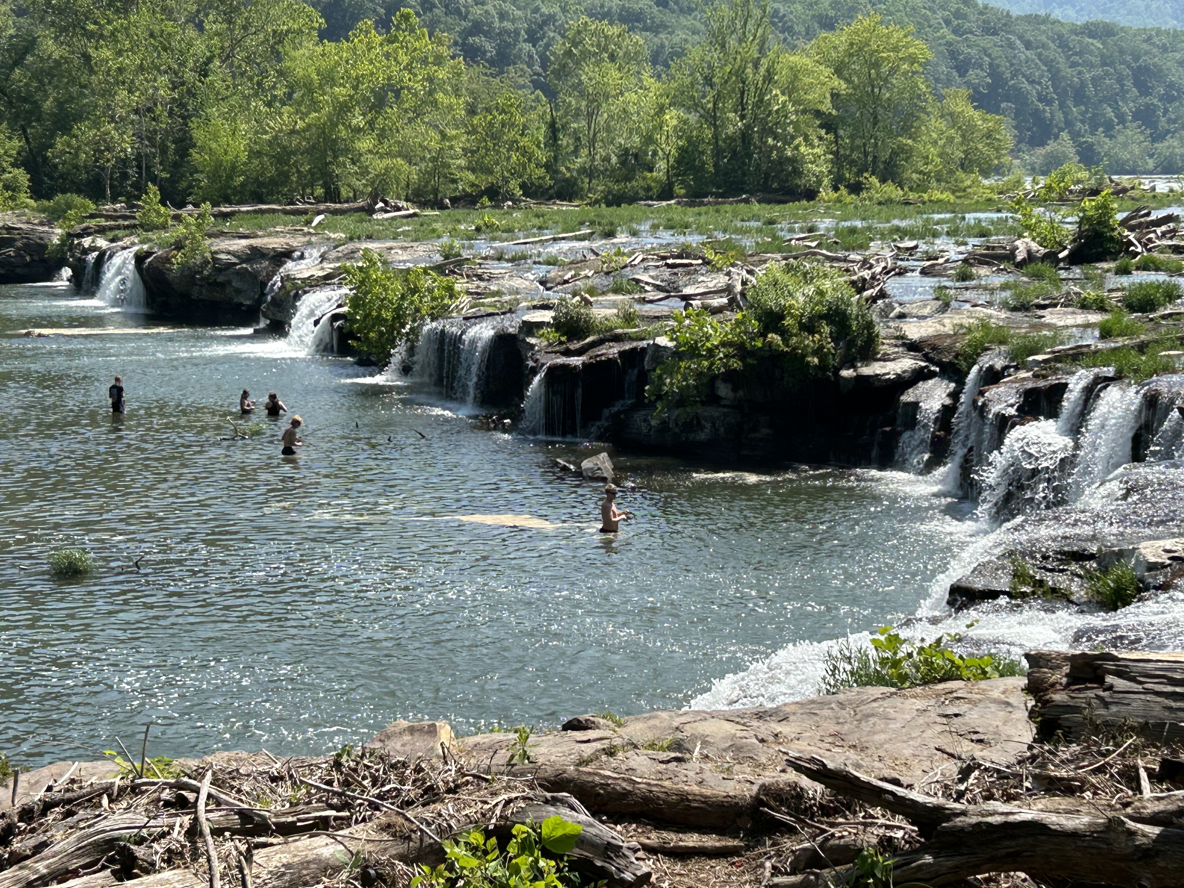
But the bridge is not the point of the park. The New River watershed is huge and very old. It starts in North Carolina near the Blue Ridge Parkway, includes the Bluestone and Gauley scenic rivers, and flows up to the Kanawha which is a major tributary into the Ohio River. The photo above shows folks fishing at Sandstone Falls, far upstream of the famous bridge. It’s a lovely spot with plenty of birds, an easy hike and a boardwalk.
The point is that the whole area was ruined by coal mining. This was the land of John Henry, if you know the old song about a railroad tunnel dug here. Now coal is more expensive than renewable energy, and many of the mines here have closed, becoming ‘exhibition mines’—fascinating tour in Beckley—, historic sites or slowly forgotten. A few coal trains still run through the gorge, but the park is now protected and recovering. Tourism generates more income and jobs now, and West Virginia is one of the most beautiful states in the US. The park is proof that we can change and improve. The point is that we can choose to save nature, instead of destroying it, and that it’s never too late to start trying.
Well every Monday morning When the bluebirds begin to sing You can hear John Henry a mile or more You can hear John Henry’s hammer ring, Lord, Lord You can hear John Henry’s hammer ring
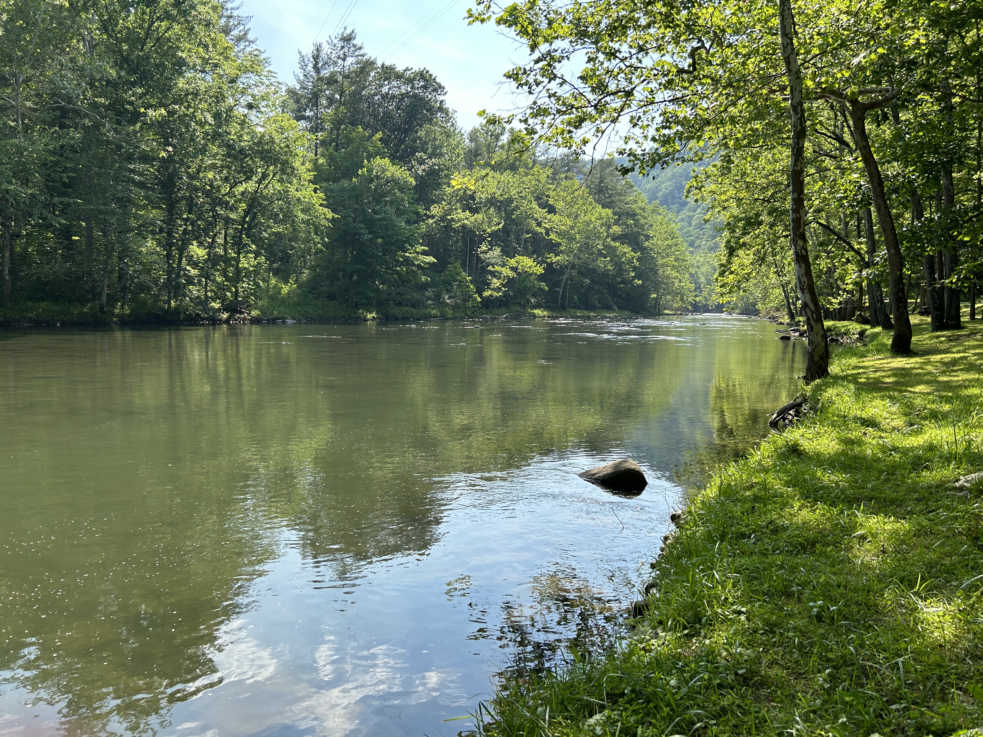
Like Gauley, this park is managed by New River Gorge and is best visited by going through a state park. Pipestem Resort State Park has a aerial tram which runs on weekends and more often in summer, and—even though it runs on gas—I recommend it as the best way to get down to the river 3,600’ below. (Look for the old moonshine cave on the way back up). Then you can hike along the beautiful river trail (see above) for as long as you like. West Virginia is wild and wonderful, and this particular river is simply stunning.
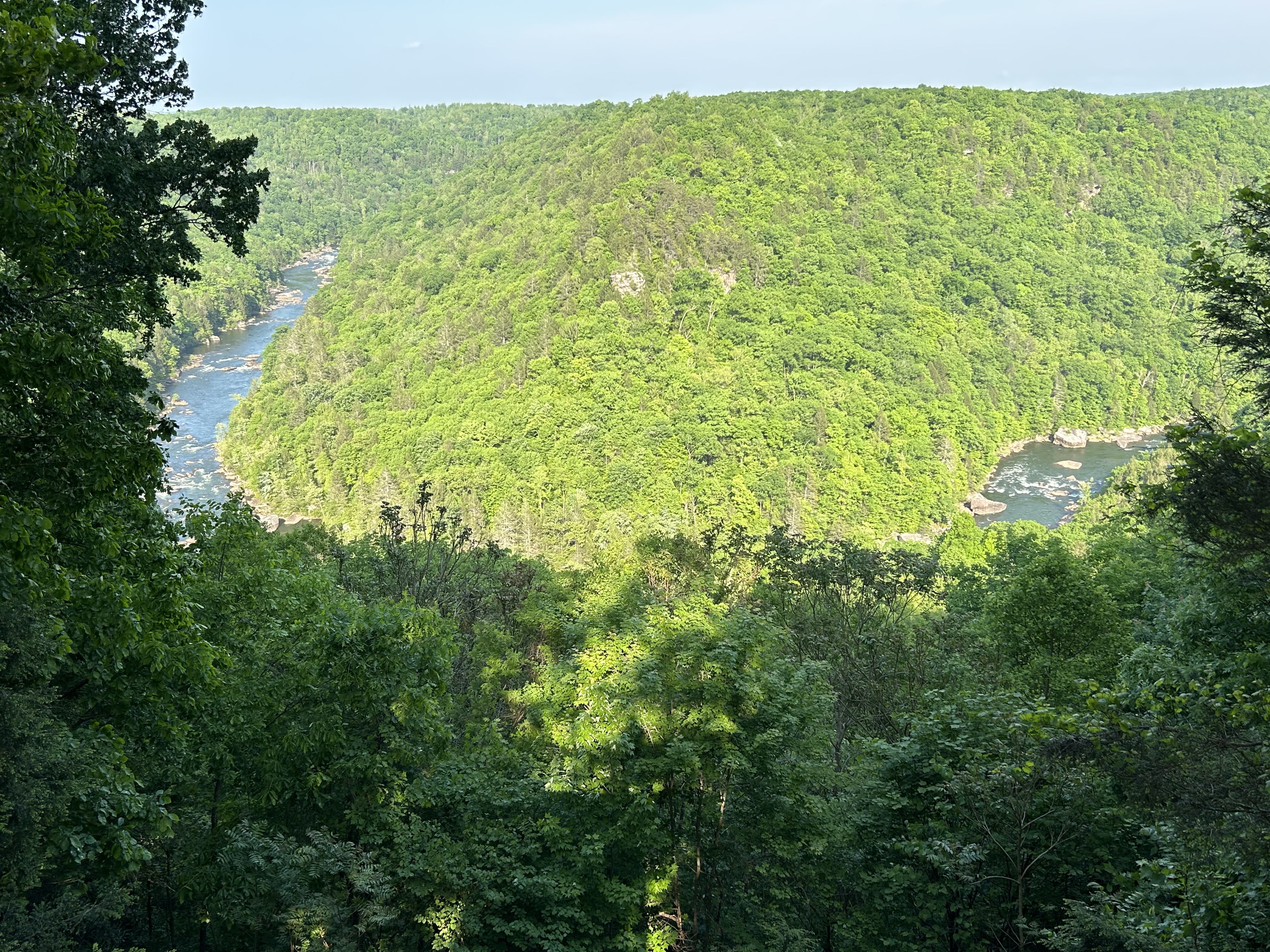
Upstream is the large Summersville Lake, which is drained each fall, creating a spectacular world class 25 mile whitewater kayak run for a few weekends through these woods and around the Pillow Rock Rapids bend above. The rest of the year, the West Virginia park belongs to the wildlife, without any significant visitor facilities and few easy access points. Information on hiking trails is available at New River Gorge nearby.
Obviously the whitewater is above my skills even if I waited until September, so I just decided to admire the views and hike in the beautiful woods. The best place for that is not the park campground—which is just a parking lot and kayak launch at the base of the Summersville Dam.
The place to go is the Carnifex Ferry Battlefield State Park—which commemorates the Civil War Union victory that helped drive the Confederacy out of western Virginia eventually leading to the creation of West Virginia. This is where I took the photo above, and where I walked into the park on the old ferry ‘road’ or trail. The state park is day use only, but it has nice facilities, beautiful lawns and a monument.
Since each park is unique, I would never be able to say which is my favorite. But this one is.
Here, at the confluence of the Shenandoah and Potomac Rivers, in 1859 the abolitionist John Brown led 18 men to capture the armory, arsenal, and rifle factory here, killing three men, freeing slaves and taking the town’s leaders captive, before being captured by Col. Robert E. Lee and martyred after a brief trial, becoming the first person executed for treason in America. Brown believed he was right, did not intend for anyone to die and argued at trial that “had I interfered on behalf of the rich, the powerful… or any of that class… this court would have deemed it an act worthy of reward.”
Native Americans lost this land to European settlers during the 16th and 17th centuries. Washington explored the area for his canal project and recommended an armory be built here. The armory supplied Lewis & Clark’s expedition, and the arsenal supplied weapons for the Civil War. During which the town changed hands eight times including the destruction of the arsenal, the capture of 12,500 Union soldiers by Stonewall Jackson and the critical resistance to the confederate army marching on DC. Major Delaney, the only African American field officer in that war, came from here, alongside many USCT recruits. Frederick Douglass and W.E.B. DuBois organized and lectured here, where the Freedman’s School and Storer College educated the descendants of slaves.
Thomas Jefferson stood on a rocky overlook and said “this scene is worth a voyage across the Atlantic.” The mountains, rocky cliffs, rivers, swamps, and floodplains here support diverse wildlife, including three species of hawk, a harrier and the bald eagle. There are over 20 miles of hiking trails in the park, including part of the Appalachian Trail (park & hike). And the tavern in town serves a draft amber ale called Almost Heaven.
“Almost heaven, West Virginia Blue Ridge Mountains, Shenandoah River”
It was hiking on the trail in New England as a boy that I got the idea to visit as many national parks as I could. Some of the counselors were discussing their trail names and talking about the best natural places to visit in the country. I never forgot that feeling of walking deep into nature, exploring, seeing wildlife, jumping into a swimming hole and imagining traveling to even more beautiful places. It took a long time, but I’m finally fulfilling part of that dream.
I don’t know if I have it in me anymore to hike the whole trail, but I would love to try. The relief map (above) in the park-partner Appalachian Trail Conservancy visitor center in Harpers Ferry gives you a sense of both the distance and the many mountains that must be summited. But I wasn’t about to take a gas-polluting bus to get from the Harpers Ferry visitor center parking lot into town, especially when I could walk a couple miles of the AT to get there. And I would recommend hiking the trail, even just a small section, if you can. For the adventurous, the expert suggested thru-hiking the trail in two sections, from Harper’s Ferry in the spring north to Katahdin in Maine and then from Harper’s Ferry south to Springer in Georgia in the fall.
Below, I’ve listed the units either on or next to the trail.